


Mt Davidson, Nevada is the county high point of historic Storey County. Just southeast of Reno, Mt Davidson has a commanding view of the Sierra Nevada and Washoe Valley. It's a simple hike but off the radar to most outside of the county high pointing world. This hike pales in comparison to Hole in the Mountain Peak and the Jarbidge Wilderness which I did later in the week but worth writing about anyways. Here's my trip report-
Notes on Approach/Trailhead
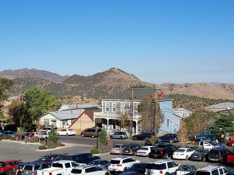
Mt Davidson, Nevada is less than a mile from downtown Virginia City to the east. This is a historic and well-preserved mining town with an old western vibe. Set Google Maps to get me here which is the informal trailhead. From Reno, it's a 30 minute drive up the sinuous Highway 341. Once in town, hang a left on Taylor Street. Drive about 0.2 miles as it ascends the hill and park wherever is convenient.
Although parking is free, it outside off the main drag so be neighborly. Mount Davidson, Nevada is entirely on public land but it isn't broadcasted either. Here's my map
Mt Davidson (Nevada) and Ophir Peak Hiking Directions
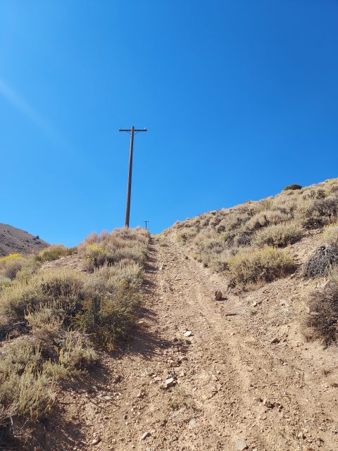
From Stewart Street, I walked about 150 feet up an unnamed paved road then took a right on a dirt road. I believe this is an access road for the telephone wires and station on Ophir Peak. Again, there was no negative signage nor anything indicating it wasn't public land. In fact, it looks like you could drive the road if you had the wheels and skill. I don't think it was suitable for anything other than an ATV or a skilled 4x4 driver; certainly not Subaru friendly.
Walking up this loose and rocky road, I headed up 0.4 miles at a 20% grade. I came to a vague intersection with a route headed left (following the telephone poles) and the road heading right. I went left but don't recommend it- it was loose rock, dust and a 30% grade. Withering under the hot afternoon sun, I eventually gained the ridgeline. This "route" following the telephone poles intersects with an established dirt road 1.2 miles from the start.
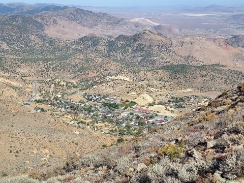
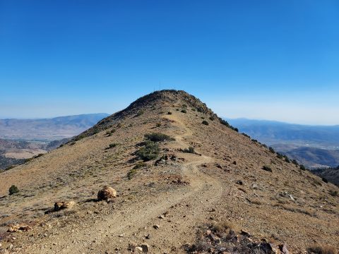
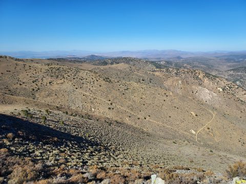
From the hot, steep climb out of Virginia City, the road at the top was a welcome reprieve. Views opened up of the Sierras, Washoe Lake and much of Reno-Carson City. Mt Rose loomed to the west.
At this junction, I went left and followed the road another 0.9 miles to the summit of Mt Davidson (Nevada). The road as a number of up-and-downs along the way but the majority of the elevation is gained in the first 1.2 miles of the hike. Once on the summit, I ate lunch, enjoyed the views and looked in vain for a summit register. None was found. Total distance to the summit from Virginia City was 2.2 miles with ~1,400' of gain (one way).
Over to Ophir Hill
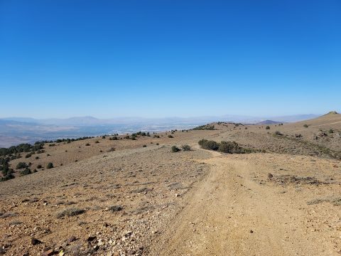
I could have returned the way I came for a shorter, more direct hike. Instead, I took a more circuitous route to Ophir Hill and down the main access road to Virginia City. This gave me more time with the wonderful views on the ridgeline and less knee-hammering loose rock on the descent.
From Mt Davidson to Ophir Hill was another 1.2 miles of rolling hills but nothing too difficult. Ophir Hill has an altitude of 7,782' with minimal topographic prominence. But the views of Reno and the Washoe Valley are more direct making the extra distance worth it.
After tagging Ophir Hill's "summit" I descended the dirt road 1.5 miles back into Virginia City. Though better than the telephone pole route, it was still loose and tedious. Going down was as strenuous as going up. By the time I made it back to the car, I covered 4.8 miles and climbed 1,800' over 2.5 hours.
Mt Davidson, Nevada was #9 of 17 Nevada County High Points.

No Comments