


On a recent road trip through Northern Nevada, I finally made it to a place that's long eluded me: the Jarbidge Wilderness and Nevada's Matterhorn Mountain. This place captured my attention years ago during my other Nevada wanderings due to its extreme remoteness and pristine nature. What kept me from coming is what keeps most from coming- there's no easy way to get there. The closest city of consequence is Twin Falls, Idaho which is about 3 hours to the northeast. Its at least a long day's drive from Salt Lake City, Reno or Boise which have the nearest airports of any consequence. Lastly, there's the 20 miles of dirt road driving that keeps away the casual tourist. For those who make the journey, some of the most untouched wilderness in the contiguous United States awaits.
Getting to Jarbidge Wilderness and Matterhorn Mountain, Nevada
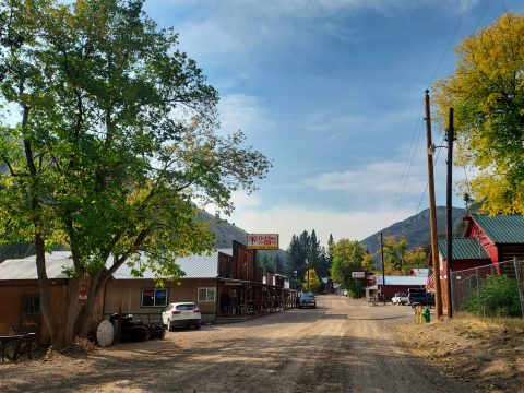
The closest town to the wilderness is Jarbidge, Nevada which proudly bills itself as the "Most Remote Populated Place in the Continental United States". The most accessible and safest route starts from Rogerson, Idaho which is 20 minutes north of Jackpot, Nevada on Highway 93 or 30 minutes south of Twin Falls, Idaho. Gas up at the station in town- there's no gas until Jarbidge and the gas there is expensive. Follow signs in town to Jarbidge; the paved road heads west from town and across the expansive high desert of Idaho. I got intermittent cell phone reception for the first 20 miles out of town then lost reception for the rest of the drive. Here's a few milestones along the way:
- 7.7 miles: Lud Drexler Park and Salmon Falls Creek Reservoir. Camping available
- 33.9 miles: Three Creek, Idaho. No Services
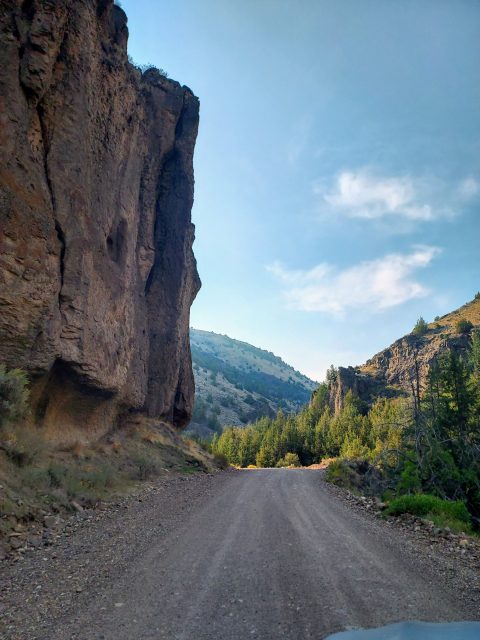
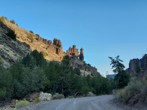
- 46 miles: Pavement ends, road descends into scenic Jarbidge canyon
- 48 miles: Murphy Hot Springs, Idaho. No services
- 49 miles: Big Cottonwood Campground, Idaho. There's extensive established and open campsites between here and Jarbidge
- 50.5 miles: The Forks campground and boating site. Worth a stop for the scenery.
- 54.7 miles: Idaho-Nevada Boundary
- 63.3 miles: Jarbidge town center
- 65.8 miles: Turnoff for wilderness areas. Extensive primitive campgrounds in the area
The road accessing the wilderness is 2-wheel drive friendly for 0.8 miles allowing access to two free campgrounds: Bluster and Pine Creek. There's a cherry stem at the end of the road for 2-wheel drive/low clearance turn around. Past this point the road is firmly 4x4 and high clearance only. I advise strong caution going past this point given Jarbidge's remoteness; this is not Subaru friendly and there isn't any AAA this far out. Even Bob Burd and his companion ran into severe trouble driving past the campground.
Jarbidge Wilderness and Nevada's Matterhorn Peak Overview
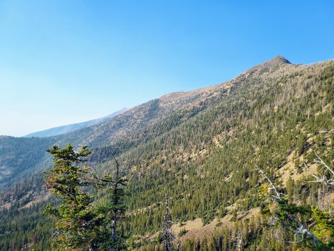
Jarbidge Wilderness of Humboldt-Toiyabe National Forest is a place of superlatives. According to Wilderness.net it is one of the least visited federally designated wilderness areas of the entire US (including Alaska). It was also the first area in Nevada designated by the Wilderness Act of 1964. The only other wilderness areas in Nevada that I've visited that even begin to match its exquisite alpine environment are Arc Dome Wilderness in Central Nevada and High Schells Wilderness near Ely.
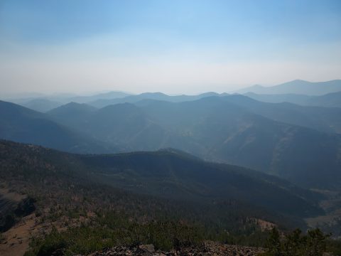
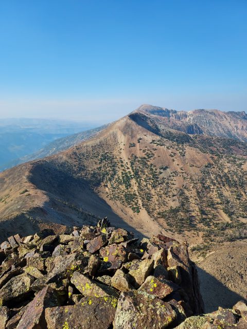
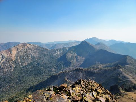
Nevada's Matterhorn Peak is the highest summit in the wilderness and the highest summit for 60 miles. Its summit is 10,837' with 4,688' of topographic prominence. Signatures in the summit register were almost uniformly from peakbaggers; Nevada's Matterhorn is quite the gem to those chasing a combination of prominence, altitude and isolation. Climbing it certainly has aesthetic reasons too; the summit has tremendous relief over the Jarbidge River valley and commanding views of 2, possibly 3 states on a clear day.
My Route
I took a direct route to Nevada's Matterhorn Mountain from the access road just south of Jarbidge. Most people elect for a climb of the entire ridgeline including Jarbidge Peak, Jumbo Peak, Square Top, Matterhorn and even Cougar Peak. Its mostly class I-II
Nevada's Matterhorn Mountain Trip Report
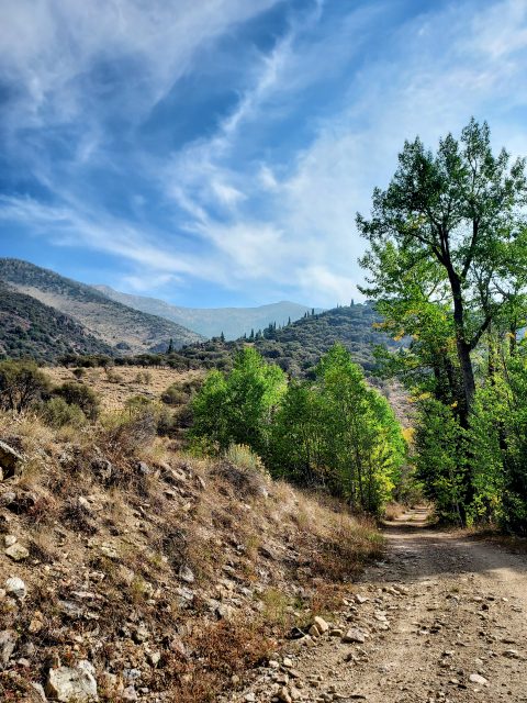
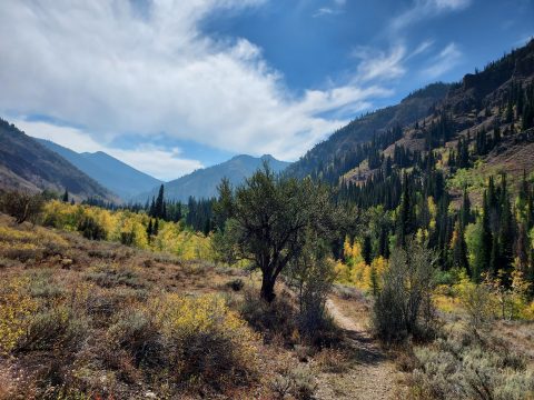
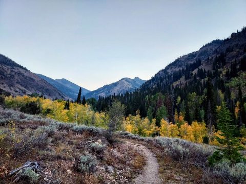
I parked at Pavalak Campground about 3/4ths of a mile away from the more popular Pine Creek Campground. Initially, I was worried about the condition of the road up to Pine creek but this was overly cautious. Any vehicle can make it the additional 3/4ths of a mile to Pine Creek and camp there.
Past Pine Creek Camp lies a cherry stem and clear signs that the road is high clearance 4x4 only. Some sections looked fairly do-able but there were a few water crossings and very rocky sections that are not Subaru friendly. If traveling on wheels beyond this section, factor in personal skill level and self-reliance. I have neither when it comes to driving such roads but I'm happy to simply walk them. It was only an additional mile to the end of the vehicle road.
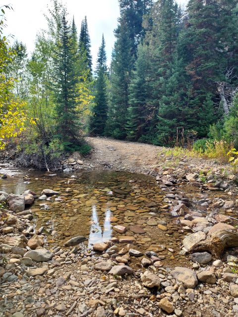
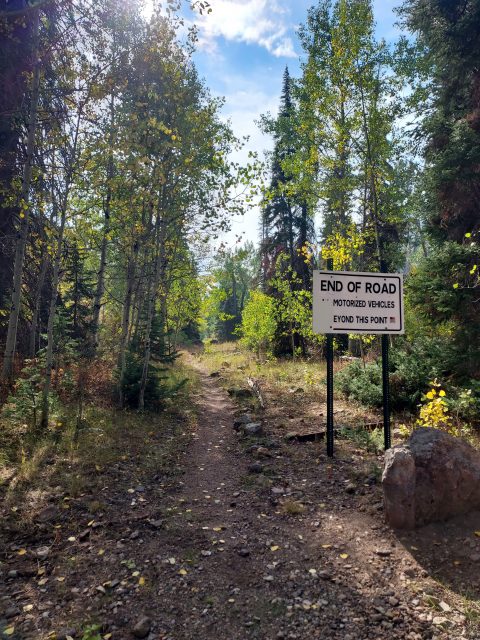
Although the road technically ends here, it still feels like a road walk for another 0.6 miles to the Jarbidge Wilderness Boundary. At this point, there's a primitive campground and the classic pentagonal sign indicating the boundary. An obvious trail continues further up the canyon. The trail meanders another 1.0 mile along the flanks of Nevada's Matterhorn Mountain and then crosses Dry Gulch. Surprisingly, the gulch had water flowing which I noted in case I ran out on the return. From here, its a long semi-scramble to the top.
Off trail to the saddle
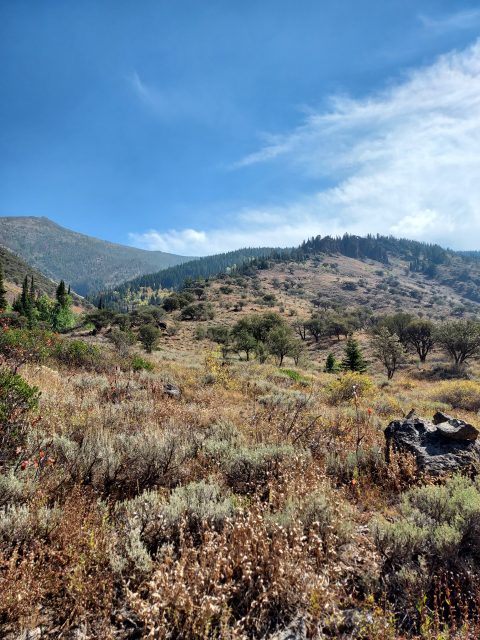
Anticipating some semblance of a route departing from the main trail, I kept an eye out for cairns or a herd path. Sure enough, after less than a tenth of a mile, I found both headed towards the saddle between Nevada's Matterhorn Mountain and Cougar Peak.
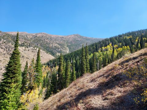
From the point I started heading to the saddle, it was consistently steep and slow going. Dry gulch at the trail is at about 7,400' and the altitude of the saddle is roughly 10,000'. I gained about 1,000' an hour which is my typical rate for off trail climbing. The first 1,000' were loose and tricky in some sections but nothing greater than class II. Deadfall was everywhere from 8,000-9,000' but the views of the Jarbidge Wilderness really opened up, which took the sting out of the slog. The final 1,000' to the saddle were the steepest with some talus and slippery sections greatly slowing my pace.
Saddle to Summit
I went through classic peakbagger thought process at the saddle. I started the day hoping to tag most, if not all summits on the ridgeline. But, it was also getting considerably late in the day to do such a thing. Drinking water and having lunch at the saddle, I decided Matterhorn was my main goal and I was sure I'd have a reason to return to Jarbidge. I bailed on trying to bag Cougar Peak which was wise in the end- Cougar Peak involves a pretty tedious (but non-technical) scramble from the saddle.
There's a lot of up-and-downs to the summit from the saddle which is not very evident from a topographic map alone. At times I followed the ridgeline and at others I tried side-hilling to avoid the unnecessary gain. In the end, it really didn't matter. Finally, I was just below the summit and it was a bit of class II scrambling through talus and boulders to the summit.
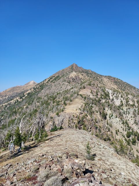
There's a post at the top which is visible for much of the final scramble. The summit also has an amazing summit register filled with the who's who of peakbagging. All the usual suspects had tread this way and I was thankful to add my name to the short list.
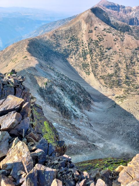
From the summit, I vaguely saw why it was named Matterhorn Mountain. The North face rises with extreme relief over the valley containing Fall Creek. Even in a profound drought and mid-September, snow lingered across the North face. Were I not short on daylight I would have spent an hour on the summit.
Notes on the descent
After making the hard decision to only climb Matterhorn and not the other summits on the ridgeline, I returned mostly on the same path. Route-finding is not difficult in either direction given the fairly parallel orientation of Jarbidge Creek and the spine of Matterhorn. Having the benefit of my GPS route helped immensely.
I got back well after dark and camped out near Jarbidge. Although the area is extremely difficult to get to, I imagine I'll return sometime within the next few years to bag some more summits.

No Comments