


On my ramble through Northern Nevada, I hiked/scrambled/climbed Hole in the Mountain Peak; the isolated monarch of the East Humboldt Wilderness. The captivating summit looms in the distance over westbound travelers on I-80 as the head into Wells, Nevada. Most assume its like any other of Nevada's hundreds of mountain ranges. To peakbaggers, Hole in the Mountain Peak is a prize. Its the 11th most topographically prominent summit in Nevada and the 35th tallest in the state. In the lower 48 states, its the 61st most topographically prominent summit making the top 100 list. Obviously outside of the peakbagging world this is useless information and the summit register is consequently only signed by us compulsive climber types. This climb was a prequel to my visit to the Jarbidge Wilderness and Matterhorn Peak to the North.
Getting to Hole in the Mountain Peak Trailhead
The approach to the trailhead is a little tricky as it involves driving on unnamed private roads with public easement granted. Google maps will not get you to the trailhead. The driving route starts from Wells and this is what I found:
- From I-80 exit for Wells Nevada and Highway 93 aka Great Basin Highway, head south. Zero odometer at the Sinclair Station just south of the highway.
- Travel 5.3 miles south on Highway 93 for 5.3 miles, take a right on NV-232. Zero odometer again
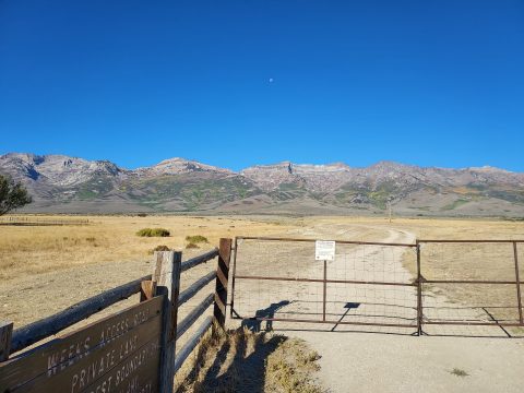
- Drive 8.6 miles south on NV-232 past several ranches. At 8.6 miles there's a gate and cattle guard on the right with clear signage for East Humbolt Wilderness. If you pass the cemetery, you've just missed the turnoff
Access Road
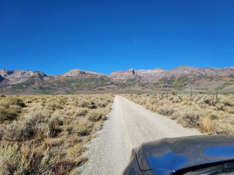
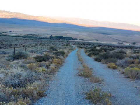
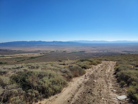
As mentioned, this is a private road with public access permitted for purposes of reaching Humboldt National Forest. Leave all gates exactly the way you found them, be kind to cattle, make room for working folks and be courteous to anyone you meet. It is 2.8 miles to the National Forest. The road is tame by 4x4 standards but bumpy, rocky and overgrown in some sections. There's ample signage all the way to the boundary and basically you follow the path of least resistance. Subaru friendly in general but I wouldn't take a passenger car on that road. After reaching the National Forest, all roads are serious 4x4 only, not Subaru friendly. Here's a few waypoints I noticed on the drive.
- 0.8 miles, first cattle guard
- 1.4 miles, second cattle guard
- 2.0 miles, road takes a sharp right over third cattle guard
- 2.3 miles, road curves left and becomes more rocky and overgrown
- 2.8 miles, fourth cattle guard, National Service Boundary. Most, should park here.
- 4.3 miles, road's end, Lissies Basin
Here's a few photos of what to expect on the drive:
Map of the Route
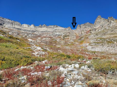
Here's the route I took which seems consistent with the one most chose. The chute becomes much more obvious once near Lissies Basin-
Climbing Hole in the Mountain Peak
This is the most commonly completed scramble/hike of Hole in the Mountain Peak. There are good but distant views of the actual "hole" in the peak. Note there are no signs nor trails for the vast majority of the hike although the route is quite clear for the most part.
National Forest boundary to Lissies Basin
I parked off the road at the National Forest Boundary and hiked the final 1.6 miles of the road to Lissies Basin. The place I parked was at 6,850' of altitude. It was pleasant road walking but I can't imagine the amount of skill and kind of vehicle that could make the final section. I'm more confident on my two feet than I am on 4 wheels. Along the way I noticed plenty of pullouts for turning around. Additionally there were a few campgrounds.
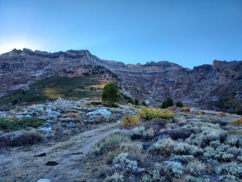
The road ends in a cherry stem with room for parking about 2-3 cars off to the side. Altitude of the end of the road is approximately 8,350'. Note there is no trail from here although there's a now well-established route through the brush and scrub. Look for a cairn at the edge of the road with a narrow but passable path through. Here's what I found-
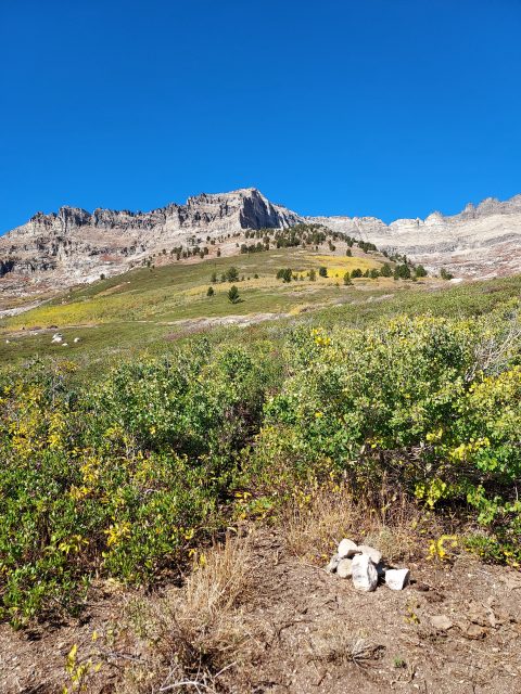
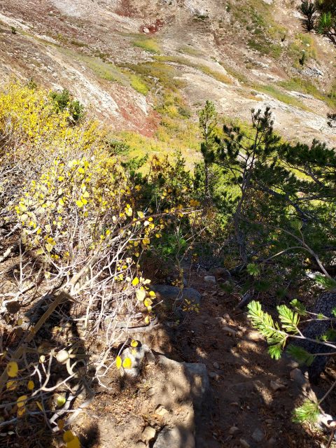
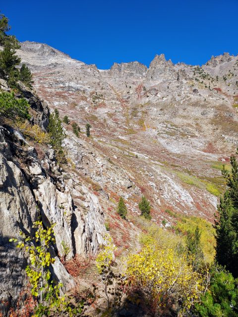
I climbed this brushy path as it meandered up and around to a seemingly impassable forest and cliffs around 8,750'. From here, I found the cairn that marks a descent along a cliff face and in to Lissies Basin. It was a bit disappointing to lose altitude on such an arduous climb although I only descended to about 8,600' before ascending again. The route took me by a few ephemeral water sources which surprised me given the drought well into late September. I noted them in case of emergency.
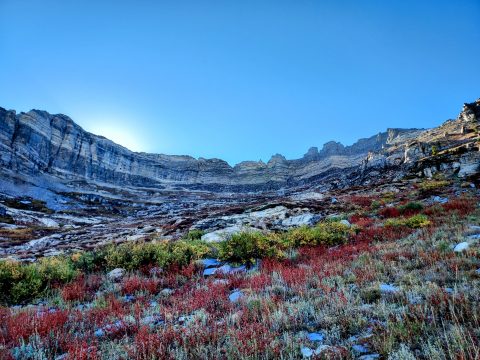
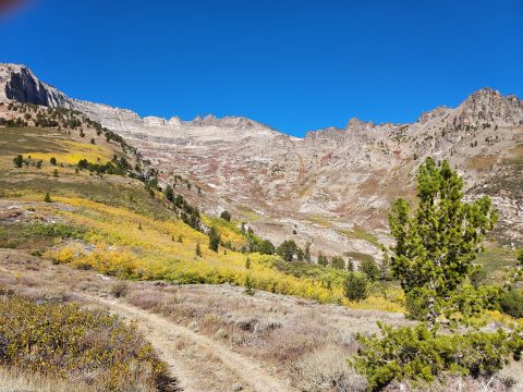
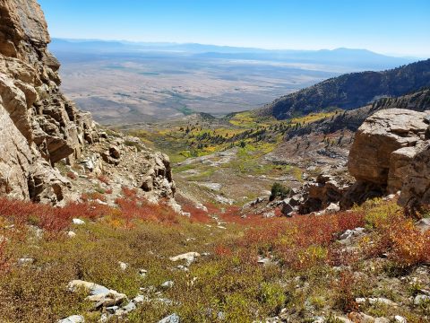
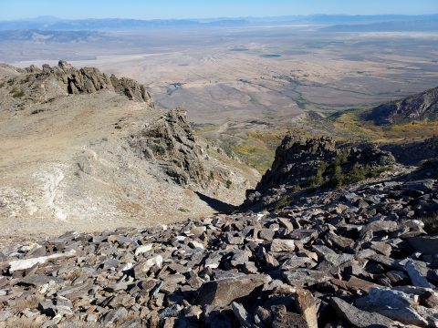
Lissies Basin up the Class II Chute
From afar, this section looks gnarly but once above Lissies Basin the chute appears straightforward. It was dry as a bone when I ascended at the end of the summer in our historic 2021 drought. Wetter year may make the ascent more tricky. While there was no evidence of a herd path or cairns, there's a line of bare rocks going most of the way until about 10,400'. Some sections were loose and arduous but no scree. Here's a few photos of it-

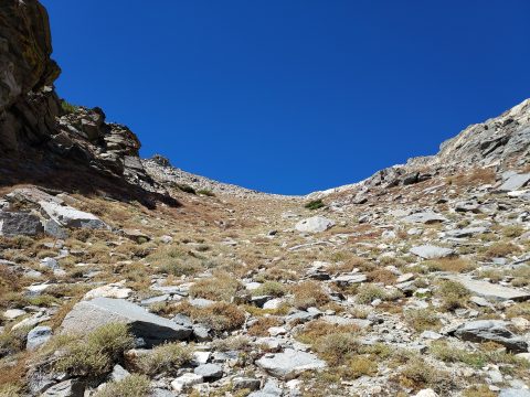
Top of the chute to summit of Hole in the mountain Peak
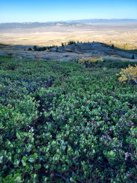
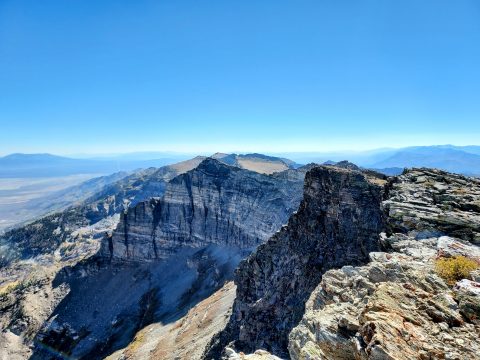
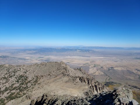
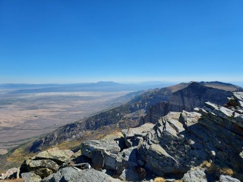
After topping out on the chute, much of the East Humboldt Wilderness and range opened up. I sure gained a lot of altitude in a very little distance! The route to the summit hooks to the west from here. Boulder fields abounded which slowed my going but it was never really tricky nor loose. The final 200-300' of altitude involved some side-hilling to avoid false summits but I eventually stood on the summit, 4 hours and 15 minutes after starting the climb.
Views were incredible, of course. All the major summits of the region were visible including the Ruby range, Mt Ibapah and Pilot Peak. Arid valleys rising to sky islands mark the view from most of Nevada's summits but every one of them is extraordinary. I'll never tire of these climbs.
I signed the summit register- 4th name and only 3rd party to do so in 2021. Naturally all the typical names were in the register. I lingered on the summit enjoying the rare, pleasant weather and trying to pick out all the summits in the East Humboldt Wilderness before eventually descending.
For the down climb, I followed my GPS track and there weren't any particularly difficult sections other than the brief climb out of Lissies Basin. Surprisingly, I had no difficulty finding the herd path through the brush and back to the end of the road. Finally back at the car, I made the whole climb in almost 8 hours exactly.

No Comments