


On my recent ramble through Northern Nevada, I turned my sights to Granite Mountain (9,736′) near Paradise Valley. It's' the highest peak in Humboldt County, Nevada. With an impressive relief over Paradise Valley and nearby Winnemucca, it's worth hiking although almost exclusively climbed by peakbaggers. Although well off the beaten track, it's an easy approach by Nevada standards. Here's my trip report!
Getting to the Trailhead
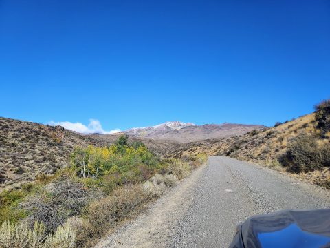
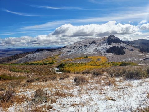
Granite Mountain is the highest summit of the Santa Rosa range in northern Nevada. Like many mountains in this part of the state, they are cold and arid most of the year. Granite Mountain receives most its precipitation as snowfall. It was no surprise to me that snow blanketed much of the shaded slopes above 7,000'. The land is all managed by Humboldt–Toiyabe National Forest with parts of the range within the Santa Rosa–Paradise Peak Wilderness. All the roads are dirt/gravel and most of them infrequently maintained. However, NF-084 which goes over Hinkey Summit seems well maintained for most passenger vehicles. Note there is no snow removal though. I had no trouble driving a stock Subaru Outback to Hinkey Summit and taking the rest on foot. NF-084 continues north then west, eventually joining US Route 95. The only campground is Lyle Creek Campground just north of Hinkey Summit.
Here's the driving directions from Winnemucca-
- Drive north on US Route 95 approximately 23 miles to NV-290, turn right. Note there's a gas station at this intersection
- Drive north on NV-290 for about 18.0 miles to the small town of Paradise Valley, Nevada.
- Turn right just after passing the Paradise Valley Saloon, then make an immediate left on Hinkey Summit Road/NF-084. Although there are signs, the road is easily missed.
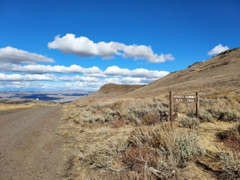
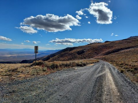
- Drive north on Hinkey Summit road for about 3 miles until the end of the pavement. Continue on this well-graded dirt road another 11.7 miles to Hinkey Summit. Passenger cars should park here.
- If you have high-clearance 4x4, turn left at Hinkey Summit and drive another 1.2 miles until the end of the road
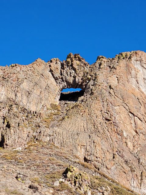
The road is steep and sinuous but passes creeks, aspen stands and a natural arch. Keep a close eye out for it just below the pass.
Here's my hiking map-
Granite Mountain (Humboldt County) Hike/Scramble
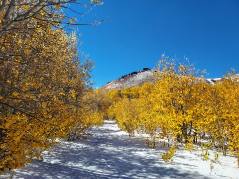
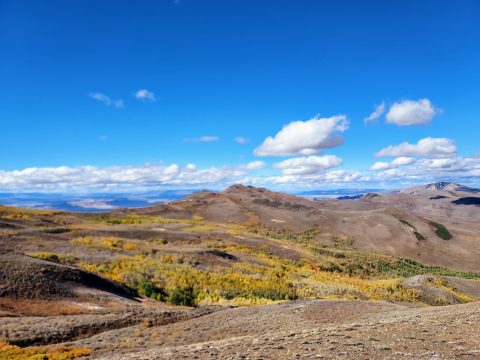
Although the route up Granite Mountain is well established, there are no trails nor signs. Most should start their hike at Hinkey Summit (altitude 7,858') and walk the access road another 1.2 miles to road's end at ~8,450'. From here I got off-route when I continued through a flat stand of aspens illuminated with fall color. Altogether, not a bad thing to get sidetracked by but I had to bushwhack back to the main route.
From road's end, it's best to follow the fence line for 0.9 miles to an altitude of roughly 9,120' . There's clear evidence of a herd path although hard to say whether its animals or people who maintain it. Extensive cow pies evidenced the former.
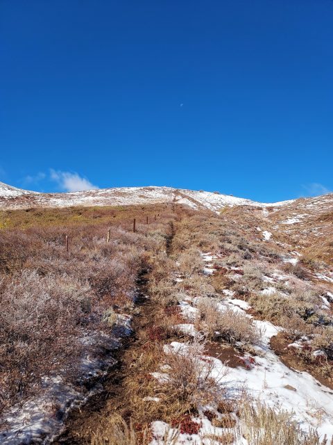
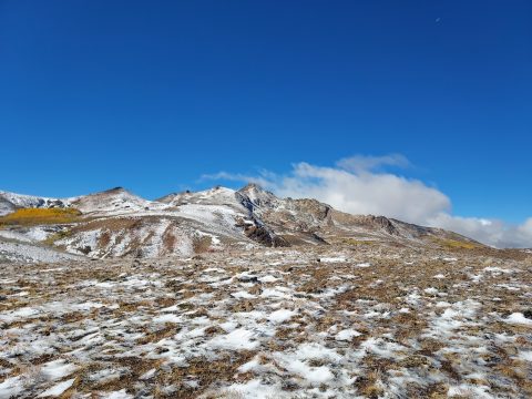
At approximately 9,120' there was a clear break in the fence line that I crossed and then began a steep climb up the false summit. Of course, I was tricked by the false summit! The true summit came in to view as well as the scramble route.
This photo shows a crude outline of the route I took-
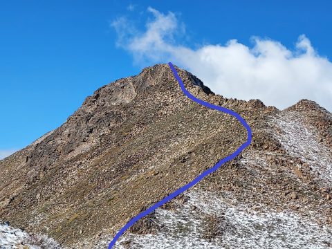
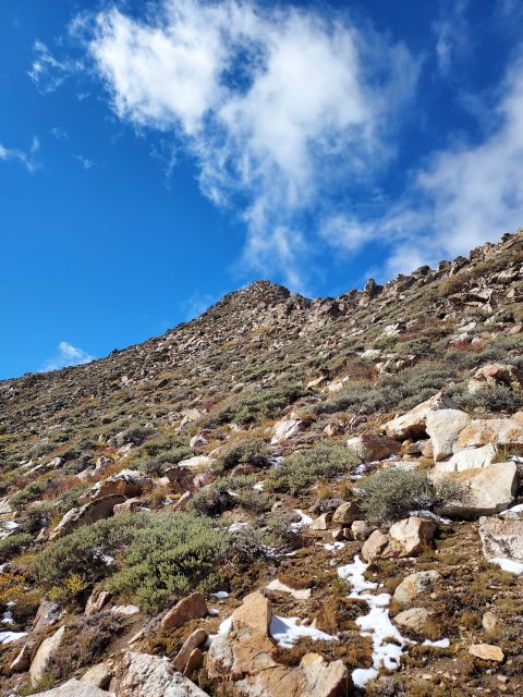
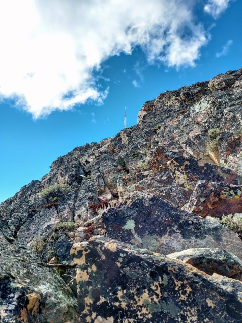
I descended to the saddle between the false summit and Granite Mountain then began climbing. I stayed mostly to the left or south of the main ridgeline. The last 200-300' were firmly in the scramble column although route finding remained easy. Thankfully there was no lose rock nor exposure to contend with. Scrambling solo always makes me worried but in retrospect it was a tame climb.
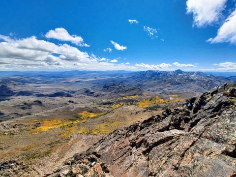
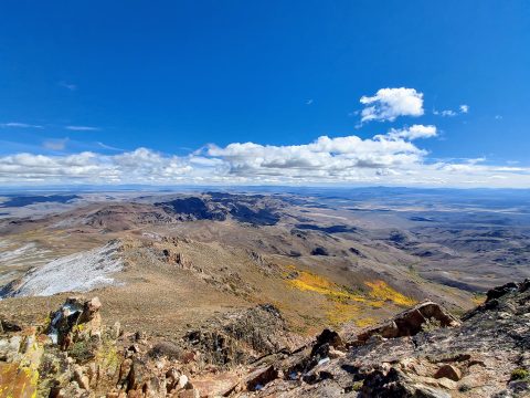
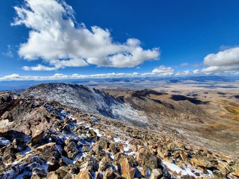
Upon the summit, I discovered expansive views of endless mountain ranges of at least three states. It must have been close to peak autumn color as well. There were two summit registers, one with signatures dating back to the 1960s. Seems that all the big names left their mark here.
After a pleasant lunch, I descended without incident. I returned to the car after about 4.5 hours which is much slower than the average peakbagger. Nevertheless, the views and the remoteness of the place were captivating enough to slow my pace. Hope I can return and climb nearby Santa Rosa Peak!

No Comments