


Greys Peak, Nevada is a prominent summit of the East Humboldt Range in the northern part of the state. It's not a major peakbagging destination but its extreme relief catches everyone's eye driving West on I-80. Greys Peak caught my attention because I needed something to do between climbing Ibapah Peak and Pilot Peak. This summit involves a class II-III climb which has some difficult route finding but is a nice 1/2 day climb.
Getting to Greys Peak, Nevada Trailhead
Getting to the trailhead is easy by Nevada standards. The closest map-dot is Wells while the closest larger settlement (by Nevada standards) is Elko. The trailhead is essentially Angel Lake Campground, however Google maps did not plot the best route. I followed this route-
- From Exit 351 on I-80, I took Humboldt Ave South and immediately turned West on State Route 231 / Angel Lake Rd.
- State Route 231 / Angel Lake Rd goes a paved but steep 11.5 miles to the Angel Lake Campground
- State Route 231 is often closed during winter. Check https://nvroads.com/ before going
Google Maps takes an odd route using State Route 232; I'm sure it would get you there too but I liked simply following State Route 231. At the end of the road is Angel Lake and the campground. The altitude is 8,382' .
Route Map
Greys Peak, Nevada via Western Slopes
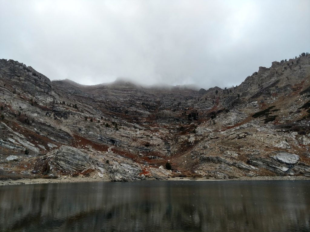
Starting from the parking area just East of Angel Lake, I circled the South side of the lake following a very clear trail. As I rounded to the West side of the lake, numerous herd paths made route finding difficult. I went up and down some bluffs above the river and crossed Willow Creek, the only creek flowing into Angel Lake.
Just North of Willow Creek was an obvious ridgeline that offered the best route up a steep headwall. From here on out it was class II and class III scrambling to the top.
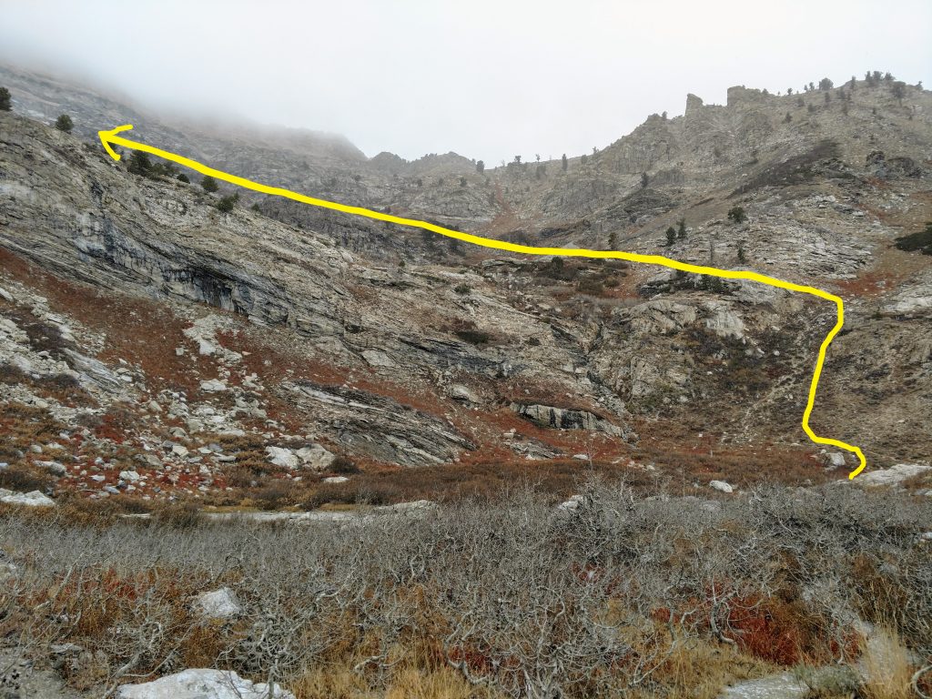
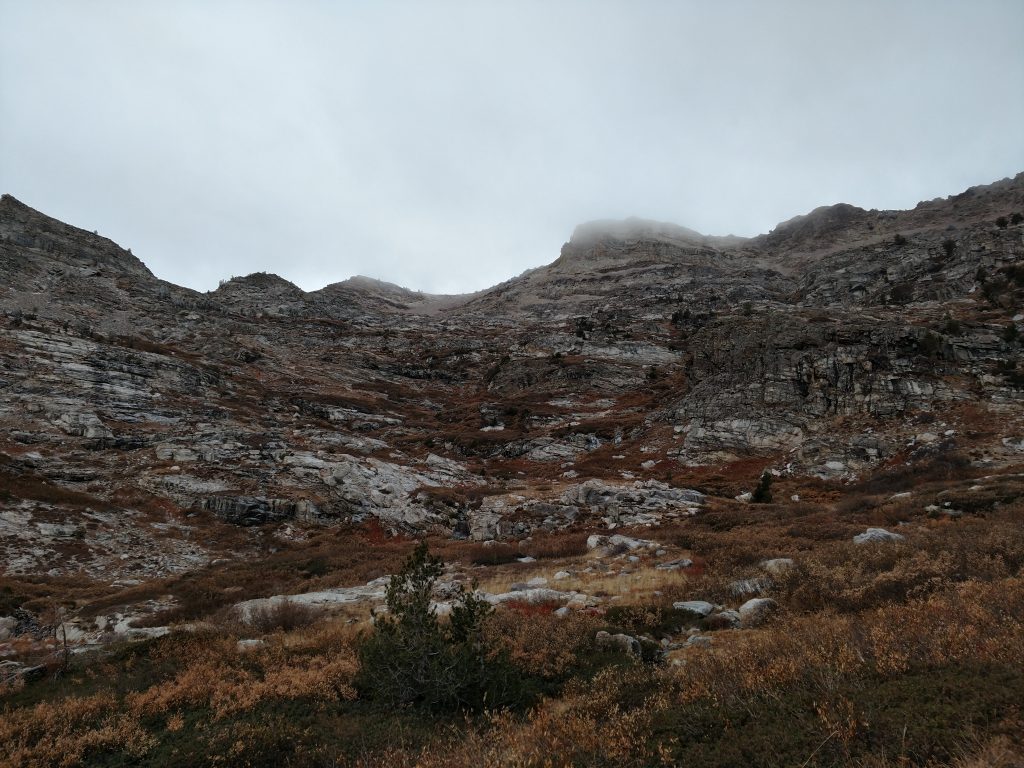
Above the headwall, I re-crossed the upper reaches of Willow Creek and took a somewhat direct route headed South-Southwest. On the way up and down, this involved some steep and slippery moves along a faint gully. I aimed for a notch just below 10,000 that was obvious from the route but not clear from the topo map.
I hit a flat, area with an incredible view of Chimney Rock and Clover Valley below. Its one of the few valleys in Nevada that's more agriculture than rangeland. Heading West from this plateau is a steep, class II ridge that intersects with the spine of the East Humboldt Range. Greys Peak isn't far.
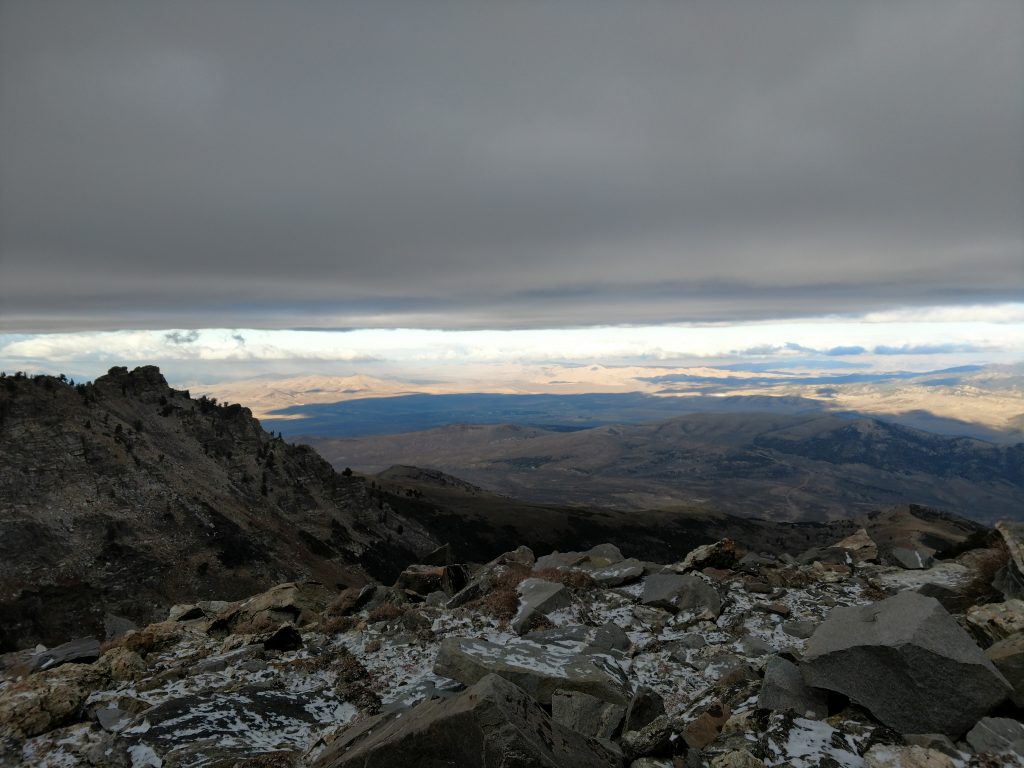
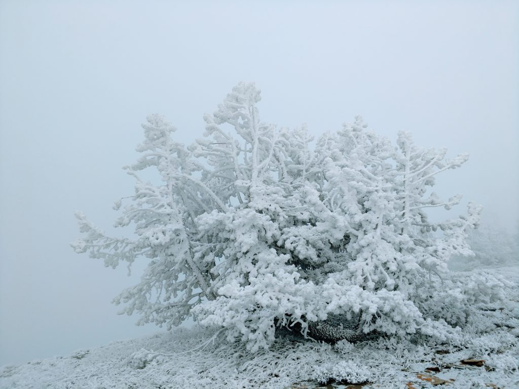
I ascended the ridgeline without much problems. Some sections were full on hands-and-feet scrambling but I gained the main ridgeline of Greys Peak in short time. It was hovering around 10-15 degrees at this point with constant wind. The scene was quite haunting-
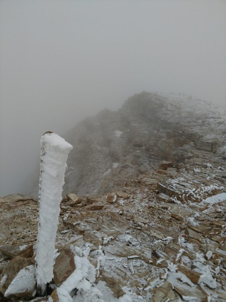
From the main ridgeline to summit was just a quarter of a mile of walking. I reached the summit of Greys Peak after dark and any view was totally socked in by clouds anyways. A lone wooden marker signified the top. Unfortunately, I didn't find a summit register but I didn't spend too much time looking with the temperature dropping and wind picking up.
Descent
There's not much to say about the descent- for the most part I simply followed my GPS route. I never found any real cairns nor herd path on the way down either. Although the wilderness was marvelous, the route itself was poor quality in general.
Back to the car hours after dark, I stayed the night in Wells. I thought about bagging Hole-in-the-Mountain Peak which is the highpoint of East Humboldt Mountains but decided to save that one for another day. Overall, I'm glad I got to explore this frequently overlooked range.

No Comments