


Until recently, I never really thought of Roseville as a hiking destination. Years of going back and forth between the Sacramento region and the Bay Area illuminated some of the lovely hikes in the region. Most folks in the area prefer hikes in Tahoe and the Sierras to anything local, but I've found several hikes that match those further up in the mountains.
Here's my 10 favorite hikes near Roseville highlighted in this post:
- Beale Falls/Fairy Falls: 5.1 mile, moderate hike with a waterfall and swimming hole.
- Hidden Falls Regional Park: 7.3 mile, difficult hike that loops though a classic group of waterfalls.
- Treelake Park to Beales Point: 7.5 mile, moderate hike that winds through a rarely visited public trail between Granite Bay and Folsom.
- Browns Ravine and Mormon Islands: 7.8 mile, moderate hike along the South shore of Folsom lake including a detour of Mormon Islands.
- Cronan Regional Park, Down and Up Trail: 5.1 mile moderate loop hike along the South Fork of the American River.
- Gerle Loop Trail: 2.0 mile, easy hike along the South Fork of the American River.
- Monroe Ridge Loop Trail: 3.1 mile moderate hike through the State Historic Park in the Sierra Foothills.
- Black Hole of Calcutta Falls Trail: 2.2 mile easy hike to a large Waterfall in Auburn State Recreation Area.
- Confluence, Cool and Middle Fork Loop: 9.5 mile very difficult hike in Auburn State Recreation Area.
- Confluence to Lake Clementine and Foresthill Bridge Loop: 8.6 mile very difficult hike of the North Fork of the American River returning via Foresthill Bridge.
Map and Overview
With any list of hikes, I'm careful to say that this is "a list" not "the list". I chose my favorite Roseville hikes based on entirely subjective experience but aimed for a nice range of environs and distances. All are roughly 1/2 hour to 1 hour from downtown.
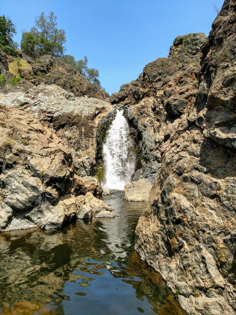
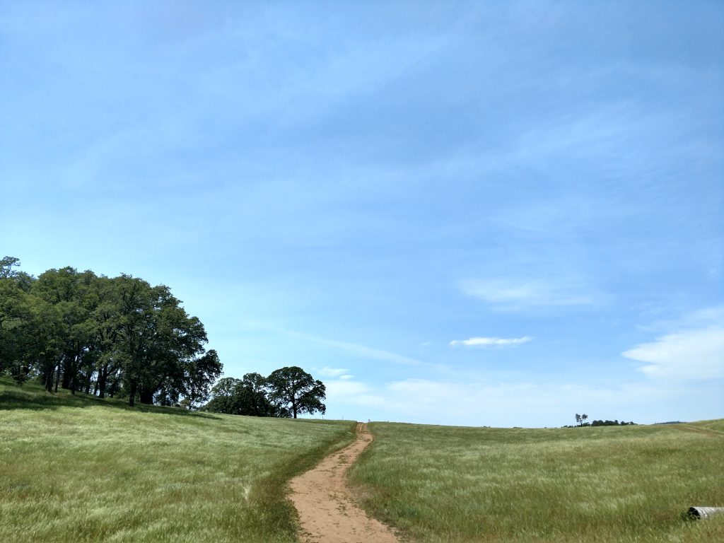
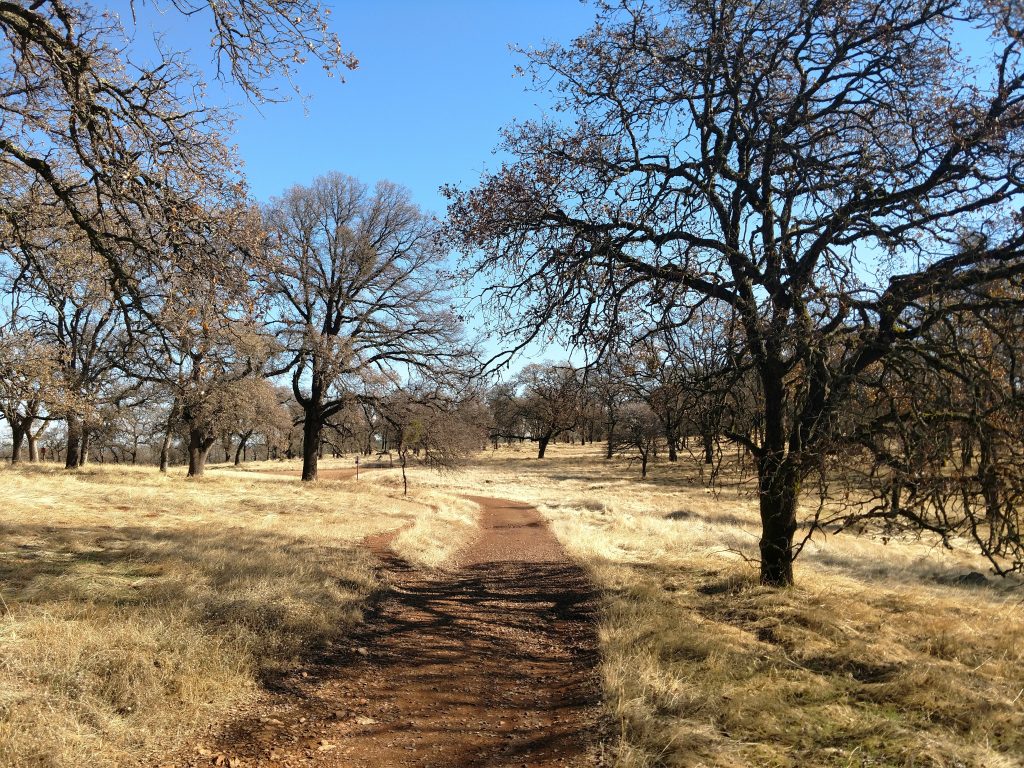
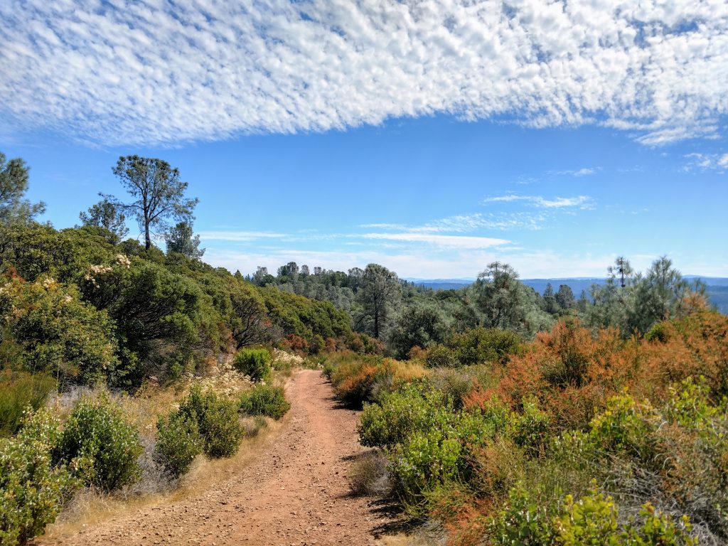
#1 Beale Falls/Fairy Falls Hike
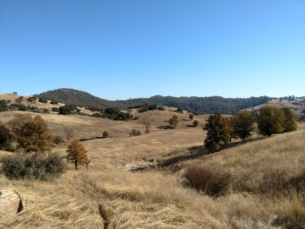
While not exactly off the radar for many, it took me years to finally hike this one. Beale Falls is close to Beale Air Force Base and is a 5.1 mile hike. The parking area has plenty of spots and the trail fills up on busy, hot weekends. Nevertheless, it's a splendid walk through oak savannahs characteristic of the foothills and leads to a large falls and swimming hole.
This hike is further afield from Roseville, about 1 hour north. Note that the road past Camp Far West Reservoir is unpaved but generally in good shape for any car. At the obvious end of Spenceville Road, there's a trailhead.
Map Below:
From the parking area, cross the bridge over Dry Creek and make an immediate right. Follow the fire road 1.2 miles as it heads in a northeasterly direction. At 1.2 miles, the trail comes to a fork; follow the sign pointing to hiker's right. Descend in a southerly direction through a lovely meadow until encountering a 3 way intersection at 1.6 miles.
Any three of the trails departing from this junction lead to the falls. The leftmost and middle trails offer more shade but they are faint in some sections. For the most straightforward route to the falls, follow the rightmost trail for another 1.2 miles. The trail essentially terminates at Beale Falls although there's some bootleg trails around the falls that I don't recommend exploring.
#2 Hidden Falls Regional Park Loop
Hidden Falls Regional Park is the most well-known hiking destination near the Roseville Area: I doubt I'm the first to remark on it. It is worth visiting despite its notoriety. Note that reservations are typically required on weekends. Reservations on weekdays vary by season, so check the park website before going.
Hidden Falls Regional Park encompasses a particularly scenic section of Coon/Deadman Creeks and two waterfalls. Known for both hiking and mountain biking, the trail network is extensive. I highly recommend having the park map handy.
Hikes range from 2 mile out-and-back jaunts to see the falls to 15+ mile loops. A nice in-betweener is the loop of South Legacy Way and North Legacy Way.
Map Below:
As this is a canyon hike down a river, note that the bulk of the elevation gain is on the second half of this hike. Start descending the 0.8 miles of South Legacy Way to Deadman Creek. Follow South Legacy Way another 2.9 miles along the banks of Coon Creek. The crossing of the Salmon Creek Bridge is 3.7 miles from the start and essentially the halfway point of this hike.
On the other side of Coon Creek, there's several return options. The best option is the appropriately named Creek Side Trail which hugs Coon Creek for 2.4 miles before linking up with North Legacy Way. For a more straightforward return, take Creek Side Trail for 1.0 miles past Salmon Run Bridge and take a left at the fork to link up with North Legacy Way.
All routes on the north side of Coon Creek (North Legacy Way or Creek Side Trail) funnel back to Canyon View Bridge and the two big highlights of the hike: Canyon View Falls, just North of the bridge and Hidden Falls, just to the South. From Canyon View Bridge, follow Hidden Falls Trail 0.5 miles to Whiskey Diggens Bridge. Take South Legacy trail up 0.8 miles to the parking lot or take the equidistant Poppy Trail for added variability.
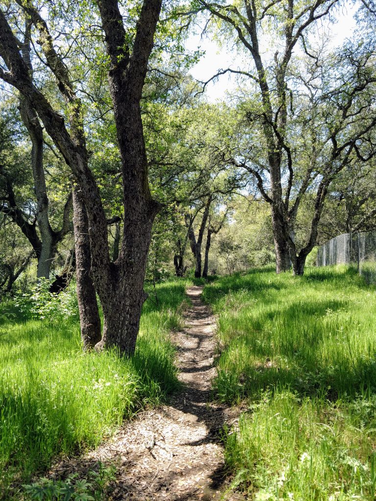
#3 Treelake Park to Beals Point
This hike is far more off the radar than the others. I discovered this over years of running out of new hikes close to Roseville during a visit to Treelake Park, coming across unmarked but well-established trail. Eventually I took it all the way to Beals Point in Folsom Lake State Recreation Area. I've probably seen a total of two dozen people over my dozens of trips down this trail.
Map Below:
From the Treelake Parking lot, walk to the tennis courts and look for a dirt trail that parallels bramble bushes towards the massive overhead power lines. Follow this trail in a generally westward direction as it wraps around several neighborhoods. At roughly 0.5 miles from the park, cross Linda Creek; note it can get swollen during the rainy season. Follow the trail until intersecting with Barton Road, 1.3 miles from the start.
Cross Barton Road and look for a trail paralleling a wooden fence on one side and driveway on the other (no signs). The trail gets very steep for a tenth of a mile but has a sweeping view of Sacramento from the top. Descend down the other side and follow for another 0.7 miles as it loops around Baldwin Reservoir.
The trail abruptly ends at an unmarked paved road at 2.1 miles from Treelake Park. Take a left and walk the road a tenth of a mile to Auburn Folsom Road. Look for another trail to the left, parallel to the road for 0.3 miles to the entrance of Beals Point, Folsom Lake State Recreation Area. From here, simply hike the road until it ends at the lake. Alternatively, take an unmarked trail just past the intersection with Auburn Folsom Road which winds through the woods and intersects with the American River bike trail. Take a left here to return to Beals Point/Folsom Lake.
When I hike this trail I simply retrace my steps back to Treelake Park, but there's any number of trails from Beals Point to make a much longer route.
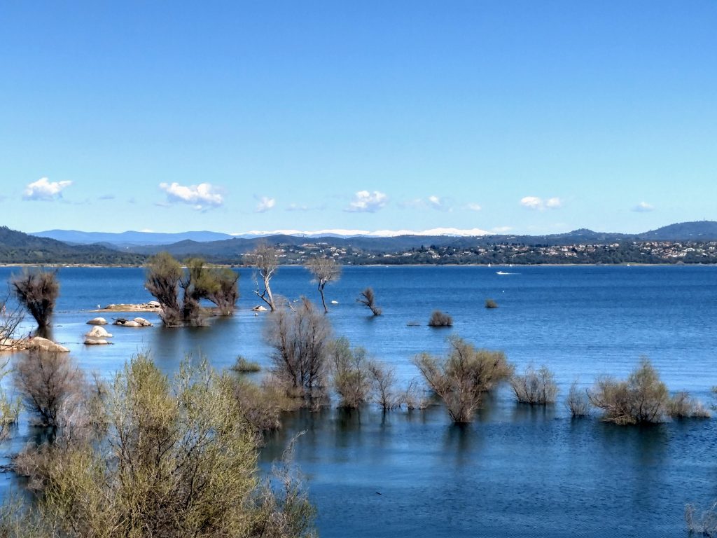
#4 Folsom Point, Browns Ravine and Mormon Islands Loop
This hike came from me wanting a different flavor from Beals Point and Auburn State Recreation Area which I hike frequently. This is also a "choose your own adventure" sort of a hike as there are dozens of trails that all go the same place. Bring a map and pick what suits you but I'll describe my favorite route.
Here's my hiking map:
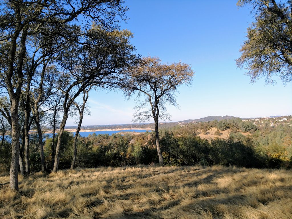
Parking at the Folsom Point Boat ramp, I followed some herd paths encircling Folsom Point with some excellent views of the lake and foothills. You can skip this part and simply head to the levee headed towards Browns Ravine. It's about one mile from Folsom Point to Browns Ravine.
At the end of the levee, several trails permeate the peninsula of Browns Ravine. I followed the trail by the lakeside two and a half miles to the boat ramp, turned around at the boat ramp and followed a single track mountain biking route back about one mile to the levee.
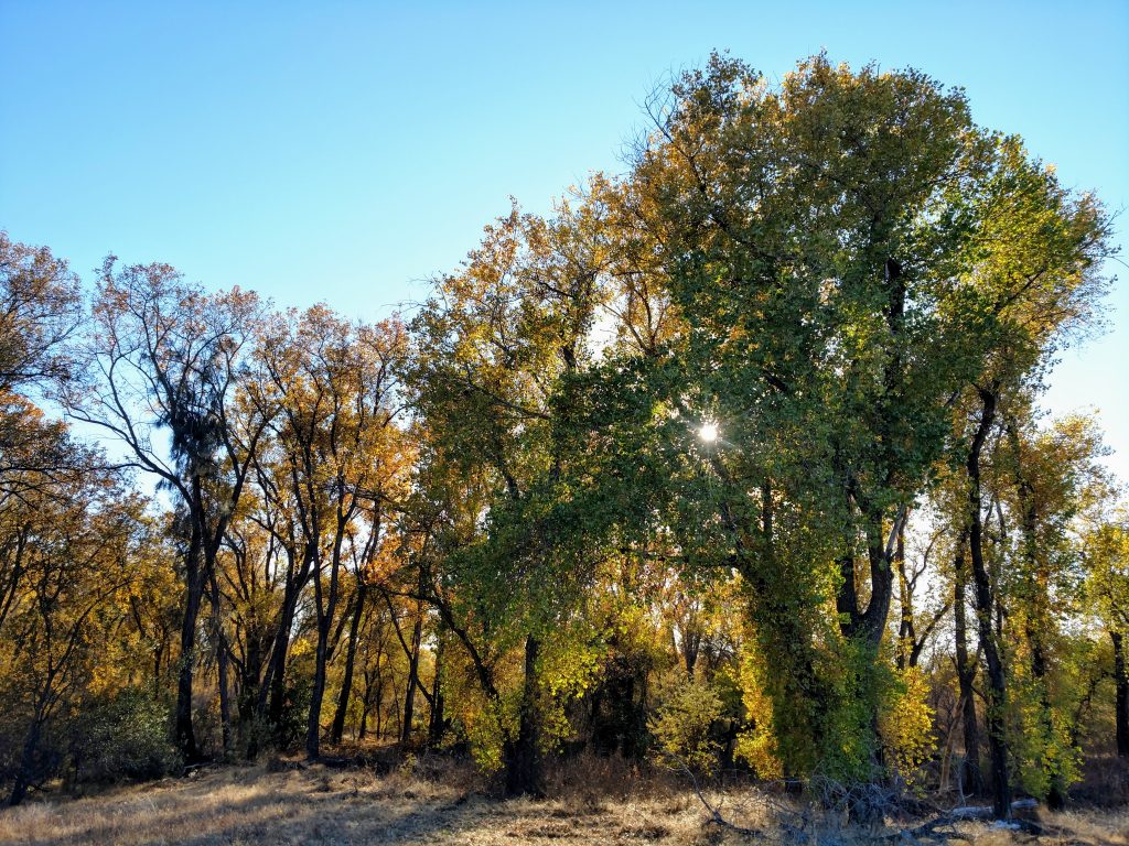
Most should just head back the levee to Folsom Point for a five to six mile total distance. I wanted to include the Mormon Islands wildlife area, so I followed the access road back to Green Valley Road. Crossing the road, I followed a herd path cut into the side of the road about 800 feet to Shadowfax Lane. I walked down this road 600 feet to a nondescript entrance to Mormon Islands. Although it was an unusual way to get to the reserve, it was a splendid place: plenty of birdwatching opportunities and more than a few well-prepared photographers confirmed it was worth the detour.
The trail through Mormon Islands runs alongside the cottonwood forest for 0.75 miles, terminating at a paved bike path. I followed this path another 0.3 miles to Natoma Street. It was a bit odd to be "hiking" on a sidewalk from here but it is the best way to get back to Folsom Point. My odd route was 7.8 miles. Again, reference the map I have above for clarity.
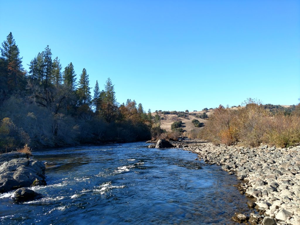
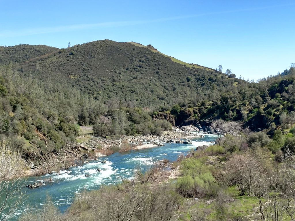
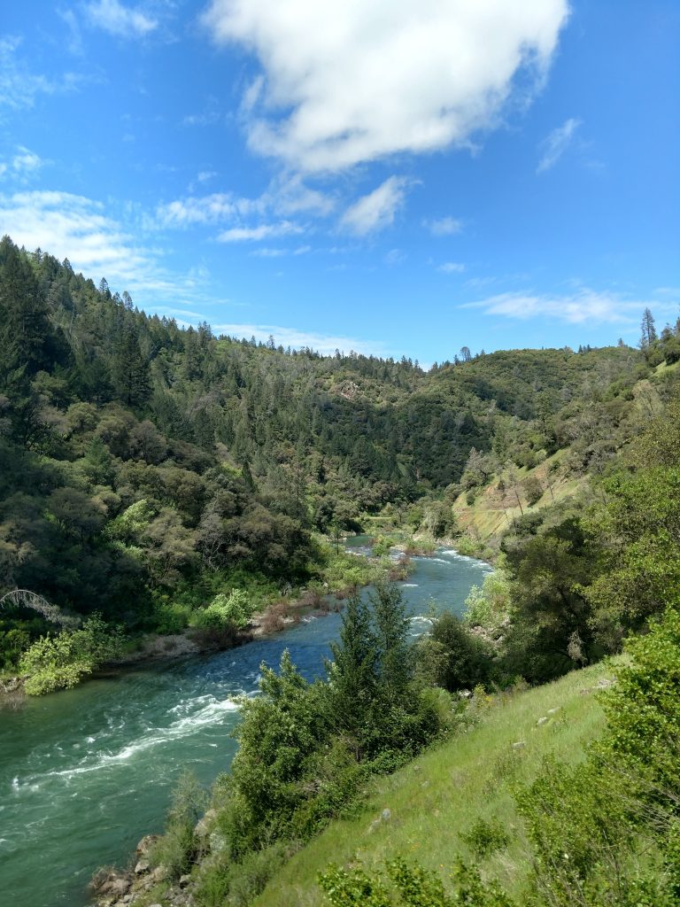
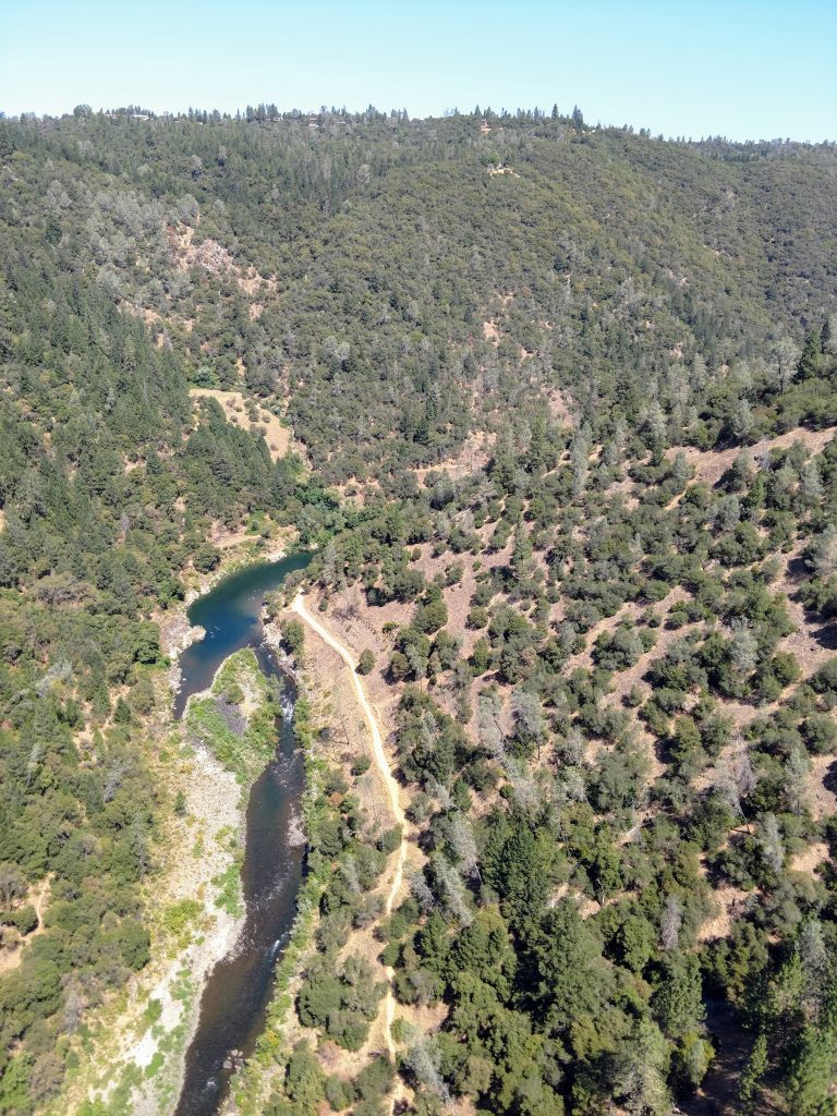
#5 Down and Up Trail - Cronan Regional Park
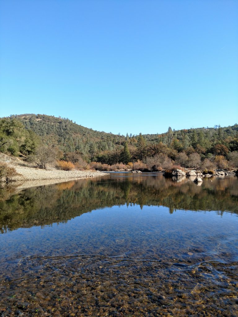
This hike is a little further out from Roseville but worth the drive. Relatively speaking, it's a newer addition to the public lands on the American River. Although popular for mountain biking, hiking and horseback riding, it's a large enough place for crowds to thin out once you hike more than a mile from the trailhead. It's a nice alternative to the often congested area of the Confluence near Auburn with plenty of 1/2 day hiking options.
Here's my map:
From the very busy parking area, head South along the main road about 1/4th of a mile to a prominent intersection. Take a left here and head up this trail another 0.9 miles. There are sweeping vistas of the American River and the aptly named "Lollipop Tree" which is a major milestone for rafters. At 1.1 miles from the parking lot, the trail begins a steep descent to the river.
The next 1.1 miles to the river are generally downhill and shaded. There are plenty of signs for the "Down and Up Trail" which helps at the numerous junctions you encounter.
The halfway point of this hike is 2.2 miles, right as the trail reaches its lowest altitude and parallels the South Fork of the American River. There's a few bathrooms here that are open during rafting season, typically.
Follow the rolling trail another 0.4 miles to the intersection of Cronan Ranch Road and take a right. Cronan Ranch Road departs from the river and heads back up towards the parking area. After a 1/3rd a mile of hiking, there's a shady spot with picnic tables and an old movie set; a good spot for another rest. To return to the parking area, take either the Long Valley Trail or Cronan Ranch Road another 1.5 miles North.
#6 Gerle Loop - Cronan Regional Park
This is a similar but shorter option than the Down and Up Trail. This hike starts from the Magnolia Ranch Trailhead just east of the Down and Up Trail. Total distance is 2.0 miles.
Here is my map:
From the trailhead, head in a clockwise direction around the Gerle Loop. The first 1/3rd to 1/2 a mile is bland as it circles around a small hill. On the backside of the hill and for the remaining 1.5 miles of the loop, the trail parallels the South Fork of the American River. Note there's an inner loop that is more well traveled and an outer loop that runs right along the banks of the river. Either way will bring you back to the trailhead within about an hour of starting.
If you want a longer hike with more altitude gain, add the Sky Ridge Loop which is about 3 miles and includes the Sky Ridge Trail, Down and Up Trail returning via Connector Trail. See this map for reference.
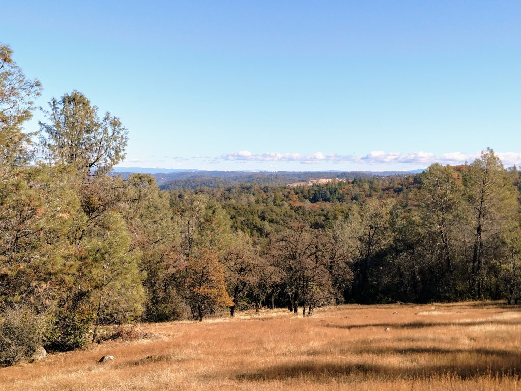
#7 Monroe Ridge Loop Trail - Marshall Gold Discovery Historic State Park
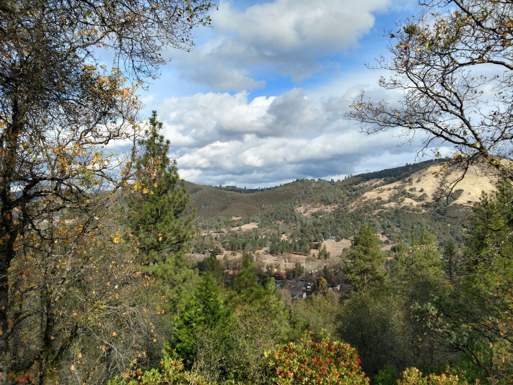
A little further afield but not far from Cronan Regional Park is Marshall Gold Discovery Historic State Park. If you grew up in Roseville or Sacramento, you probably visited this place at least once during a state history field trip. Its the cradle of the California Gold Rush. When I visited here as an adult, I happily found a short but steep hiking trail over the hills lining the South Fork of the American River. Total distance is 3 miles with 600' of gain.
Here's a map of the Monroe Ridge Loop-
This three mile hike starts from the parking areas near the Gold Discovery Museum. Look for the Monument Trail nearby the museum which winds it's way 0.5 miles up to the James Marshal Monument. This is also the terminous of CA-153, dubbed "the Shortest State Highway in California". Keep walking up the hill, past the picnic area and follow the trail as it crosses the road.The trail gets steep as it climbs the hill overlooking South Fork. About 0.5 miles after the monument or 1.3 miles from the parking area, arrive at the highpoint and picnic area. The hard part's over!
From here, the trail flows along the ridgeline with little ups-and-downs for another 0.7 miles. There's a few more view points and another picnic area before it descends 0.6 miles back to the valley's floor. Cross the highway and check out a few of the historic sites before returning the the museum.
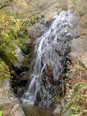
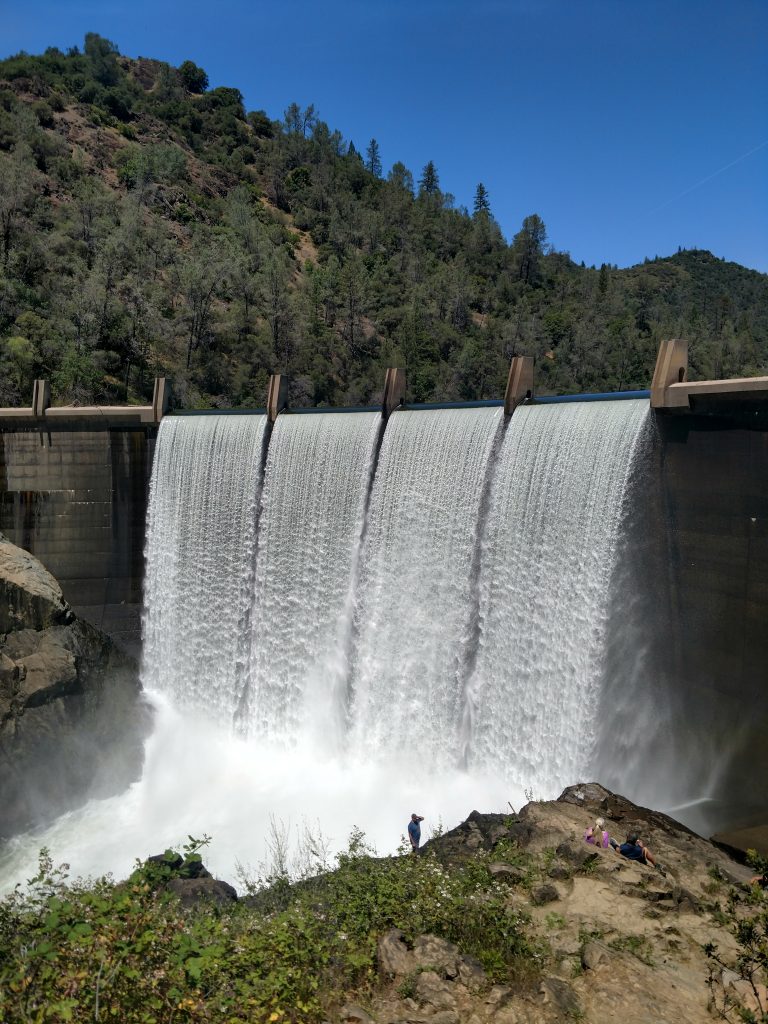
#8 Black Hole of Calcutta Falls Trail - Auburn State Recreation Area
Moving on to my favorite hiking area in Roseville-Sacramento region, Black Hole of Calcutta Falls is a perfect place to start. Its a 2.0 mile round trip hike with minimal elevation gain to a horsetail waterfall. Although winter and spring are the best time to visit, the falls typically run all year. I've previously written about this hike but thought it worthwhile to describe it again.
Here's a map of the hike:
Park at any of the spaces or trailheads around the Confluence/nearby the bridge. The trail is just South of the Highway 49 Bridge and parallels the North Fork of the American River for 0.2 miles. The trail crosses the river on No Hands Bridge which is an extremely photogenic spot of the canyon. Continue for another 0.9 miles along the trail that narrows to a single track towards the end. The falls are at a very obvious spot 1.1 miles from the trailhead. There are several places to grab photos of the falls. Note that this spot gets busy on most weekends.
#8: Confluence, Cool and Middle Fork Loop, Auburn State Recreation Area
Given the multitude of trails near the Cool area, this is a bit of a "choose your own adventure" sort of a hike. What I like about it is hiking alongside both the North and South Forks of the American River along with the views of the Sierras from Cool. My route is 9.5 miles and is strenuous.
Here's a map:
Park anywhere you find a space near the confluence and take the same trail head that serves the Black Hole of Calcutta Falls. Look for a trail departing to the left just before the walking bridge. Take a left up this trail, follow it for 0.2 miles to the next intersection and then go right on the Pointed Rocks trail. Also know as Training Hill, climb this extremely steep route up 1,000' over 1.3 miles. Ignore the side trails as you climb unless a nice view catches your eye.
After the climb, the trail hits a peaceful plateau with an extensive network of trails. Its handy to have a preloaded map through this section given the spider-web of routes. My preferred route was to follow the Olmstead Loop trail in a generally eastward direction until intersecting with the Wendall T Robie Trail. Follow this trail until intersecting with Highway 49. The shortest distance from the top of Training Hill to Highway49 that I see is 1.3 miles. The loop I took involved a greater section of the Olmstead Loop Trail.
After crossing Highway 49, descend 1.3 miles down a trail which eventually terminates at the Middle Fork of the American River and the Quarry Trail. Stay left at both trail junctions as you hike down to the river.
From the intersection with the Quarry Trail, simply take a left and head 1.6 miles back to the trailheads along Highway 49. Depending on where you parked, you may have to walk part of the highway back to the car. Most drivers are considerate in this congested stretch of road but be careful.
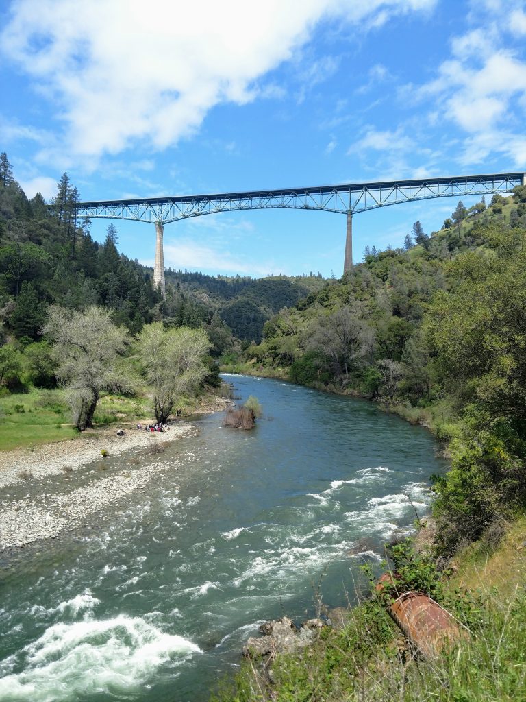
#10: Confluence to Lake Clementine and Foresthill Bridge Loop
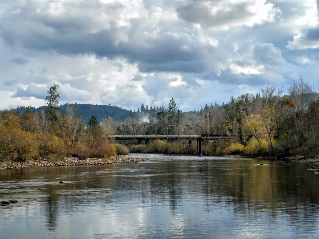
This is my favorite hike near Roseville area and I hike it several times a year. The highlight is going under and over the famous Foresthill Bridge which towers 730' above the North Fork of the American River. The addition of Clark's Hole, Clementine Lake and the higher elevations of Auburn SRA is a bonus. Note my route involves some road walking near Lake Clementine. My route is 8.3 miles with 1,400' of gain.
Here's a map of my preferred route. The final eastern loop could be cut out to shorten the hike.
Park near the confluence and walk towards the ranger station. Look for the Lake Clementine Trail which heads North towards the Foresthill Bridge. Although a little congested at first, crowds thin out after about 0.5 miles after going underneath the bridge. Follow this trail North another 1.3 miles as the river bends and the dirt trail ends at the paved Lake Clementine Road (roughly 1.8 miles from the trailhead).
From here I go right and take Lake Clementine Road up 1.4 miles to the next trailhead. Its a 500' climb but the pavement takes the bite out of the hike. The next trailhead has an obvious pullout, portable toilet and often a number of mountain bikers hanging out. Look on the left side of the road for a single track labeled Connector Trail.
I like adding the Connector Trail to my route. It weaves through the dense forests lining the upper reaches of the canyon and adds nice variability. The Connector Trail is 1.0 mile and with only minor ups and downs. It eventually terminates at the junction of Foresthill Road/Lake Clementine Road
If choosing this option, take a right at the end of the Connector Trail to stay on Lake Clementine Road, returning to the start of the Connector trail. This is a 0.6 mile road walk. At the junction, look for signs pointing towards the Fuel Brake Trail which heads in a westerly direction back towards Foresthill Bridge.
For the next 1.5 miles, the Fuel Break Trail goes up and down several small hills before reaching a maximum altitude of 1,680', over 1,000' above the altitude of the Confluence. There are marvelous views of the foothills and the Crystal Range of the Sierras, about 50 miles East. Usually the Coast Ranges of the Bay area are visible as well. Past the highpoint, the trail sharply descends to Foresthill Road with the famous bridge.
From the Fuel Break Trail to the other side of the bridge is about 0.6 miles, all flat of course. There are sidewalks on both sides and trails on both sides that eventually descend to the Confluence/HQ of Auburn State Recreation Area. My preference is to cross the bridge into Auburn and take the Bridgeview Trail to the Stagecoach Trail back down. This route is 1.0 mile and well marked/signed.
Other Destinations
Well, those our my favorite hikes near Roseville/Sacramento! Hope this is a nice start. Other areas worth checking out that have great walks and hikes are: South Yuba River State Park, Dotons Point and Beeks Bight (both near Folsom Lake), Deer Creek Hills and Cosumnes River Preserve.
Happy hiking!

No Comments