


After years of drifting across Southern Utah, it was time to take an excursion down the Coxcomb: one of the fantastic wilderness areas of Grand Staircase-Escalante National Monument. I've passed this area on other, equally incredible trips such as the Toadstools Hike, Spencer Trail and Wire Pass/Buckskin Gulch. The Coxcomb eluded me due to logistics. It is a nearly 40-mile drive down a wilderness dirt road where weather and conditions frequently change the accessibility. In October 2020, the conditioned looked suitable and dry for several weeks and I mustered the courage to explore this vast area. What follows is my summary of the drive and the can't-miss destinations along the way. I've written about five hikes: the Paria Box, Lower Hackenberry Canyon, Cottonwood Narrow, Grosvenor Arch and Round Valley Draw.
Accessing the Coxcomb on Cottonwood Canyon Road
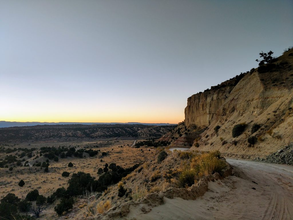
There is a single main road to access the Coxcomb, which most maps reference as Cottonwood Road. The road is unpaved, frequently wash-boarded and runs 38.7 miles between the entrance of Kodachrome Basin State Park to the North and US-89 to the South. Generally speaking, 2WD vehicles are okay, but only when it is dry. Wet conditions make the road all but impassible. Except for the very first few miles in the South, there's little or no cell phone reception. I drove from South to North in a Subaru Outback in October 2020 without too many issues other than a ton of washboard. Here are my mileages:
- 0.0 miles: Intersection with US-89
- 11.8 miles: Paria Box/Yellow Rock Trailhead
- 14.4 miles: Lower Hackenberry Trailhead (elapsed time: 1 hour to here from the pavement)
- 24.7 miles: Cottonwood Narrows South Trailhead (elapsed time: 45 minutes between Hackenberry and Cottonwood Narrows)
- 25.6 miles: Cottonwood Narrows North Trailhead
- 29.2 miles: Grosvenor Arch Turnoff (drive about 1 mile down Last Chance Creek Road to obvious trailhead)
- 38.7 miles: Reached the pavement again near Kodachrome Basin State Park.
- 45.9 miles: 7.2 miles of pavement to Cannonville, nearest gas station to Kodachrome Basin State Park
While many regularly coax their rental cars down this route, it is important to remember that its a wilderness road. Self-reliance and preparedness are necessities. Be prepared to perform basic auto repair tasks on your own, like change a flat etc.
Map of the Coxcomb: Driving Route, Points of Interest and Hikes:
Zoom in to find my hiking GPS tracks
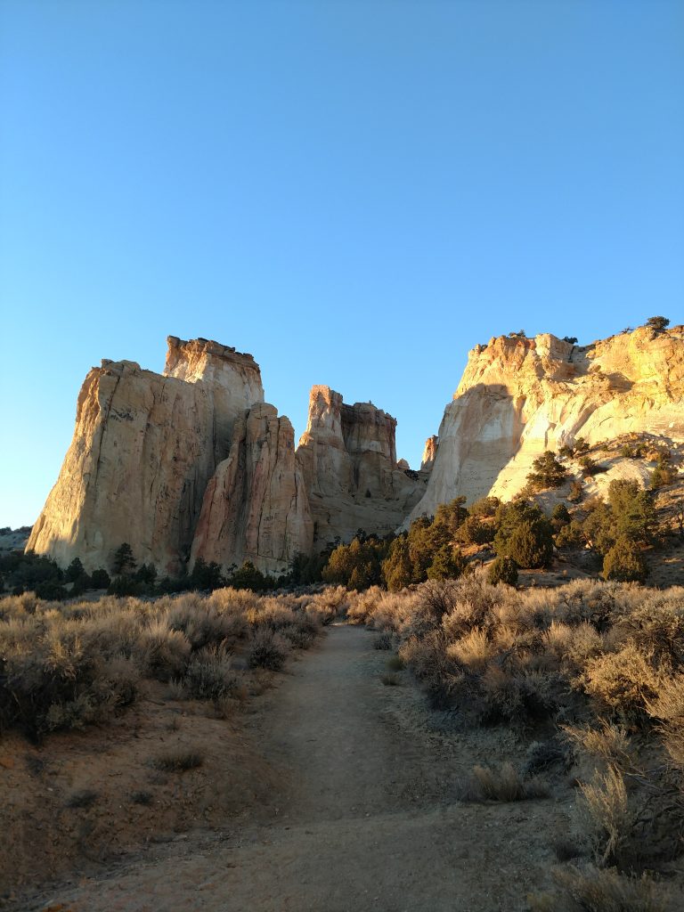
The map above includes five main hikes/points of interest. All are reasonably accessible in standard clearance vehicles except Round Valley Draw. This is hardly a comprehensive list of destinations; those willing to take multi-night trips out and those with true 4x4 vehicles can see far more of this region than I've explored so far.
- #1: The Paria Box/Yellow Rock: A route departs from the road into a box canyon of the Paria River. Overland hiking and scrambling (no real trail) brings you to the summit of Yellow Rock.
- #2 Lower Hackenberry Canyon: Hikes up this narrow and deep canyon range from just a few miles to multiday treks. Don't miss this one if going down the Coxcomb
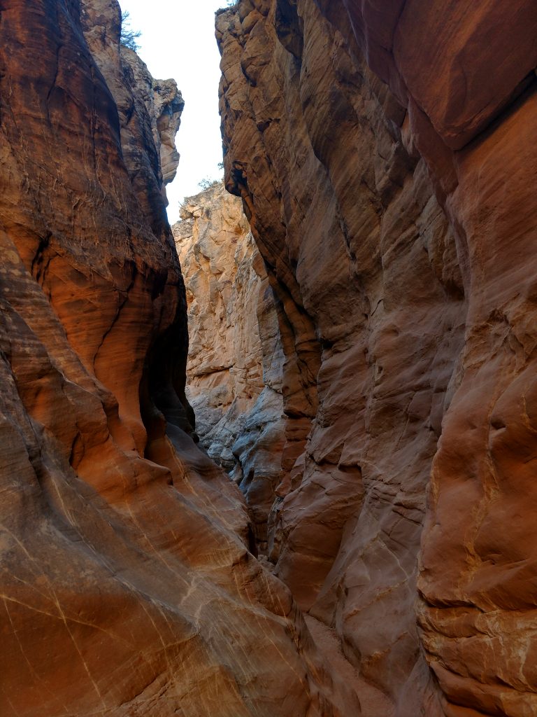
- #3 Cottonwood Narrows: In the most remote part of the Coxcomb, these narrows are a great four mile hike with several small slot canyon side hikes.
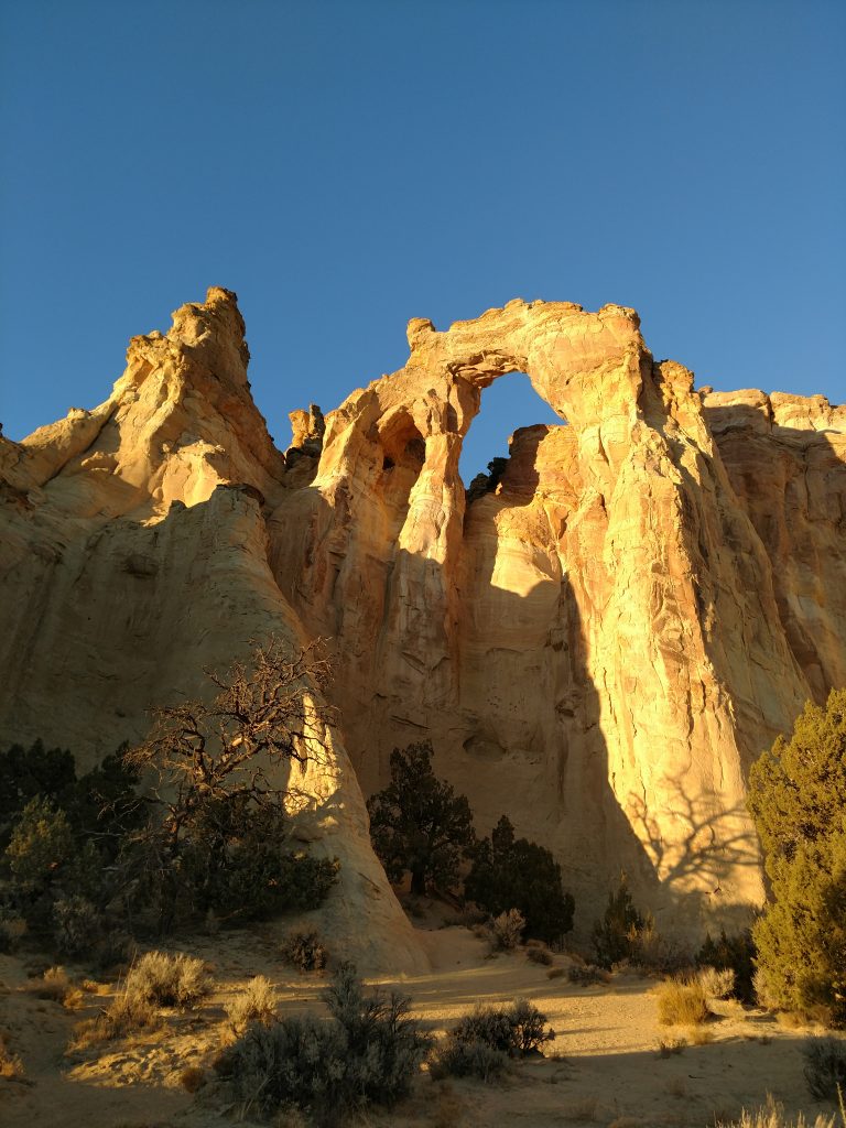
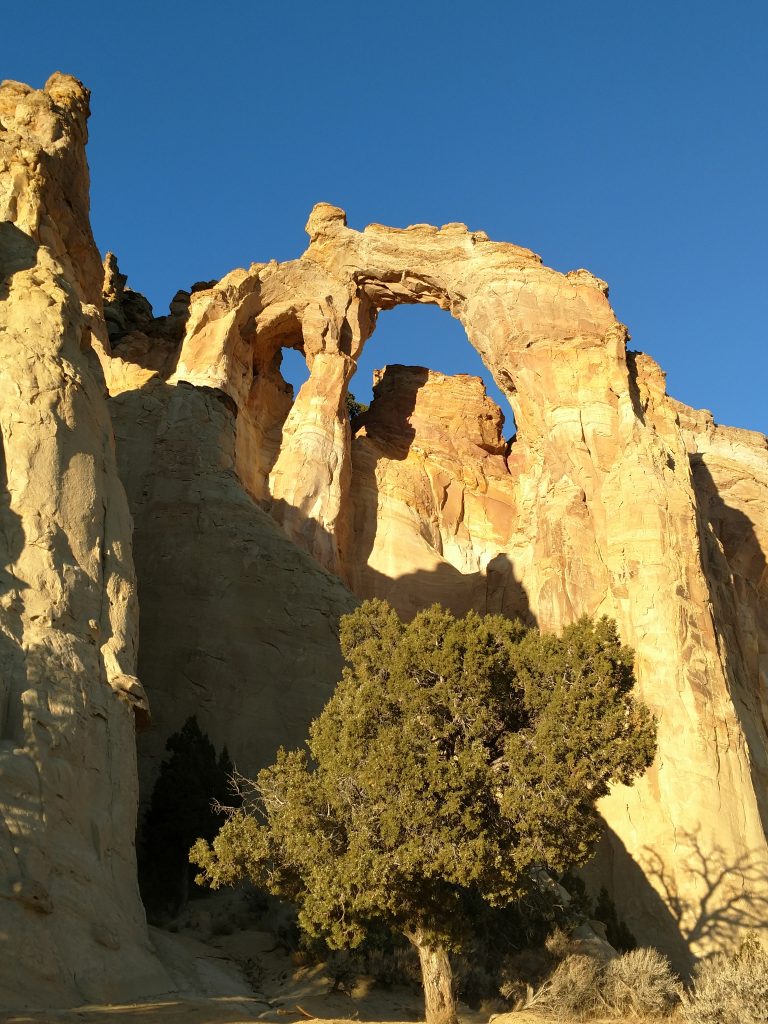
- #4 Grosvenor Arch: Perhaps the most famous image from this region. The hike is less than a mile and the Arch can be seen from the trailhead
- #5 Round Valley Draw: A half-day hike of varying distance (two to six miles), depending on how deep into the canyon you want to get. A true slot canyon.
The Coxcomb Hike #1: The Paria Box/Yellow Rock
Were the Paria Box located anywhere else in the World, it would be the destination for miles. But unfortunately it's a bit bland compared to the nearby hikes up the Coxcomb. If time is of the essence, this is a hike best skipped in favor of the Cottonwood Narrows or Hackenberry Canyon. This is a roughly six to seven mile hike, depending on the route you select. You can either walk down the road or parallel Cottonwood Creek. Beware: this is a vague route. Map yours carefully!
For this hike, start at either the Hackenberry Canyon Trailhead or the Paria Box Trailhead. Both are within a few miles of each other. Starting from the Paria Box trailhead, follow the Paria River Northwest as the canyon tightens up on its way to the Paria Townsite. Once the canyon narrows, there's a few side canyons to the North of the Paria River. Pick your poison/route out of the Paria and ascend the Navajo Sandstone. There's really no trail nor route at this point but Yellow Rock becomes quite obvious and prominent. Scramble up the rock if you choose or begin descending down a side canyon that brings you back to Cottonwood Wash. Follow the wash or get back on the road to the Box Canyon trailhead.
This site has great photos of the Paria Box and Yellow Rock.
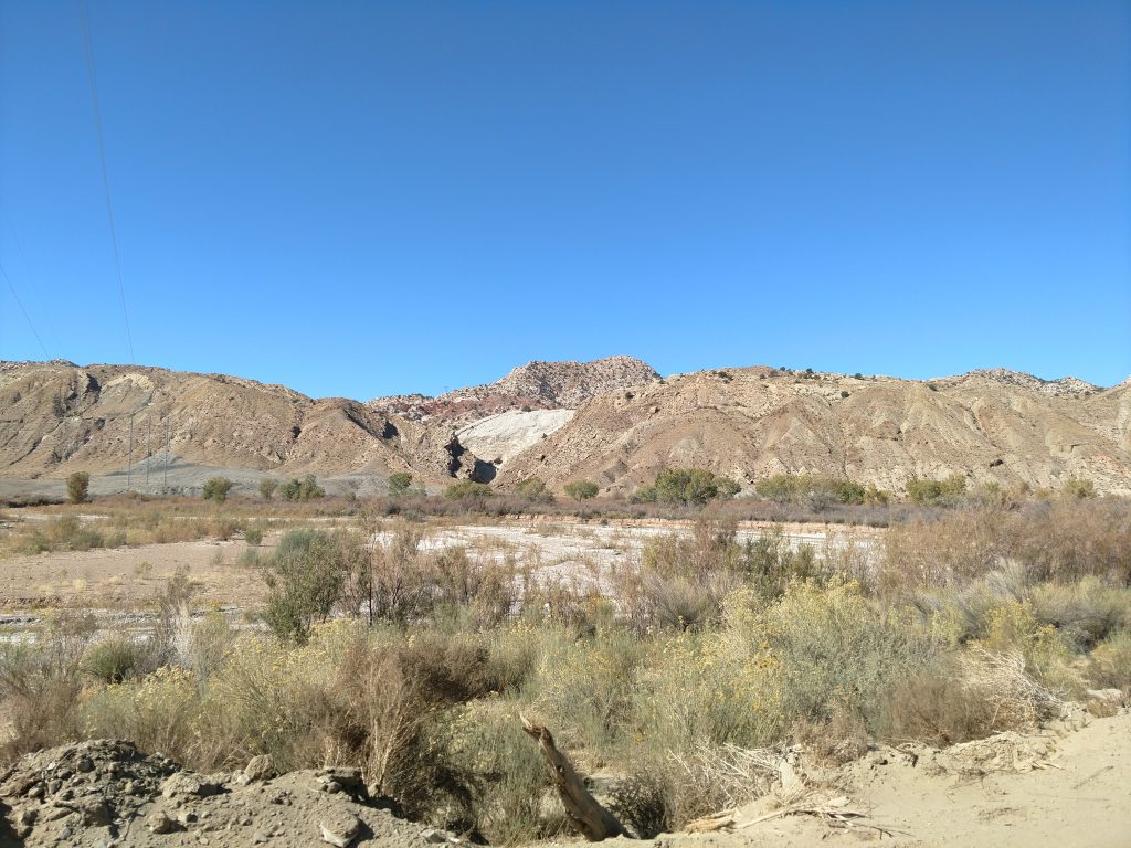
The Coxcomb Hike #2: Lower Hackenberry Canyon
This is the second best hike on the Coxcomb and one of the finer hikes in Grand Staircase-Escalante National Monument. At 14.4 miles from US-89 or 24.3 miles from Kodachrome Basin State Park, there's a trailhead on the West side of the road with parking for about a dozen vehicles marked Lower Hackenberry Canyon. A few ambiguous BLM signs indicate a path but I followed my own route on a topographic map to be sure.
Following a herd path through deep sand, I crossed the canyon lined in cottonwoods and found the entrance to Hackeberry Canyon. It was only 0.15 miles from the trailhead to the canyon entrance. From there, the entire canyon remained sandy resulting in some slow going but the scenery was phenomenal.
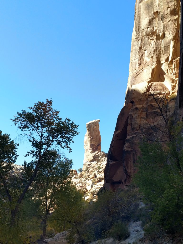
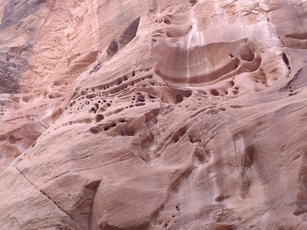
Hackenberry Canyon is a vast and deep canyon. It isn't quite the slot canyon that the region is famous for, but just as mysterious. The sheer cliffs of ribboned Navajo Sandstone give way to lush groves of cottonwoods at the bottom. Colors are distinctly Southwestern.
After about one mile of hiking from the mouth of the canyon, I came across a landmark and perfect turn around spot- there's a towering pinnacle that can't be missed. I went a little further ahead, but the canyon opens up and becomes less dramatic after the pinnacle. Although I turned back, hiking another mile up Lower Hackenberry Canyon brings you to some fossilized dinosaur tracks.
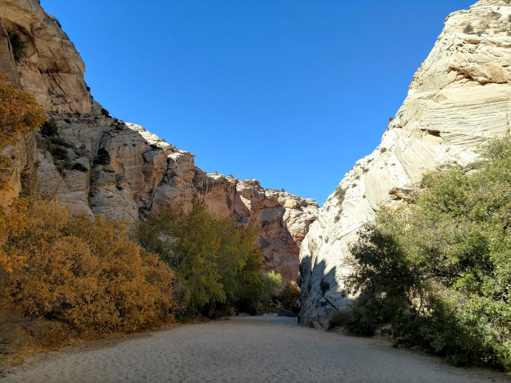
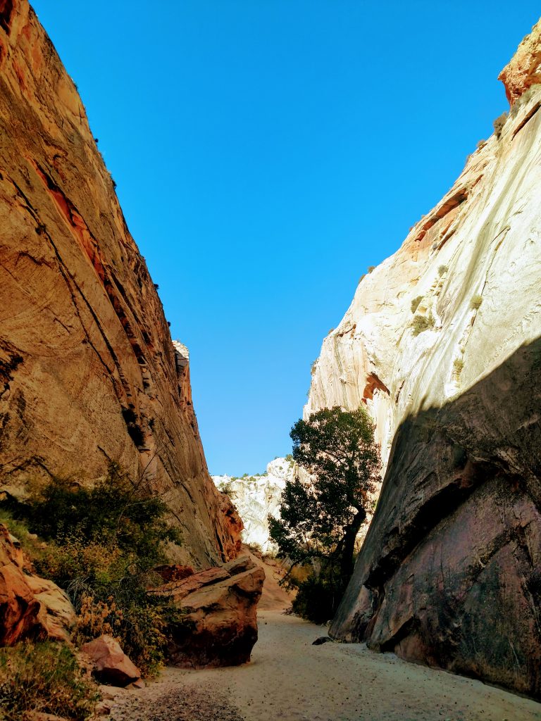
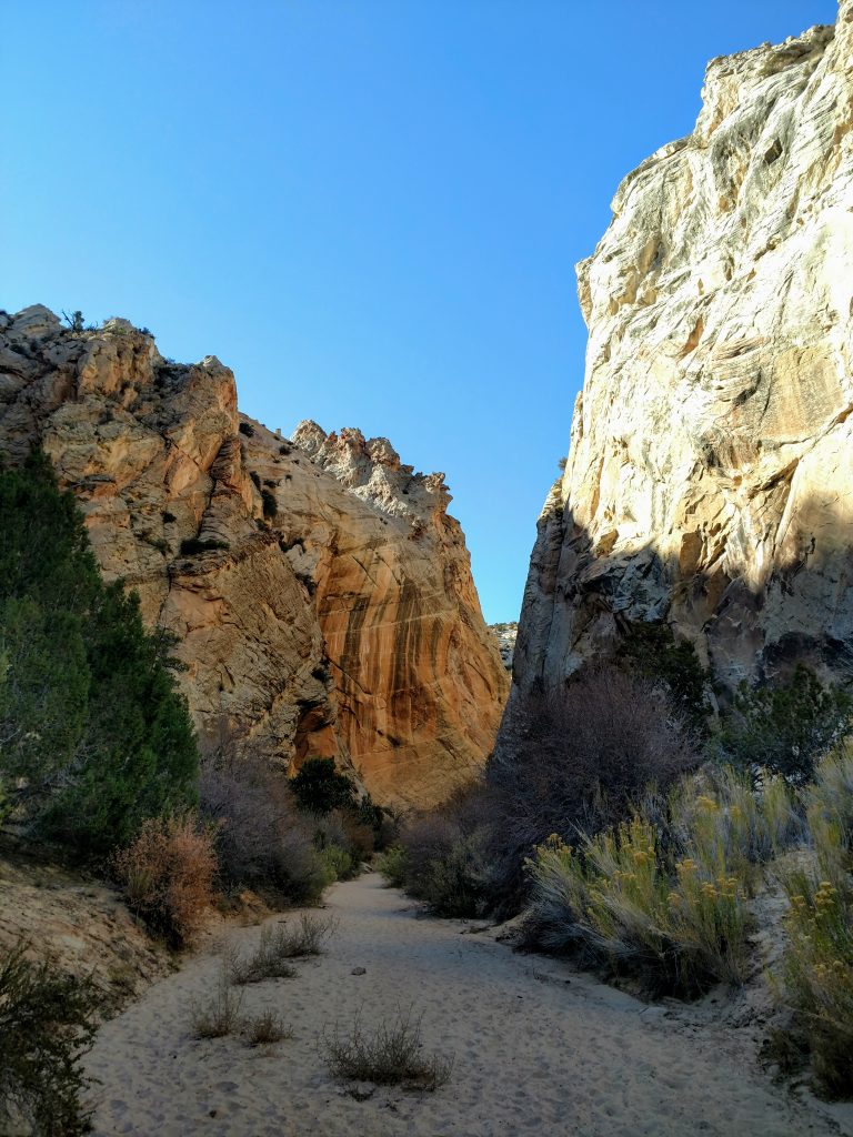
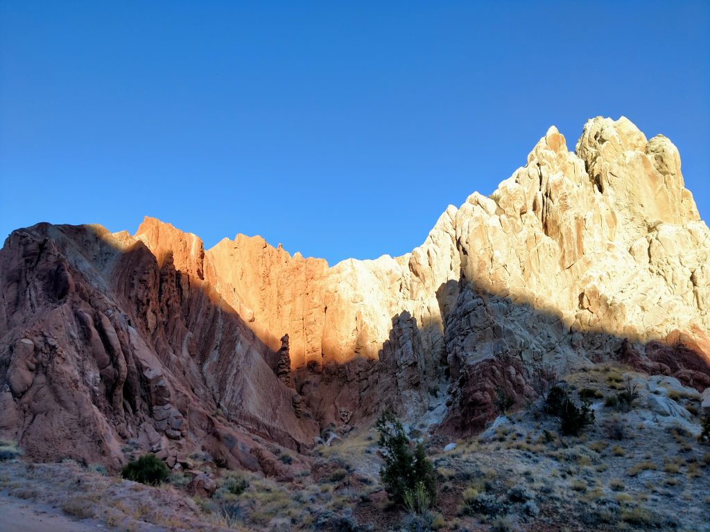
The Coxcomb Hike #3: Cottonwood Narrows
Its hard to imagine others finding a better hike on the Coxcomb than the Cottonwood Narrows. Deeper, longer and even grander than the previous Hackenberrry Canyon, the Cottonwood Narrows is the premier hike of this section of Grand Staircase-Escalante National Monument.
There are two starting points for this hike. The southern entrance and exit is at a parking area 24.7 miles from US-89 or 14.0 miles from Kodachrome Basin State Park (or 10.2 miles North of Hackenberry Canyon Trailhead.) The Northern entrance/exit is 0.9 miles North of the Southern trailhead. Either are suitable areas to start the hike.
Starting from the unsigned South parking area, I slithered down some banks above the wash that parallels the Coxcomb and found the entrance to the Cottonwood Narrows. Like the previous canyon, it was nothing but deep sand. I carried half the desert in my shoes by the end.
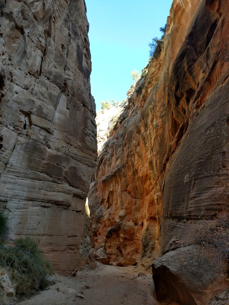
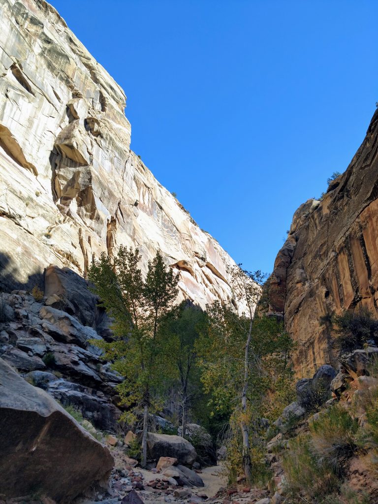
From the South entrance, I headed in a generally westward direction up the canyon for some hand-and-feet scrambling along the way. After a quarter of a mile, the canyon dog-legs North. After 0.2 miles North I found a side canyon which was worth a short detour. It is extremely deep and quite narrow and dead-ends in a few hundred feet with some outstanding photo opportunities.
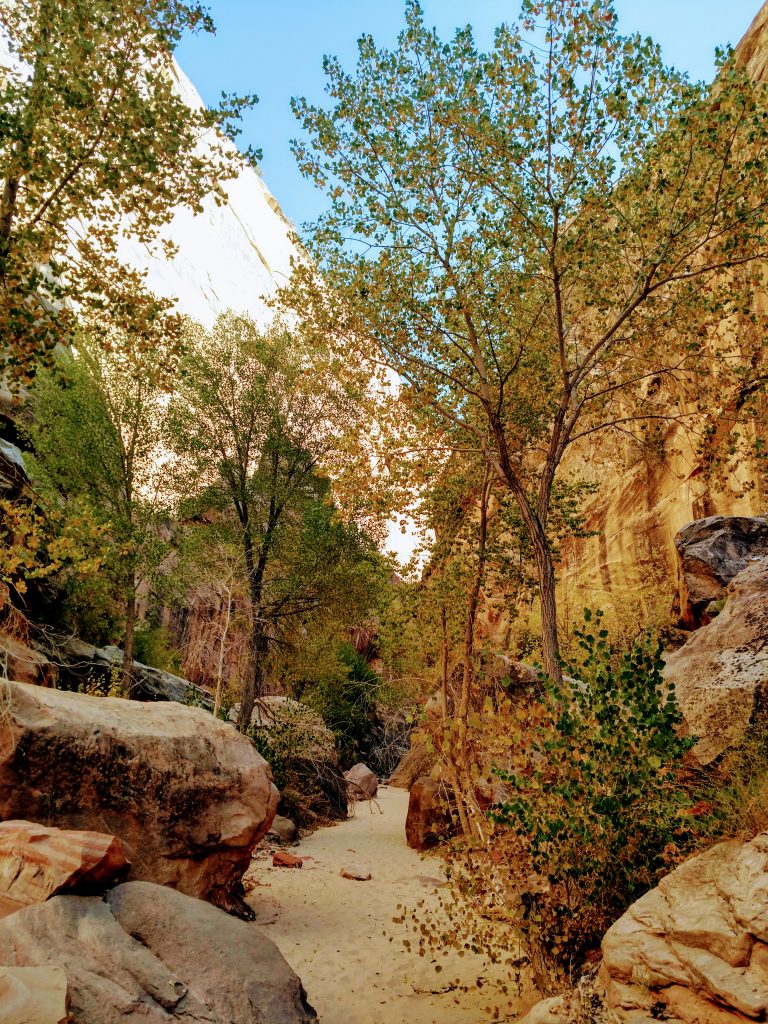
Back in the main wash, I headed further North on a sinuous route through the Narrows. The canyon opens and closes along the way making it feel remote and unspoiled. I enjoyed every step, exploring every nook, cranny and side canyon along the way.
About 0.9 miles from the dog-leg, I encountered the North entrance. Although obvious if you look at a map and know the region, it could be easily missed if not vigilant. There's a single plastic BLM stake marking the exit. I dropped a waypoint and decided to continue further up the canyon. It slots up for a bit but eventually becomes a wash within 0.3 miles North of the entrance.
Back at the Northern entrance, I popped out of the canyon and back onto Cottonwood Canyon Road/the Coxcomb. I simply walked South on the road back to my car to save time. If taking the road from the North Entrance to the South, the distance is about 0.9 miles.
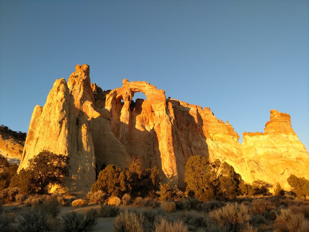
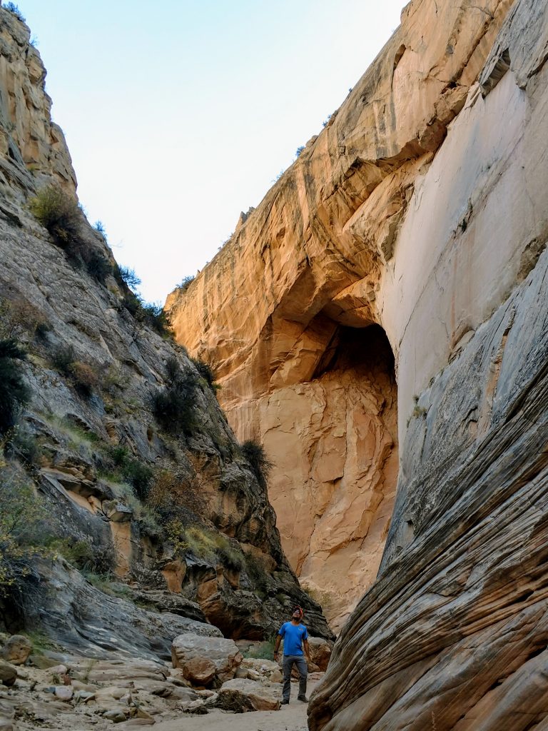
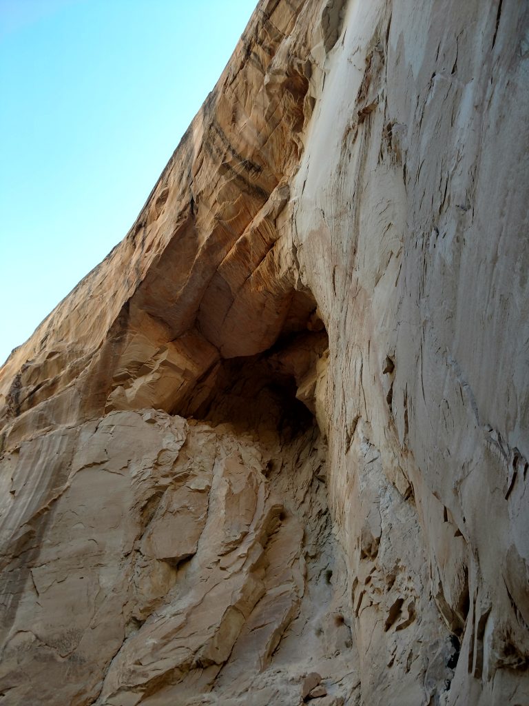
The Coxcomb Hike #4: Grosvenor Arch
Although more of a short walk than a hike, Grosvenor Arch is the de-facto emblem of the Coxcomb. A short, paved path leads to the arch.
The trailhead for Grosvenor Arch is approximately 29.2 miles from US-89 or
9.6 miles from Kodachrome Basin State Park. A well worn dirt road, signed for Grosvenor Arch departs from Cottonwood Canyon Road; take it one mile East to the trailhead. This is the only trailhead with a pit toilet.
From there, Grosvenor Arch looms a few hundred feet away. There's a paved trail allowing access for those with limited mobility. Whether viewed from a distance or up close, the arch is positively mystical-
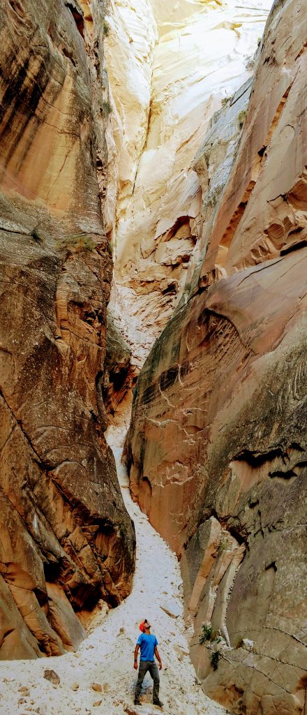
The Coxcomb Hike #5: Round Valley Draw
By the time I finished hiking Grosvenor Arch, it was growing dark so I missed out on this last hike. Round Valley Draw is a great, half-day hike from near the Northern entrance of the Coxcomb. It's a true slot canyon, unlike Cottonwood Narrows and Lower Hackenberry. I'll certainly have to visit this one next time I'm in the region.
One of my favorite reference sites for Utah Adventures, Road Trip Ryan, has an excellent description of the drive and hike.
From what I can tell from my drive and some online research, access to Round Valley Draw is 6.7-miles from Kodachrome Basin State Park or 32 miles from US-89. There's an access road heading South from Cottonwood Valley Road. From the trip reports I've read, its a decent road that runs about 1.6-miles to a bare, unmarked parking area in the wash.
From the parking area, walk down the wash to the narrows. Though not technical, descending into this canyon involves some hands-and-feet scrambling. Its about 0.9 miles of descending with a few big drops. Because of that, there's an exit canyon after the narrows and a return route on the North rim.
Kodachrome Basin State Park and Other Destinations
Kodachrome Basin State Park was another destination I missed on this trip. There was just too much to see and not enough light in the late fall for this destination. Fortunately, the pavement starts up again at Kodachrome Basin State Park and its not far from Tropic, Utah and the infamous Bryce Canyon National Park.
Had I all the time in the world, I would have headed East from Cannonville to Escalante and taken another trip down Hole-in-the-Rock road or Hells Backbone; both comparable to the splendor of the Coxcomb/Cottonwood Canyon.
So, like so many of my adventures in Southern Utah, I achieved many goals that had been on my list for years but left with a longer list of thing to return for.

No Comments