


Spectre Peak (4,482') and Aqua Benchmark (4,419') are the tallest mountains in the remote Coxcomb Mountains of Joshua Tree National Park. The park's eastern section is rarely seen, much less hiked. This one's been on my radar for a very long time, however. With recent October road trip and excellent weather, we made a bid for this lonely mountain.
Spectre Peak Overview and Trailhead
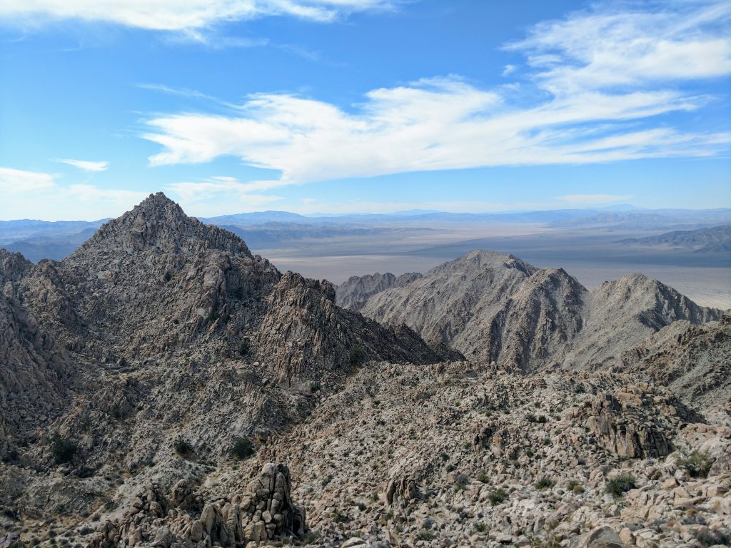
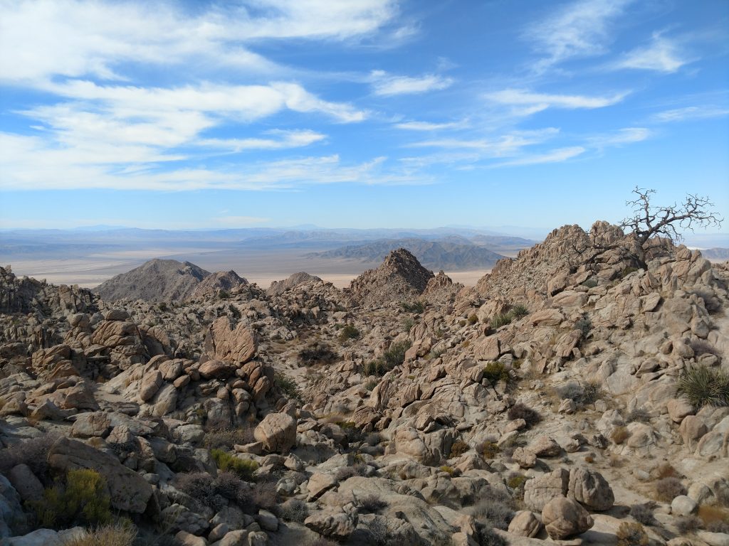
The Coxcomb Mountains are at the intersection of two major North American Deserts. Here, the high-desert of Mojave collides with the lower reaches of the Sonoran. You won't find Joshua Trees in this part of Joshua Tree; its almost all brush and scrub with a few hardy Pinon Pines towards the summit.
Naturally, there are no trails, signs nor any indications of civilization out here. Early in the hike we followed a long deteriorated 4x4 road but it was vague and unreliable. All 13 miles of this hike were essentially scrambling or overland hiking. There's no water on this hike.
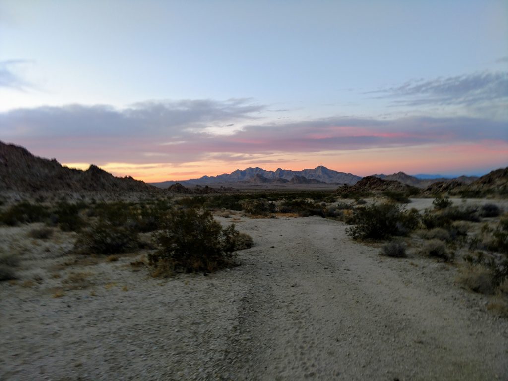
Getting to the "trailhead" is actually pretty easy. Simply plug in the these coordinates and head off. CA-62 or the Twentynine Palms Highway is paved and always in excellent shape. Although cell phone reception should never be relied on, I had reception for most of my drive on CA-62. The nearest gas stations/services are 52 miles East at Vidal Junction or 40 miles West at Twentynine Palms.
The "trailhead" has a clear dirt pull out, enough for probably 6-10 cars. Just South of the highway is a gate marking the National Park Boundary.
Here's a map of the route I took up Spectre Peak and Aqua Benchmark:
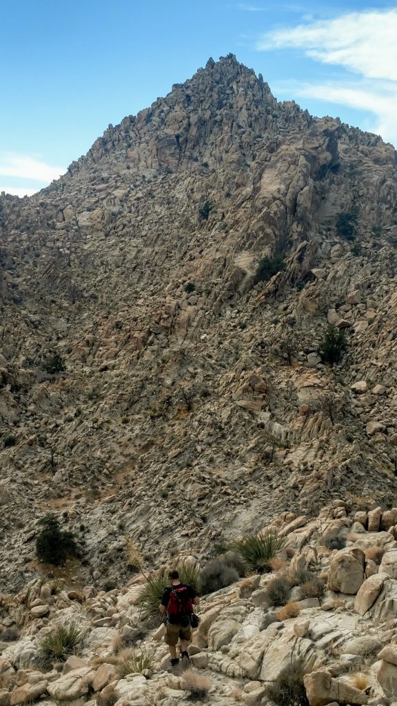
Overland Hike to Start of Scramble
The first part of this journey was an overland hike through the desert to the foot of the mountains. From a map, the hike looked straightforward but all mountains look the same in this area so following a GPS route was essential
We started past the gate and followed the remains of a 4x4 road for a few hours. Notably the road is all but indistinguishable from the desert at times. We followed a southerly direction, eventually cutting between a small pass that bisected the hills. It was about 2 miles from the pavement to the pass.
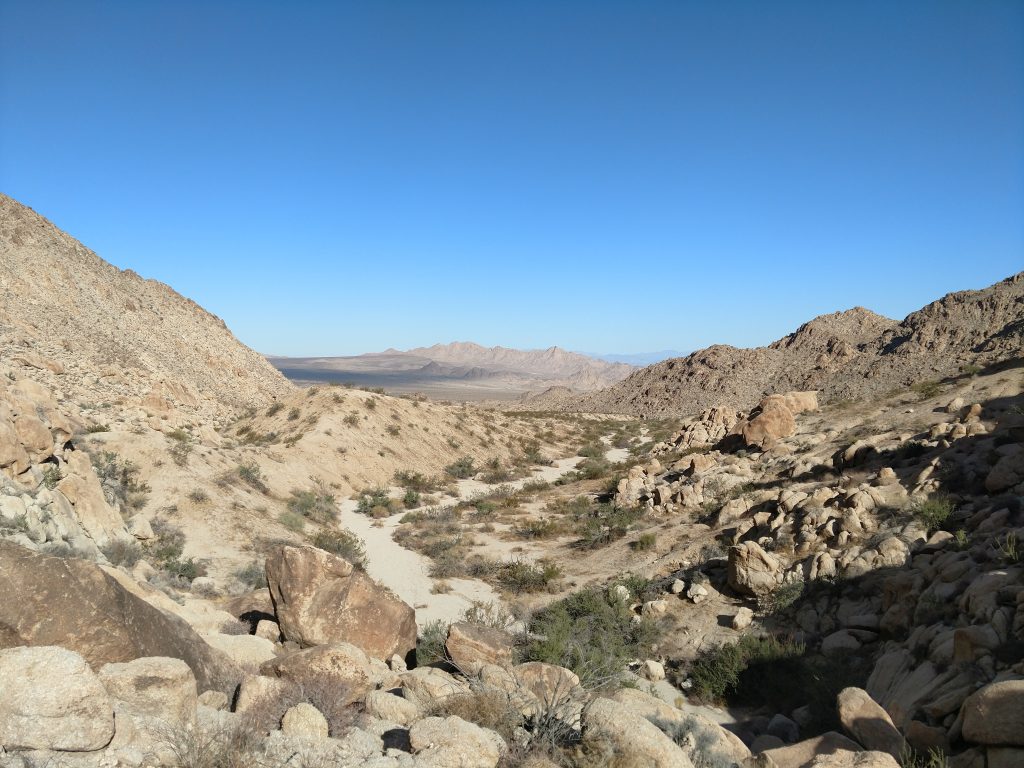
Just beyond the pass, we aimed for a canyon where the real route began. Again, we followed a pre-loaded GPS track for this section as its easy to head up the wrong canyon and not find the route. From the pass, we traveled another 2.0 miles to these coordinates. At 2,800', we were still 2,600' below the summit and nearly all the climbing in front of us was a scramble.
Scramble to Aqua Benchmark
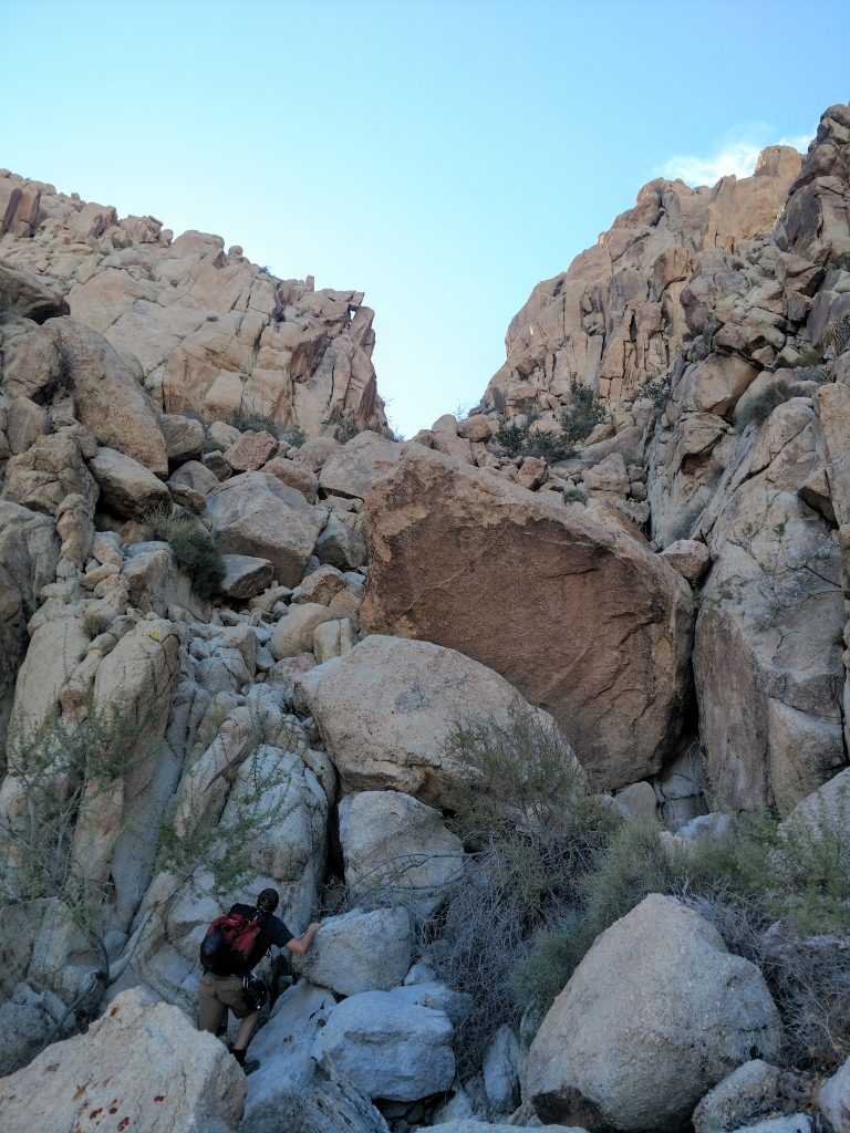
The chute which leads to the summit of Aqua Benchmark and Spectre Peak looks obvious from a topographic map but is nebulous from the ground. Again, we followed a pre-loaded GPS route which took the guess work out of the climb.
From the foot of the mountain and beginning of the chute, we steadily ascended a mix of Class II and Class III terrain for a rough 1,000'. Typical for Joshua Tree, there were sections of intense brush and rotten rock. Thankfully no falls. With a little creative route finding, we gained a small saddle at about 3,600' . I think we could see the summits of Aqua Benchmark and Spectre but they were ambiguous
With some of the steepest terrain behind us, we made a straight line towards another small saddle just West of the Aqua Benchmark. This section was nothing greater than Class II scrambling and there's no exposure. Gaining the saddle at 4,200', we were just 200' shy of the summit. We picked our way along and tagged the top. It was about 7 miles from the place we parked to the top.
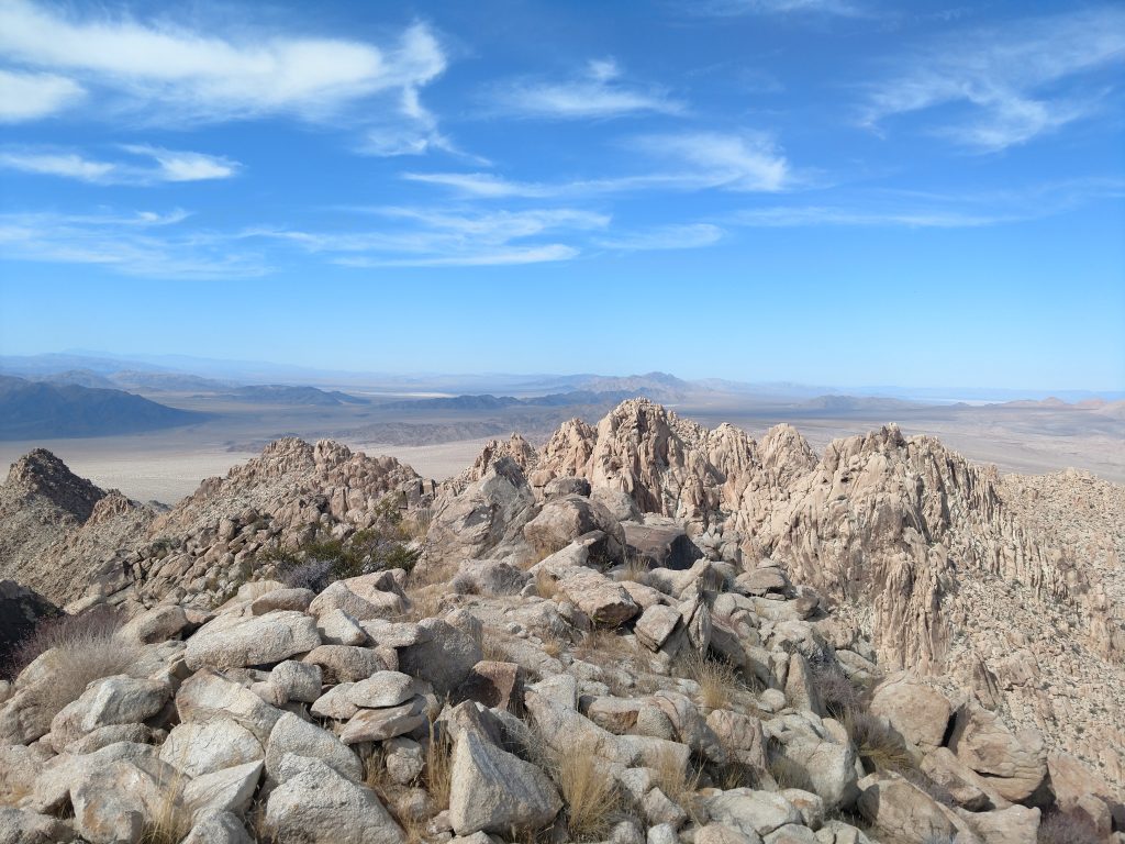
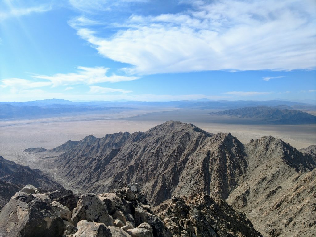
Aqua Benchmark is at 4,419' and was previous thought to be the highpoint of the range. We were delighted to find a summit register dating back decades and with nearly every major name in the annuls of California Peakbagging. Views were amazing, especially of the aesthetically conical summit of Spectre Peak.
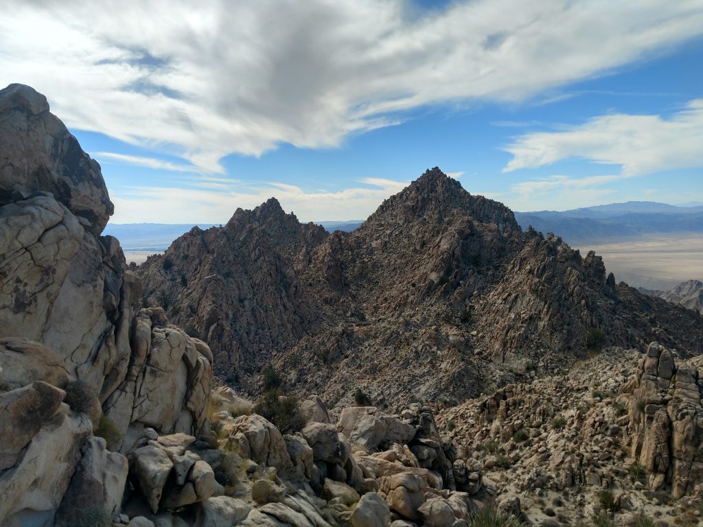
Aqua Benchmark to Spectre Peak
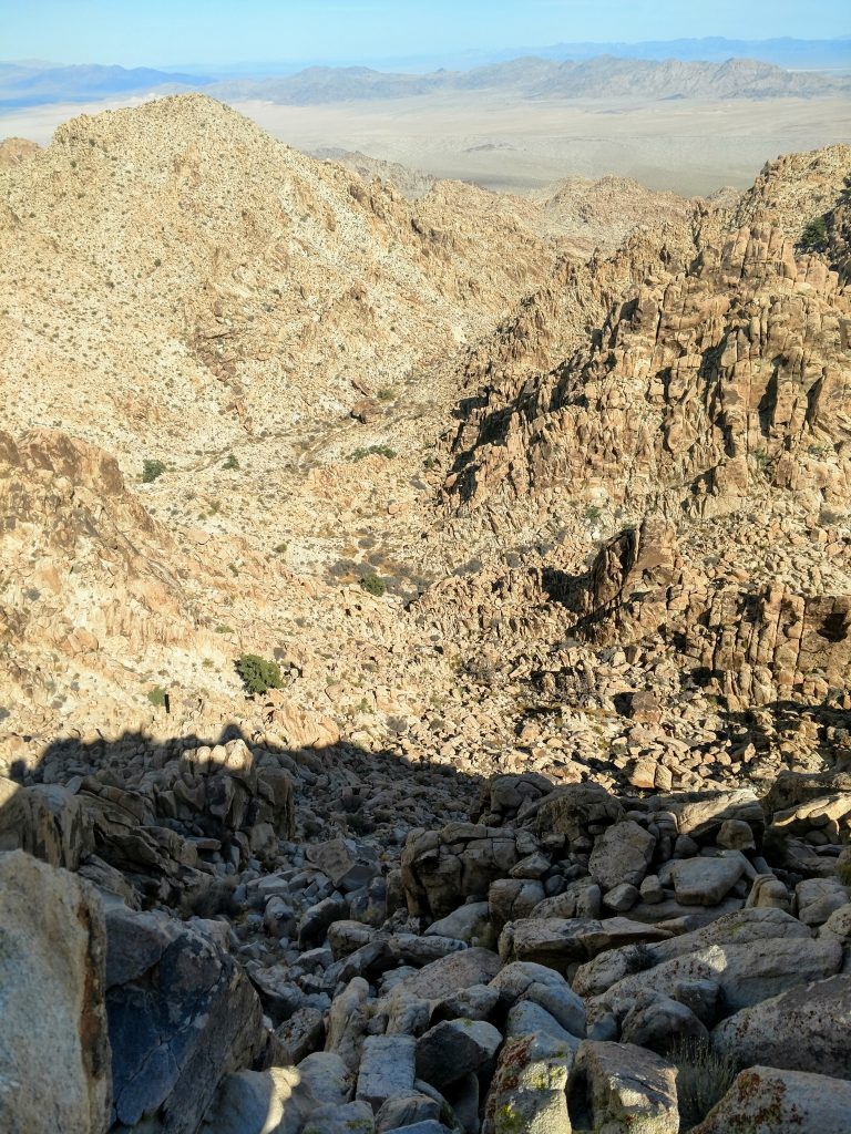
From Aqua Benchmark, we descended into a bowl below Spectre Peak. This was a tedious descent of about 400' but before long we were gaining altitude again. In the picture above, we essentially took the path of least resistance to the saddle in the center of the photo. The saddle is 200' below the summit.
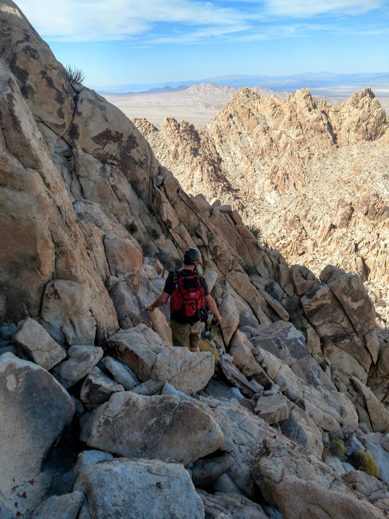
Ascending to the saddle was more of the same Class II/Class III rock hopping. However the saddle to summit section was the crux. There's some loose, rotten rock sections and a lot of exposure. Unfortunately there's also no "standard" route or any cairns. Its a "choose-your-own-adventure" kind of a climb. The last 200' took about 30-45 minutes when all said and done. But we topped the mountain (4,482') and were treated to a vast view of the desert floor/Pinto Basin. What a glorious summit!
Descent from Spectre Peak
After a brief celebratory lunch, we began our long descent. We took a slightly different route down the crux of Spectre Peak, bypassing the saddle at 4,200' from earlier. Honestly, there was no easy or comfortable way to ascend or descend those final 200 feet; any route involves exposure and sections of rotten rock.
Finally back to comfortable class II travel, we descided to take a different route down altogether. Others who've climbed these summits remarked that the chute heading Northeast from Spectre Peak is a little easier but longer (reference my map above). This route was about 1.0 mile of downclimbing to 2,800'. Compared to the ascent, we had mixed opinions. To me it felt a little easier to downclimb on class II terrain rather than the steeper class III that we ascended. Nevertheless, it was still rather rough. If we ever return to climb Dyadic, I'm sure we'd just ascend and descend the class III chute from earlier in the day.
The Northeast chute spat us out at a wash at 2,800'. From here, we took a 90-degree turn left and headed Northwest for 1.5 miles, up another saddle and down the other side. Eventually we rejoined our tracks along the deteriorated dirt road and made the long, overland walk back to the cars. We started this hike at sunrise and got back at twilight. Total time was 11 hours and 11 minutes with 3,500' of gain and 13.2 miles traveled.
Although very sore by the end, this is a hike I would totally do again. Hopefully we can bag Dyadic Peak next time...

No Comments