


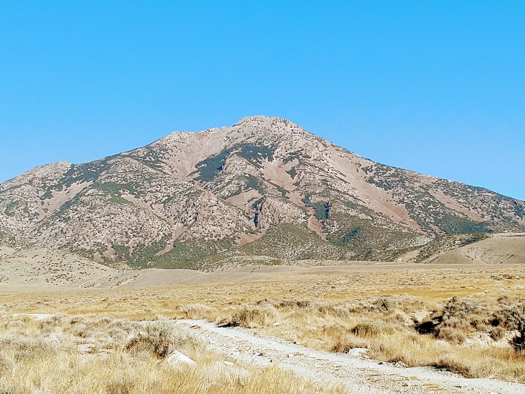
After climbing Ibapah Peak, south of West Wendover, I turned my sites North to Pilot Peak, Nevada. This mountain looms over the Great Salt Desert and is impossible to miss if traveling westward from Salt Lake City. Its profile appears nearly conical from a distance and its topographic prominence is impressive at 5,726'. Pilot Peak makes the short list of Contiguous US Ultras. Therefore its been on my tic-list for some time but the long drive and difficult logistics make it essentially inaccessible except for very dedicated peakbaggers. Hence, I passed it by on my previous road trips across the American West.
In my most recent ramble of late October 2020, I decided to finally conquer this pair of far flung Ultra Prominent Mountains- Ibapah Peak and Pilot Peak. Ibapah was a wonderful wilderness climb whereas Pilot Peak was a total sufferfest. Here's my guide and trip report anyways.
Getting to Pilot Peak/Miners Canyon Approach
Although comparatively shorter than the drive to Ibapah Peak's trailhead, this road is washboarded and very slow going. Google Maps is unreliable with directions here. To get to the Miners Canyon Approach, I recommend the following:
- Fill up on food and fuel in Wendover/West Wendover
- Take I-80 East towards Salt Lake City for about 5 miles to Exit 4: Bonneville/Speedway
- Head North on Leppy Pass Road, past the Sinclair (last gas station) as if on your way to the Salt Flats. Set Odometer to Zero after exiting freeway and turning on Leppy Pass Road
- Drive 1.3 miles North and take a left when the road makes a bend. This keeps you on Leppy Pass Road
- Leppy Pass Road is paved for about 7.8 miles between the freeway exit and the Nevada-Utah State Line
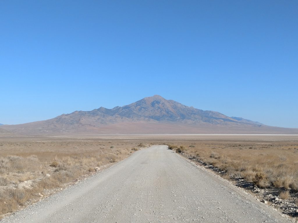
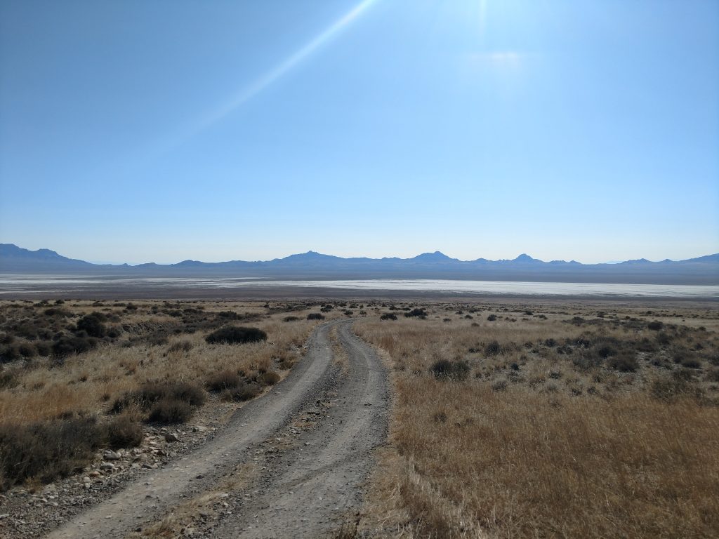
- Follow this tediously washboard road as it meanders through the barren salt flats. Its 17.2 miles to the turnoff for Miners Canyon. The turnoff is just a few feet before a cattle guard marking the Utah-Nevada State line
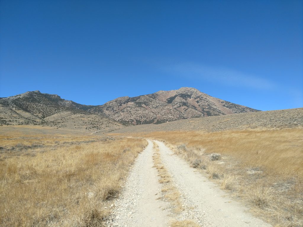
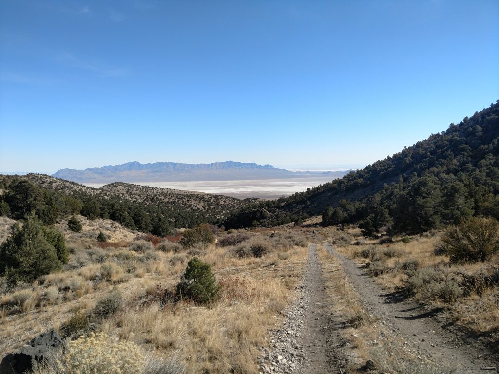
- Take a Left on this unmarked, one-lane road and drive as far and high into Miners Canyon as you can. Its about 5 miles to the end of the road. The first mile or so is okay but it becomes a true high-clearance 4x4 road at the end. Not a great road for a casual SUV/Subaru.
As for me in my Outback, I made it about 2 miles up the road to an altitude of ~4,800'. I brought a mountain bike and simply biked the rest to the end of the road. Its not a bad way of getting by tricky and questionable roads for my experience level.
Note there are absolutely no services, cell phone reception, water or really anything other than wilderness and dirt roads on this hike. Take necessary precautions and know your limits.
Here's an idea of what the roads are like:
Driving Map and Hiking Map
Here's an overview of the driving route I took. Note that if you simply plug in the coordinates to Miners Canyon in Google Maps, you will end up on long-disappeared roads. Bring a paper map!
Here's a map of the route I took to the summit-
Pilot Peak Hike/Climb: End of the Road to Saddle at 9,000'
Before I climbed Nevada's Pilot Peak, I knew I was in for a very, very long day. This route has never been well-established and I've read many reports by fellow bloggers and peakbaggers of getting turned back by the insufferable combination of steepness, weather and loose rock. Don't attempt if you're not in great shape and prepared to turn back if necessary.
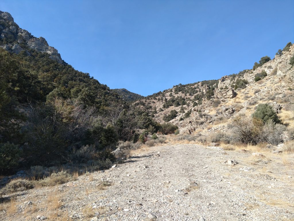
I started my climb from the end of Miners Canyon road. Note that I biked the last three miles of this road and I anticipate most will have to walk at least part of this road. The end of the road is at an altitude of about 6,700' which is 4,000' lower than the summit. Here we go...
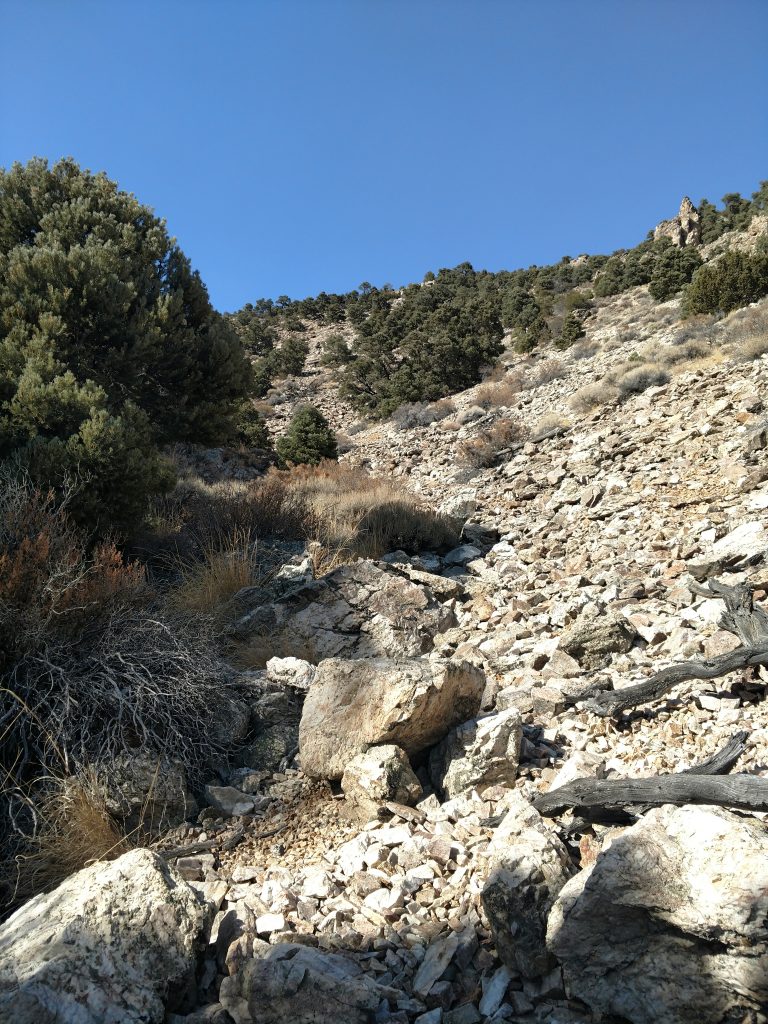
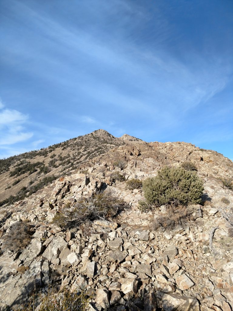
I followed the canyon at the end of the road for a few hundred yards, picking up a herd path here and there. Eventually the brush was too thick to push through so I began my slog up the talus. Between about 6,800' and 7,200' it was just nasty. Nothing but knee-hammering rocks and plenty of things to turn an ankle on. My pace was less than 0.5 miles per hour.
After what seemed like an eternity, I hit a bit of a stride for the next 1,000' of climbing. I stuck to a Northerly bearing finding that the climb shaded by the trees had better footing than the barren, shade-less area. I felt okay for a bit
At an altitude of about 8,400' the trail became very steep and I took on a few class III sections to help with the altitude. None of it was technical, sketchy or exposed but it felt arduous at that altitude. In the next few hundred feet I gained the Southwest oriented ridgeline and a sub-summit. Unexpectedly, I descended this summit to a notch-shaped saddle with now clear views of the summit. It took about 3 hours to climb from the end of the road to this saddle at 9,000'. Effort-wise, this was the halfway point to the summit.
Saddle to Summit
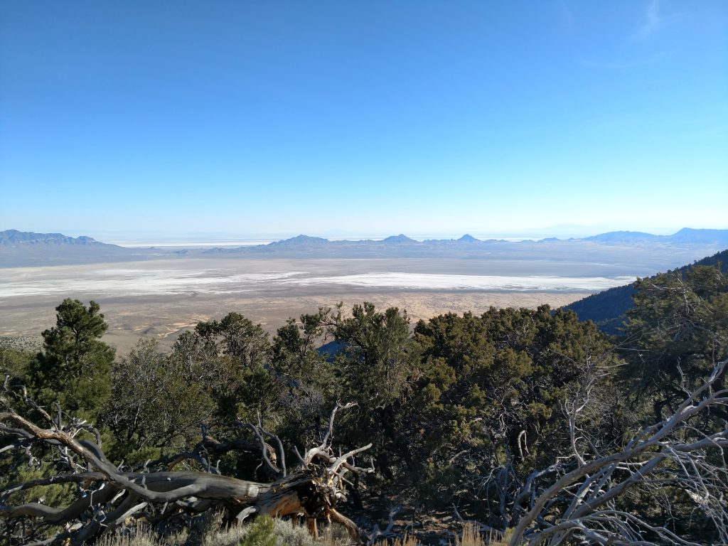
I took a break at 9,000 and surveyed my next 1,700' of climbing. I had an excellent view of the ridgeline as it ascends to 10,000 and the route didn't look too bad. The next 1,000' of climbing was comparatively easier although the brush and vegetation was noticeably thicker in some sections. My paced picked up considerably in this section
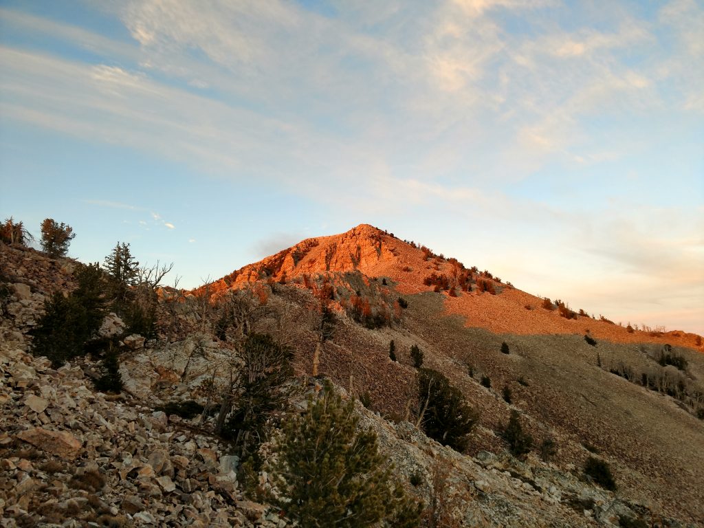
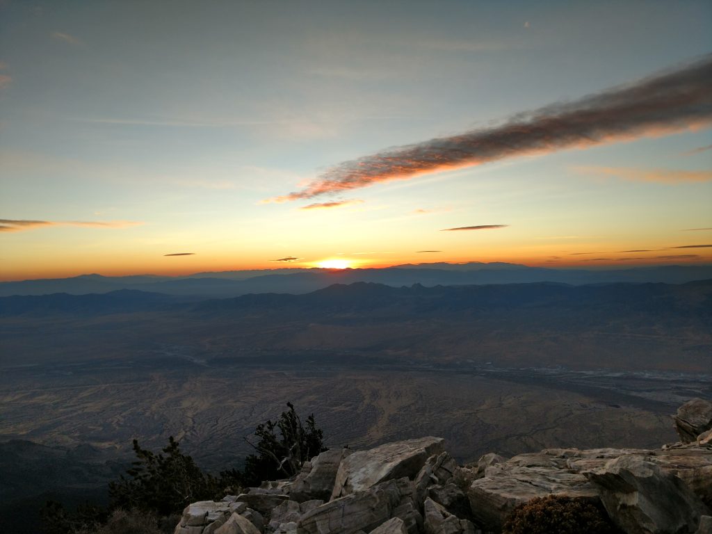
I gained the false summit at 10,100' at sunset and knew I was in for an all-nighter given my pace. Oh well.
As is often the case on mountains like these, the final 700-800 was slow and tedious. I had to wrap my way around the ridgeline to avoid some class IV moves on rotten rock. I had to double back a lot as well trying to get through a tricky section at about 10,200'-10,400'.
Past that section, it was a straightforward slog up a boulder field to the summit. Pilot Peak makes you work for it all the way to the bitter end.
Pilot Peak Summit and Descent
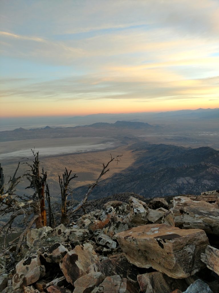
Pilot Peak's summit log was the Who's Who of peakbagging in the Western States. Every famous name was written in the log. I added my own and began my extremely difficult descent to the car.
For the most part, I tried following my GPS track the same way down. It looks like some others try going down a different canyon or a different ridgeline but I couldn't see any of them being less excruciating.
One noteworth deviation I took on the way down was between 10,000-10,400'. I stayed along the ridgeline, not minding the more exposed class III moves which saved me some side hilling on very lose granite and talus below.
Back at the saddle at 9,000', I ate "dinner" at 2300 and was grateful for the moonlight illuminating my route below. However, it was very hard to simply follow my GPS track and I just followed the path of least resistance until I eventually got back to the end of Miners Canyon Road. It took almost four hours of scrambling down in the dark to go from Pilot Peak's summit to the road.
Sore, cold and exhausted, I hiked down the road to my mountain bike and then biked back to the car. It was 0330 when I finally finished this climb.
I'm not sure I'd ever do this climb again but I finally finished all 8 of Nevada's Ultra Prominent Summits. Whew...

No Comments