


The Spencer Trail, best hike in the Lees Ferry Area
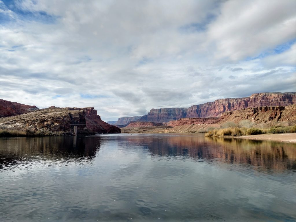
Along my travels through the Southwest, I finally visited Lee's Ferry, the famously placid and flat section of the Colorado river before dipping into the Grand Canyon. For many years, this was the only reasonably accessible crossing of hundreds of miles of the Colorado River. Even today, there are no auto crossings of the river between Navajo Bridge and Hoover Dam leaving the Grand Canyon largely preserved.
One of the finest hikes in this area is the Spencer Trail which climbs to the rim of Glen Canyon, overlooking this famous juncture. This is a 4.5 mile trail with 1,500 ft of altitude change and typically takes a half a day to complete.
Directions to Trailhead for the Spencer Trail
The trailhead is located close to Navajo Bridge, the mouth of the Paria River and not far from the Lee's Ferry Boat Ramp. If coming from Page, head South on Route 89. This is a gloriously scenic highway that drops off the mesa towards the river. After about 22 miles, turn right at the Junction with Highway 89A North. Take this about 14 miles to the Navajo Bridge and Marble Canyon. Turn right just after the bridge and head to the obvious end of the road!
If coming from the South and most metro areas in Arizona, Route 89 will eventually take you to Bitter Springs and the same Junction with Route 89A. Follow the directions as above. Here's a general area map and the hike:
Navajo Bridge and Marble Canyon
Just before Lee's Ferry is Navajo Bridge or the last auto crossing of the Grand Canyon. In addition to the view of the canyon and an architectural marvel, I noticed a pair of California Condors! These are the rarest birds in North America that exist in the wild. A friendly biologist monitoring them with the Peregrine Fund confirmed they were condors and it was a mother-son dyad . Here's a brief video of them:

Hiking the Spencer Trail
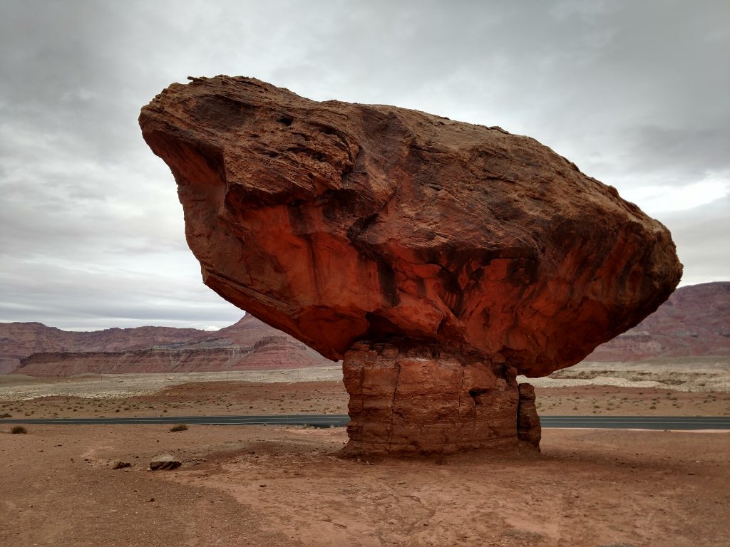
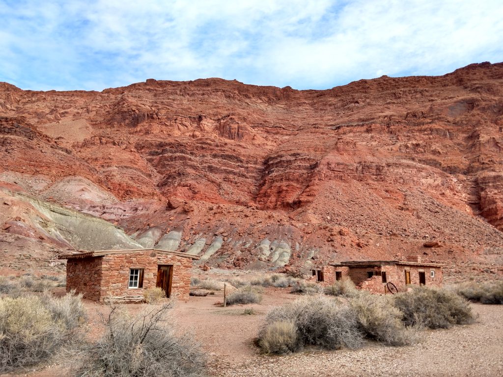
After sufficiently conquering all the detours, I finally made it to Lee's Ferry and the Spencer Trail. It starts from the parking lot/boat ramp and the end of the road. A very obvious trail-head points the way and highlights several pioneer-era relics along the way.
Condor watching is the famed birding opportunity of the area but I equally enjoyed the innurable waterfowl and occasional birds of prey around the Lee's Ferry area. Its remarkably placid and would have been a fine spot for angling or boating had I the gear.
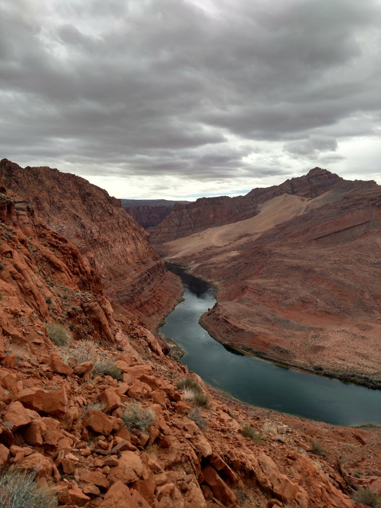
Almost immediately, the Spencer Trail gains altitude. The entire trail is steep and switched backed but with ever expanding views. Thankfully the trail is well marked and very easy to follow. It follows a nearly unbroken ascent to the unmarked plateau overlooking the Colorado River.
Overall it took me about an hour and a half to ascend the Spencer Trail, taking tons of time for photos.
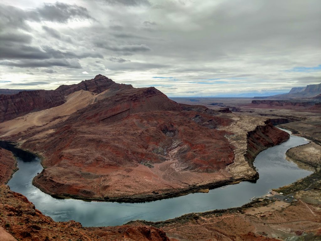
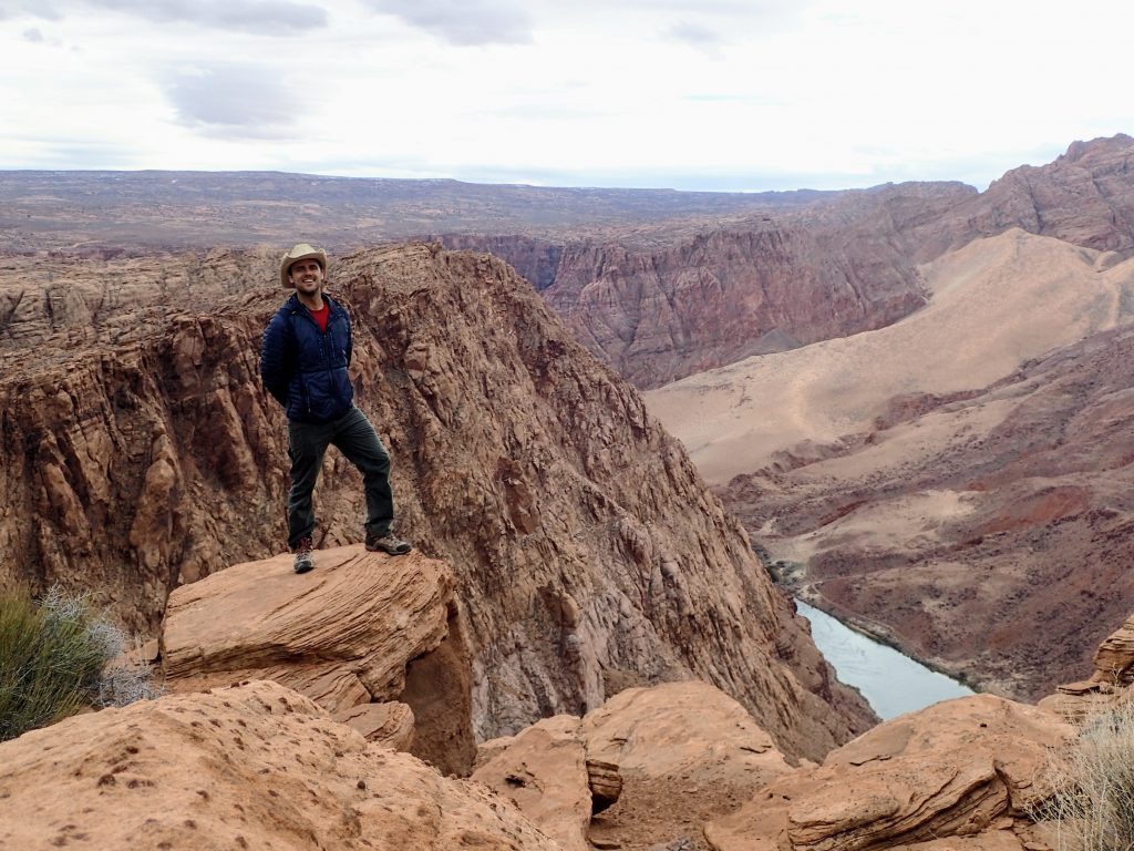
Top of the Spencer Trail
At the very top, there's a sign to mark where the trail ends. I was thankful for that given that the plateau is fun to explore but disorienting. Were it not for a GPS or the sign, I doubt I'd have found the way down.
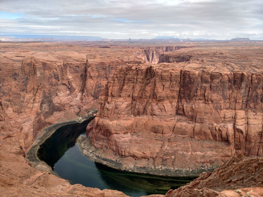
I set off exploring the mesa overlooking the river but was very careful to follow my surroundings. Various rock outcroppings and small trees helped me navigate an otherwise formless landscape. Nevertheless, I caught some exceptional views of Marble Canyon, Glen Canyon below the Dam, Navajo Mountain and even a glimpse of Horseshoe Bend. Surely this is a preferable hike to the hordes clambering around the more famous vista.
I stumbled upon a small cairn revealing a geocache and "summit log". Though I saw hardly a soul on the day I hiked, the log had tales of folks from all over the country coming to this spot. Most remarked on their preferences of this view to the one at Horseshoe Bend.
There's only one way down from the Spencer Trail but it was hardly repetitious. I gulped views of the Colorado river and the distant cliffs of the Grand Canyon and the Vermillion Cliffs. It took about 1 hour to descend.
Hopefully next time I'm here I'll hike the Paria Canyon Route!

No Comments