


The Honaker Trail; A Grand Canyon without the Crowds
Southern Utah is one of my favorite places in the world and one I haven't spent much time in since my great trip across the country in 2011. Returning after 8 years was like seeing an old friend.
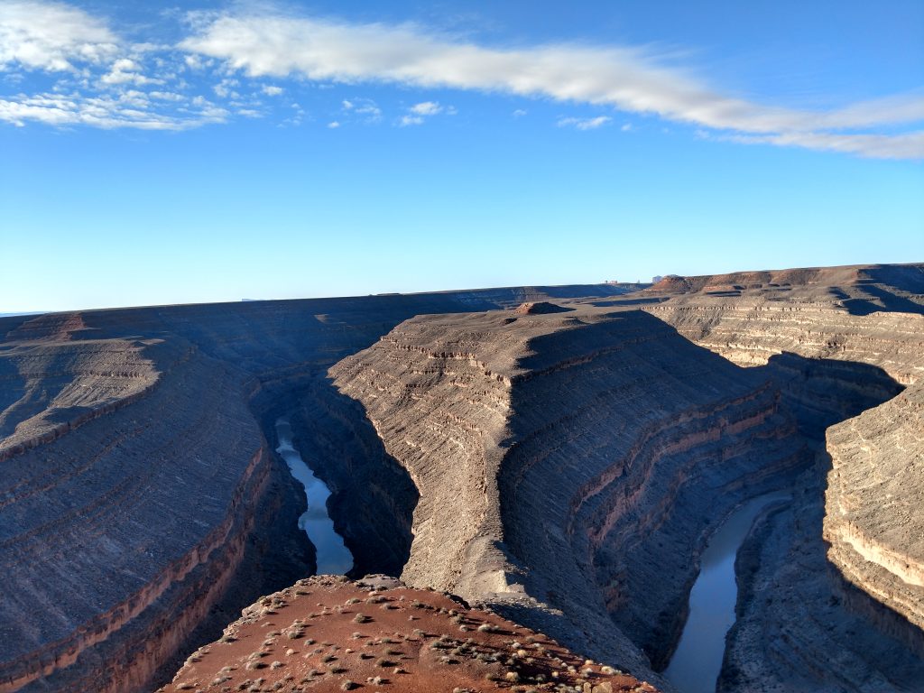
Just as it was then, there's no shortages of side trips that turn into all day affairs. While headed back West, Goosenecks State Park looked like a nice, brief stop. While most come for the expansive view of the undulating San Juan River, the Honaker Trail is an under-appreciated section of the park that most never make it to.
Overall the trail is difficult, mainly due to the sharp drop in elevation getting to the river and having to climb back up. Mileage estimates vary, probably due to the lack of GPS signals in the lower canyon and the highly switchback nature of the route. I clocked 4.5 miles total on my route but that included some side jaunts. Its 1,600 ft of elevation change from the rim to river.
Directions to the Honaker Trailhead
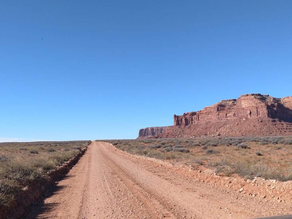
So Google Maps does not get you to the trailhead if you try. This is one of those "watch your odometer" kind of approaches. If starting from the campground and main entrance to Goosenecks State Park, drive back the way you came as if you were returning to US-163. Set your odometer at the entrance. After 3.0 miles of driving north, bear left on to Johns Canyon Road or Road 244. Drive 2.6 miles on this fairly well maintained dirt road. After 2.6 miles keep a close eye on the left and look for a dirt track. When I traveled here in early 2019, there was no mark or sign for the trailhead.
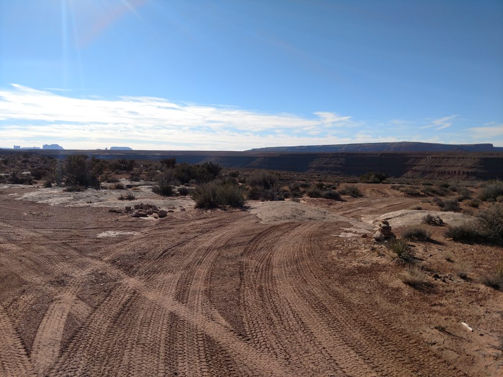
After leaving Johns Canyon Road, drive this unmarked, poorly maintained road for 2.0 miles to the trailhead. Several smaller tracks deviate from the big one but as long as you stay on the most driven track, you'll get to the trailhead. Most cars would be fine on this road but I chose to park just a little off the track and hike in from there. Here's a map that should illuminate the directions further-
Honaker Trail Overview
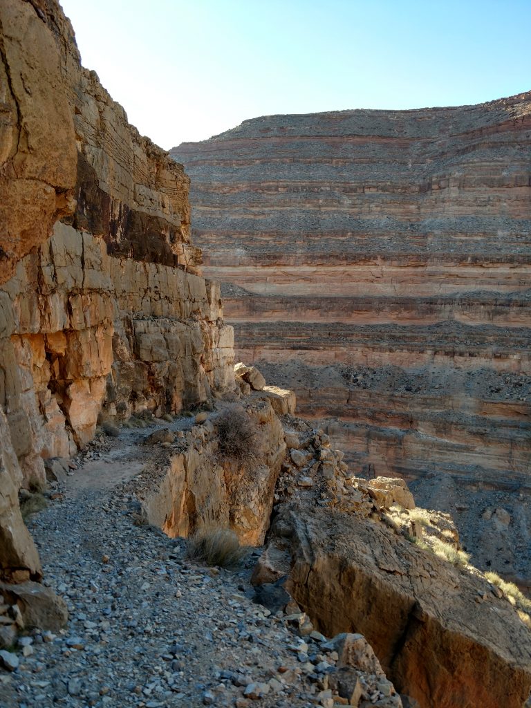
From the parking area, the trail almost immediately drops below the rim. Keep a close eye for the most trod trail as there are no signs nor directions on the way down.
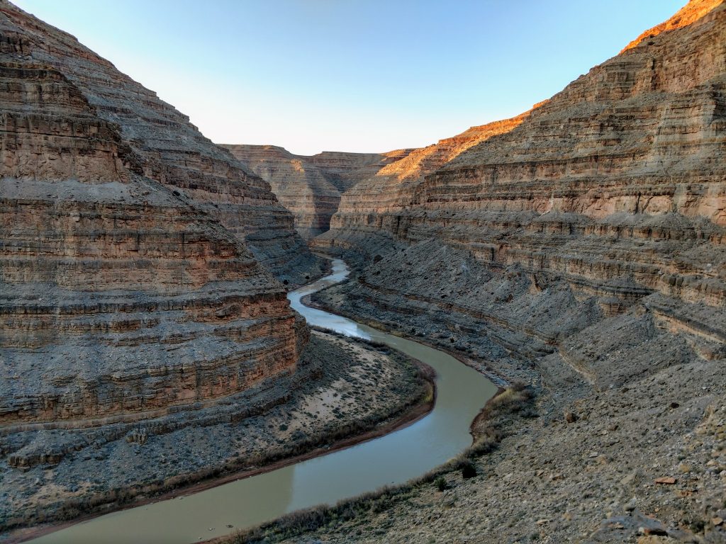
With numerous switchbacks the trail generally follows a southwesterly direction before coming to an obvious bend in the river. After about 1.5 miles of descending, the trail comes to a fantastic overlook deep inside the canyon:
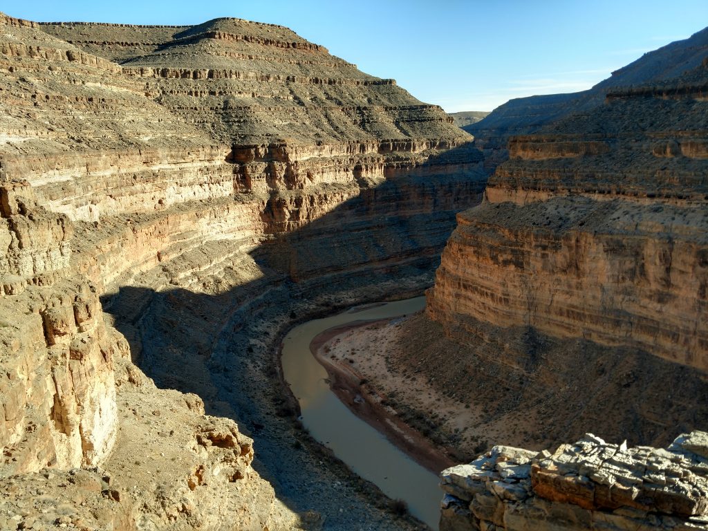
After this, the trail follows along another rim for nearly a mile without much altitude change. Suddenly the trail took another steep drop through a less steep section in the rim and dropped down to the river. The Honaker Trail looked like a gigantic, elongated "S" shape. when it was all said and done.
The bottom had signs of a campsite and I wondered if people routinely backpack to the bottom just for the wonderful solitude. I wished I had more time to run this river- I'm sure its equally amazing.
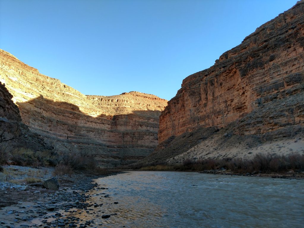
As you see in the photos, its almost always dark at the bottom, especially off season. Pack warm layers!
Like all canyon hikes, the hard part is getting back out. Its like climbing a mountain in reverse. It took me about 2 hours to hike back out of the canyon but that included innumerable photo stops. People less obsessed with picture taking get out much sooner.
Overall, a good hiker could hike the Honaker Trail in half a day but take your time if you can. Its not often you get views like these without anyone else around.

No Comments