


Cox Peak is an infrequently climbed mountain in extreme Southern New Mexico, just 9 miles from the international border
I love it when I find a mountain that gets less than a dozen visitors a year. Cox Peak in New Mexico's Doña Ana County is one of those peaks. Plainly visible from much of El Paso's West Side and Las Cruces, you'd think more would make it this way. But as far as I can tell, it gets no more than a few visitors a year.
In my frequent trips to El Paso and West Texas, the looming summit always attracted me. On this most recent trip, I visited nearby Kilbourne Hole . Getting there was half the fun on old, partially marked dirt roads. But since I was there, might as well continue on to Cox Peak!
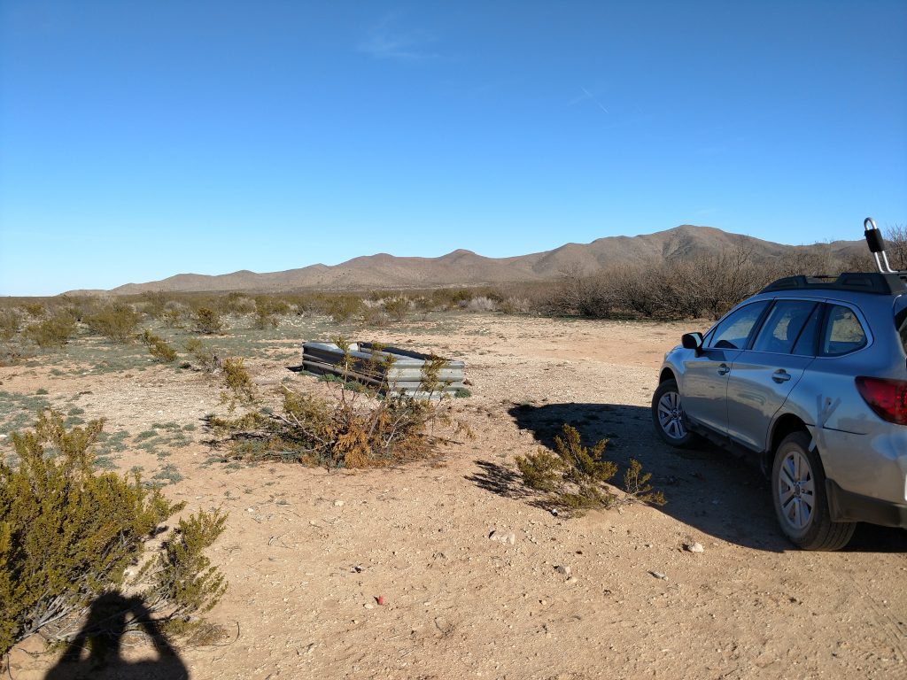
Getting to Cox Peak
By serious 4x4 wheel drive standards, the roads are gentle. However its a very remote location that's only 9 miles North of the border. I'm not aware of any especially concerning danger in the area but keep a sharp eye for it anyways. I encountered nobody for the whole day I was out that way.
There's very spotty cell phone reception here so bring an old fashioned paper map. I used summitpost for directions. Rather than repeating them, here's a map:
In dry weather, the roads are dusty and a bit sandy but not a problem in my Outback.
Cox Peak Trailhead and Hike/Route
As the hike has a completely unobstructed view the whole time, basically I made a line straight to the summit. Its chose your own adventure out here. I kept an eye on the increasingly thick vegetation towards the top but otherwise it wasn't hard to avoid all the prickly plants and cacti.
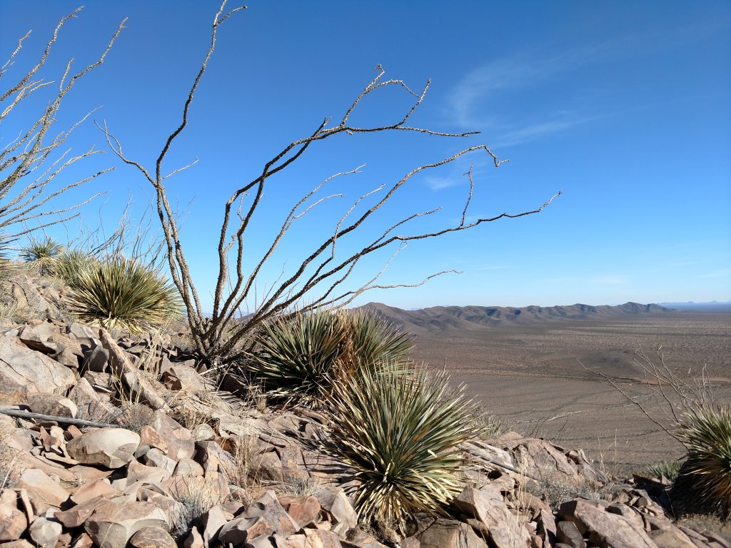
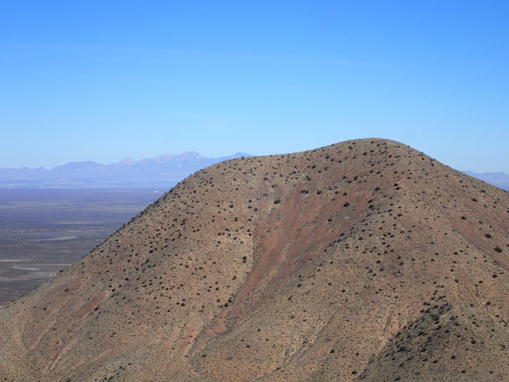
The upper reaches of Cox mountain are shaped like an irregular three sided pyramid. I mainly followed the southeastern ridgeline to the summit. There's a small false summit just before the true one. Within about 2 hours of setting off from my car I was on the top.
A Unique View in Bordercountry
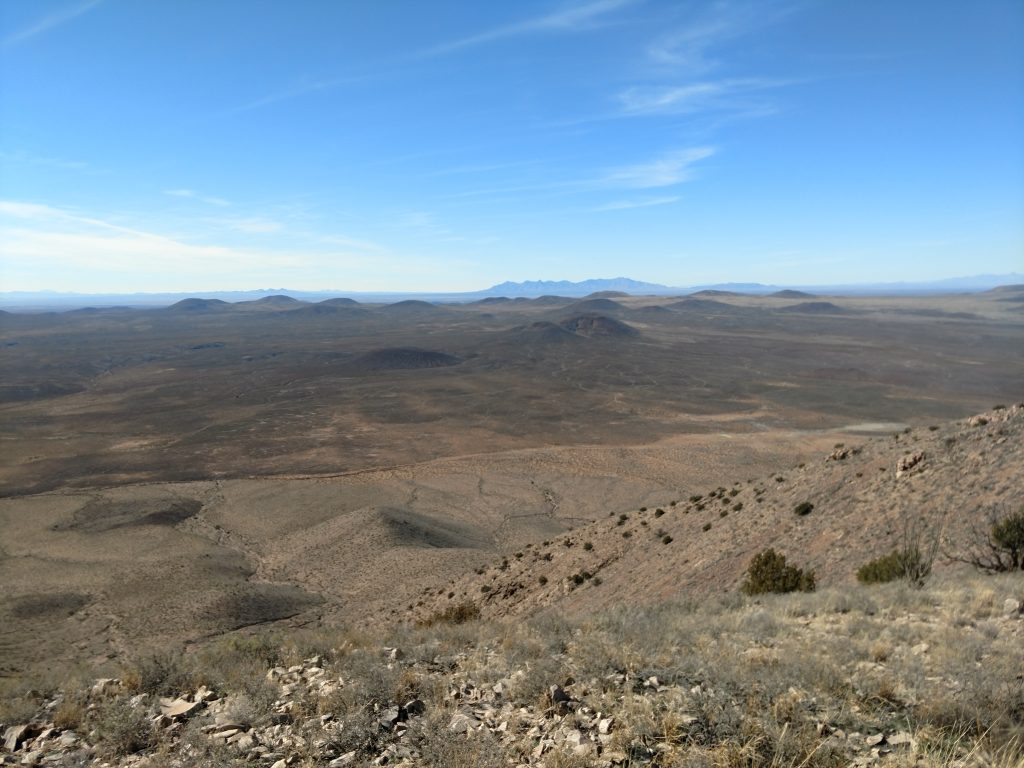
For what Cox Peak lacks in altitude, it makes up for in isolation. At the summit, I was 30 miles or more from the next mountain of comparable size. Below me was the stark planes of the Chihuahuan Desert. To the west were the sawtoothed Franklin Mountains of West Texas. The aptly named Organ Mountains rose in their fluted glory to the northeast.
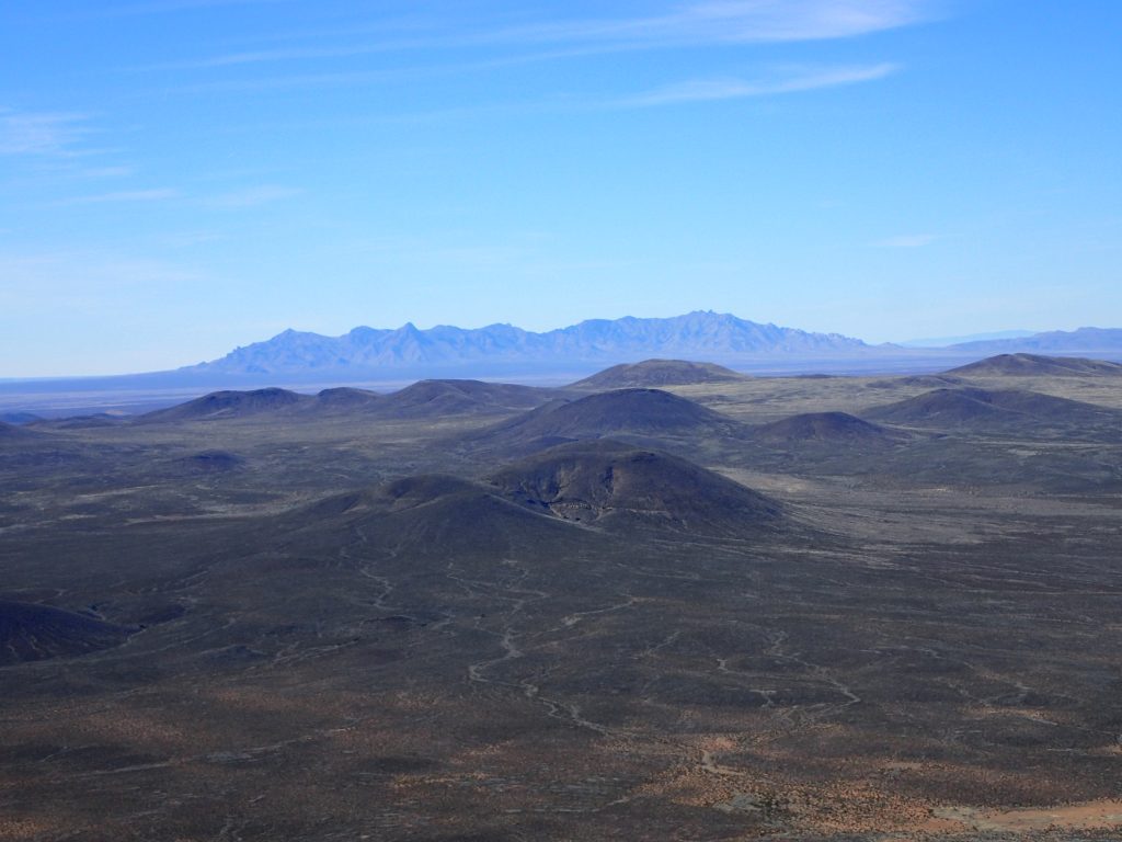
My favorite view was the Potrillo volcanic field. Just west of Cox Peak are perhaps a hundred volcanic cones looking like black checkers rising from the flat desert floor. I read the volcanic field is a leftover from the Rio Grand Rift or the massive valley that effectively divides New Mexico in two. Though peaceful now, the area clearly had a fiery history.
I searched for any sign of a summit register but didn't find any. I need to start establishing them when I hike strange places like these.
The way down was nothing difficult. It was helpful to use a GPS as once I got down to the desert floor I lost my heading towards the car. Other than the mountain itself, there's not a lot of reference points!
On the way out, I drove South, eventually linking up with State Route 9. I don't anticipate that any 2 wheel drive vehicle would have trouble approaching the summit from either direction.
Onward!

No Comments