


At the very Northern edges of what people call the Bay Area lies Lake County and the rugged Coast Ranges. While many Mt Konocti is a massive mountain in the Coast Ranges of California with an unmistakable volcanic cone. Hiking to the summit is not particularly difficult but has unique appeal with views of Clear Lake, the Coast Ranges and an old growth Oak Forest. Konocti Regional Trails has massively improved the trails to allow public hiking on previously restricted land.
Getting to Mt Konocti County Park
Getting to the trailhead is not difficult but Google Maps does not exactly make it clear. If you follow directions with Google, you'll definitely get there but its confusing. Here's a few pointers:
From most places in the Bay Area, take Route 29 or Highway 175 to Kelseyville, California. Both Highways intersect just South of town. From that intersection, head 3.5 miles North. Turn right on Main Street and follow it for 0.3 miles. Turn Right on Konocti Road, just past the 76 station. Follow this road to the edge of town, passing the High, Middle and Elementary Schools. The pavement ends at Lakesport Speedway and immediately starts gaining altitude. Its a dirt road of excellent quality that shouldn't give any cars trouble. From where the pavement ends to the parking area, its 3.1 miles.
At the main parking area for Mt Konocti County Park, there's space for a few dozen vehicles, bathrooms and excellent directions. A locked gate prevents any further travel on wheels. Here's a regional/hiking map:
Hiking Mt Konocti (Wright Peak)
Before coming, print out the brochure from the website. I'm thankful the county has invested so much into this park as the directions and signs are all well established. Note that some of the hiking is on publicly accessible private land but be careful not to deviate off the main hiking route.
With all the side trails I hiked, my mileage came out to 9.22 miles which took about 5 hours (factoring in lots of stops for photos)
Starting at the gate, the trail mostly follows the gravel road to the summit. However there's a section early in the hike where a footpath leaves the main road to avoid walking through a private orchard. I found it well marked and established. After this brief detour, the footpath links back up with the main road and steadily gains altitude
Its about 1.6 miles from the trailhead to the first major fork in the road. There are pit toilets here that are open year round. Take a right if you want to hike Wright Peak (Mt Konocti high point) only.
Side Hike to Buckingham Peak and Clear Lake Overlook
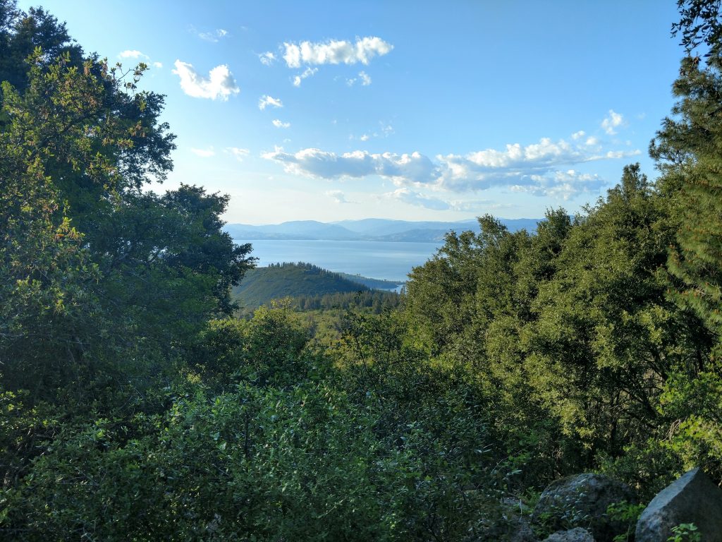
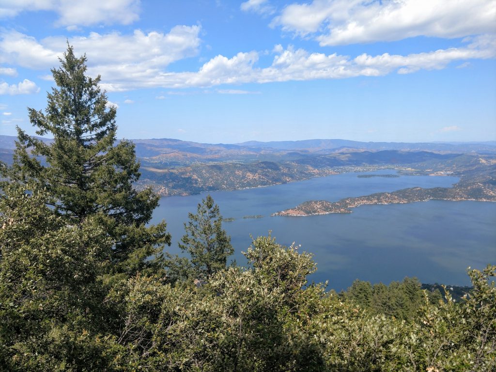
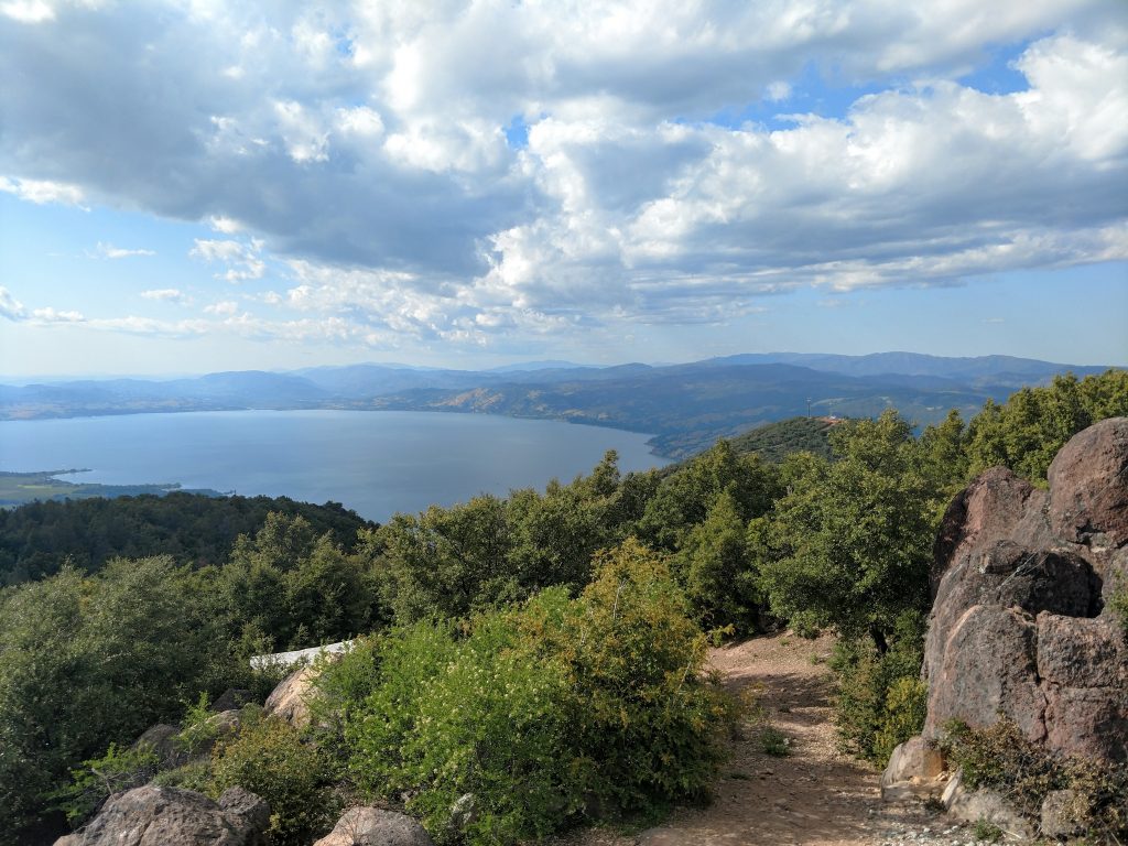
Going left offers a 0.8 mile (1.6 round trip) trip to the summit of Buckingham Peak. The peak itself is crowded with radio towers though clearings near the summit have the best view of Clear Lake. Mt Konocti's slopes drop precipitously into this exceptionally scenic and old lake. Geologically speaking, its the oldest freshwater lake in North America and the largest lake entirely within California (baring endorheic sinks with massive seasonal fluctuations in size). The hike to this mountain is steep but well worth the efford
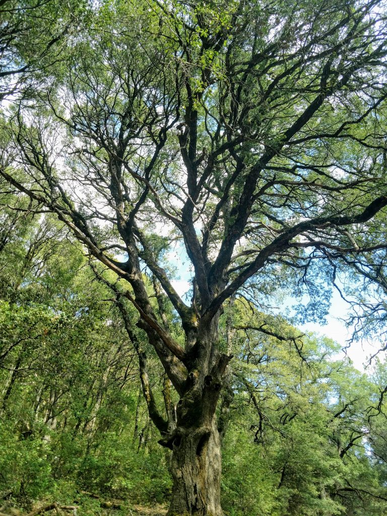
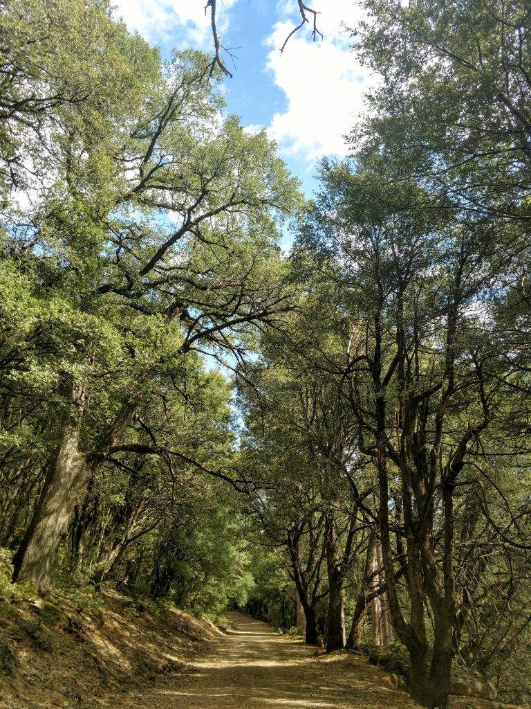
Live Oak Forest
Back to the major junction and on the main road up to the high point, I came across the exceptionally well preserved and presumably old growth Canyon Live Oak Forest. The trees were gnarled, tall and had flourishing crowns. It was like walking through a fairy tale forest.
There's evidence of former homesteading and some active orchards nearby as well. On a hot day, this section is the only mercifully shady spot on the entire hike.
Short Side Trail to Howard Peak
Howard Peak is only slightly shorter than Wright Peak which is the main summit. It is far less developed than the latter so well worth a 0.5 mile (total) detour to its summit. Simply follow the overgrown dirt road at the saddle between the two summits to the top.
Wright Peak, aka Mt Konocti
I don't know why the summit of Mt Konocti is named differently but so be it. Its less than a half a mile between the saddle of Wright and Howard Peaks to the true high point. There's a number of radio towers at the top but they don't obstruct the view. The county erected an interesting sign noting the distances between this summit and other mountains of California.
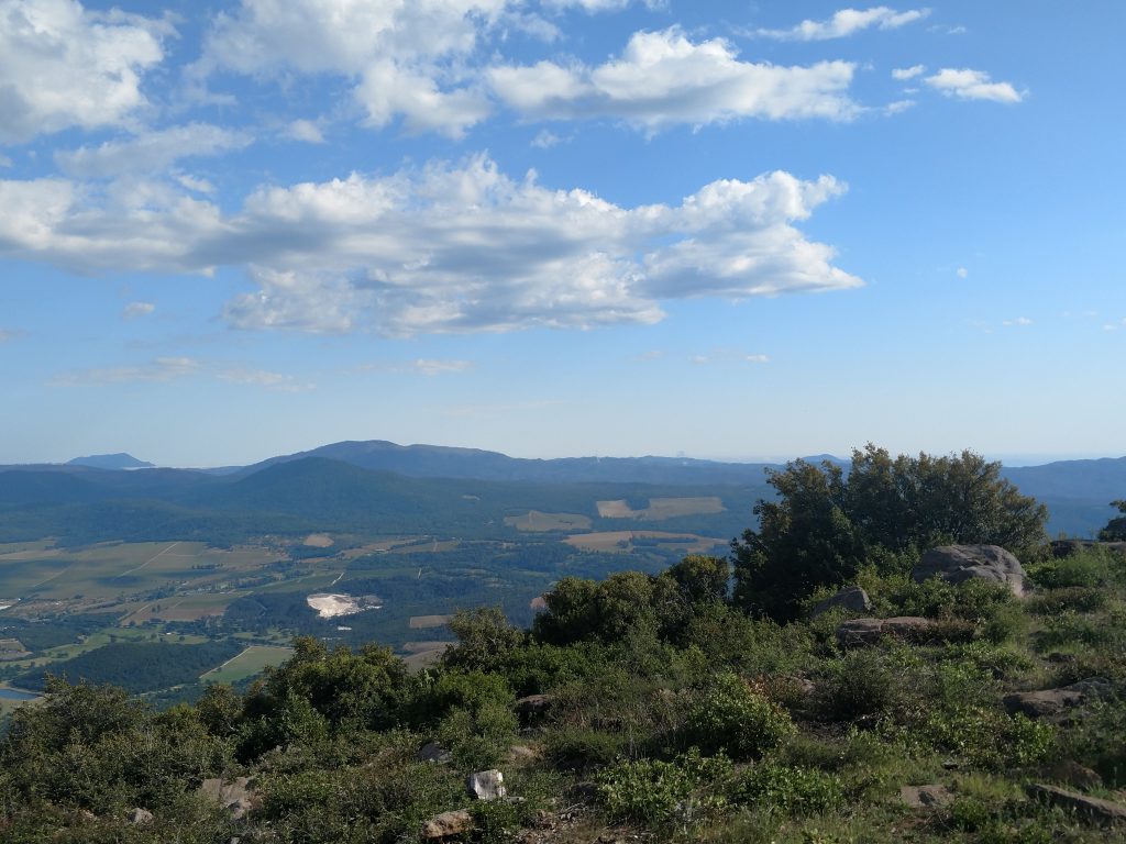
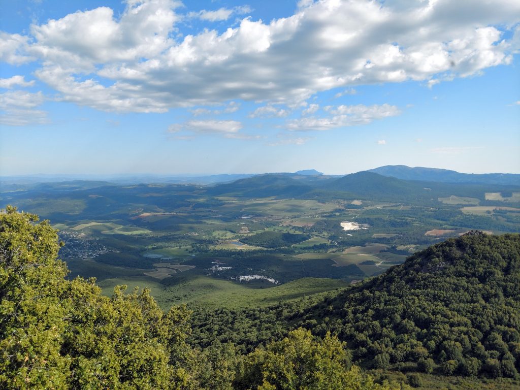
Perhaps the best view from the summit was that of Cobb Peak, the Geysers and Mt St Helena. The geyser plums almost looked like fires in the distance. The entire complex is the largest geothermal power plant in the world and consequently sits on the world's largest geothermal field. I had no idea until I looked it up afterwards
After summiting, simply return the way you came and hopefully catch a gorgeous sunset over Clear Lake.

No Comments