


Nevada's Mount Jefferson is one of the most significant summits of the Great Basin and, for that matter, all of Nevada. This strikingly prominent summit dominates the hinterlands of Nye County. Mt Jefferson is therefore rarely climbed except by dedicated and tenacious peakbaggers. Thankfully, its not too difficult of a hike. However, its not a place anyone just stumbles upon- here's my guide to getting there and the hike itself.
Mt Jefferson's Background and Location
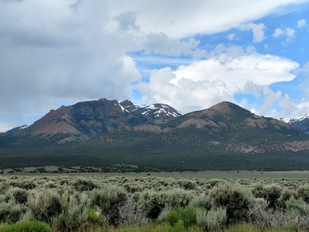
Mt Jefferson is a summit of superlatives, both in remoteness and altitude.
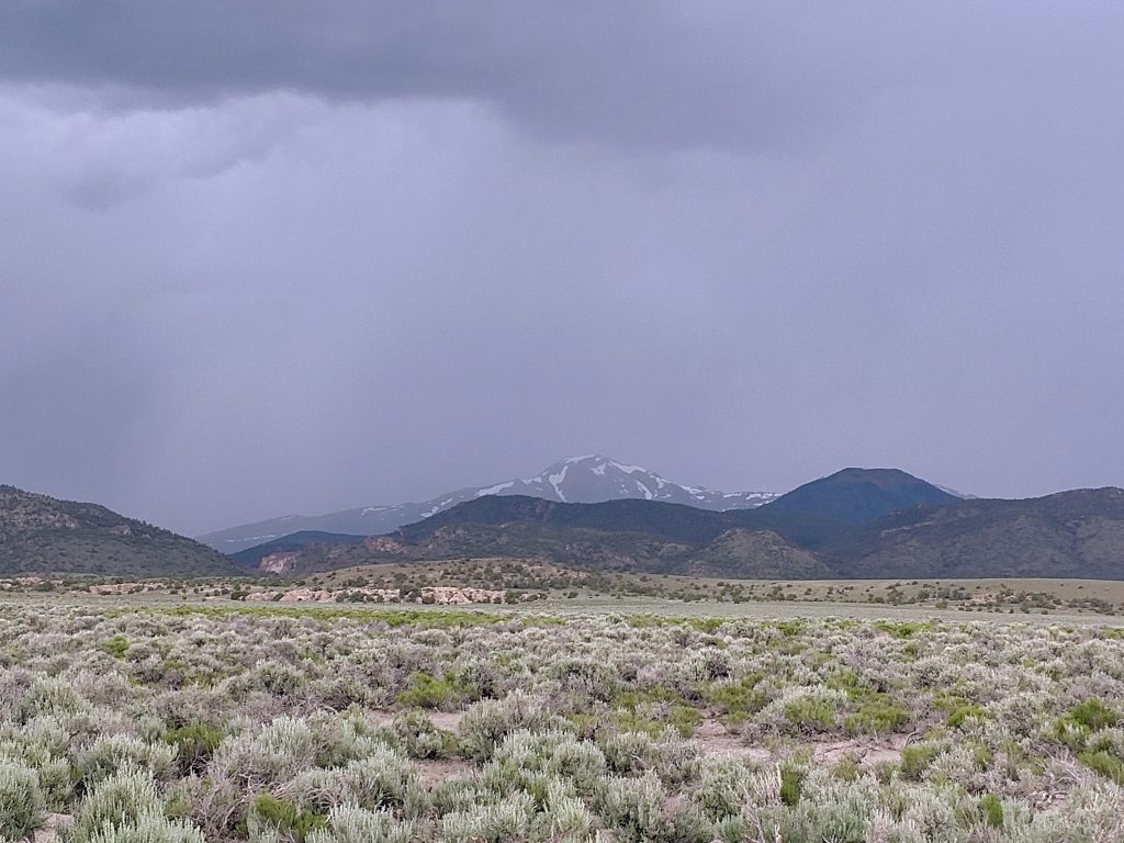
At 11,949' and the highest summit of its range, the Toquima Range. Its the highest summit for nearly 100 miles, only surpassed by the Nevada state high point, Boundary Peak and the White Mountains of California. Just North of the high point is Alta Toquima, an archaeological site of the highest pre-historic Indian village in the United States.
The closest town to Mt Jefferson is Tonopah, Nevada. It has plenty of amenities and all the marks of a small town. Compared to Reno or Las Vegas, Tonopah is barely more than an outpost but considering how far it is from any town of consequence, it might as well be a metropolis.
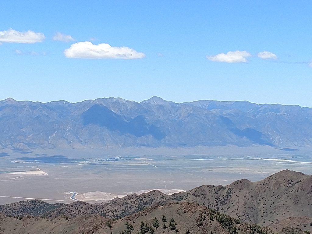
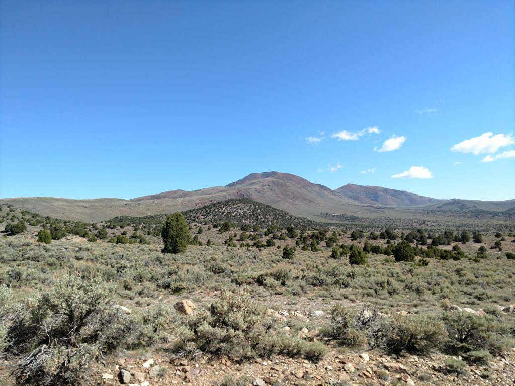
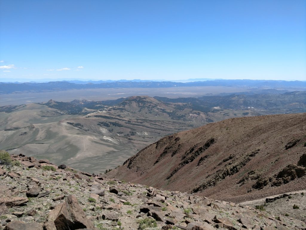
On the western side of the range is the Big Smokey Valley, almost seven thousand feet below the summit. Big Smokey Valley has a striking, man-made feature- the Round Mountain Gold Mine. Its one of several massive, open-pit mines in the state that you never knew produced 5% of the world's current gold production. The Toiyabe Range forms the Western edge of the valley, culminating at Arc Dome.
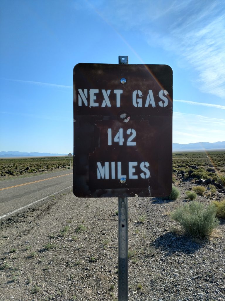
East of Mt Jefferson and the Toquima Range is the Monitor Valley, an extremely isolated place. There's some large ranches and a long, unpaved road and that's basically it. The lower and less imposing Monitor Ranges bounds the eastern side. This sign amusingly sums up the place-
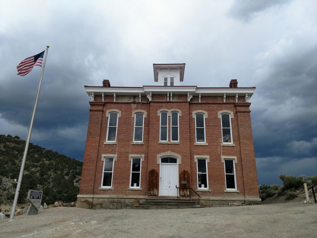
There's one final noteworthy location- the town of Belmont, Nevada. Its a classic mining boom town but they retained the original Nye County Courthouse. In both my visits to this far flung locale, there were plenty of residences and even a gift shop.
Getting to Mt Jefferson's "trailhead"
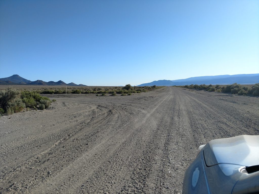
Starting from Tonopah and the intersection of US-95 and US-6, I drove East on US-6 for 5.4 miles and turned left/North at the intersection of US-6 and Nevada 376. I drove 13.3 miles North on this road to the intersection of NE-376 and NE-82. The "next gas" sign above is at that intersection.
This road is roughly paved for 27 miles as it heads North to Belmont, Nevada. Note there are no real services in Belmont. I stated on the road as the pavement turned to gravel and the road enters Monitor Valley. About 5 miles from the end of the pavement and almost 32 miles from the junction with NE-376, I turned left on an unmarked but fairly clear dirt road known as Meadow Canyon Road also known as NF-010.
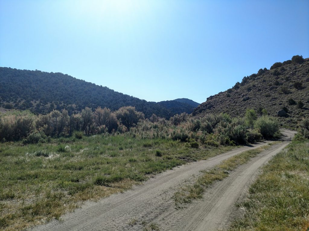
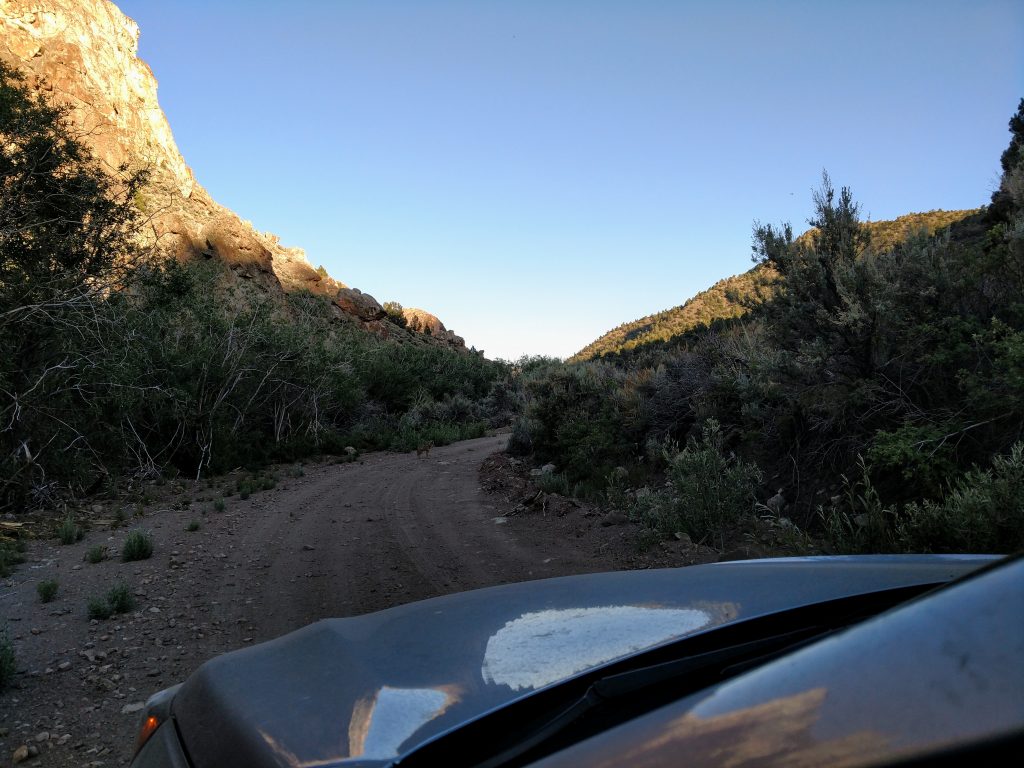
Meadow Canyon Road heads West into the mountains, slowly gaining altitude. After 2.6 miles, I came to a small turnoff, campsite and cattleguard. I recommend low-clearance vehicles and/or inexperienced drivers go no further than this point.
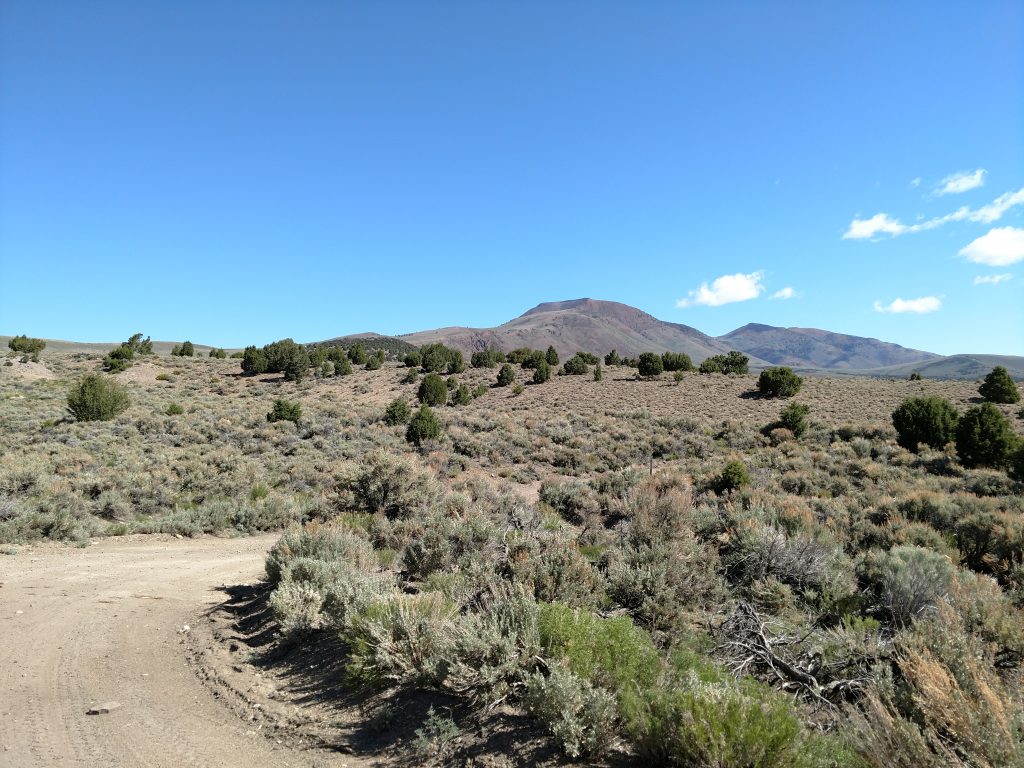
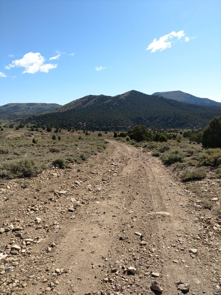
Continuing on in the Subaru, I drove another 3.3 miles through Meadow Canyon, paralleling the creek. I picked up some "racing stripes" from the overgrown vegetation but didn't' have too much trouble. It was quite slow and rocky however. I parked at an old livestock corral which was 5.9 miles from where I turned off NE-82/Monitor Valley Road. Here's some photos of the drive-
Here's my map for the hike itself. It shows where I parked and traveled on foot/mountain bike to Jefferson Summit and then the route up Mt Jefferson:
Hiking the rest of the Road to "Jefferson Summit".
I used a combination of mountain biking and hiking for the last part of Meadow Canyon Road/NF-010 however some drivers and wheels make it all the way to "Jefferson Summit" or the pass between Mt Jefferson to the North and Shoshone Mountain to the South. Here's the link for it on Google Maps.
From the corral to the next major fork in the road was just 1.7 miles, one-way. I could have easily driven it but I was being cautious due to being alone and far from any sort of cell reception. The fork in the road is the furthers I conceive any non-modified 4x4 vehicle can make it.
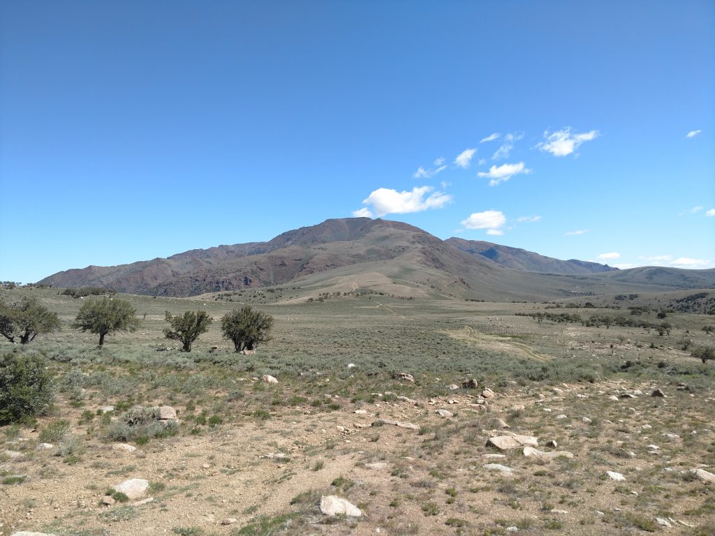
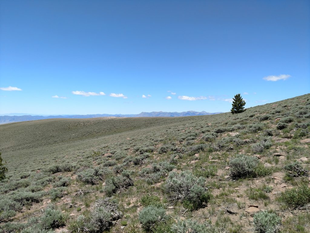
From the fork to the pass was another 1.4 miles and a steep 700' of gain. The mountain bike helped a lot, especially on on the return. At the pass, there was a clearing for camping and great views of the Big Smokey Valley.
Jefferson Summit to Mt Jefferson (Nevada)
The pass stands at about 8,800' and the summit is just below 12,000'. The way I did it, my round trip distance from pass to summit was 10 miles. There were no switchbacks so plenty of "hands-and-feet" kind of climbing laid ahead.
At the pass, I saw a deteriorating dirt road paralleling a fence-line that headed off to the summit. Above the conceivable end of the road, a faint path took a direct route North. I road my mountain bike about another mile before going on foot. Stashing the bike beneath the only strand of trees for miles, I pressed on. Although there were no signs nor directions, the path was pretty clear.
The route was relentlessly steep and entirely unshaded. Thankfully the cool temperatures and high altitudes made the hike pleasant. Any hotter however and I would've run out of steam fairly quickly.
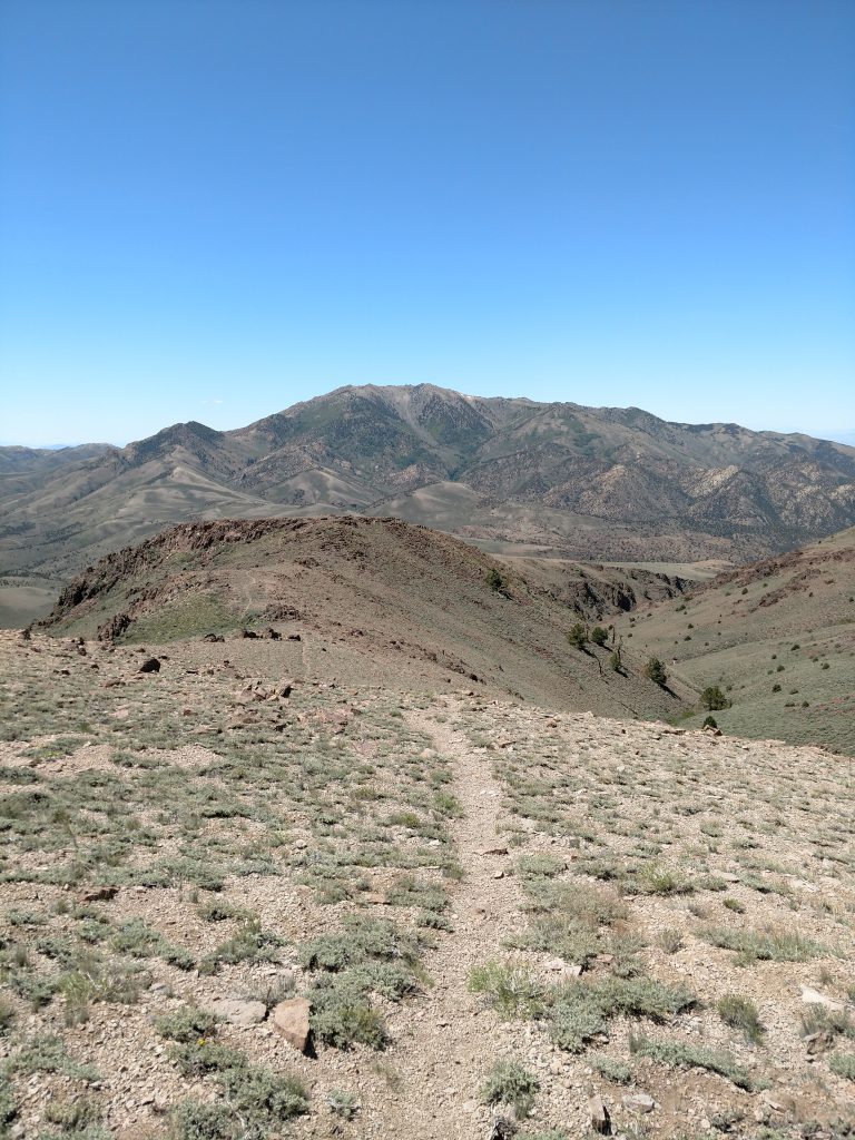
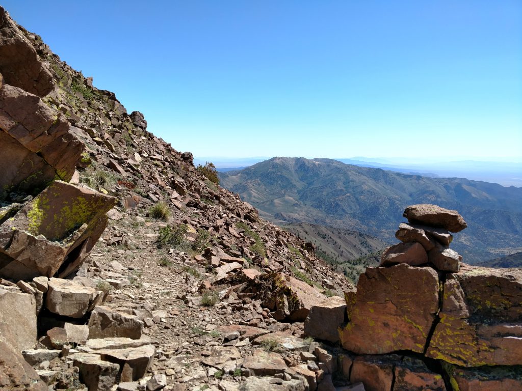
Surprisingly, the path remained clear and easily followed. I lost it briefly, here and there but cairns and common sense marked the way. As long as I headed North and kept gaining altitude, I was on the right track.
Between about 10,000' and the 11,949' summit, I crossed a few talus fields and false summits. It was never technical or that difficult compared to a true talus scramble. However, the moment I got off the main track, it became quite slippery.
The final 400' were totally trail-free but obvious enough. I simply took a straight line towards the summit towers.
Mt Jefferson's (Nevada) Summit
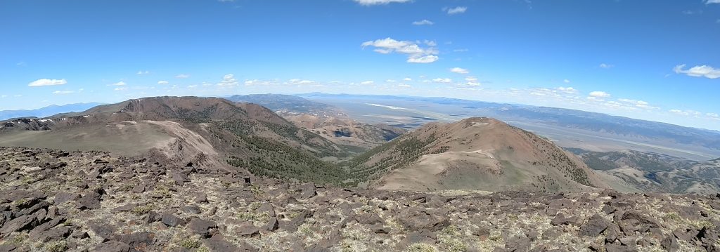
In spite of all the climbing, Mt Jefferson's summit was flat topped and broad. I found several candidates for "true highpoint" along the piles of rocks but no summit marker nor register. I found that disappointing- would love to hear other's experiences and how far they traveled for this Ultra Prominent Peak.
Views of the Monitor Valley were absolutely incredible. I think I had this entire region to myself (save for a few ranchers). Also, the Northern view of the several sub-summits was other-worldly. I wished there was more evidence of the Alta Toquima archaeological site but there was none from where I stood.
Although very faint, I also saw the White Mountains and Nevada's Highpoint to the Southwest, over 100 miles away.
Standing up there, I felt like the last person on Earth. Few places have such a great sense of solitude and isolation. I was the king of physical distancing in the time of COVID-19.
Descent
I followed my GPS track down and back to my bike and car. It was not too hard to follow- again there's simply no trees or any other obstructions of view. Having the GPS helped however- going overland, instead of following the path, would take me across miles and miles of thorn-bushes and sagebrush. Thankfully I didn't have that experience.
It took about 9 hours and 15 minutes to complete the hike I did. Total round-trip distance was 16.5 miles. I clocked 4,400' of altitude gain along the way. Not bad!
Mt Jefferson (Nevada) was my 39th Ultra Prominent Summit of the 57 Ultras in the Lower 48. Onward to Mt Charleston!

No Comments