


For years I've wanted to climb Clark Mountain. This far flung summit rises to an exceptional altitude of 7,933' in a land of pancake-flat playas barely above sea-level. Unlike many places I write about, most have seen Clark Mountain and might even recognize its profile. Clark Mountain is not far from I-15 between Los Angeles and Las Vegas. The map-dot down of Mountain Pass is close by and more well known as a choke-point on the road to Vegas. To someone like me, Clark Mountain beacons for a climb every time I pass.
Clark Mountain Overview
Clark Mountain strictly appeals to peakbaggers like myself. Just under 8,000', its not tall by any California standard. The altitude is dwarfed by far taller and more famous summits of the Mojave such as Telescope Peak and Mt Charleston. However, it makes up for it in prominence; Clark Mountain rises 4,232' above its saddle. Consequently, the summit notches at #15 on California's most topographically prominent summits.
Other than this, Clark Mountain finds its way to several peakbagging tic-lists including the Sierra Club's Desert Peak Section, Western States Climbers List and Western States Climbers Emblem Peaks.
This region is part of Mojave National Preserve. It's seldom visited and there are no improved roads in the area. To this climber's knowledge, the only roads that delve into the range are from the nearby Mountain Pass Mine. Thankfully, there's no entrance fee or permits needed for day visits.
Directions to Clark Mountain Trailhead
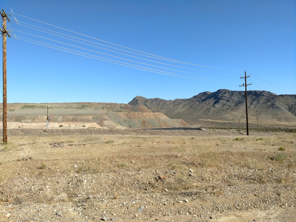
The best access to Clark Mountain is off the Bailey Road/Exit 281 off Interstate 15. This exit is about 1 hour South of Las Vegas and 2.5 hours North of San Bernardino. After exiting, take the first left on Clark Mountain Road. Follow this initially paved road past the mine and the Cal Trans facility.
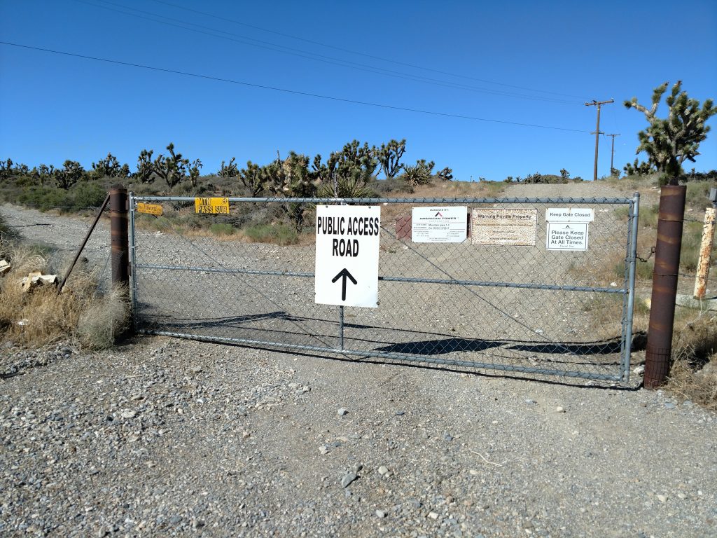
The road becomes dirt and it feels like a place you shouldn't be. Don't worry; this is a public easement road. I continued 1.7 miles along this unusual road as it circled the mine. I came to a gate which looked like this-
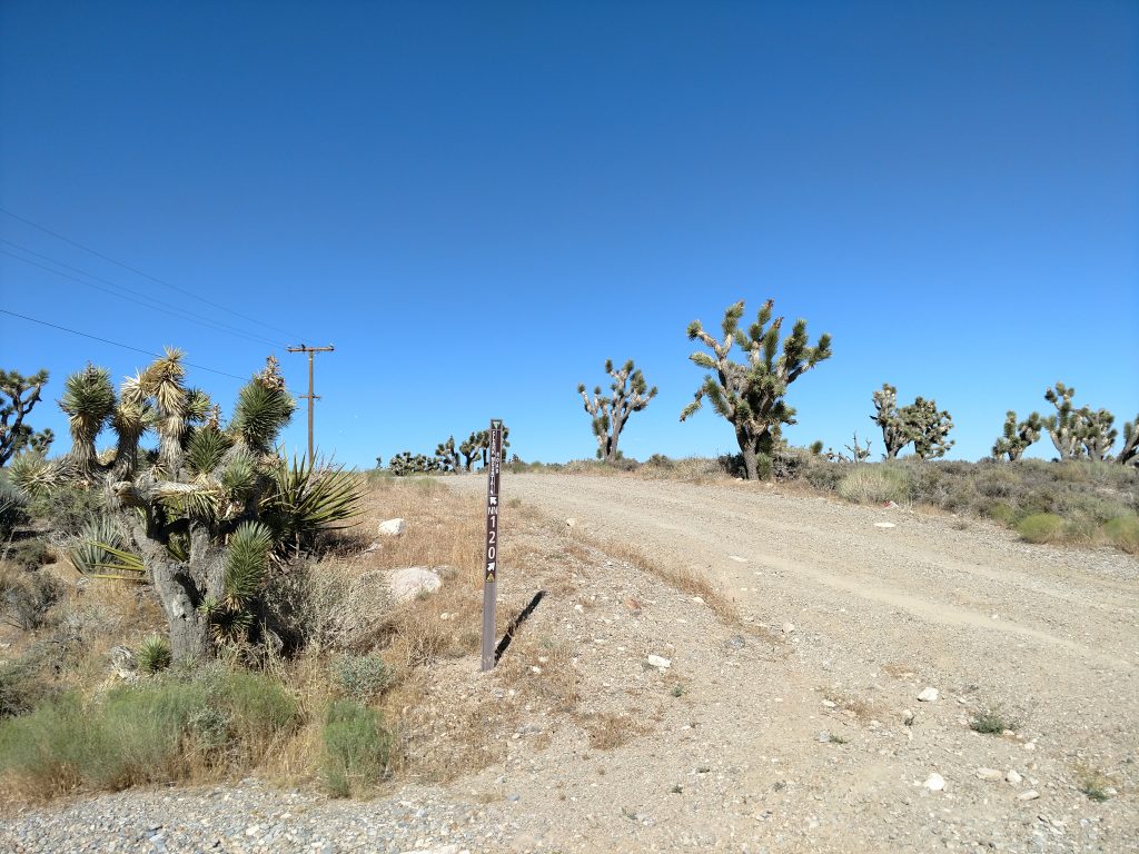
Through the gate, there's a hive of BLM-marked roads which are all but impossible to follow except with a satellite view. I just parked inside the gate above and continued on bike but there's a way to drive all the way to the BLM campsite in a well-equipped vehicle.
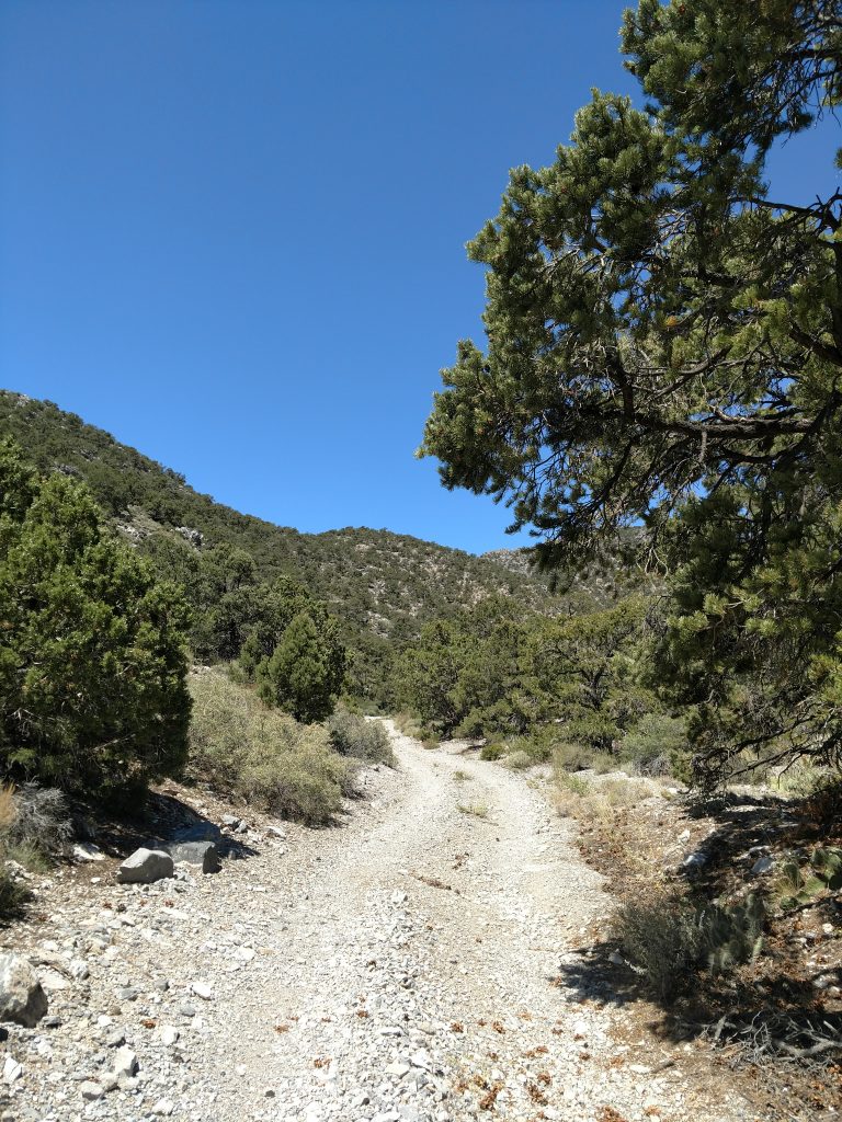
From the gate above, the traditional route involves taking a right at the fork and going along this straight but hilly road 0.6 miles. Turn left when it terminates in a wash and take this decrepit wash/road 3.2 miles to the BLM Campground. I didn't feel comfortable in my vehicle on those roads so I found my way on bike (route is below).
Here's an idea of the roads in case you were wondering-
Here's a map of the area including the drive from I-15, the alternate route I took and the ultimate hike/scramble to the summit-
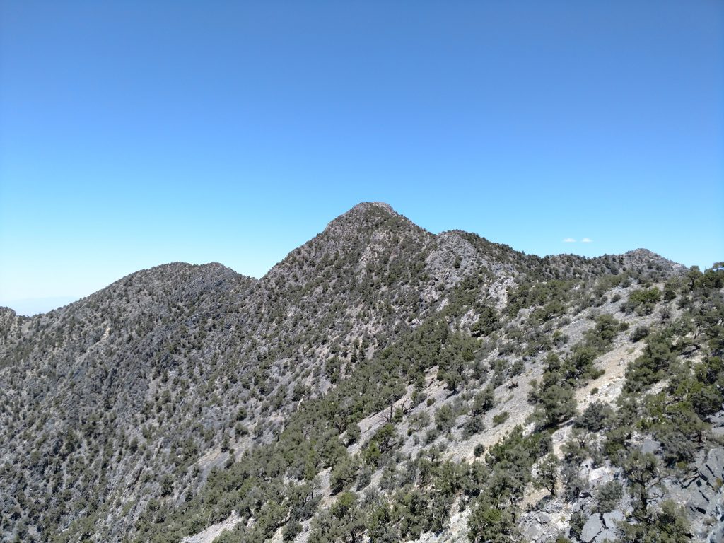
Clark Mountain via South/West Ridge
Again, I rode my mountain bike a few miles instead of driving. Doing that in July was naturally insufferable but better than getting myself stuck and alone in my car.
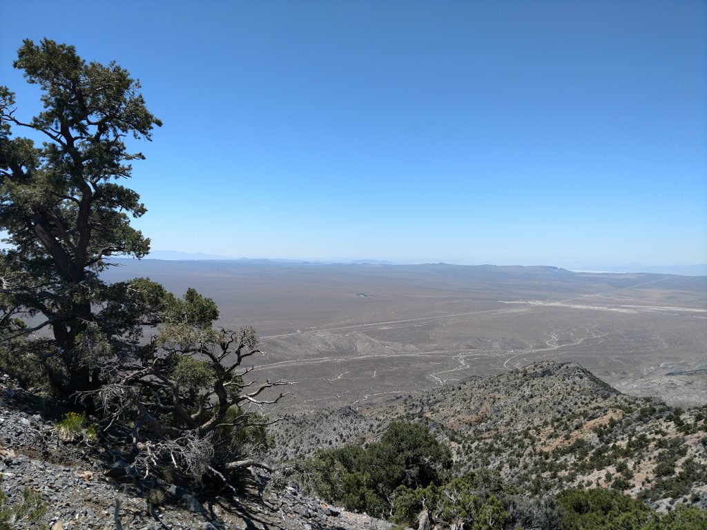
At this point (click for link to Google Maps) I left the road and began my scramble up the East-West running ridge-line. This is class I-II bushwhacking and I saw no markers nor cairns marking the way. I picked my way up the somewhat loose slopes, eventually gaining the ridge line itself.
Once on the ridge-line, I simply followed it until it dog-legged to a North-South orienting ridge-line.
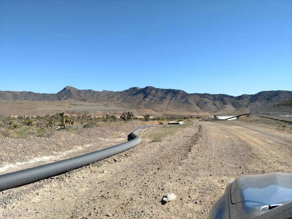
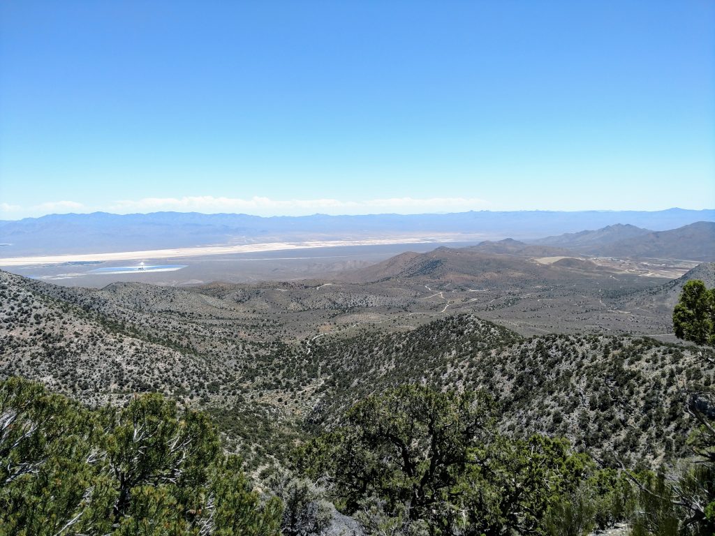
There was a fantastic view of the Mountain Pass Mine and the Ivanpah Solar Power Facility; symbols of two modern day California gold rushes. Ivanpah Solar Power Facility is the largest "solar thermal power station" in the world. The three sun-bright towers/boilers create a futuristic looking scene when driving near Primm and Las Vegas. There's all kinds of interesting and somewhat sordid background to the plant. But we Californians just beam with pride at how green we are.
Mountain Pass Mine, on the other hand, was once the largest and presently the only rare earth elements mine the United States. The significance of rare earth elements in modern living cannot be overstated. I don't know if we'd have Silicon Valley without the Mountain Pass Mine. Of course, the mine has a far more dubious background...
Scramble turns to a Bushwhack
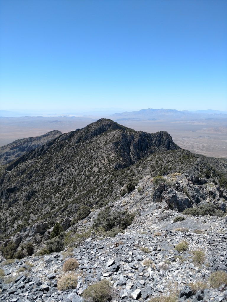
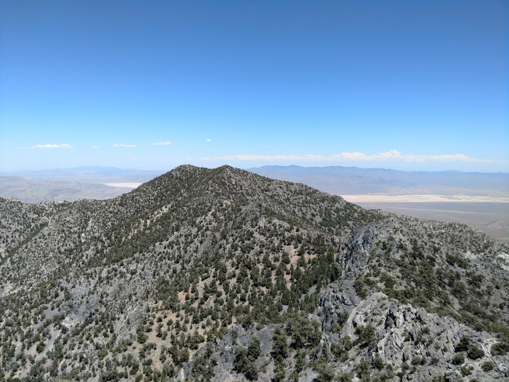
The East-West ridge-line becomes the North-South Ridgeline which eventually leads to Clark Mountain's summit. This part was tricky. Although a map makes it look like a ramp, there's a lot of ups-and-downs along the way.
I stayed right of the ridge-line, avoiding some of the more difficult scrambling and thicker, spinier vegetation. Occasionally I'd pick up a herd path here and there but it was a lot of careful meandering between cactus, brush and junipers.
Below the summit was the thickest brush and steepest scrambling. Nothing was exposed but it was very slow going. I doubled back a few times and eventually found my way to the summit.
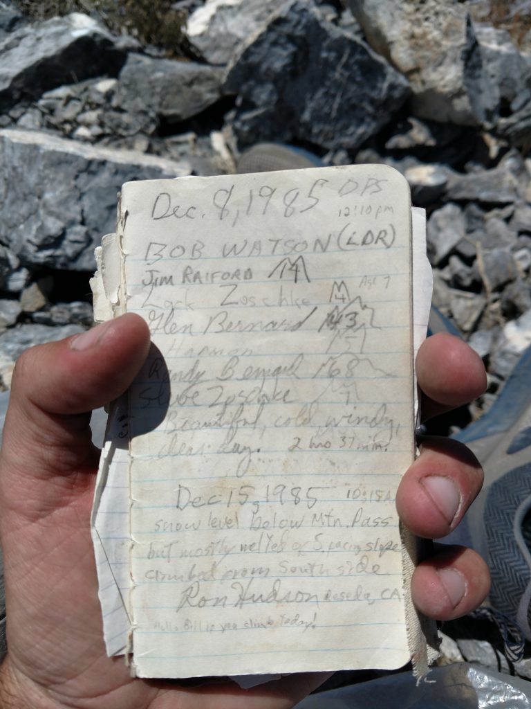
There's a fine register at the top of Clark Mountain entries dating back to 1985. Many famous peakbaggers signed the book, many who are no longer around. I happily added my own name. There must have been less than 120 parties who made it to the summit in 35 years. I looked like the only fool who did it in July.
The descent was thankfully uneventful except gaining 20-degrees of Fahrenheit along the way. Ultimately, I'm also glad I didn't try to drive the 3 miles from the gate to the parking area also- it was certainly beyond my skill and capabilities.
Another "P4K" down! I made my way to So-Cal, then set my sights on Mt Pinos.

No Comments