


Mt Pinos and nearby Sawmill Peak are the high points of Ventura and Kern Counties, respectively. Both summits are easy hikes just North of Los Angeles and West of the Grapevine/I-5. When I lived in Southern California over 10 years ago, I always wanted to climb these summits. For whatever reason, I never did until this most recent large road trip across California. Hiking Mt Pinos and Sawmill Mountain involves a moderately difficult hike at around 8,500' with an option of bagging Grouse Mountain nearby. Most hikers complete this out-and-back hike in about 1/2-3/4ths of a day.
Getting to Mt Pinos Trailhead
This is an easily accessed trailhead. I came from the South by driving I-5 to Exit 205/Frazier Mountain Road. This highway goes through the mountain communities of Ventura County, becoming Cuddy Valley Road. I essentially stayed on this road and followed signs for roughly 22 miles until at the end. As the road climbed into the mountains, I noticed many free campgrounds along the way. The road is paved to the end
Of note, there's a very large parking area that is often open through the winter for Nordic skiing. However, you must purchase an Adventure Pass, available at most gas stations nearby; its $5. A national lands annual pass is valid here as well.
Here's a map of the hike itself-
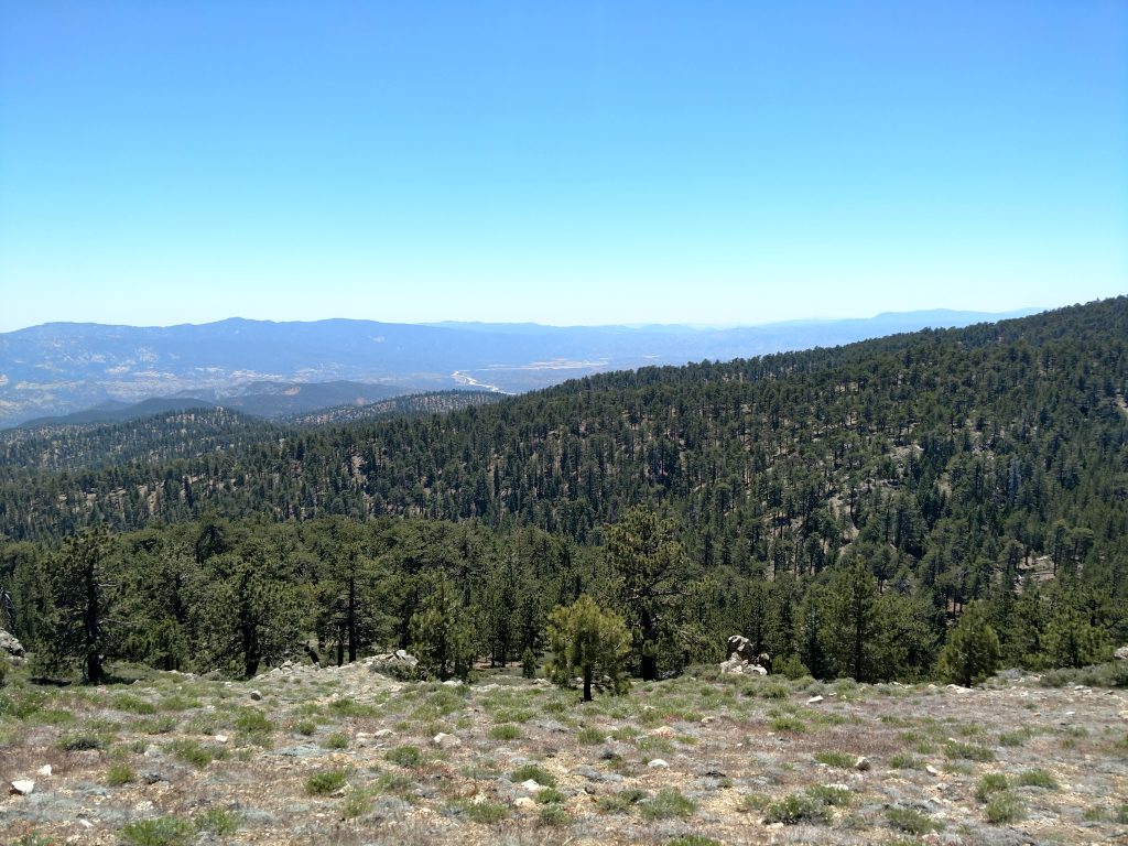
Trailhead to Mt Pinos
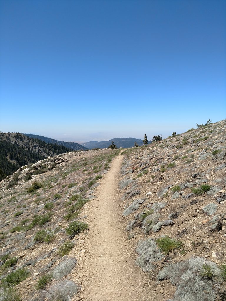
If you want to simply hike Mt Pinos and back, its an easy 3.0 mile, out-and-back hike from the parking lot. Its a straightforward trail, would be hard to get lost or detoured.
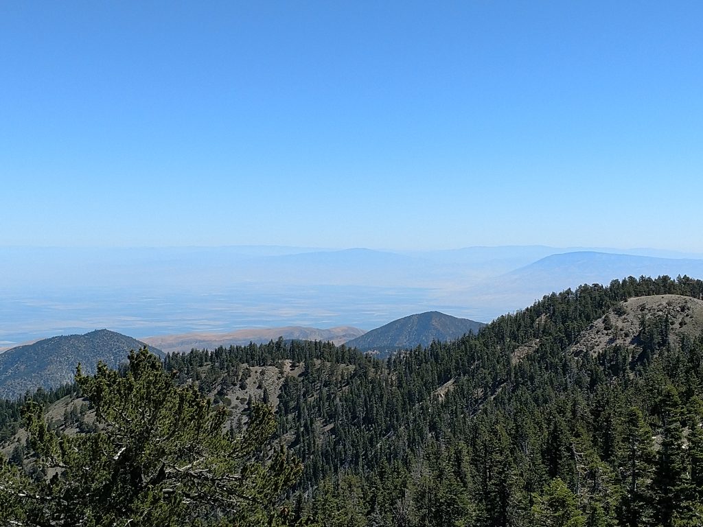
I started at the trail from the Western side of the parking lot, walked about 0.1 miles and then took a left towards Mt Pinos. This trail started out in the shade but was fairly hot, even at 8,500'. After half an hour, the trees thinned out and I had incredible views of the Central Valley.
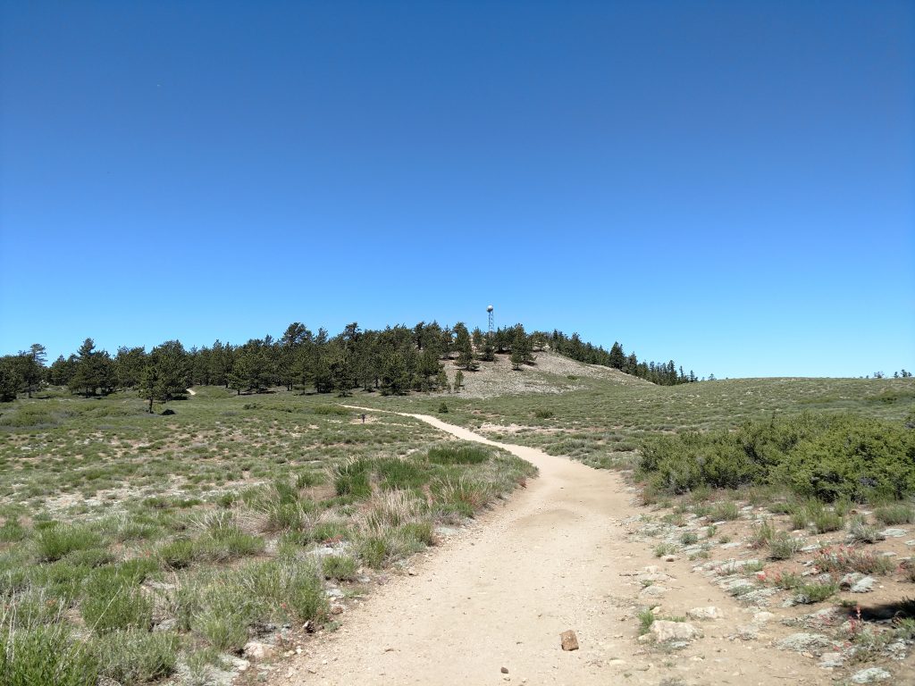
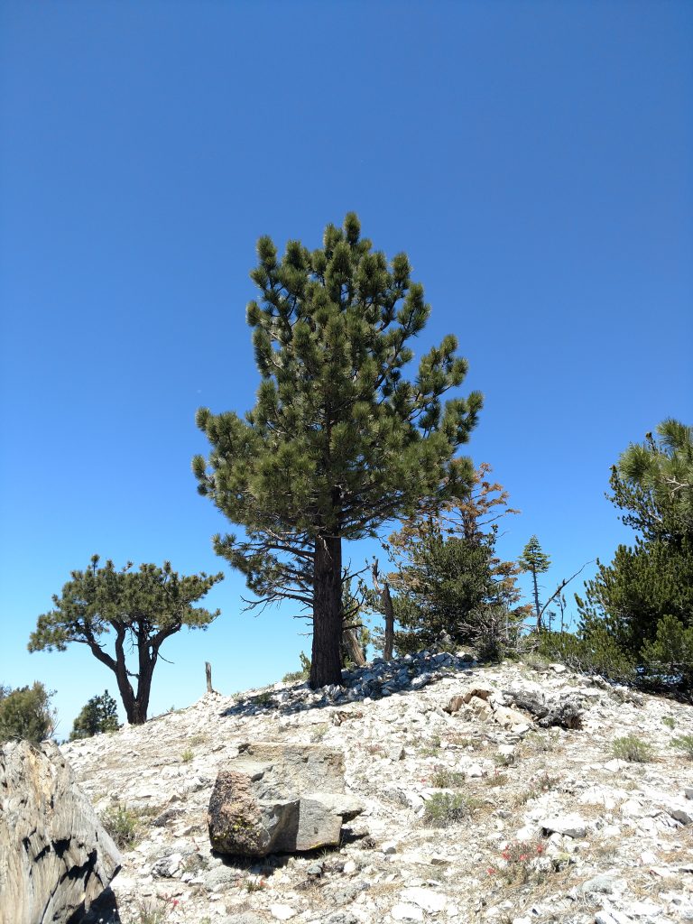
There were a few side trails that deviated from the main route- on the return trip I checked them out and they just lead to nice views of the Central Valley. The now shade-less trail gently gains altitude and wraps its way to Mt Pino's summit (altitude 8,847'). There's a summit marker and some radio towers but no register- too many visitors for that type of thing. Distance from trail-head to summit came in at about 1.5 miles
Mt Pinos to Sawmill Peak
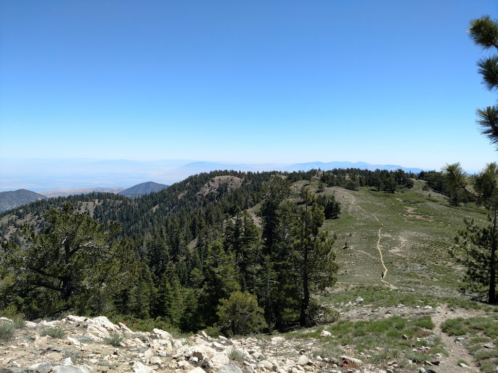
I continued on the obvious trail that headed in a generally westerward direction towards Sawmill Peak. Its about 2.0 miles further from Mt Pinos but there's a lot of altitude loss and gain along the way.
I followed the trail as it passed the Condor Observation Site and then descends a number of switchbacks to the saddle (altitude 8,370') that separates the two highpoints. I lost about 500' of altitude in this section, only to regain neraly all of it ascending Sawmill Peak.
Of note, the normal Forest Service trail does not cross the top of Sawmill Peak but I found a well-trodden path departing the trail to the summit. Its a little more shady on the eastern flanks of the summit.
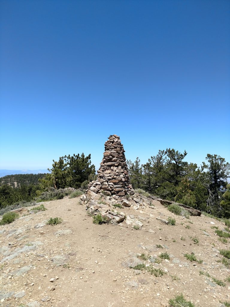
Sawmill Peak (attitude 8,819') itself is marked with a tremendous cairn and summit register. Like Mount Pinos, there were great views of the valley and the Transverse Ranges of Kern and Ventura Counties.
Sawmill Mountain to Grouse Mountain
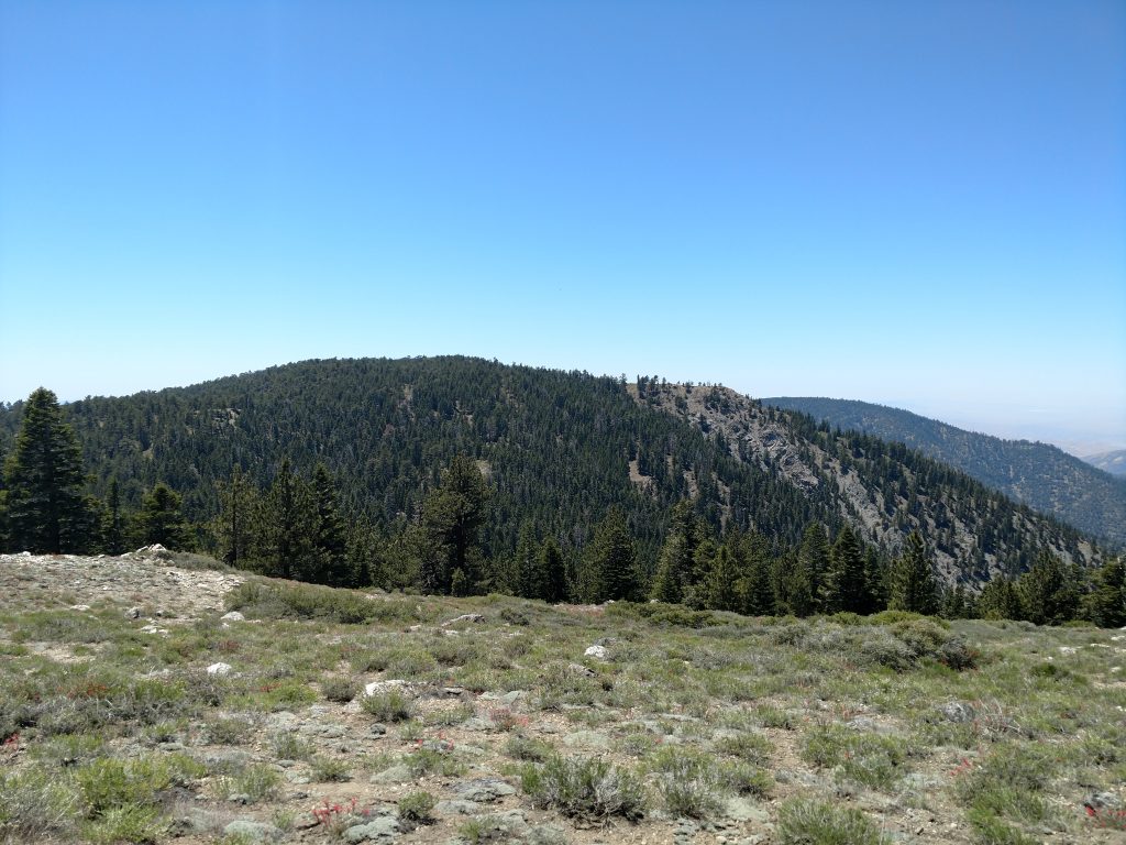
I had plenty of time left in the day and the temperatures weren't too bad so I went for a final summit- Grouse Mountain. This one shows up in the Sierra Club's 100 Peak Section, a peakbagging list.
Once again, I descended to a saddle (altitude 8,320') and lost another 500' along the way. There's a few trail junctions in between the two summits but as long as I headed West, I was on track to Grouse Mountain.
I tagged an interesting point along the way- Sawmill Mountain-West which is a "Triple Divide Peak". Water falling on this inconspicuous spot flows down three different major watersheds. The northern part of the summit flows down the San Emigdio Creek and eventually into the endorheic basin of the South Central Valley. The South side flows to the Santa Clara River and into the Santa Barbara Channel of the Pacific Ocean. Finally, the western side flows down the Santa Maria River and into the Pacific Ocean North of Point Concepcion.
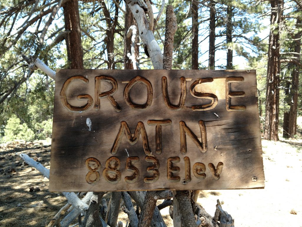
Just past the saddle of Sawmill Peak and Grouse Peak, there's a fork in the trail and I went left, climbing the single track route to the summit. There's a rocky area that seems like the high point of Grouse Mountain (altitude 8,582') but I found another candidate (with a sign) just to the North.
Return
The up-and-downs of the return matched the difficulty of the earlier part of the day. It was much hotter of course so I felt like I was climbing 6 mountains on this trip instead of three.
I made it back to the car after bout 4.5 hours of hiking. There were almost no people between Mt Pinos and Grouse Peak but tons between the parking lot and Mt Pinos. I certainly recommend going further than the high point if you want some peace and solitude.
Mt Pinos, Sawmill Peak and Grouse Mountain were a great introduction to the vast peakbagging opportunities West of Tejon Pass. I'll try to bag a summit each time I drive up and down to So Cal.

No Comments