


Thunder Mountain, Amador County is the 9,414' county highpoint. Although known more for its foothills and valleys, Amador County has a small sliver of the Sierra Nevada, just outside of Kirkwood Mountain Ski Resort. Hiking this summit leads to spectacular views of the High Sierras between Yosemite and Tahoe.
Note that I refer to Thunder Mountain in this piece as Thunder Mountain Amador County, not to confuse with the many other Thunder Mountains of the World and, of course, the more famous Thunder Mountain Ride in Southern California.
Getting to Thunder Mountain (Amador County) Trailhead
This is an easily accessed trail-head. Its probably a long drive for most but thankfully there's no navigation of crazy dirt roads across poorly marked forest service territory. Google Maps will get you to the spot marked "Thunder Mountain Amador County Trailhead" without a problem.
Just a few things worth mentioning about the travel. Most travel up CA-88 or the Carson Pass Highway. Between Pioneer, California and Kirkwood Ski Resort, there are no services to speak of. Gas up at the valley. Kirkwood has a gas station that's often pricey. In this nebulous area South of Tahoe and North of Yosemite, there are limitless camping options but in the summer all the polished sites are often booked or hard to snag. There's a lot of free camping around the region though
The trailhead itself is free. There are no bathrooms, however. There's no water source at the trailhead or anything to speak of on the whole hike. Note that many people mountain bike on these trails so keep an eye out on the steep sections.
Here's a map of my hike. Note it includes a side hike of Martin Point which was worth the small detour. Martin Point has a nearby pinnacle with outstanding views of the Central Valley.
Thunder Mountain (Amador County) Trailhead to Martin Point Side Trail
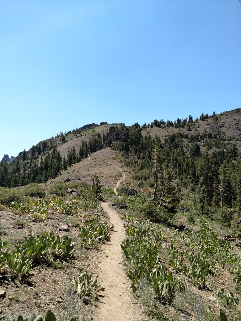
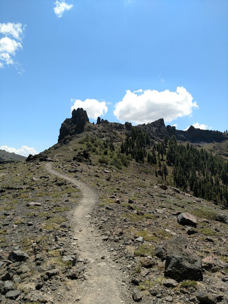
From the trailhead, just shy of 8,000' in altitude, I began the trek up the single track from the far side of the parking area. Initially, the trail was well-shaded which I was grateful for. Its quite steep as it ascends the Carson Spur but flattens out after about a mile and a quarter.
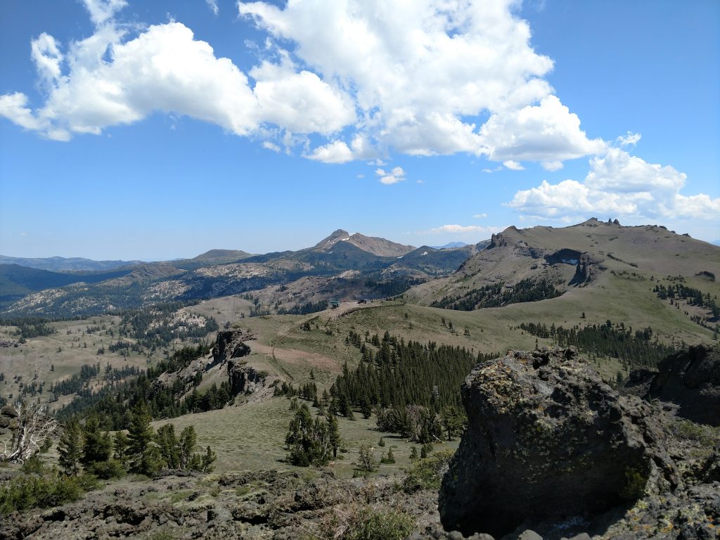
As the trail gets above the trees, Kirkwood Ski Resort becomes visible. I passed by a few pinnacles that looked like fun climbs but the rock waas rotten and loose.
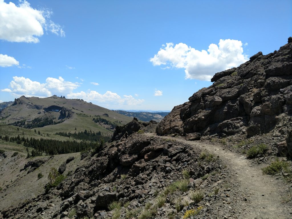
The trail continues gaining altitude for the next 0.8 miles but not as significantly. A few mountain bikers passed by at exceptional speed- I had to keep my eye out for them constantly.
At almost exactly 2.0 miles from the trailhead, I saw a faint herd path deviating Northwest and decided to bag Martin Point. This otherwise inconspicuous side-summit doesn't end up on any major climbing but I went for it anyways.
The route was straightfoward and less than 1/3rd of a mile (one way) but it was slow going. There's plenty of sharp underbrush requiring careful steps. Rocks are just as sharp. I picked my way along and arrived at the highpoint.
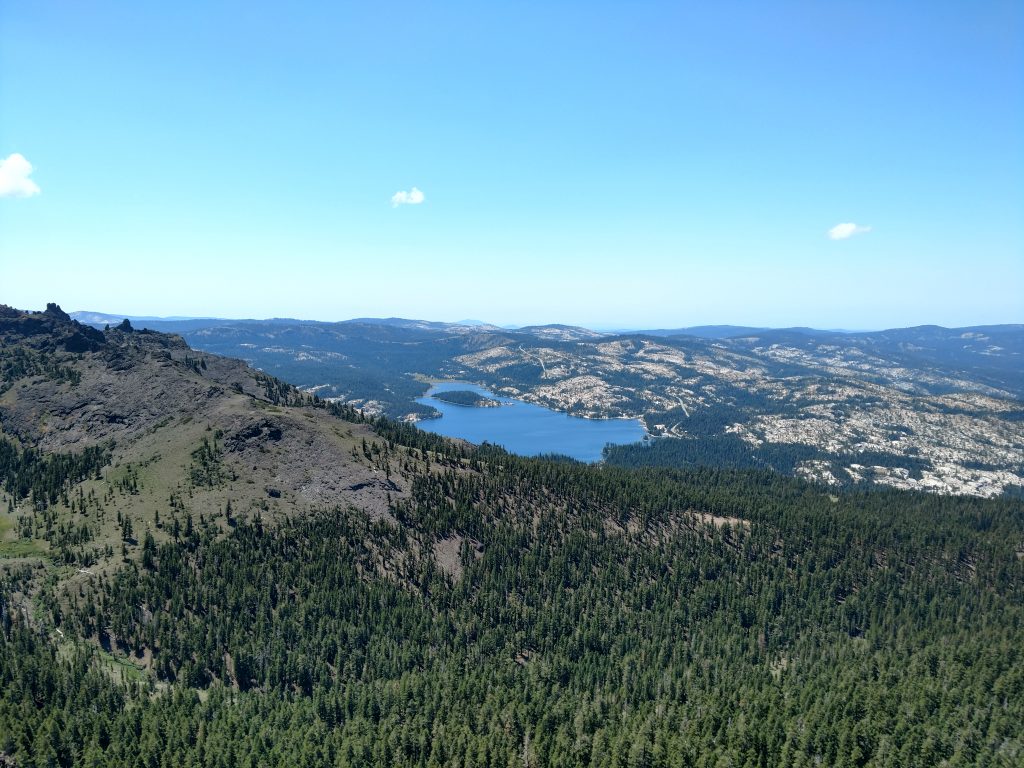
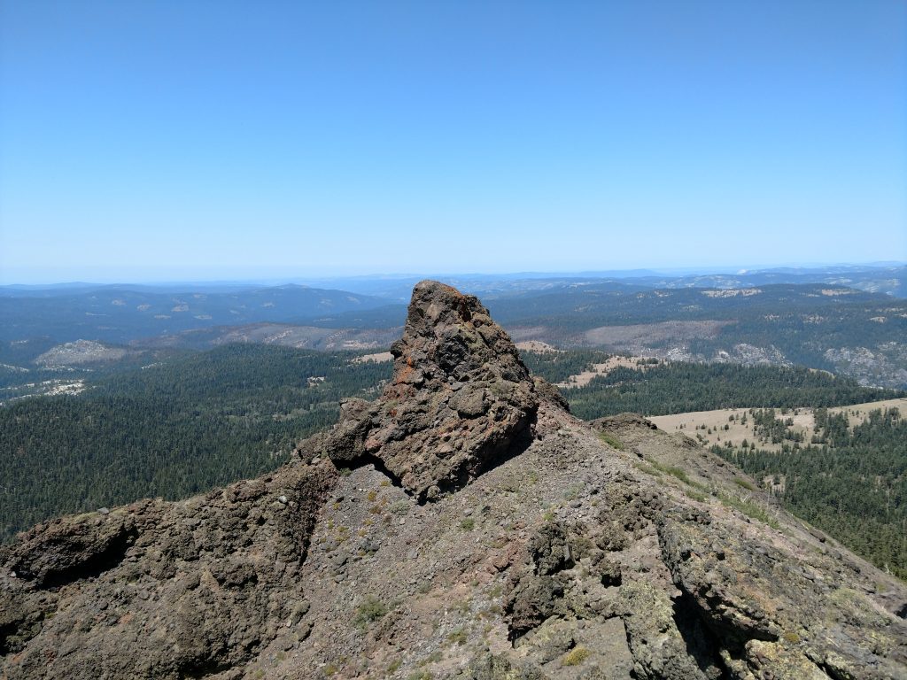
The actual highpoint requires nothing more than hiking but there's a pinnacle just south which was a fun scramble. At the top of the pinnacle, it felt like I was at the very beginning of the Sierra Nevada. To the West, there was nothing obstructing the view of the foothills and Central Valley. On a clear day, I bet you can see to the Coast Ranges.
Martin Point to Thunder Mountain (Amador County) Summit
Its less than a mile from where I hiked Martin Point to the summit of Thunder Mountain. I walked along the ridgeline, descending about 300' to the saddle and then re-ascended a steep and switch-backed trail to the turnoff.
About 0.2 miles from the actual summit, there's a poorly marked trail that deviates to the right (if coming from the North). I took this trail and was on the summit in no time. I'm not sure where the trail goes if you miss the turnoff but it's probably obvious that it doesn't make it to the top.
The summit as its marked on Google Maps is different than the highpoint (abobut 0.2-0.3 miles East of the high point itself). Nevertheless, it was confirmatory finding the summit register at the very top. All the usual names were there in addition to plenty of Amador County residents.
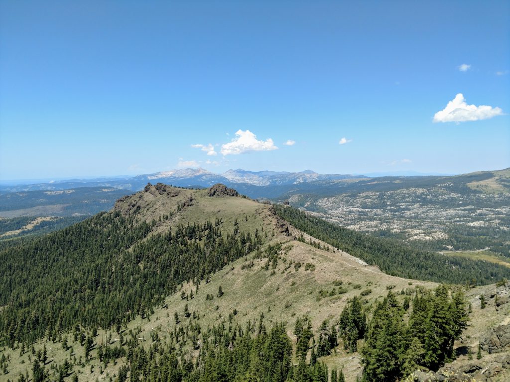
From the top, several iconic summits can be see. To the North is the Crystal Range and Pyramid Peak, one of the principle ranges encircling Lake Tahoe. To the South are the taller summits near Ebbetts Pass and Sonora Pass. I'm fairly certain I could see Leavitt Peak and Sonora Peak, two other summit's I've climbed since returning to California. Also South is Mokelumne Peak, the most prominent point in Amador County. Highland Peak is to the West and finally the conical Hawkins Peak is to the Northwest along with Round Top. I hiked both of those summits on this particular trip.
Return to Trailhead
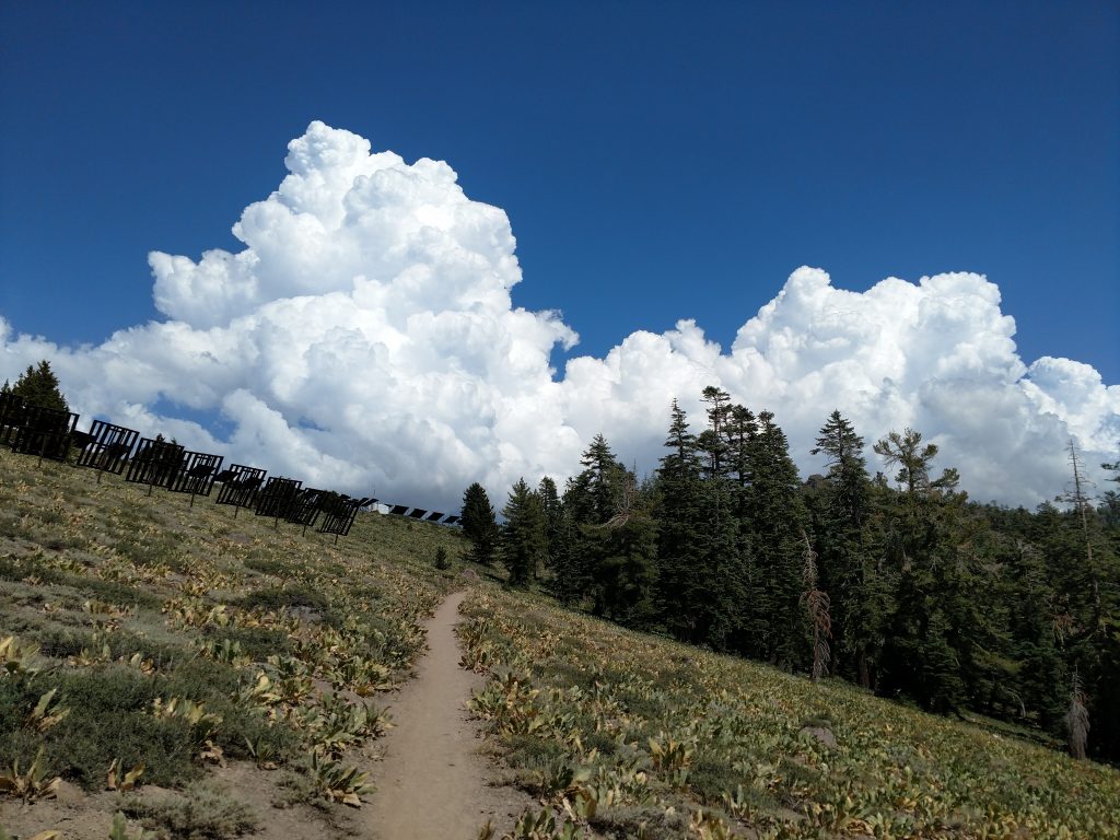
I returned the way I came and was back within a few hours of reaching the summit. Afternoon thunderstorms were moving in as if to confirm Thunder Mountain (Amador County)'s namesake-
The whole trip took about 4 hours in total. I had plenty of daylight left so I went on to bag Round Top, a nearby P2K.

No Comments