


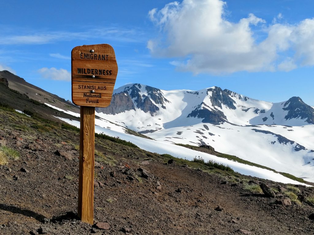
Leavitt Peak rises from Sonora Pass and is accessible from the Pacific Crest Trail. Its a peak with over 2,000' of topographic prominence and is the high point of the Emigrant Wilderness and Stanislaus National Forest
Leavitt Peak has been on my list for a while due to its topographic prominence. My last trip up here was in Mid-September and, wouldn't you know it, it was covered in deep powder. I successfully climbed Sonora Peak but left Leavitt for another day. On this most recent road trip, I finally had the opportunity.
Leavitt Peak, first stop on a road trip
I begin this 17 day road trip in the way most my road trips go; a lot of familiar ground to cover before seeing new sights. Although we had larger destinations in mind, so, I drove for Sonora pass up in the High Sierra and gauge the snowpack and conditions. It was risky to head up that way for hiking this time of year. This last winter, 2019, was the snowiest and wettest of my memory. For several weeks, I tracked NOAA’s snowfall and snowpack maps. There was still several feet of snow about 8,000ft. Peakbagger had no recent trip reports available on the Sonora Pass area so I was flying blind.
The drive up Sonora pass with characteristically beautiful. I was surprised that I didn't encounter a trace of snow until about 8,500’. However it was very wet. The Stanislaus River looked like it was breaching it's banks. If I did end up hiking, I would get soaked.
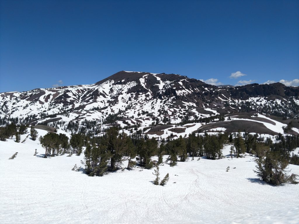
Snow-pack was deep and consistent on North Facing slopes above 9,000’. Surprisingly, I saw tons of people up on the pass. Most were just snapping Instagram photos but a sizable number were local skiers. This place is apparently popular for back-country descents. People usually park one car at a lower attitude and have a car shuttle to Sonora Pass. Then they hike up a bit and shredded back down. Sure looked like a lot of fun and a way to save time!
I took a route that mostly paralleled the Pacific Crest Trail (PCT) but deviated when the snow allowed easy ascent of steeper inclines. Here's a map to give you an idea:
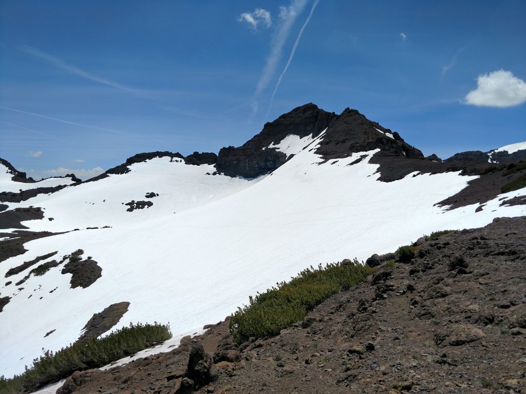
Sonora Pass to Ridgeline/False Summit
It was hard to get my bearings at the beginning but I found a pathway marked by bootprints and ski trails. I shaved off a mile and a half of the Pacific Crest Trail by using snow to my advantage. A veritable staircase of bootprints led the way up to the ridgeline and I was past 10,000’ in less than an hour. I followed this ridgeline to the Emigrant Wilderness Boundary near a false summit.
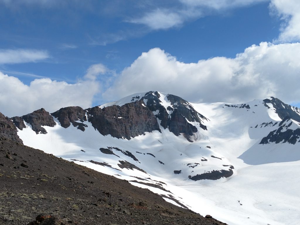
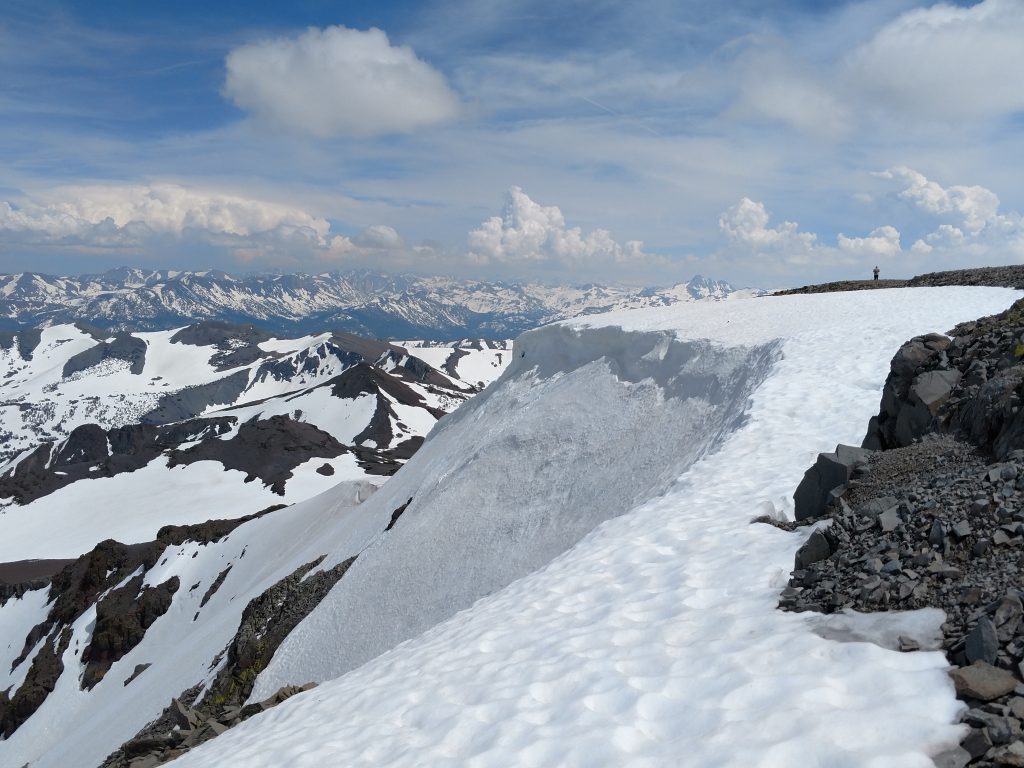
The Pacific Crest trail snakes away along the ridgeline until reaching the wilderness boundary at approximately 10800 feet. This is the first time Leavitt peak came into view. It look like a gorgeous summit with a classic whaleback shape and evidence of cornicing near the top. Again I was not expecting to make it all the way but the trail became very clear and manageable once it flattened out. I pressed on.
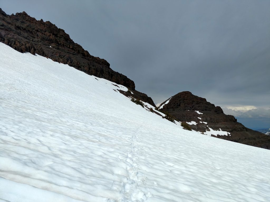
At 10,800’ and near the false summit, I was less than 1,000’ vertical feet from the top but I’d barely completed a quarter of the climb. The trail undulates and loses altitude as it avoids false summits on the way to Leavitt Peak. It generally stays west of a ridgeline before popping out at a pass between a very jagged section and Leavitt Peak.
Down and Up
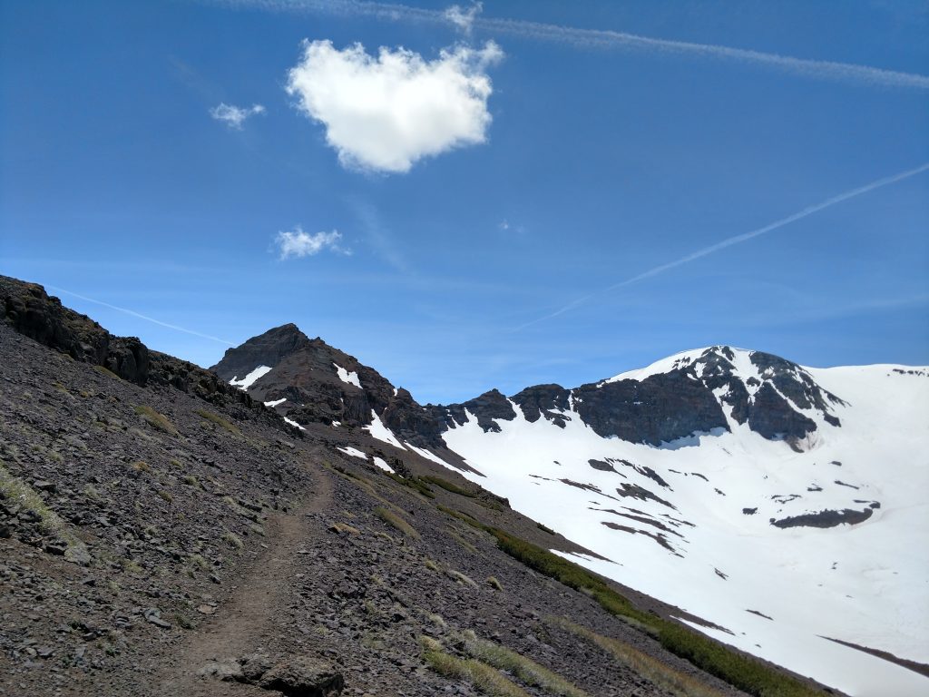
Its about 1.2 miles of relatively flat terrain between the wilderness boundary and the first pass. Altitude remained between 10,700-10,800' but it felt like work none the less. Thankfully snowcover was comparatively mild and I relied on hiking boots alone. At the 1st pass, Leavitt Peak looked close enough to touch but I had to take the scenic route.
The snow was now deep enough for snowshoes. Well... perhaps I would have been fine without them but I lugged them all the way here so I might as well use them. The trail was completely covered in snow but I approximated and descended to 10,550's before climbing back up to the second pass. Getting to the second pass was obvious, thankfully.
Another down and up
At the second pass, Leavitt Peak was in view. I felt I could make it! Once again, the PCT descends another few hundred feet before regaining the same altitude. This section was harder than the previous as the snow was deeper and the run-outs were longer. I slowed to less than 1 mile per hour making this careful and precipitous descent.
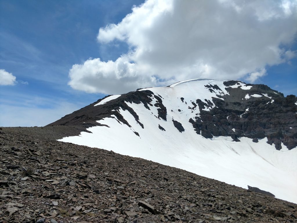
Though I was losing altitude, the goal remained in view. I started deviating from the Pacific Crest Trail and ascended to the East ridgeline of Leavitt Peak. Once I was back to ascending, the route remained obvious.
The East Ridgeline is the preferred way of climbing to the summit. Even with spring conditions, I identified a clear footpath to the top. The route became more of a scramble but never rose above a Class II rating. Within about an hour and a half of gaining the second pass, I was on the summit
Leavitt Peak's Summit
Unlike the preceding terrain, Leavitt Peak is a flat summit where its difficult to tell where the highpoint lies. I ran into another person near the summit who was similarly focused on finding the highpoint. In spite of our efforts, neither of us found any summit canister. We concluded it was buried in snow.
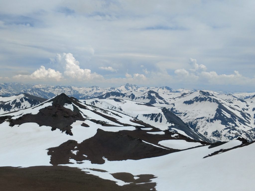
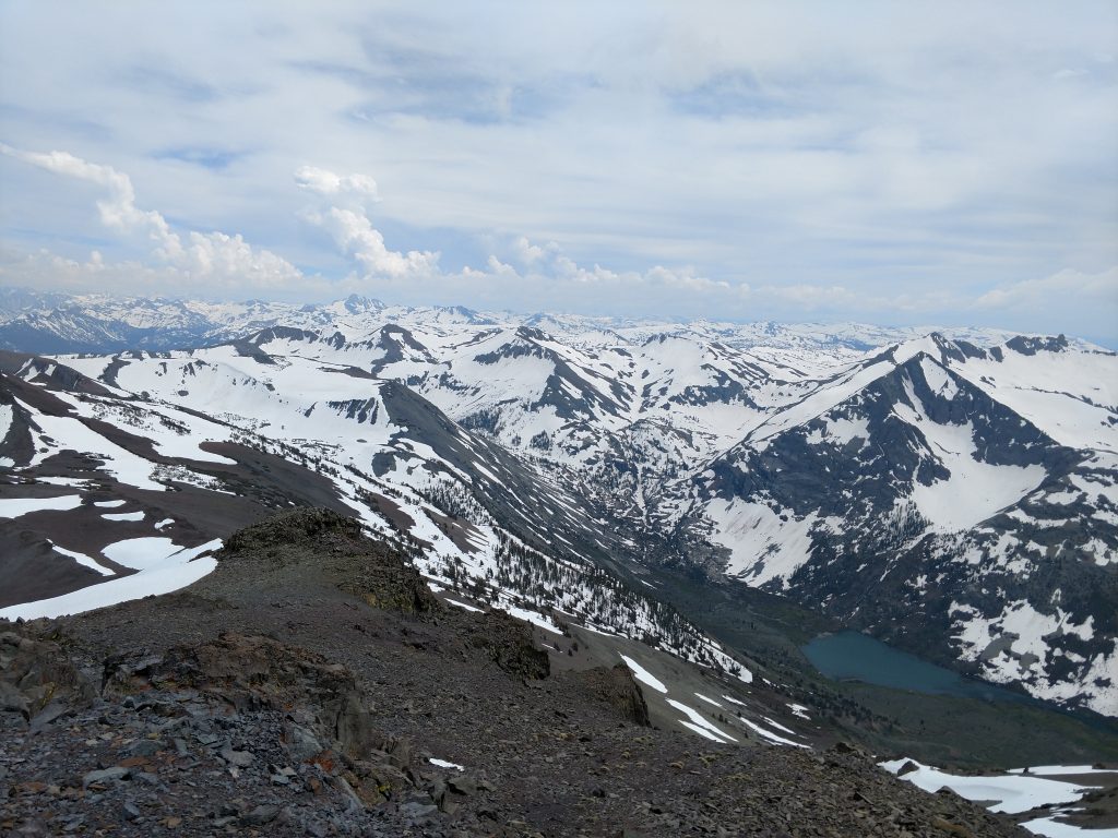
Summit views were, of course, fantastic and unobstructed. The Southern view was the best. I could see the profile of Tower Peak and dozens of other nameless summits creating a Himalayan view. Some parts of California never experience summer.
Descent
I took the same way down as I did up but I noticed it was much harder to follow my path. From the summit, an endless number of ridgelines follow the way back to Sonora Pass. I think a GPS in winter and spring conditions is absolutely paramount.
Owing to route finding, my descent was only marginally faster than the ascent. Nonetheless, I enjoyed all the views on the second lap. Leavitt Peak is a marvelously clear summit and absolutely worth climbing, even if you're not a crazy peakbagger like me.

No Comments