


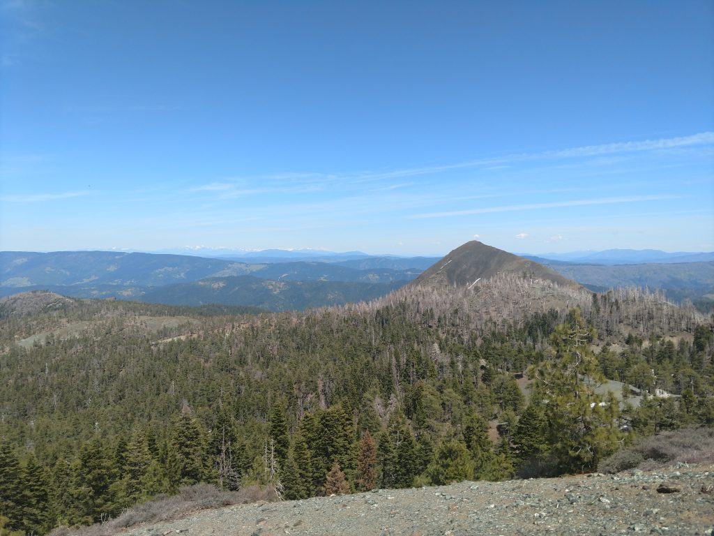
After climbing Mt Cahto, getting nearly stuck on the King Mountain Road and some simple hiking around Humbolt Redwoods, I continued to my final destination of this jaunt: Black Lassic. This summit is not tall by California or even North Coast Standards. However it rises abruptly from the Mad River Valley and has an outstanding panorama at the summit. Its also a P2K by prominence standards. Nearby Signal Peak and Red Lassic are nice additions
Getting to Black Lassic, Red Lassic and Signal Peak
Getting there is half the adventure in this part of Humbolt County but is a bit easier than other destinations. From all directions, set your GPS to the tiny town of Mad River, California. Its located deep in the Six Rivers National Forest. Its about 1.5 hours Southeast of Eureka on Route 36 or about 2 hours West of I-5 exit at Red Bluff, CA. In either case, you drive through the exceptionally scenic and winding Route 36. At the Junction of Route 36 and Van Duzen Road, head South (right turn if coming from Eureka, left turn if coming from Red Bluff. The US Forest Service Mad River District Office is just East of the turnoff.
Head South on the paved Van Duzen Road 8.8 miles through a few small settlements and homesteads. Somewhere along the way you lose cell reception. At 8.8 miles turn right on Forest Road 1S07. I spotted it easily as long as I followed the odometer.
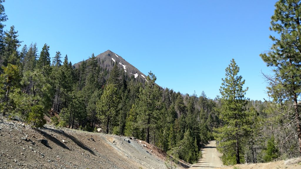
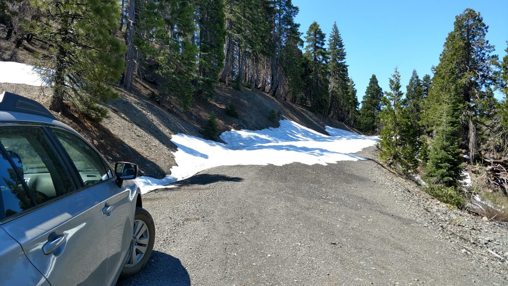
Forest Road 1S07 is a good quality dirt road that's drivable by most vehicles. As far as I can tell, it is not maintained nor plowed in the winter. Take this sinuous road up the mountain, not worrying about the extensive turnoffs of clearly abandoned roads. Its roughly 7.5 miles to the crest in between Black Lassic and Red Lassic/Signal Peaks. In late May 2019, I ran into an impassable snow-bank at 5,700' and traveled no further. I pulled off to the side and hiked in from there. Here's an area map
Hiking Route up Black Lassic
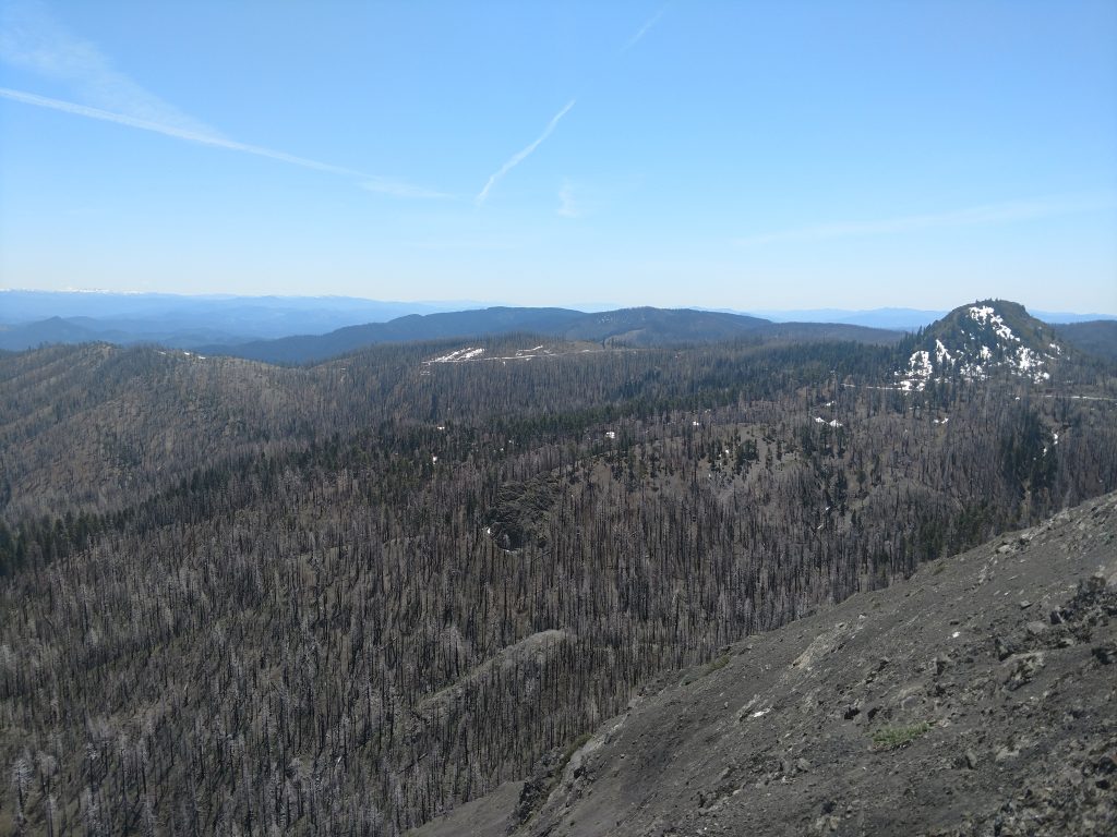
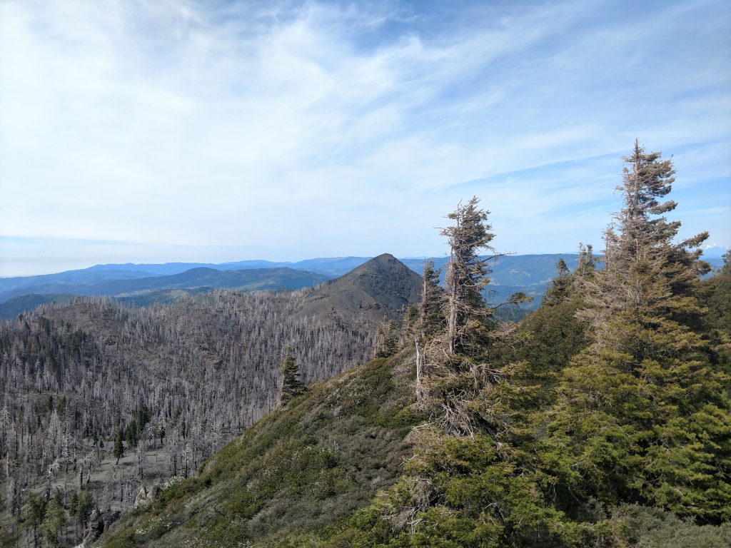
Black Lassic looks nearly impossible to summit with normal hiking gear on the drive up but once around the backside and the saddle, an easy path arises. I made the mistake of hiking all the way to the saddle between Black Lassic and Signal Peak, then making a straight shot to the summit from the road. This caused me to climb a couple false peaks between the road and summit.
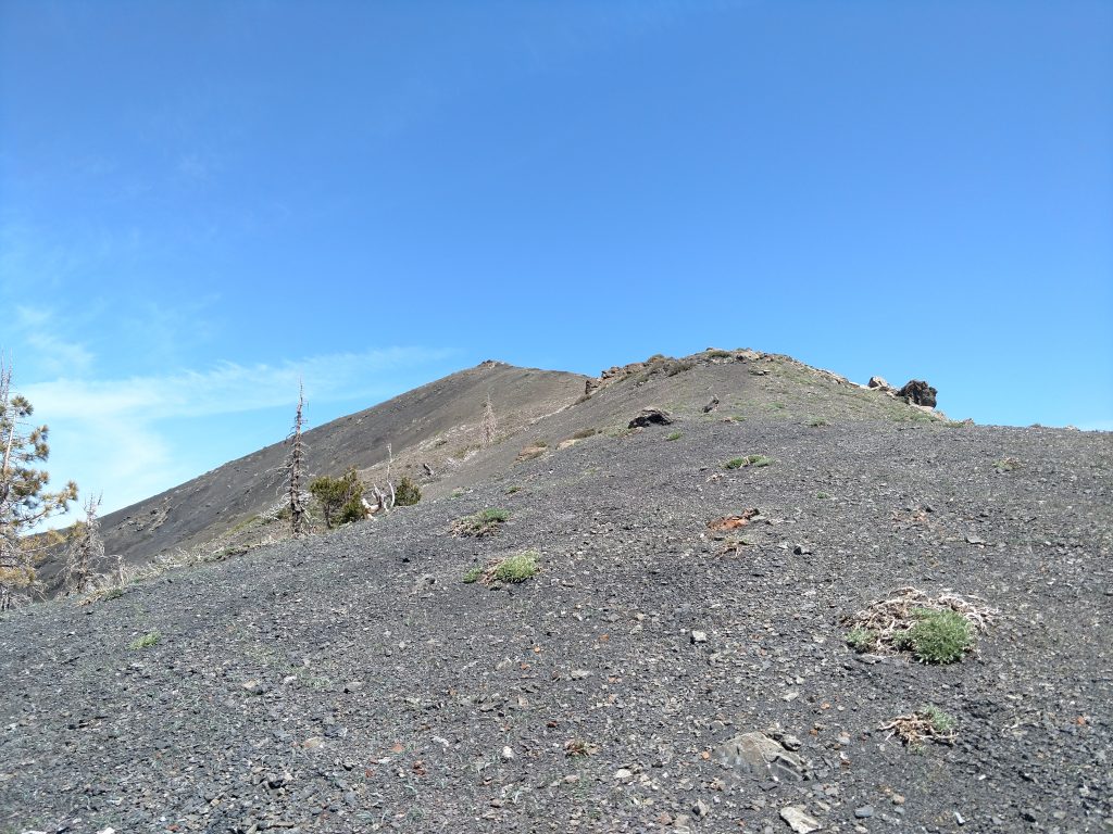
A topographic map of the area easily reveals a route that avoids the false summits. Just a few hundred horizontal feet below the saddle, there's a gully that takes you between the false and true summits. I took this on the way back down and I can't imagine it taking longer than half an hour to summit.
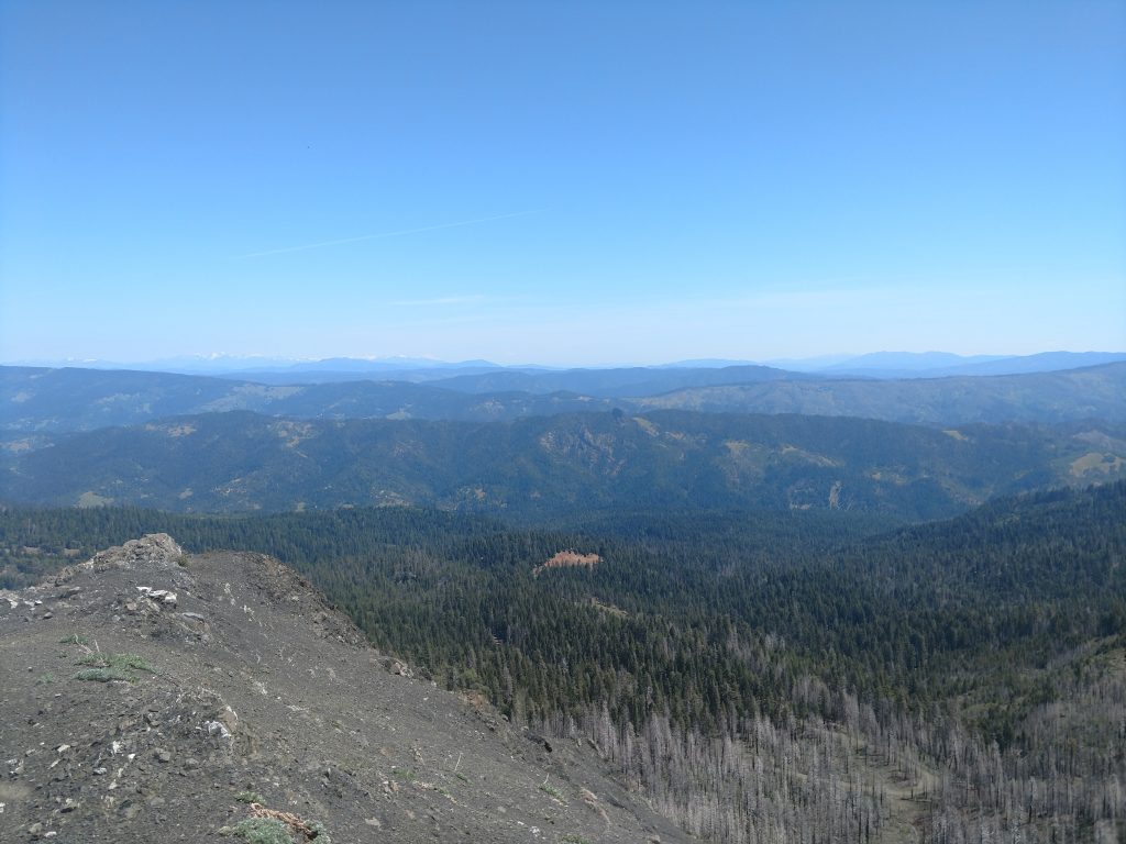
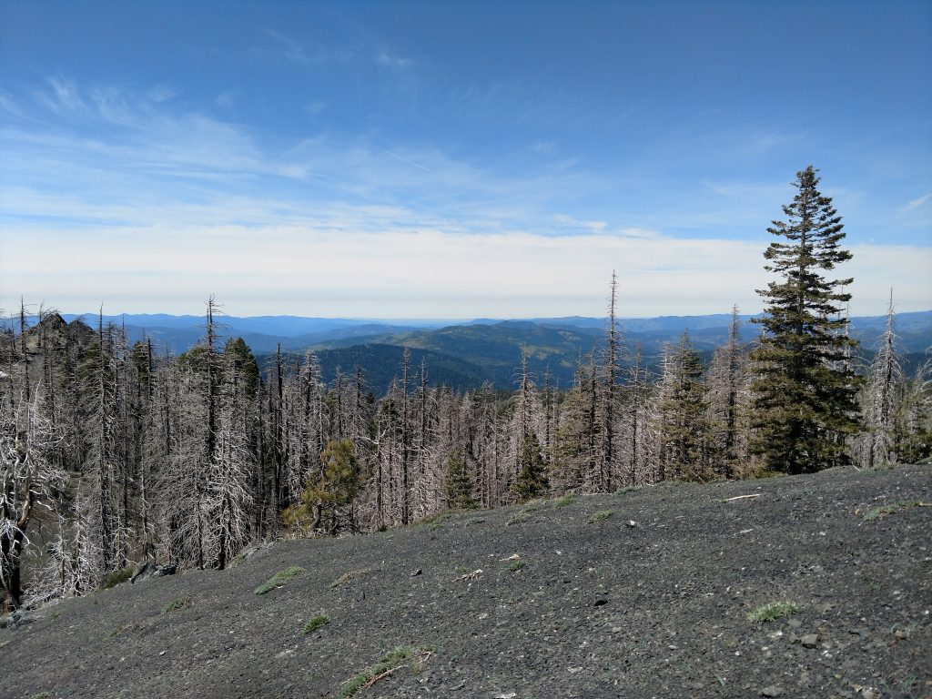
Though Black Lassic is an easily climbed mountain, the views were outstanding. I could see all the way to Shasta (100 miles), Mt Lassen (almost 110 miles) and even the Whitehorse Mountains at 130 miles. WOW! (photos don't really show the clarity of long distance views)
Hiking/Bushwhacking Signal Peak
After taking the path of least resistance down to the road, I found the point with the shortest distance to Signal Peak and set off on a bushwhack. Signal Peak was the easiest of the three I climbed that day. I even picked up a small herd path that took me nearly to the summit. With a light amount of scrambling, I stood tall on the summit.
Signal Peak is the highpoint of the Mount Lassic Wilderness. Ironically, the wilderness boundary neither includes Black nor Red Lassic. Also, Signal Peak had the only large summit marker of the three.
Hiking/Bushwhacking Red Lassic
Red Lassic was short but challenging. I didn't initially find any route so I encircled the mountain by hiking on the forest service road and then found an opening through the brush. I basically climbed the summit in the most direct manner from the road. There's easier ways I think. The brush was extremely thick and where there wasn't brush, the scree was steep. It didn't take long to get to the summit but I sure got scratched up doing so.
From the summit, I found a herd path that dipped below the cliffs and thought it was slightly easier. Reference the google maps above for the approximate route.
The ascent of all three summits took about 1/2 a day. I ran into one other person who was from Eureka and he'd never run into anyone else in this vicinity. Take necessary precautions if you venture into this area and prepare for abundant solitude.

No Comments