


Hayford Peak is the tallest summit of the Sheep Range just North of Las Vegas. Frequently overshadowed by the nearby Spring Mountains, this summit appeals to solitude seekers and peakbaggers.
After a failed bid at Mt Jefferson curbed by high water and difficult roads, I set my sights South. Hayford Peak is another Ultra-Prominent peak in Nevada that's more desert-like than most of the summits of the Great Basin. At an altitude of 9,924', its hardly tall by Nevada standards. Nevertheless, the topographic prominence of 5,392' indicates its exceptional rise from the surrounding deserts. In spite of its proximity to Las Vegas, few venture this far into the wilderness.
Hayford Peak and Desert National Wildlife Refuge
The Desert National Wildlife Refuge is a massive swath of public land permeated only by a few rough gravel and dirt roads. The main visitors center is located in Corn Creek. Its only about half an hour from Las Vegas and there's a newly paved road leading to the entrance.
The highlight of Desert National Wildlife Refuge is the Sheep Range which has many summits worth climbing. Interestingly, the refuge backs right up to Nellis Air Force Range and is not far from the Nevada Test Sight where they blew up all the atom bombs in the Cold War. You'd never know it from the range but you catch a unique glimpse into the base from the summit of Hayford Peak.
Any trip into the Wildlife Refuge requires extensive planning and preparation. Cell phone service is spotty. It is not regularly patrolled in most places. Roads are fairly good by 4x4 standards but profoundly remote. Past the visitors center, there are no real services.
Getting to the Trailhead
Anyone who's climbed remote summits in the Great Basin knows part of the challenge is simply getting to the trailhead. This mountain is no exception.
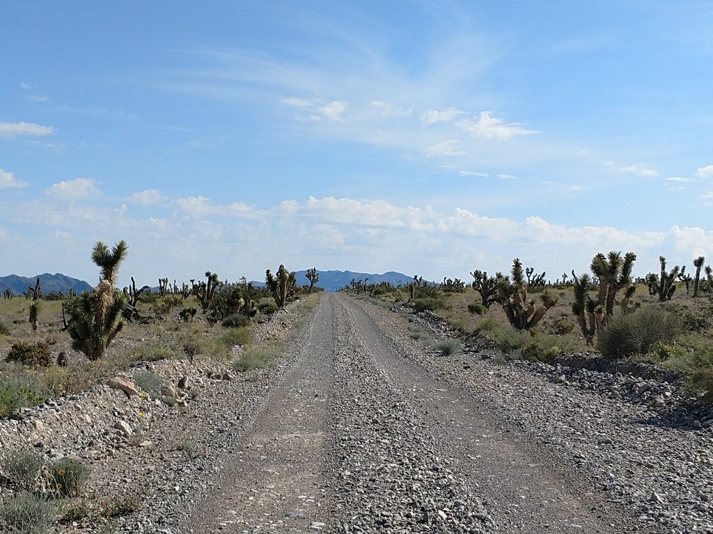
From the Visitors Center, sign the register and then take the paved road 100 yards to the intersection with Alamo Road. Set your odometer here. Turn left on Alamo Road and follow this very rocky road 15 miles. Again, by 4x4 standards, the road is good but I can't imagine a low clearance or passenger car making it up this road. There's some sections of fairy deep gravel and clearance will be the issue. It took me about 1 hour and 15 minutes to drive these 15 miles of Alamo Road.
After 15 miles, you'll encounter the signed Hidden Forest Road. The turnoff is very obvious making me wonder if people don't frequently travel further North on Alamo Road past Hidden Forest Road. Turn right here and steadily gain altitude for 3.7 miles to the trailhead. There's a gate that prevents further travel and plenty of parking at the trailhead.
Here's an area map with the Hike
Hidden Forest Trail to old Hunting Warden Cabin
I was surprised there was an established trail most of the way up Hayford Peak. The first section is 5 miles, one way, to the old Hunting Warden Cabin. The second is a less clear class I-II hike/scramble to the summit. Both take equal amounts of time in my book.
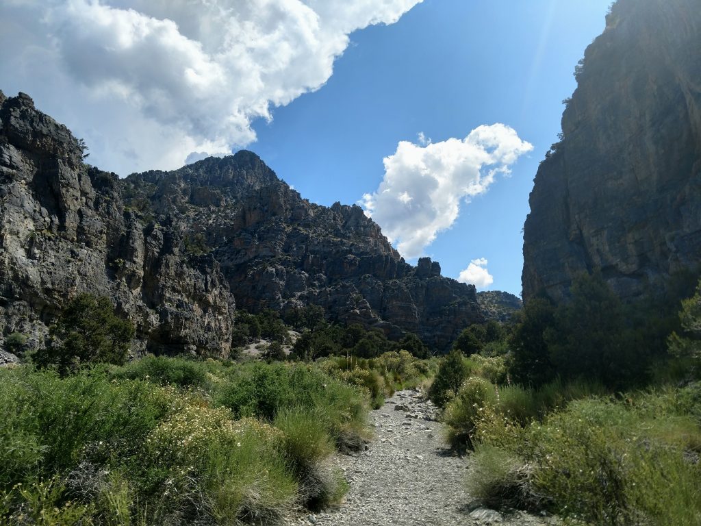
Starting from the parking lot, I made the brief descent into the canyon and began the remarkably steady climb to the Hunting Warden's Cabin. This hike is often done on its own by locals. Its a great hike! It starts with Joshua Trees and slowly climbs the canyon and changing biomes. With every mile, I felt like I was entering an entirely different environment. The first two to two an a half miles had all the characteristic spiny plants of the desert. This time of year wildflower blooms were everywhere as well. Eventually, junipers start outnumbering other stout trees and the temperatures were noticably cooler.
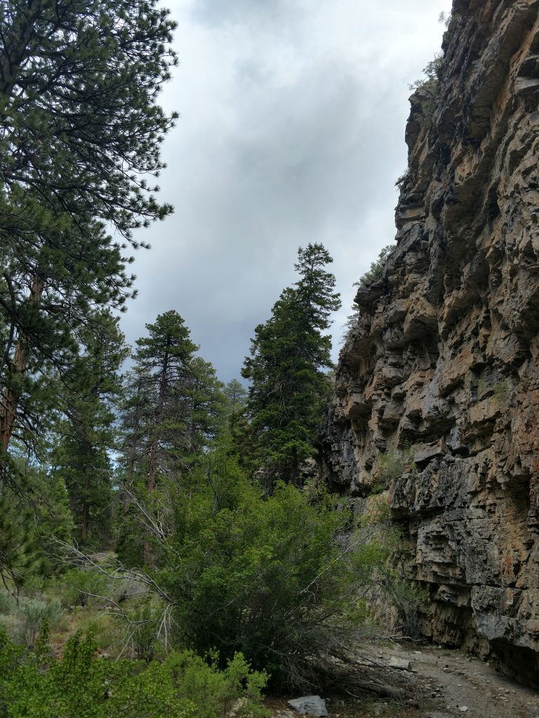
At 7,000 ' the Ponderosa Pines begin appearing. Widely distributed across the continent, their forest here is a welcome sight for those too used to the desert. These stately and muscular trees do not commonly occur in Nevada.
I passed by many potential campsites on my way to the Hunting Warden's Cabin. Along the way, I also noticed many potential trails- there are no signs nor preferred routes. Most seemed to just follow the path of least resistance.
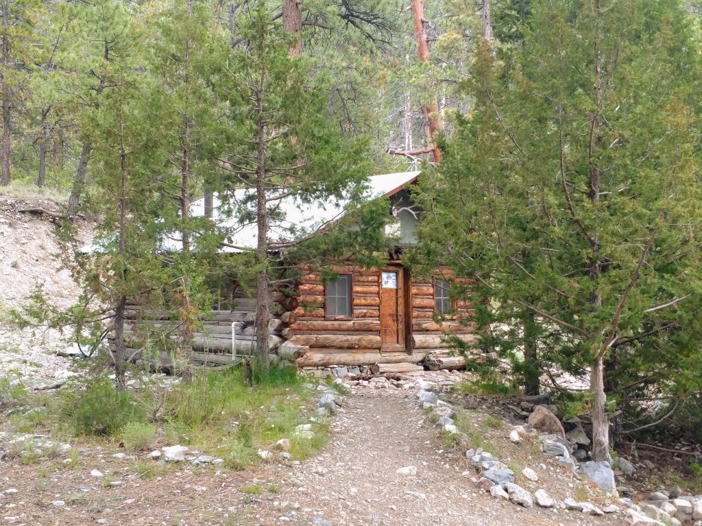
At an altitude of just under 8,000' and about 2,000' vertical feet from the summit lies the Hunting Wardern's Cabin. This was recently restored allowing overnight visits. There's a seasonal spring that was active as of June 2019 and enough space to comfortably house about 2-3 people. Picnic benches and tent campsites are abunant here as well. After reading the logbook of the place, it looks like most turn this hike into an overnight by way of the cabin. Contact the DNWF for permits.
Hunting Warden's Cabin to Hayford Peak
From the cabin to the peak, its a clear route but not a clear trail. Reference the map above.
North of the cabin, I found a herd path that took me to the source of the springs. From here, I meandered through the forest, following the ridgeline until I eventually picked up another herd path. A few cairns marked the way but they were inconsistent. It appears there are multiple "cairn-ed" paths up this ridgeline
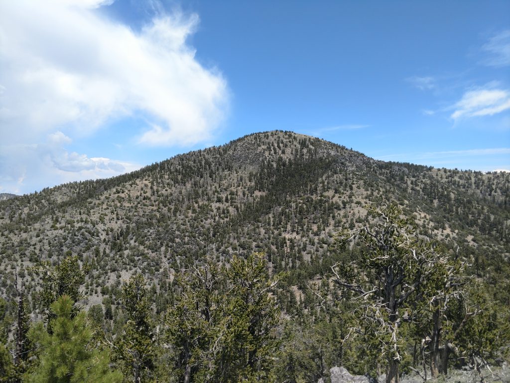
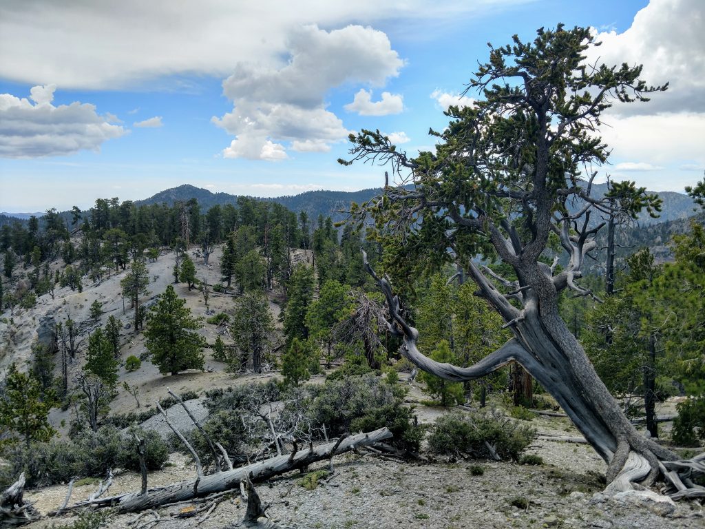
Once on ridgeline, I essentially followed it North all the way to the false summit. Bristlecone Pines appeared around 9,000ft and their grizzled appearance delighted me. They are the oldest trees in the world though the ones growing here are not quite as old as higher altitude stands.
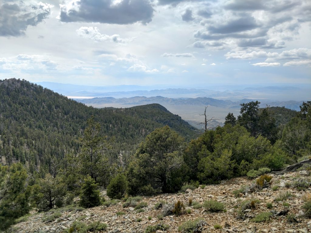
I recommend climbing to the top of the false summit for a unique view of Edwards Air Force Base. It doesn't necessarily have views of infamous Area 51 but given the constant secrecy around the place, perhaps you are looking at it!
False Summit to Hayford Peak
Hayford peak comes in to plane view from the false summit. I lost about 100-150 ft of altitude crossing the col between the two and then worked my way up to the peak. This section is a little lose and has some scrambling but it doesn't approach anything precipitous or difficult. It took about 30-40 minutes to make the climb from the false summit to Hayford Peak
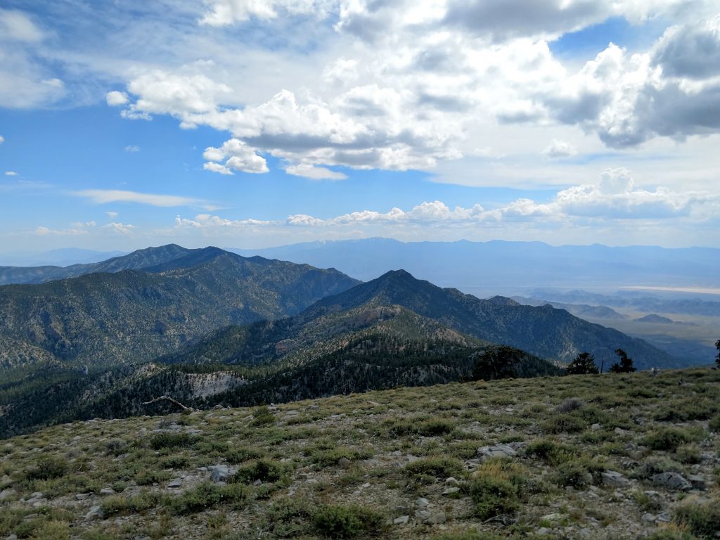
The summit has several radio towers which are not very pretty but the views are outstanding. From the top, you see the entire Sheep Range and most of the Spring Mountains/Mt Charleston. Innumerable desert valleys and sub ranges can be seen as well. The summit is less than 10,000ft meaning conditions are typically quite pleasant and allow plenty of meandering.
There's a summit register that's getting somewhat full. I loved reading the stories and reasons that other people endured the endless gravel roads and long hike to get here.
On return, I followed my GPS path back to the cabin and then down the canyon to the parking area. For whatever reason, I found more cairn-ed paths on the way back to the cabin. I doubt anyone who's hardy enough to make it this far would get lost but pay close attention to where you're going as there are several ways to get lost on various ridge-lines extending from the top.
That's my 31st ultra-prominent summit! Can't wait for more on this trip!

No Comments