


The Henry Mountains and highpoint Mt Ellen were the last mountain range in the lower 48 to be formally surveyed by the USGS. They are profoundly remote and unspoiled, well worth a trip!
Since I first took a road trip around Utah in 2010, the Henry Mountains fascinated me. Standing on an overlook on Route 12, I looked at their saw-toothed profile and wondered what it would be like to climb them. An informational sign told me they were the last mountains in the lower 48 to be surveyed. Its like the final frontier of the contiguous US.
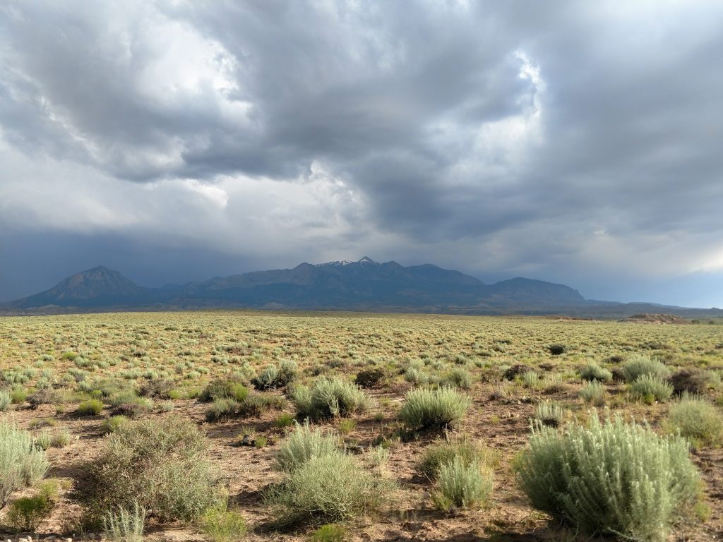
As I took further road trips around the state, I noticed these mountains are visible from almost anywhere in Southern Utah. Their pull was magnetic. Finally, on this most recent road trip, I planned an ascent of Mt Ellen, the range highpoint.
Planning Considerations for Mt Ellen
Not surprisingly, this mountain range remains remote and inaccessible to unplanned travelers. A trip into the mountains requires preparation from the standpoint of backcountry hiking and backcountry driving. I heavily relied on the BLM office in Hanksville. The rangers here were very helpful, especially with road conditions
As of June/July 2019, we're dealing with an extremely wet year with biblical amounts of snowfall still in the mountains. Knowledge of the preceding winter is essential in getting up into the Henrys. Snowmelt can all but destroy some of the old roads in the mountains. Because of this, nobody could get to Bull Creek Pass which is at 10,900' and the closest approach to the range high point.
Trip reports for the mountains are few and far between but Peakbagger.comand Mountainhandbook.com were helpful
Driving Approaches into the Henry Mountains and Mt Ellen
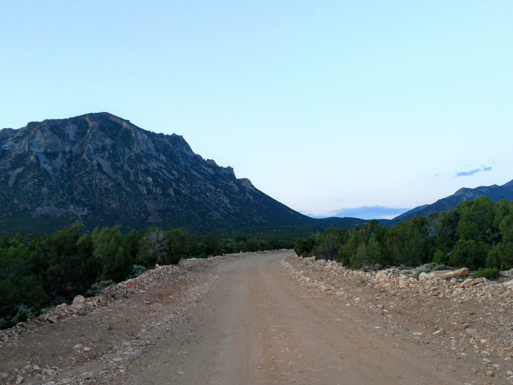
A few approaches exist for Mt Ellen. The "main approach" is from Hanksville. I knew cell reception was spotty hence I took my ever-reliable Delorme Map of Utah. Google Maps is not reliable in this area and doesn't take the best route. See my map below for further clarification
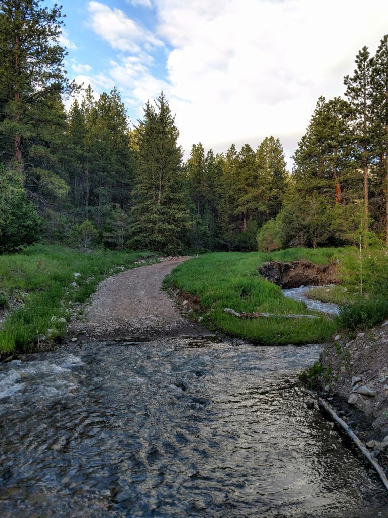
I was aiming to get to Lonesome Beaver Campground or as close as I could. My approach from Hanksville began at the intersection of Route 24 and E 100 N, right by the Post Office. I headed South on this road (labeled as Sawmill Basin Road in Google Maps). Its initially paved but quickly becomes dirt after leaving town. This was an excellent quality dirt road for about the first 13 miles as it crosses the desert plains. After crossing by a large sand pit that almost looked like a quarry, the road narrowed and became more typical for mountainous dirt roads. The next 6 miles were fairly steep and rocky. I appreciated having an AWD. At 6 miles, the road crested, then dropped in altitude down to a creek.
Bull Creek Crossings
I don't recommend this creek crossing for anyone without experience in water crossings and a high clearance 4x4. It was running swiftly and was thigh deep in some sections. I pulled over to the side of the road at a makeshift campsite and hiked in from here. From this point, I was 1.5 miles to Lonesome Beaver Campground. Note there's a second, deeper and swifter creek crossing 1/4th of a mile up from the first crossing. I saw only a few people past this place, all driving modified 4x4 rigs.
Bull Creek Pass will likely be inaccessible with snow drifts for at least several more weeks as of July 2019. Experienced 4-wheel drivers made it to Wickiup Pass but not much further up to Bull Creek Pass. The distance between Lonesome Beaver Campground and Wickiup Pass is 1.6 tedious miles. Note there is a gigantic mud trap at Lonesome Beaver Campground, easily avoided by a side road that leads through the campground itself.
Here's a general map of the area:
Mt Ellen: Lonesome Beaver to Wickiup Pass (as I completed it)
I started my hike from this point, approximately 1.5 miles from Lonesome Beaver Campground. After a short but frigid creek crossing, I began ascending the dirt road to Wickiup Pass. Within 1/4th of a mile, I made the second creek crossing, then came across Sawmill Basin Campground after 1 mile of hiking. This looked like another good campground as an alternative to Lonesome Beaver. I doubt either campground ever really fills up. Within an hour, I was passing the Lonesome Beaver Campground.
There's a massive mud trap that I read people often get stuck in at Lonesome Beaver. Avoid it both by foot or wheel by taking a right (at the fork if headed uphill) and going through the campground. Within no time, it intersects with the main road to Wickiup Pass.
As mentioned, its 1.6 miles to Wickiup Pass from Lonesome Beaver Campground. This is easily hiked but if driving, beware of an increasingly rutted dirt road with plenty of deadfall. Consider bringing an axe or chainsaw if driving.
Mt Ellen: Wickiup Pass to Bull Creek Pass
Wickiup Pass is well marked and the first intersection I encountered after Lonesome Beaver Campground. This broad, flat area has plenty of room for camping if necessary. The pass is at an altitude of 9,225' or about 1,300' lower than Bull Creek Pass. Cautious drivers who've made it this far can find parking here.
I headed right from here on Bull Creek Pass Road. Its 2.7 switchbacked miles from Wickiup Pass to Bull Creek Pass. I encountered snow at about 10,000' and it was enough to prevent any further 4x4 travel as of June 2019.
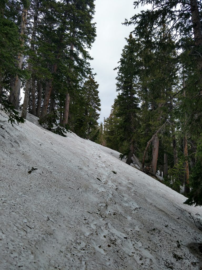
I had microspikes for this section which was incredibly helpful. I don't recommend bringing snowshoes or crampons this time of year as they'll just add weight. Nevertheless, I doubt I would have made it up to Bull Creek Pass without ample traction.
Once at Bull Creek Pass, I noticed several pullouts, enough for 6 cars.
Bull Creek Pass to Mount Ellen
Finally I made it to the actual climb! In dry years and with good experience in 4-wheel driving, Bull Creek Pass serves as the actual trailhead (but not today!)
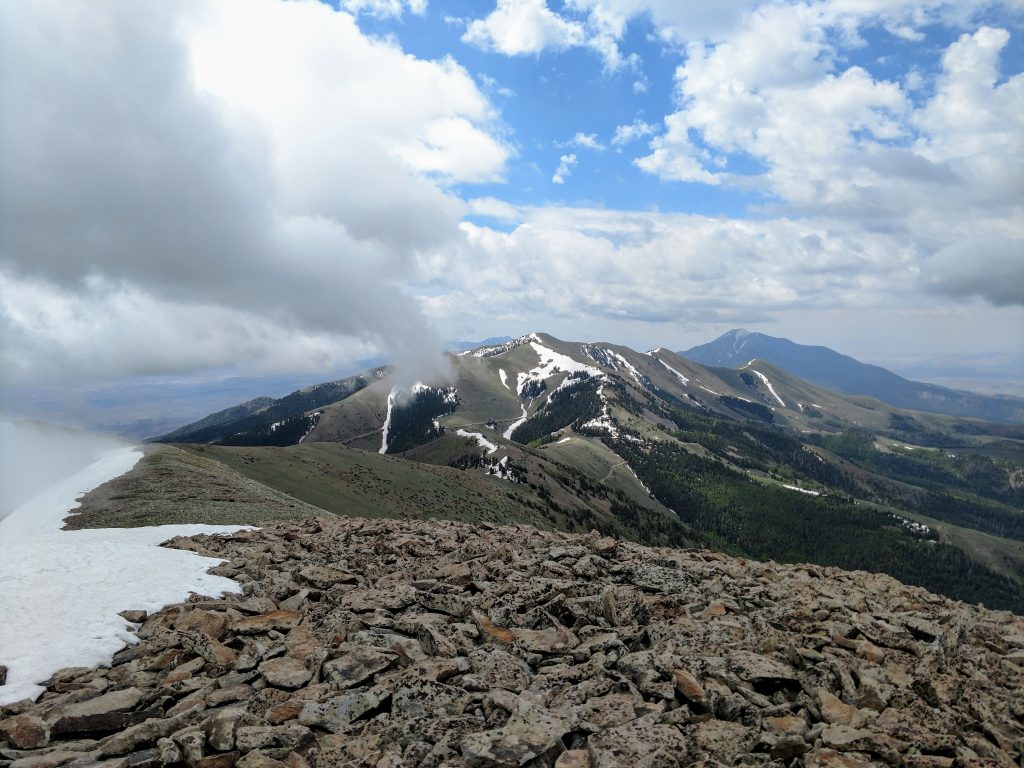
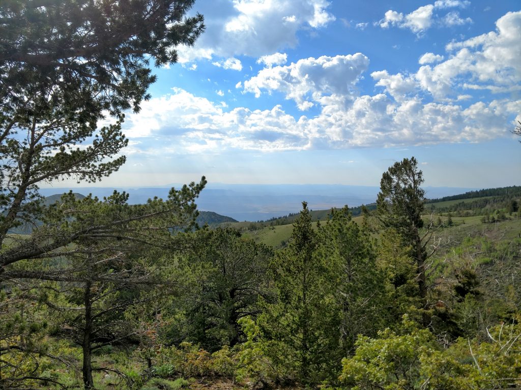
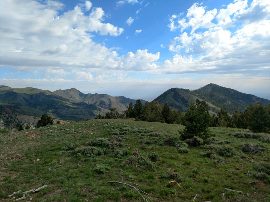
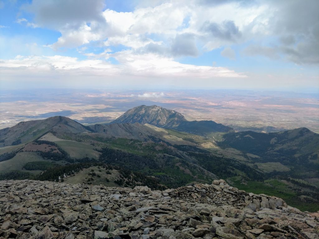
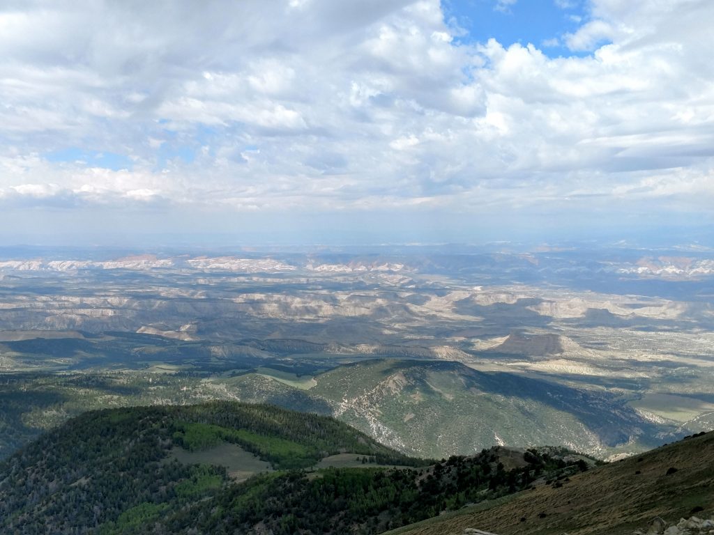
The trailhead is marked with a register. After signing it, I headed on a well-trod trail up several false summits. After Bull Creek Pass, I was completely above treeline. Views were, of course, phenomenal. To the West was the San Rafael Swell and Capitol Reef. Numerous mesas emerged from the desert to the North. To the East, I saw the entire Canyonlands National Park. To the South, I'm certain I could make out the visage of Navajo Mountain, some 75 miles away. The line of sight was exceptional.
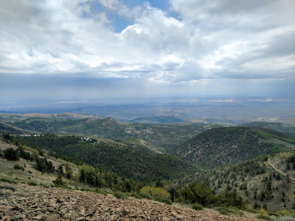
The trail to the summit became increasingly faint as I gained altitude. At times I picked up a herd path that helped avoid the false summits. Between snow and unstable talus, it was slow going but I made it to the top from Bull Creek Pass within about 1 hour and 45 minutes.
Summit of Mt Ellen and Side Hike to Mt Ellen Peak
At the summit, I found the peak register and read all the stories of peakbaggers like myself who made the trek here. Surpisingly, somebody signed the register shortly before I did. They must have found a way from the East.
I took many photos at the top of this rugged range. Certainly the Henry mountains are one of the wildest places I've ever been.
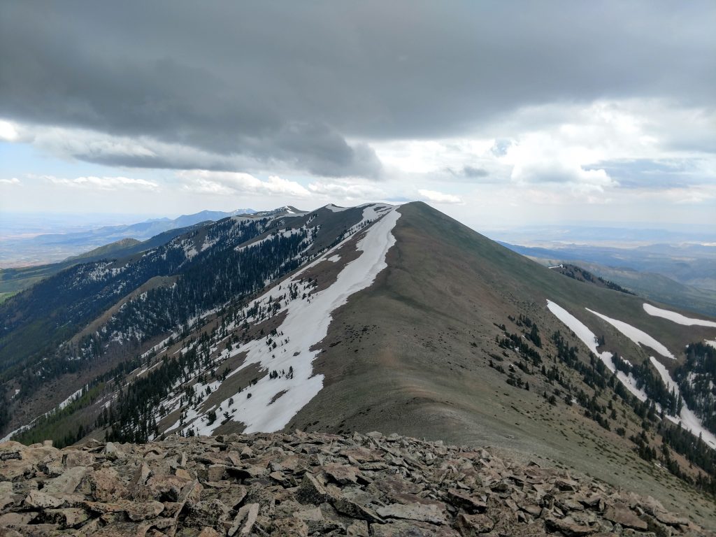
There's a great side trip from the summit worth taking. The conical summit of Mt Ellen Peak (shorter than "Mt Ellen") rises just 3/4ths of a mile North. From a distance, it looks like the tallest peak of the range. I decided to hike it.
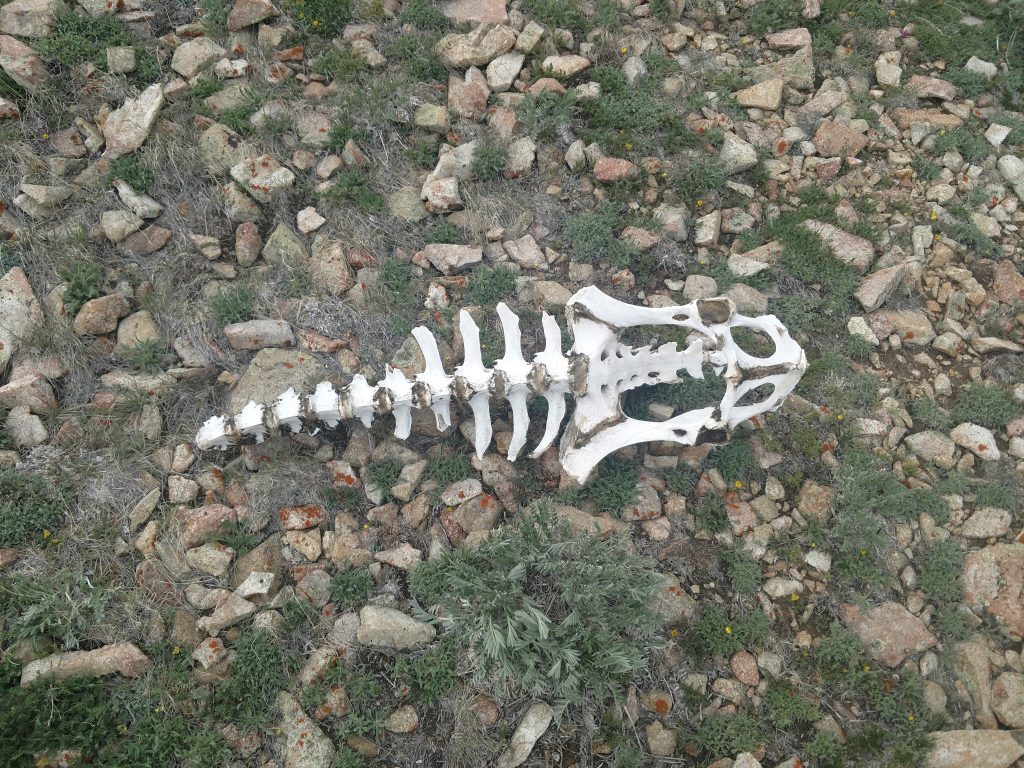
Descending from Mt Ellen, several faint herd paths lead to the saddle. Its a 400 ft descent and then re-ascent to the summit. Interestingly, I stumbled upon the presumptive skeleton of a bison. There's a free roaming heard in these mountains that's infrequently seen.
I found no summit register at the summit of Mt Ellen Peak, 11,120' but the unobstructed views to the North made the effort worthwhile.
After snapping some photos, I descended from Mt Ellen Peak, re-ascended Mt Ellen and made my way back to the car. A few thunderstorms mildly inhibited my descent. Later in the summer, thunderstorms become a more consistent threat.
Save for a few 4-wheel drivers, the mountain was mine alone that day. The solitude was incredible but I'm glad I took some extra precautions in such a remote place. I hope you make it out to the Henry Mountains for this hike!

No Comments