


After hiking nearby Thunder Mountain, I had at least half a day left of light so I went on bagging peaks. Round Top is a prominent, long extinct volcano in the far flung wilderness between Lake Tahoe and Yosemite National Park. Thankfully, access is pretty easy off the Carson Pass Highway/CA-88. Although a short hike and climb, the top involves some Class III scrambling on loose rock with modest exposure.
Round Top lands on several peakbagging lists including Tahoe-Ogul Peaks, the Western States Climbers List and the Sierra Club's Sierra Peaks Section.
Getting to Round Top Trailhead
Round Top has two main trailheads. The more popular and shorter trailhead is from Woods Lake, about halfway between Kirkwood Resort and Carson Pass.
If coming from the West, drive CA-88 past Kirkwood Resort and the scenic Caples Lake. Keep an eye out for a paved road on the right less than a mile from Caples Lake. There's a large Forest Service Sign noting the location of Woods Lake Campground and Recreation Area. Take a right on this paved road.
Drive 0.8 miles along this good road and make an obvious right at the only major fork. Park at the large day use parking area (here on google maps). I vainly tried finding an open campsite at the Woods Lake Campground but that was foolish on a summer weekend. It was all booked. Nevertheless, I filled up on water here before hitting the trail.
Trailhead to Round Top Lake
After paying the day use fee, I departed the parking lot (altitude 8,170'), crossed the bridge headed to Woods Lake and found the trail that bypasses the campground. This single track trail wanders through the woods for about 0.5 miles and then joins the remnants of a road as it gains altitude.
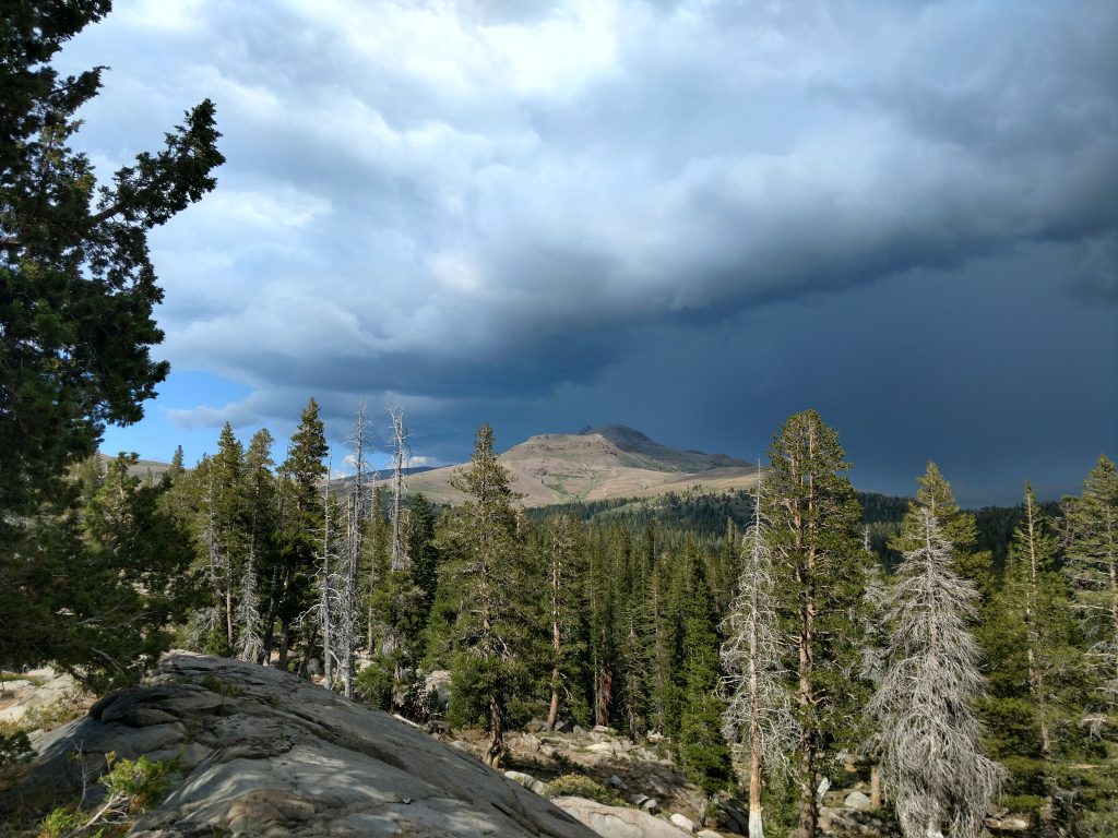
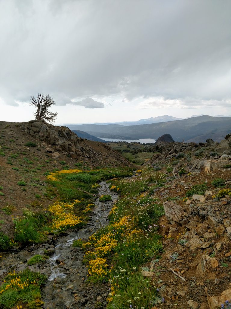
Initially there was plenty of shade but the trail quickly became exposed at higher altitudes. As you see above, I got hit by a thunderstorm and some hail. Nevertheless, I continued on.
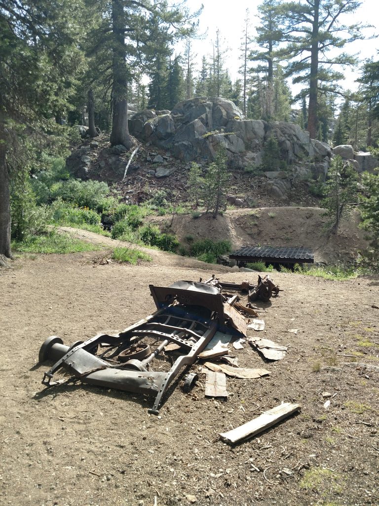
The trail gains about 1,100' over about 2.5 miles between the parking lot and Round Top Lake (altitude 9,350'). Along the way I passed the remains of some ancient vehicle-
For a relatively low altitude by Sierra standards, the area around Round Top was exceptionally alpine. Krummholz and low growing wildflowers dominated the flora. This meant I had no place for shelter when it tarted hailing - oh well.
It took a little over an hour to hike from the parking lot to Round Lake and the junction with Winnemucca Lake Trail. I didn't see a soul on the climb up.
Round Top Lake to Round Top Summit
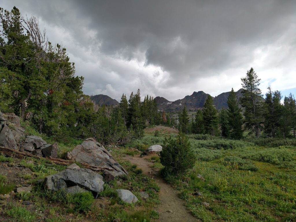
From the junction of the Winnemucca Lake Trail, its less than 1,000 vertical feet over 0.8 miles to the summit. However the trail becomes more of a route and eventual scramble along the way.
I followed on of many herd paths that follows the main stream dumping into Round Top Lake. There's a large, permanent (presumably) snowfield below the col separating Round Top and the Sisters to the West. Initially I was worried I'd have to negotiate the snowfield and I didn't have the proper gear. However, I found a very clear route around the snowfield to the col. There was plenty of scree but not too much talus along the way.
About the time I hit the col, my camera ran out of batteries which is a shame- wish I could post some pictures of the exact route I took from here to the summit.
It was a slow but straightforward class I/II climb from the col to the false summit. I think many stop here seeing whats ahead. I nearly turned back myself as it was hard to tell which summit was the tallest.
It took about 30 minutes to make the final hundred yards or so between the false and true summits. There's a lot of up and down over various pinnacles. None of them are truly "technical" but there's some exposure and loose rock that made the experience interesting. I found the easiest route was just South of the ridgeline itself.
The crux of the climb is a class III section just before the summit. I descended very loose rock to the notch below the crux which was a mistake. The steeper rock descending to the notch was far better quality. From the notch I found a great class III route that didn't have too much exposure. It was the steepest part of the trip but the rock quality was great and I made it up in no time. Peakbagger has a great photo of the class III section.
Round Top Summit and Descent
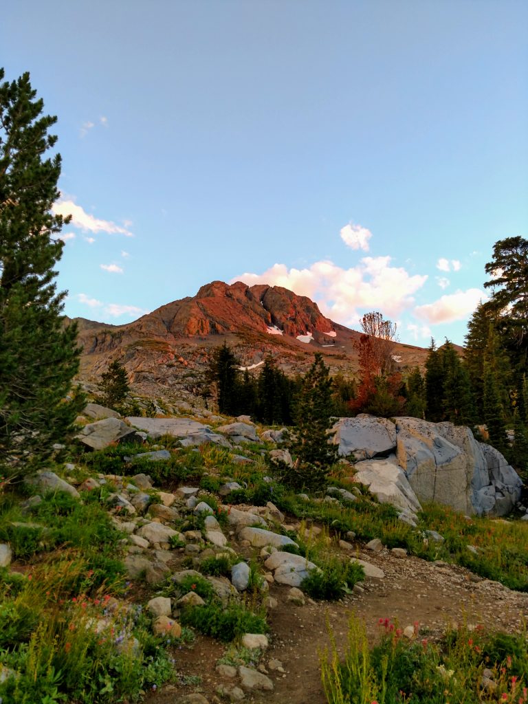
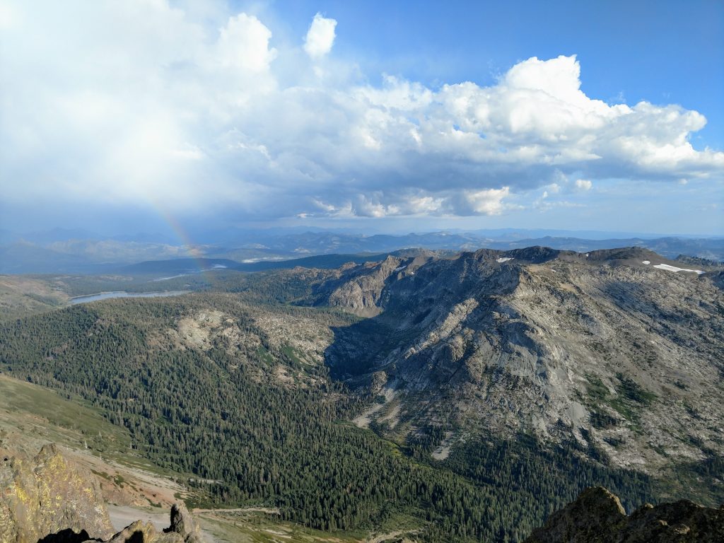
Late in the day I stood on the summit (altitude 10,381) and tried identifying every summit and major feature I could see. The most obvious ones were Freel Peak to the North, the monolithic Hawkins Peak to the Northeast and the gorge of the Mokelumne River. The summit register had all the usual names and many local Tahoe folk on their way to completing the Tahoe-Ogul summit list.
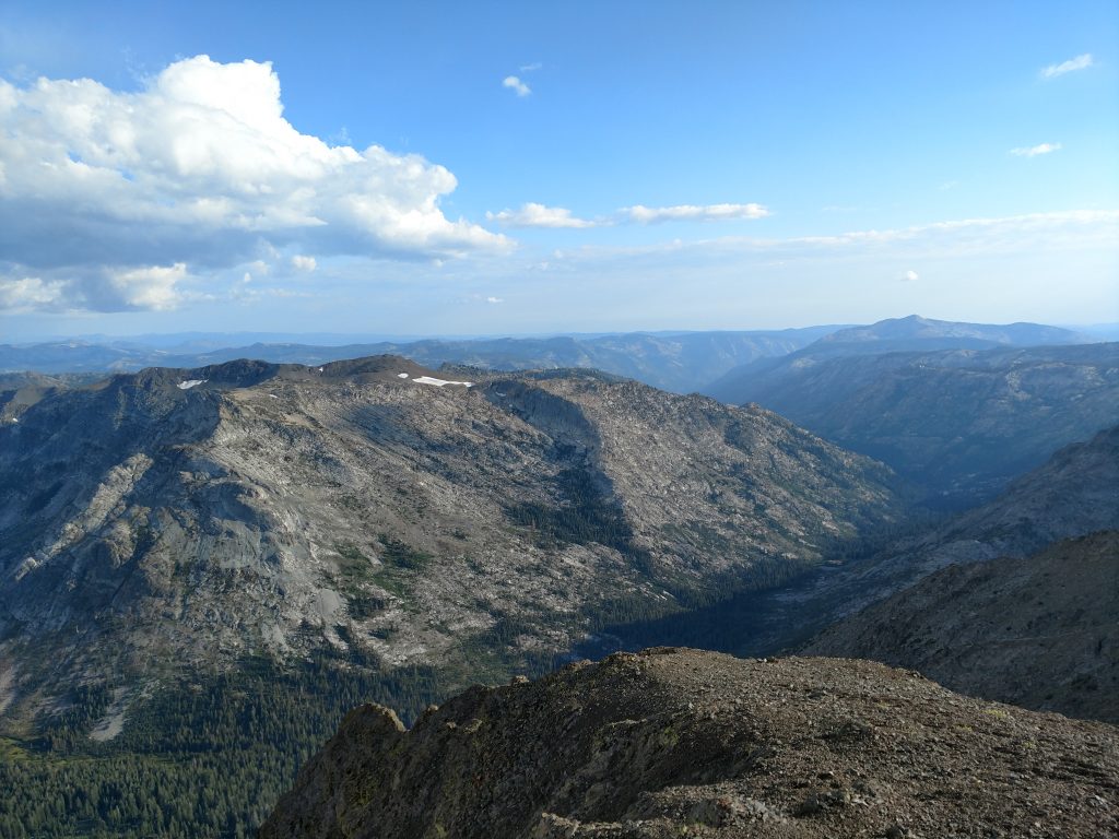
The descent from Round Top's summit to the junction with Winnemucca Lake Trail was essentially uneventful. I found a better way route up and down the notch separating the false and true summits- steeper rock was generally better quality and worth the exposure.
Back at the junction, I decided to take Winnemucca Lake Trail back. This added an additional 0.6 miles to the hike but it was worth a change in scenery. The trail descends about 1.0 mile to Winnemucca Lake (altitude ~9,000') and then another 1.5 miles to the parking area (altitude 8,170). I clocked 5.7 miles of hiking/scrambling by the end.
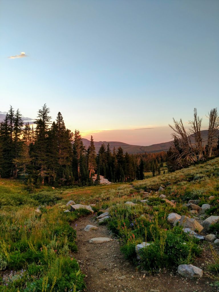
Though I eventually ran out of light, I caught some glorious alpenglow on the descent (see the first photo). Round Top sure felt a lot more alpine than its modest 10,381' suggests!
I camped out at some open ground in the National Forest and went on to climb Hawkins Peak the next day.

No Comments