


Pyramid Peak is an extraordinarily scenic summit of the Lake Tahoe region and one that's always captured my attention. After climbing nearby Round Top and Hawkins Peak, I turned my sights to Pyramid Peak, completing a long weekend of climbing. Pyramid Peak is neither a hike nor a true scramble; its somewhere in between. I took the standard route from Highway 50, gaining 4,000' in about 3.6 miles.
Pyramid Peak Trailhead and Access
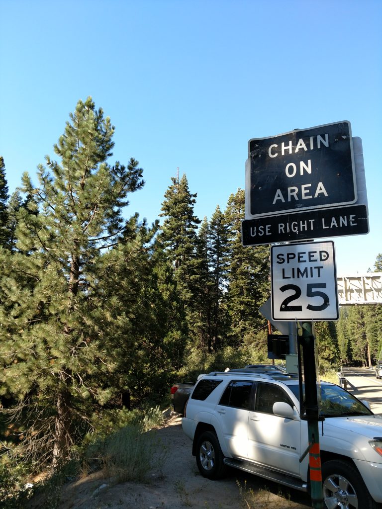
Access to Pyramid Peak is straightforward. Although the trailhead is unmarked, the trail starts right of Route 50. There's two areas on either side of Route 50 with pullouts large enough for day parking. Both are just East of the map dot of Strawberry. Note that the spots are easy to miss and a bit hazardous given how fast people cruise down the highway. There's no charge for parking and no need for permits if going for the day
After parking, I crossed on to the North side of Route 50, crossed a small bridge and found a herd path headed towards Pyramid Peak.
Here's my map and route:
Pyramid Peak: Class I Hike to Treeline
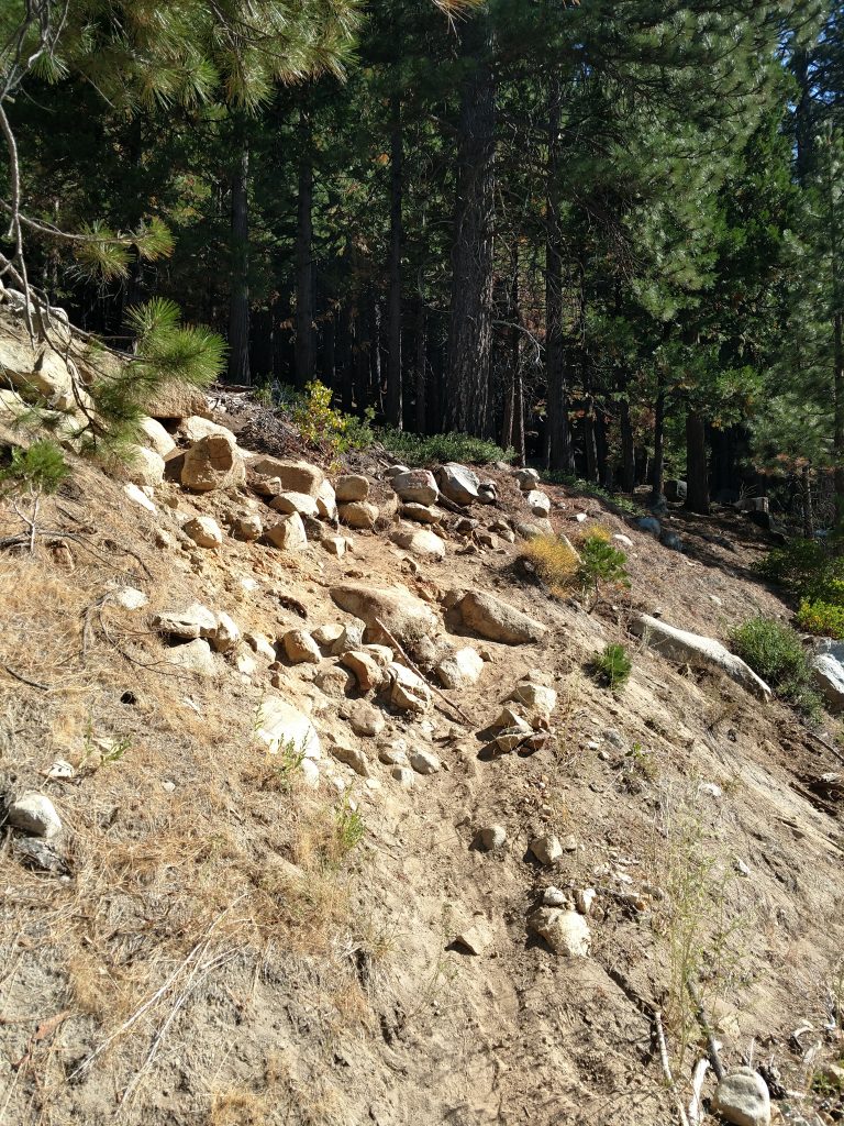
This is an extremely steep and difficult hike initially. Starting at 5,900' and Route 50, I gained 1,500' within a mile of hiking. I wasn't sure what to expect in the way of the route- initially I thought it would be a very thick scramble/bushwhack through the forest but a route has clearly formed over the years. Only briefly did I ever lose the trail or brush.
The trail/route does not exceed Class I during the first few miles. It remains relentlessly steep and a bit lose but never technical. After 1.0 mile, it went from "very steep" to just "steep". I crossed a stream which could serve as a water source on the return.
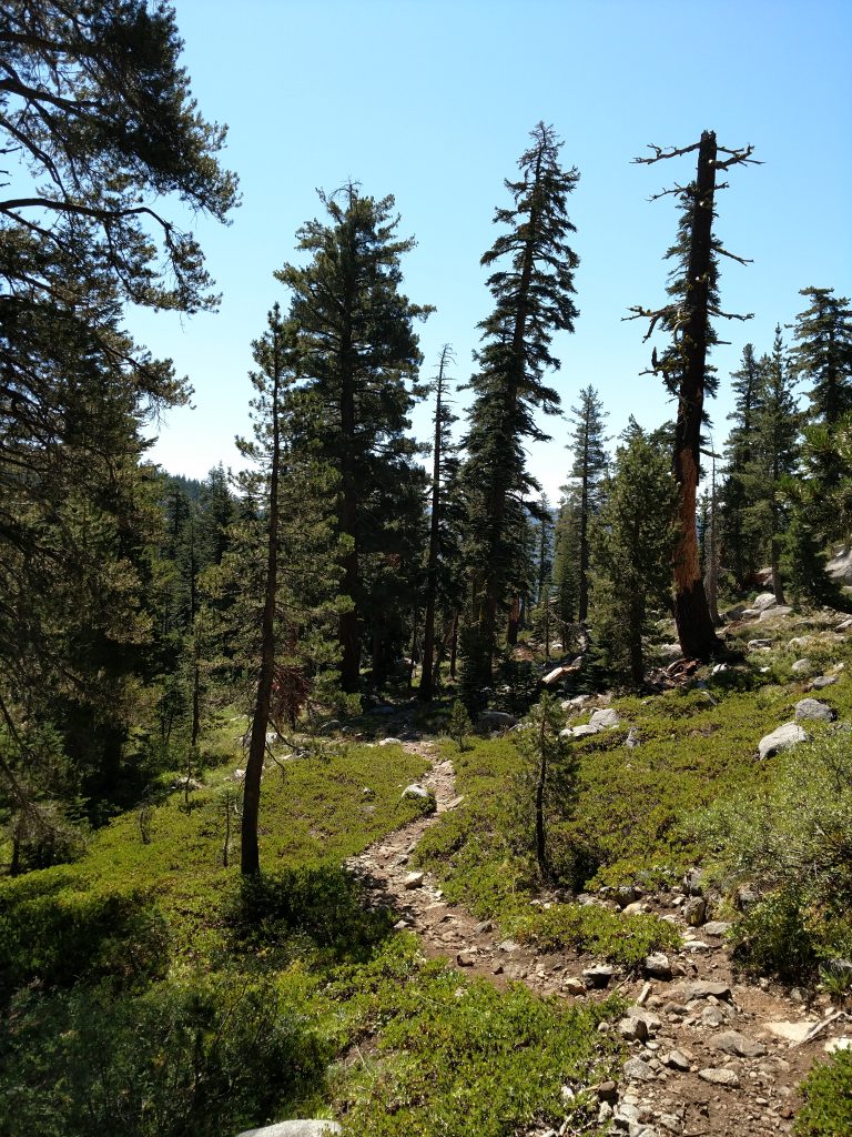
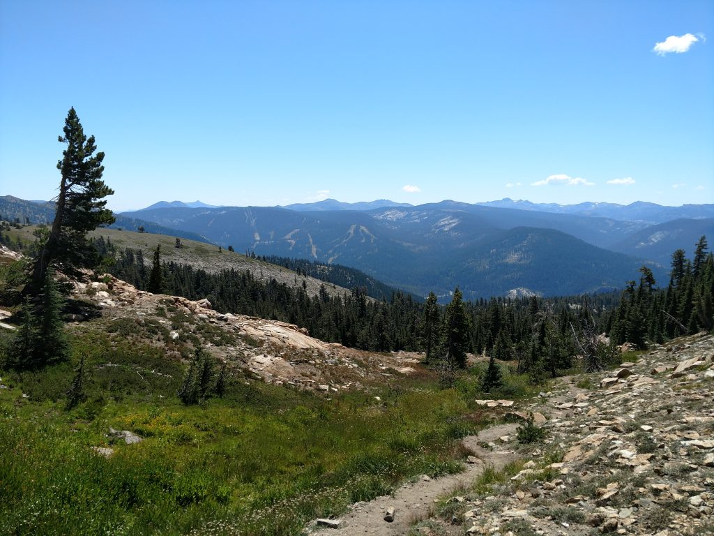
At about 7,500' and on the mile 2, the route became a little more meandering and less shaded. I lost the trail a few times but with some common sense I found the route again. There's infrequent cairns and I didn't think they were reliable. Between mile 1 and mile 2, I gained about 900'.
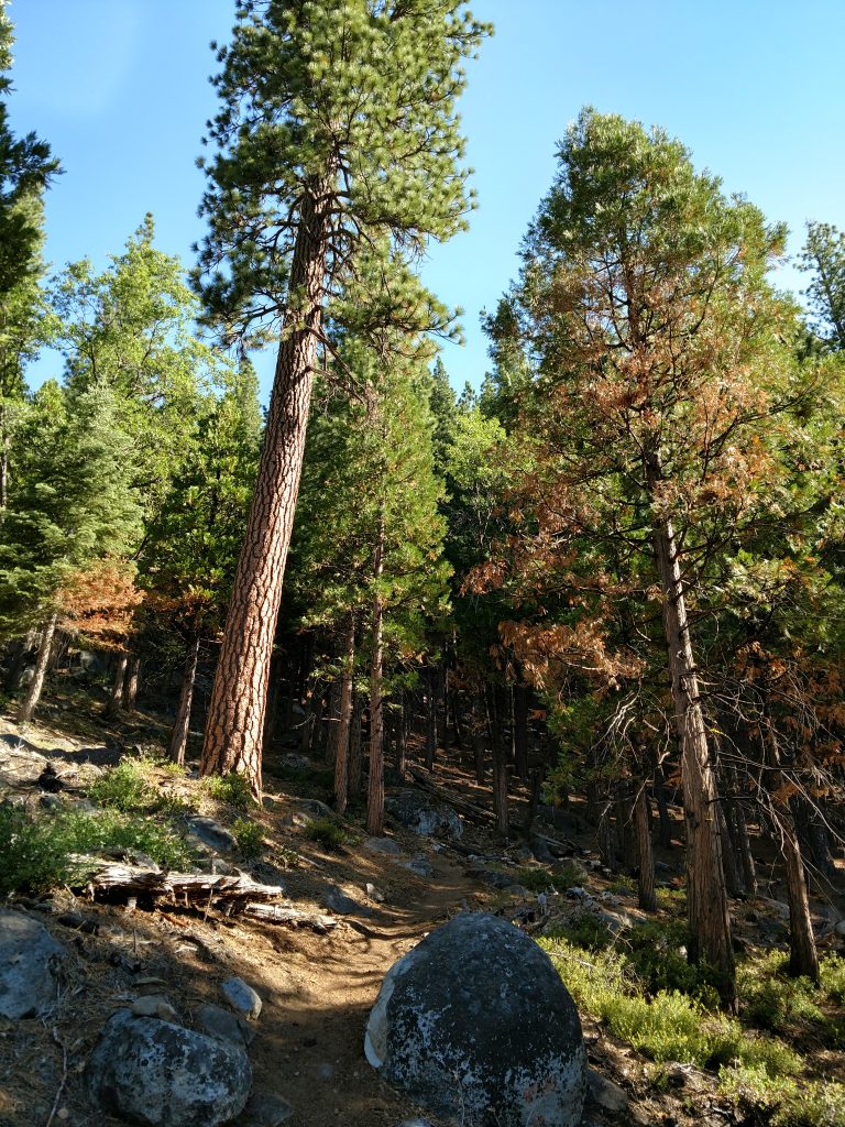
Mile 3 returned to the original steepness without much shade. Another 1,200' of gain to the "base" of the talus pile that makes up Pyramid Peak. There were some great
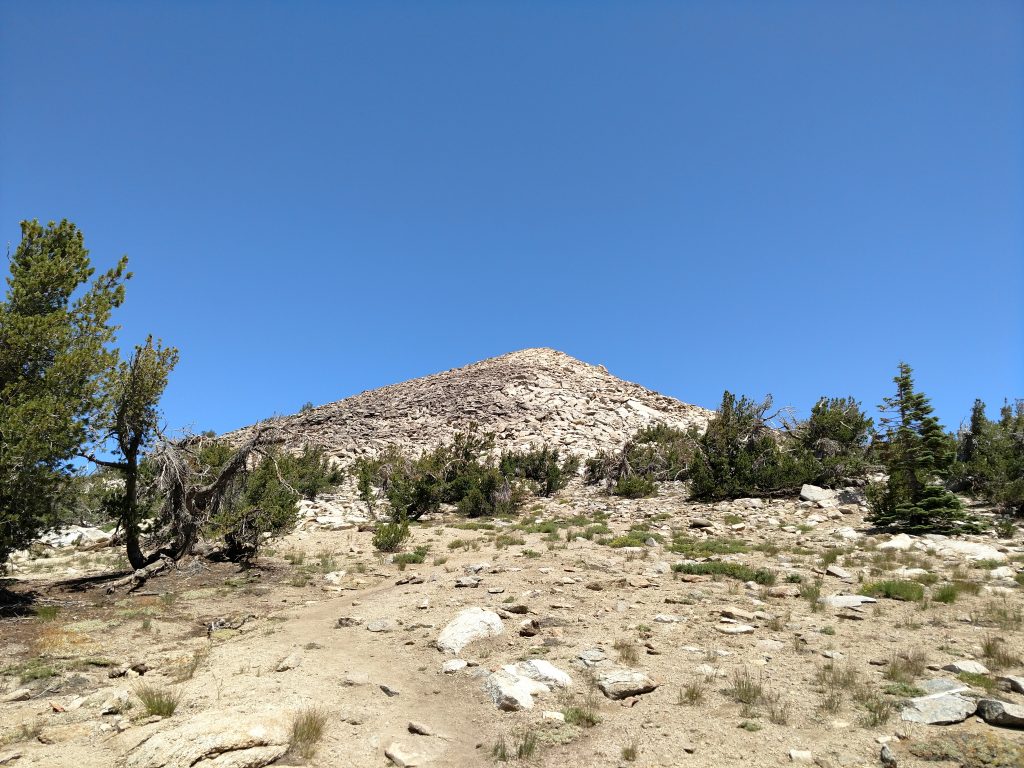
Class II Scramble to Pyramid Peak's Summit
Although not technical, the final section is a Class II climb. Hiking poles, as usual, were invaluable. Its a lot of mostly table talus but the last 300-400' took me 45 minutes. Fortunately, there was no snow in the late summer- this is never guaranteed during wetter years.
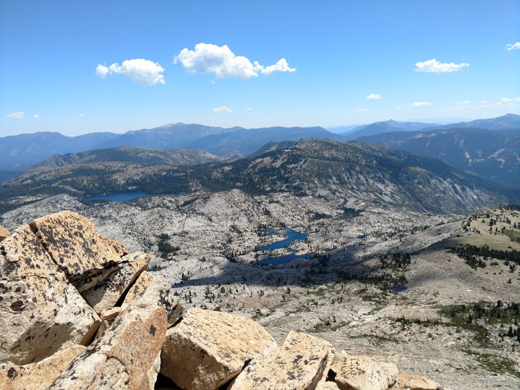
I picked my way along with increasingly glorious views of the Desolation Wilderness. Eventually I gained the summit. Although I saw hardly a soul on the way up, the summit was crowded. A lot of folks were doing a far more difficult Crystal Range Traverse.
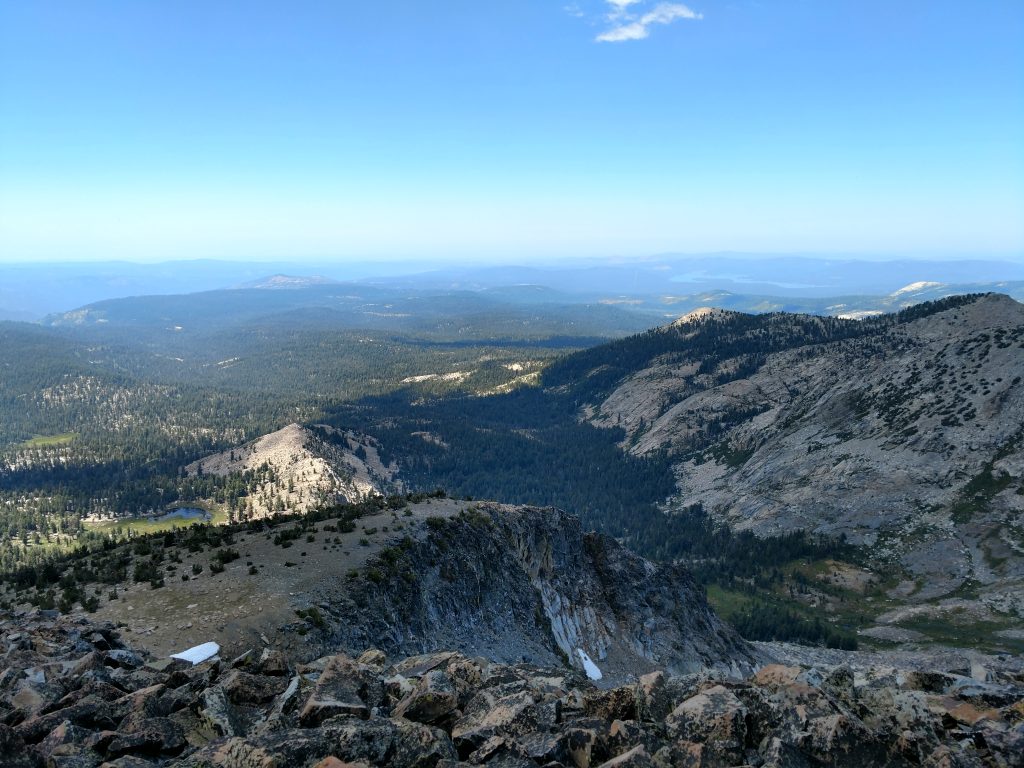
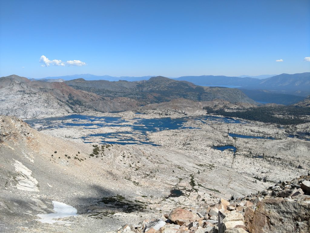
Pyramid Peak matches the incredibly scenic views of other Tahoe favorites like Mt Tallac, Mt Rose and Freel Peak. Although Tahoe is barely visible from the summit, there's unique views of the foothills and the Central Valley. During the time of year I went, there were dozen of waterfalls and hundreds of lakes visible from the top.
The descent wasn't too difficult beyond the Class II section. Again I had to be vigilant in following the route but I never got more than 10 feet away from the same route I took up. It certainly felt great to get below tree line and out of the sun.
That wrapped up my most recent trip to the Central Sierras and I climbed everything I set off for this trip. I still want to hike other summits on the Tahoe Ogul List. As far as P2Ks go, I've done most the California P2Ks of this area.

No Comments