


Much earlier in the year I hiked Snow Mountain, East which is a unique summit of the North Coast Ranges. Snow Mountain East is the highest point of both Lake and Colusa Counties. As I ended up discovering, its perhaps the only summit close to the Bay Area with a relatively large alpine zone.
In addition to being the County High Point of Colusa and Lake Counties, it is also the most topographically prominent summit of Colusa County. Snow Mountain East also shows up on the Western States Climber List.
Getting to Deafy Glade Trailhead
While certainly off the beaten track, getting to Snow Mountain East's trailhead is actually easy. There's a paved road the whole way. Although not a highway, essentially any vehicle can get to the trailhead. Google maps gets you there without a problem but in case you need it, here's how I got there:
- From most points in the Bay Area, drive North on I-5 to the Maxwell Exit which is about 32 miles North of the Highway 5
- Take Maxwell/Maxwell Sites Road through the small town of Maxwell and head West for about 8.5 miles out of the town and turn Right at the Fork (signs for Stonyford and Lodoga)
- Take this meandering road another 14 miles through the foothills to Lodoga California.
- Turn Right on Lodoga Stonyford Road and follow this road for 7.7 miles to the small town of Stonyford.
- This road forks in Stonyford, turn left to go through town about 0.3 miles. There's a gas station and market in town if needed.
- Just past Stonyford Garage and 1st Street is a Forest Service Road labeled as M10/Fouts Springs Road. This is the main access road to the National Forest in this area.
- Take M10/Foutes Springs Road 13.1 miles to the end of the pavement. Along the way you'll pass many side roads and ATV trails. As long as you stay on the pavement, you'll get there.
- Deafy Glade Trailhead has space for about a half-dozen cars.
Note there are tons of campgrounds in this area. Hard to imagine not finding a spot, even on a busy weekend.
A Few Considerations for this Hike
There's a few important things about this area that should be taken into account. The first is the fire danger. This part of California seems perpetually on Fire during the season (Late Summer - Fall) and frequently faces closures. To my knowledge, they haven't opened up the Summit Springs Trailhead and Campground which takes a substantial amount of distance and climbing out of this hike. Check with Mendocino National Forest about closures before going.
Going hand-in-hand with fire danger is the shear aridity of the region. There's a few water sources along the way but I met at least a few hikers who turned back on this summit due to running out of water. This year, 2020 was relatively dry for California. We didn't receive any significant precipitation during the entire month of February. In spite of that, I found two great water sources within 3 miles of the summit but none in the five miles below, except for the very beginning of the hike. If you backpack, plan on packing ALL your water.
Last bit of advice; this is a very strenuous hike. My distance clocked in at roughly 17 miles with 4,700' of altitude gain. There's lots of sun on this route and it gets hot during the summer. Come prepared!
Here's my route:
Snow Mountain East: Deafy Glade to Summit Springs Junction
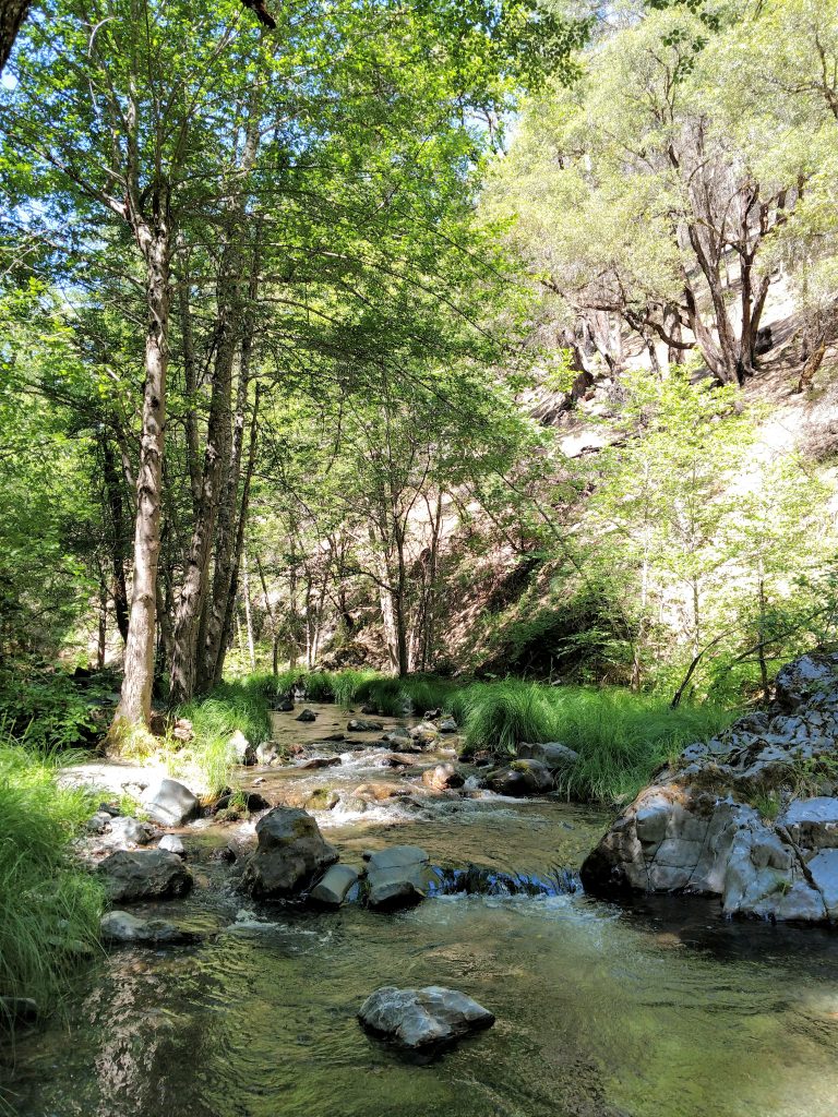
Starting from Deafy Glade, altitude 3,279', the trail drops altitude over the first mile to the South Fork of Stony Creek. Its a bit disheartening to start a big climb by losing altitude but at least its shaded. The crossing of the creek was easy for me in June but might be treacherous during high water.
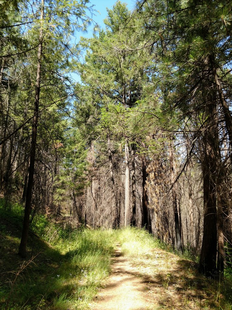
After the creek crossing, it was a near continuous stretch of climbing for another 3.9 miles. Thankfully this part was shaded. There's been no recent fire activity on this section of Snow Mountain so the wilderness looked quite lush. Even in late June there were wildflowers too- plenty of lupines.
I gained 2,400' of altitude between Deafy Glade Trailhead and the intersection with the Summit Springs Trail. It took about 2.5 hours.
Summit Springs Junction to Alpine Zone
The one any only junction in this trail is with the Summit Springs Trail at about 5,550', 4.9 miles from the trailhead. From here, it is almost an entirely unshaded and steep 3.3 miles to the summit. Going right at this junction brings you to Snow Mountain East. Left takes you to the Summit Springs Parking area/Trailhead which is closed (as of June 2020).
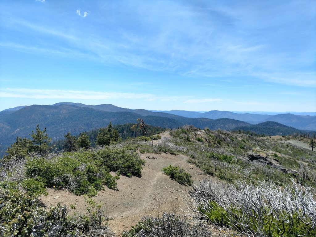
Going right, I followed an increasingly faint trail which wrapped around the slopes of Snow Mountain. Its clear this area was burned a few years ago but the lack of trees allows exceptional views of the Coast Ranges and the Central Valley.
At about 5,700' and as I was walking through an area of new growth, I came across the first water source since the beginning. I was surprised that there was plenty of water with the previously dry winter.
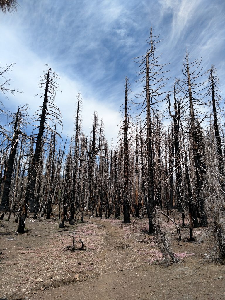
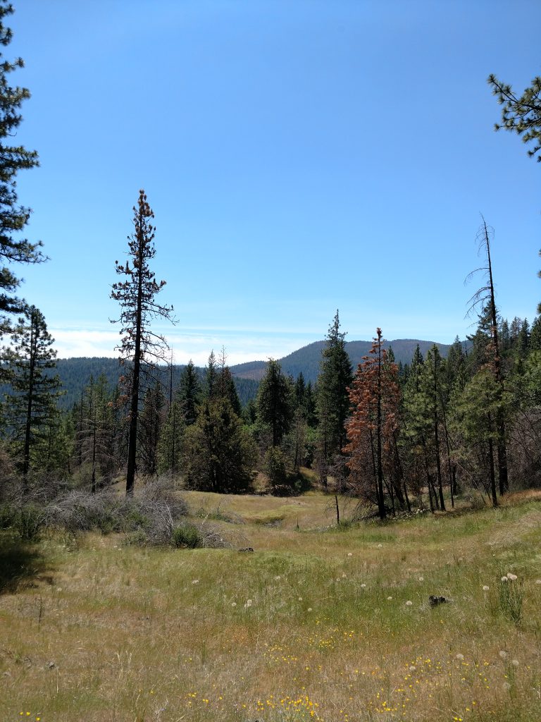
Between 5.5 miles and 7.0 miles (from trailhead), I passed through an extensively burned area from the 2018 Mendocino Complex Fire. At the time, it was the largest wildfire in California History (surpassed in 2020, unfortunately). Skeletons of Douglas Firs lined the trail creating an erie scene. The trail was noticeably flatter, however.
At 5.8 miles, the trail was very faint however there's evidence of several primitive campsites nearby a tarn.
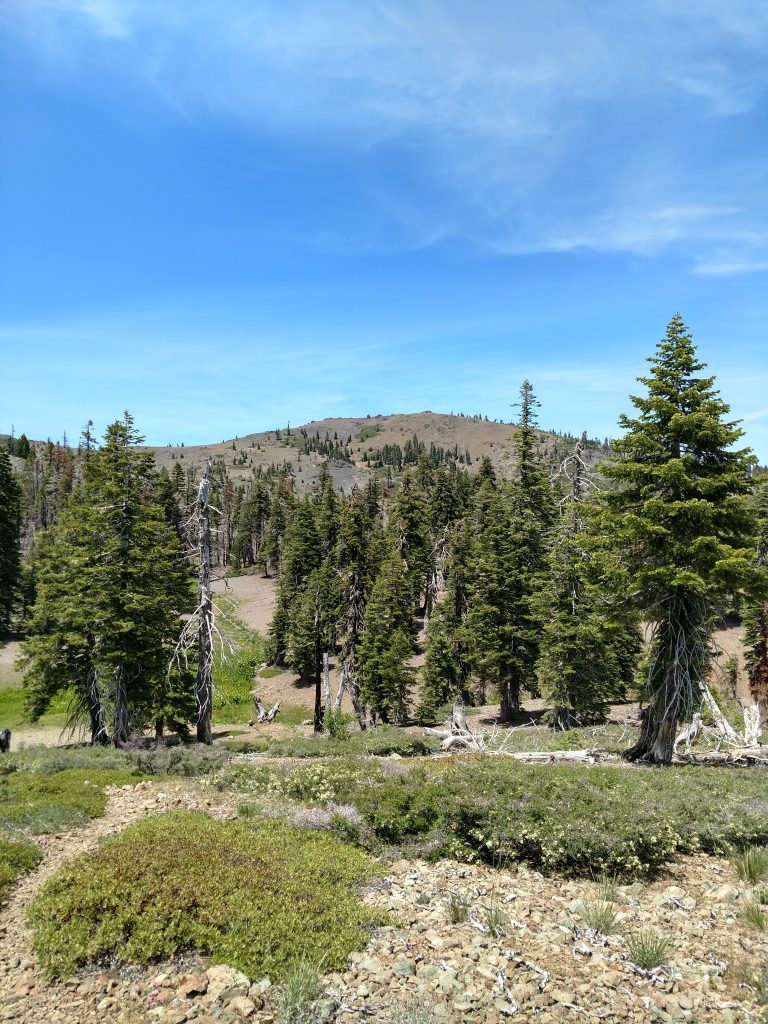
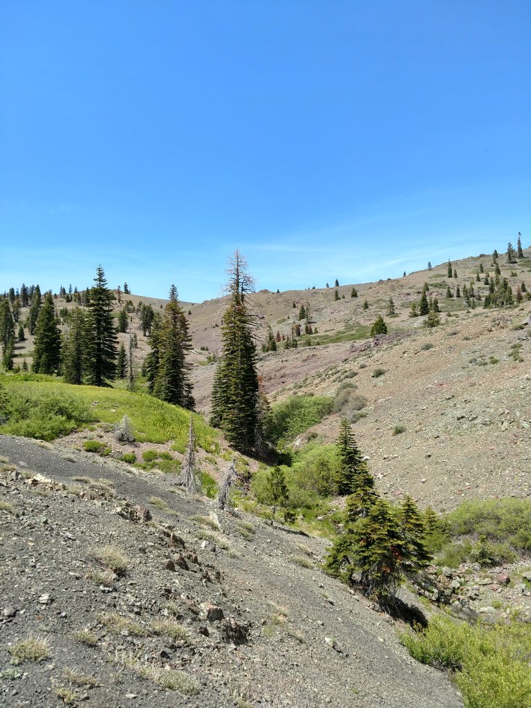
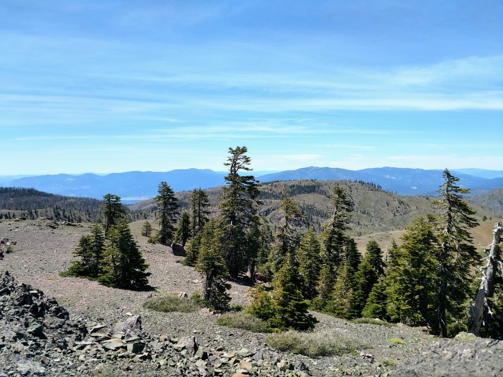
The flora became noticeably alpine at 7.0 miles and above 6,500'. This section was mercifully saved during the 2018 wildfires. Vegetation was sparse and stout. Almost looked like the Sierras-
Snow Mountain East Summit and Return
Snow Mountain East isn't visible until the final 0.5 miles and just 500' below the top. This final push was marvelous as there was absolutely no sign of civilization. Gaining the ridgeline and then the summit itself, I had unobstructed views nearly to the coast and of every major summit in the region. It took an even four hours from trailhead to summit for me.
The furtherst I could see was Mt Diablo, 113 miles South. Hundreds of other less well known summits were in view as well. I liked the views of Berryessa Peak in Napa and Hull Mountain in Mendocino County the best.
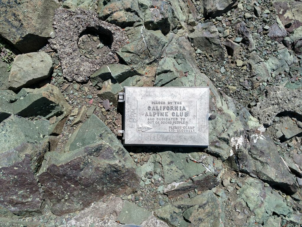
There were a few points on the summit that could be the highest so I tagged them all. The summit register is in a classic California Alpine Club metal box-
I returned the same way I came without too much trouble. I briefly tagged the West summit of Snow Mountain which was equally glorious although no summit register.
The water source at 6,500' was a lifesaver for me. Three liters was not enough for this trip; I filled up at the small creek and continued descending, returning to the trailhead after 7 hours and 15 minutes of hiking. Just below Deafy Glade, I camped at Dixie Glade Campground which was free at the time
Snow Mountain East was a wonderful hike. In fact, this might be one of the few summits that I hike again in the future.

No Comments