


I'm picking up steam with trying to tag all the California County High Points. Of course, this includes serious mountaineering ventures including North Palisade, Mt Lyell and Mt Ritter. Corral Hollow Hill is far more obscure but just as important in the quest. This 8000' high point is located in far-eastern Calaveras County, just barely within its boundaries. Although remote, access is relatively easy. I climbed this one in August 2020, shortly after hiking nearby county high point, Thunder Mountain of Amador County.
Getting to the "Trailhead" of Corral Hollow Hill
The closest town to Corral Hollow Hill is Bear Valley, home of the Ski Resort with its namesake. Its about an hour up the mountains on CA-4 from Angels Camp, on the way to Ebbetts Pass. CA-4 is closed in the winter closer to the pass but Corrall Hollow Hill and Bear Valley are accessible year round.
The area around Corral Hollow Hill is a local hotspot for Off-Road/Off-Highway vehicle driving. Like me, you're bound to see far more dirt bikes and 4x4s than hikers. Keep an eye out for them if on foot.
Given that the roads were clearly beyond my vehicle and skill level, I simply parked a short distance off CA-4 in this location (click for google maps link). People with adequate skill and a very sturdy, high clearance vehicle or dirt bike can get within a tenth of a mile to the summit. For me, I simply walked.
I've included my walking route and some way points below. The overlook is the furthest you could conceivably drive.
Corral Hollow Hill Hike: FS 7N35 to Mokelumne Coast to Crest Trail
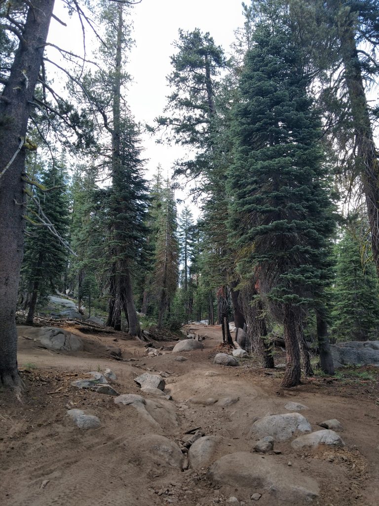
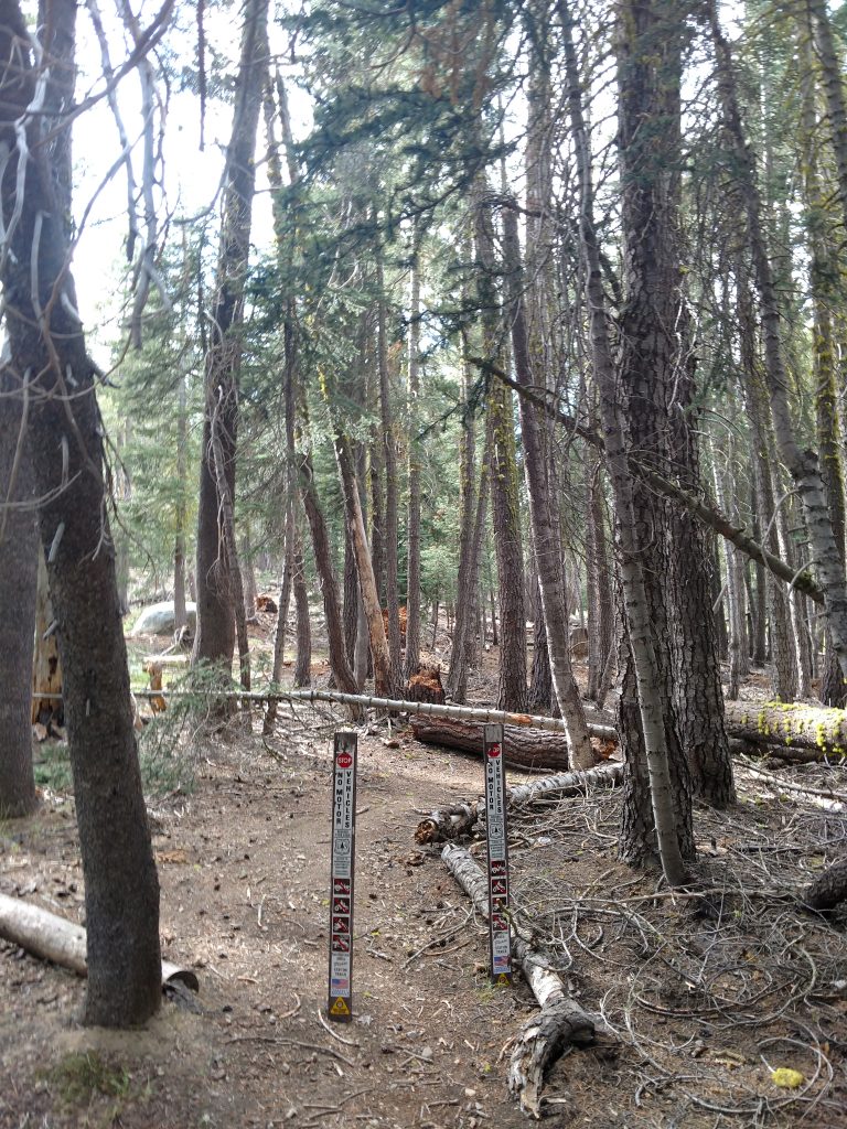
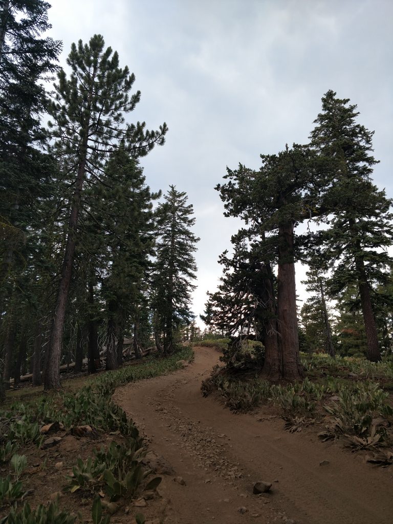
I began my trek with a 1.3 mile walk up FS 7N35 which is the main road departing from the highway (altitude ~7,200'). At the beginning there's a message board with standard reminders to off-highway drivers. There's no sort of fee to get in although I believe OHVers have to register with the state.
For me, I parked in a dirt spot with room for 2 cars and began my "ascent". The most dangerous part of course was the dozens and dozens of dirt bikers. I kept to the side of the road, gave some friendly waves and was generally not bothered.
I didn't do a ton of research on this one so I got a little side tracked. Thankfully, I had somebody else's GPS track which was invaluable. Using the track, I eventually found the side-trail that saved me the danger of hiking on a busy 4x4 road. You could simply walk FS 7N35 all the way to near the summit but there's a little side-trail that cuts off some distance and only hikers are allowed. The GPS coordinates for the turnoff are in the map above or here (click for google maps)
Mokelumne Coast to Crest Trail Cutoff back to FS 7N35
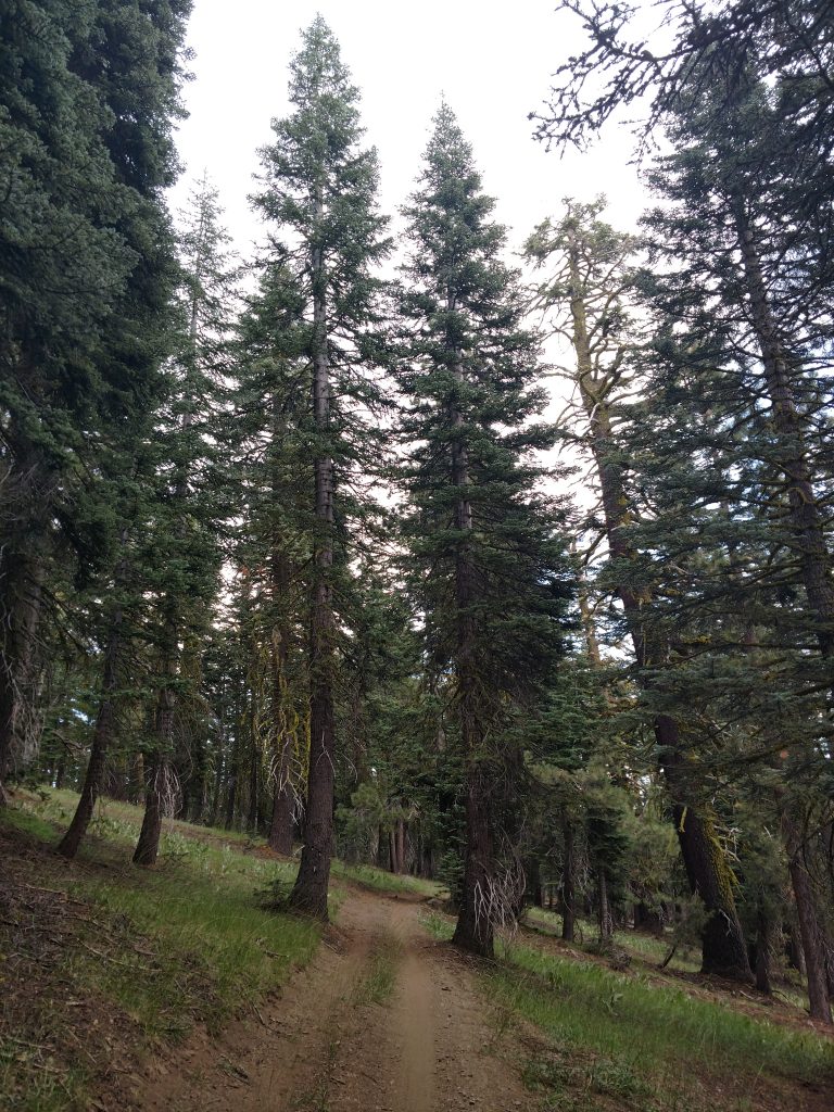
The next 0.9 miles along the Mokelumne Coast to Crest Trail were pleasant. Of note- I didn't know this trail had a name until after the hike. This trail was not well marked and a bit ambiguous at first but I found my way up the slopes with increasing views of the foothills to the North and East.
At around an altitude of 7,800' and roughly 0.5 miles from FS 7N35, the trail started flattening and I came to another vague intersection. Corral Hollow Hill was clearly to the right or North at this intersection. I followed this trail, unmarked on any map, another 0.4 miles until it dumped into FS 7N35 again. By this point, there was almost no traffic on that road.
FS 7N35 to Overlook and bushwhack to Corral Hollow Hill Highpoint
Its a little over 1,000' from the trail junction with FS 7N35 to the Corral Hollow Hill Benchmark. This was a very dusty walk but hardly any altitude change at this point.
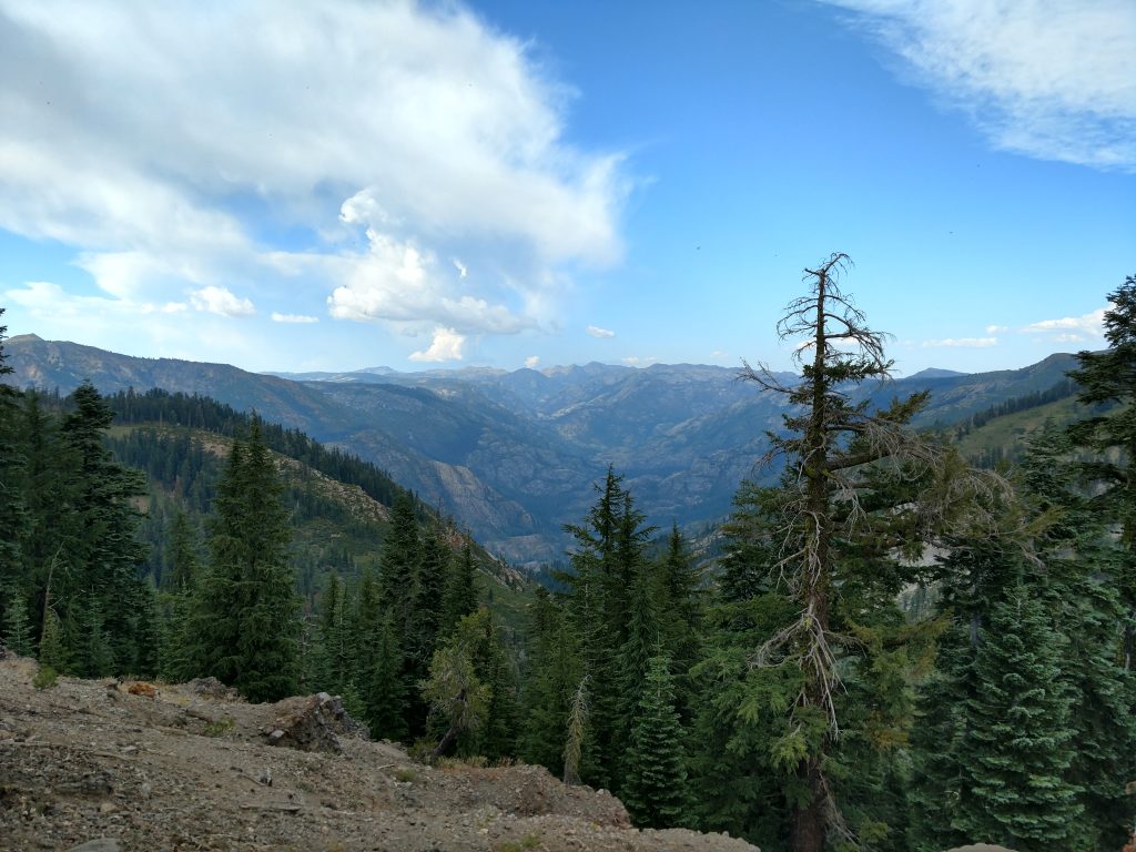
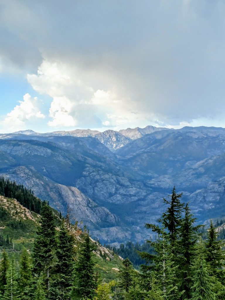
Just before the highpoint, I came across a glorious view of the Mokelumne River and gorge. This view made the trek worth it for an otherwise forgettable high point. People clearly use this spot for lunch or camping and had I the time, I would have done the same-
Near this spot there's a wire gate crossing the 4x4 road which prevents further travel on wheels. It doesn't appear there's any restriction to hikers crossing the gate/fence. I didn't see any negative signage or "no trespassing" evidence. The actual highpoint was not more than a few hundred yards past the gate anyways.
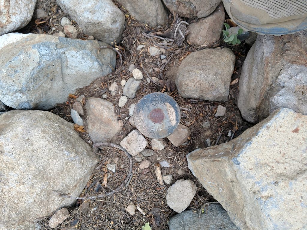
At this point, I departed the road and walked through the open forest and over dead-fall searching for a benchmark or register. Without too much difficulty I found two benchmarks- one that was scarcely more than a hammered in pole and another with a large cairn and a summit register. I decided to call it at the summit register. The altitude was approximately 8,170'.
The top had no views whatsoever so I perused the register, full of familiar county high pointing names. If I had to average it, this was people's 20th-30th county high point. Nobody finished or started their county high-pointing adventure at this obscure place. Nobody really stumbled upon it either.
As obsessive as I am about county high-pointing, I did not visit the nearby alternative highpoints indicated on Peakbagger. The truly dedicated visit any and all possible county high points, especially in a poorly surveyed area such as this one.
As for me, I turned back the way I came, avoiding a thunderstorm and giving me time to find a campsite on the Carson River. That's 36/58 county highpoints for me in California!

No Comments