


She/He Devil are a pair of summits on the Idaho side of Hells Canyon. Though not well known outside of the hardcore peakbagging community, the twin summits are extraordinarily beautiful and remarkably accessible considering their remoteness. She Devil and He Devil are essentially the same altitude with some sources indicating He Devil is slightly higher. Ambiguity persists on which is higher which is why many climbers do both.
For peakbaggers, She Devil and He Devil are a wonderful prize. The higher summit ranks 52nd on most topographically prominent summits of the lower 48. Its one of contiguous-US's only 57 "ultra-prominent summits" (5,000' of topographic prominence). Like all summits on the list, their rise over the surrounding terrain is unmistakable. I finally bagged one of these summits on my recent road trip through Oregon and Idaho. In fact, this was my second ultra-prominent summit in 2 days after climbing Sacajawea Peak the day before.
Getting to She Devil/He Devil Trailhead and Seven Devils Wilderness
Riggins, Idaho off of US-95 is the main point of access to the Seven Devils Wilderness. Riggins is a perfect small adventure town catering to all things outdoorsy. There's plenty of lodging and camping nearby. I camped for free at Island Bar Recreation Site just outside of town. There are abundant free camping areas around Riggins.
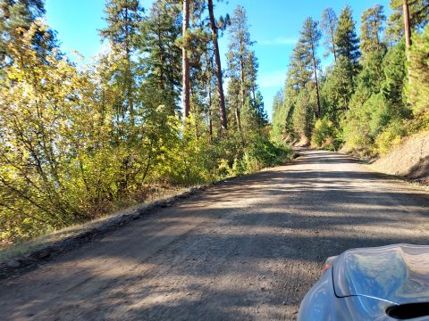
From the Riggins Ranger Station just outside of town, head south on US-95 about 1/3rd of a mile. Take a right on NF-517/Seven Devils Road and follow it for about 1.7 miles. Stay left at the fork and take this road 15 miles to Windy Saddle Campground. Its a fairly straightforward drive to Windy Saddle- simply stay on the main road. The road is dirt as it enters the forest service land. It is a well-traveled and well maintained road that is essentially suitable for any vehicle. The ranger at the station told me people regularly take rental cars to Windy Saddle without incident. I had absolutely no trouble in a stock Subaru.
At Windy Saddle, I turned left and headed 0.5 miles down to Seven Devils Campground. This serves as the "trailhead". When I visited in October 2022, the campground and its roads were somewhat maintained.
Note that Riggins is at an altitude of 1,821' whereas the campground is at 7,600'. Snow regularly falls throughout much of the year in the wilderness. There are no services between Riggins and the campground, come prepared.
Overview of the She Devil/He Devil Route
Like usual, I read every single trip report I could get my hands on prior to climbing. Its such a remote area that I would have hated to lose my way and opportunity to bag at least one summit. I discovered people climb these mountains in many different ways:
- Climbing She Devil alone is the "easiest" route that's only Class II. Its still more of a route than a hike so it was slow going for me. My route is posted below
- She Devil-He Devil-Mt Baal is a standard route that includes 3 of the 7 Devils. This is a demanding route that involves a class IV crux between She Devil and He Devil. See Greg Slayden's trip report.
- Its possible to avoid the crux between He Devil and She Devil with a much longer route. See Sam Grant's trip report. I would have liked this route but I ran out of time to do He Devil
While I discovered well beaten paths in the wilderness, all routes are unmarked and require basic orientation skills.
Here's my route with major landmarks noted-
Trailhead to Goat Pass/Sheep Lake
I followed a somewhat straightforward approach to climbing She Devil. Here's my trip report-
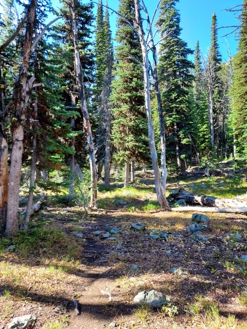
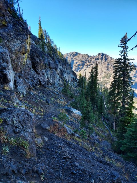
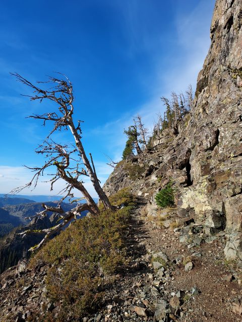
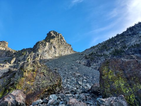
From the parking lot, I bushwhacked in a generally southwestern direction before eventually picking up on a use trail. This trail was a little vague in sections but became more clear as it neared Goat Pass. The cliffs below the pass looked foreboding but the use trail neatly skirted around the steepest parts before arriving at the pass. It was about a 900' climb from the campground to the pass.
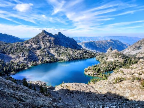
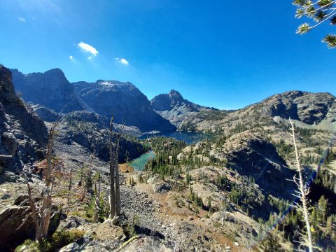
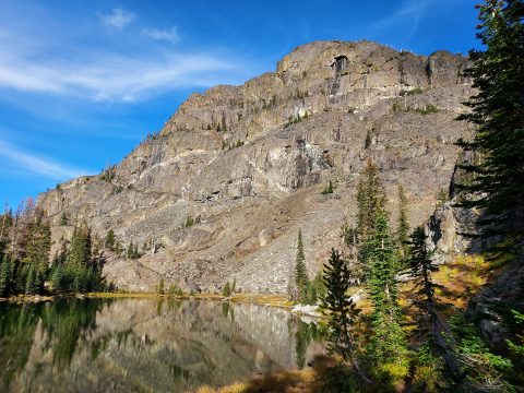
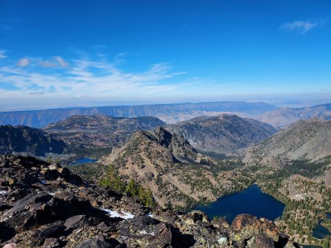
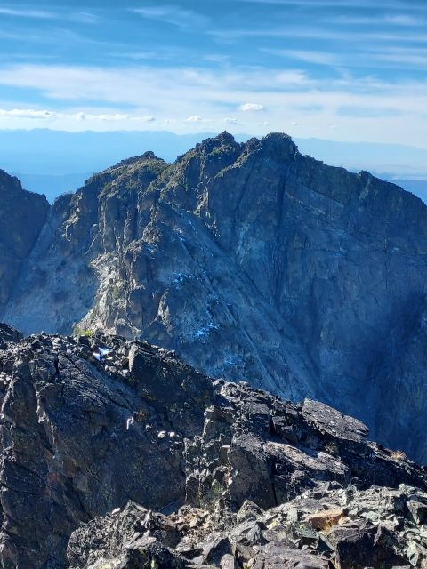
Goat Pass has a flat section and views of the imposing Tower of Babel overlooking Mirror Lake. Many climbers follow a route/use trail that side-hills beneath the summits of the Tower of Babel and Mt Baal. It looked challenging to me, at least from the pass. I decided to drop down to Sheep Lake and make way to the summits.
From Goat Pass (Elevation ~8,490') to Sheep Lake (Elevation 7,882') involves an unfortunate loss of altitude. There's a somewhat obvious route although I found it tedious. A few scree filled sections were slippery and exposed. I crossed them as carefully as I could. Eventually I dropped down to Sheep Lake which has excellent views and camping opportunities.
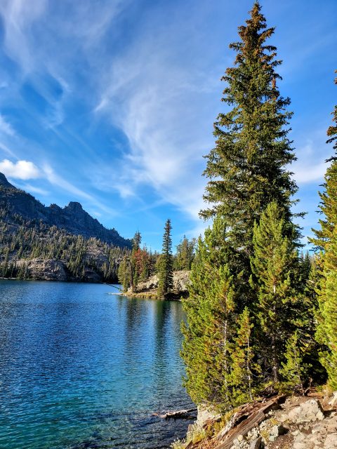
Sheep Lake to She Devil's Summit
From Sheep Lake, there's a large and wide screen slope ascending the col between She Devil and Mt Baal. The slope is very steep and slippery but not exposed. After considering all my options, I trudged up the slope. It was unpleasant. Much of it was painstaking one step forward, two-steps back kind of climbing. Parts were slippery enough to put me on edge but I eventually made my way to the col. It took over an hour to climb from Sheep Lake (Elevation 7,882') to the col (Elevation ~9,020').
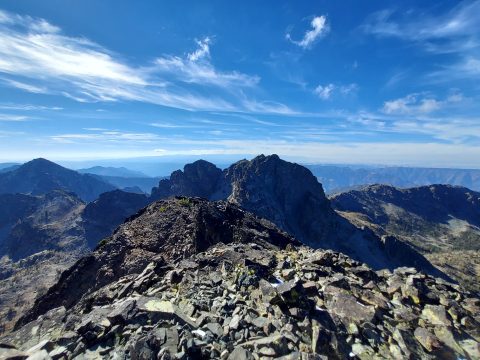
From the col to the summit of She Devil involves light and mostly pleasant class II scrambling. I mostly kept to the right or north of the ridgeline to avoid the up-and-downs. Parts were slippery but it wasn't exposed. Hiking poles were sufficient with a few hands-and-feet scrambling sections. In about a half an hour I was on the summit of She Devil (Elevation 9,400'+).
The views were phenomenal. The summit register also had many famous names of far more accomplished peakbagger. I love seeing who's working on what lists.
Descent
The descent was mercifully uncomplicated. I snaked my way back to the col, unsure of how the scree descent would go. Fortunately I basically boot-skied down the scree pile. What took an hour and a half to ascend took 20 minutes to descend.
Back at Sheep Lake, it was hard to find the route back to Goat Pass. Here I was glad I had a pre-loaded GPS track and my own GPS. There weren't many cairns to mark the way. In retrospect, it seemed like an easy place to get turned around.
Including stops and backtracking, the climb took me 6.5 hours. I really wished I could have bagged He Devil while I was there but I didn't think that would be wise doing alone. I've read at least a few injury reports on the mountain so I'll have to save He Devil for a different time.

No Comments