


Steens Mountain is a far flung summit in the hinterlands of southeastern Oregon. Rising a vertical mile over the nearby Alvord Desert, its a stunning natural wonder not well known even among Oregonians. I had the opportunity to hike Steens Mountain and explore the loop road while on an Eastern Oregon road trip.
Steens Mountain Loop Road and Overview
Steens Mountain is located in extremely remote Harney County. The largest county in Oregon (larger than many states in the Northeast), only 7,500 souls call it home. The most noteworthy settlement near the mountain is Frenchglen (population 12) which serves as the main jump off point for the Steens Mountain Loop. Frenchglen is 3-4 hours from literally everywhere- Bend, Medford/Ashland, Klamath Falls and Boise are all a 1/2 a day's' 's drive. Perhaps that's why the area's so enchanting.
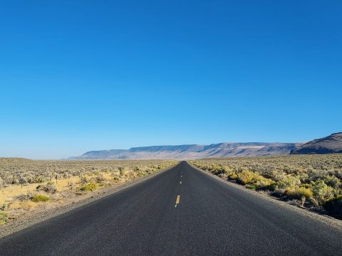
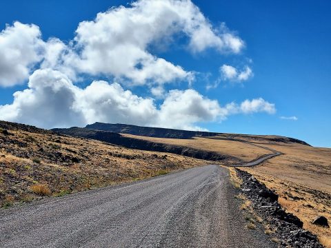
For whatever reason, I didn't know the entire loop is unpaved. It was not a difficult drive but it certainly changed my plans based on timing. There's two access points - the southern entrance and the more commonly used northern entrance. Its a 59 mile loop that takes about 2-3 hours if you're driving straight through. Most any vehicle can make the loop without problems but be prepared for backcountry driving. It's a long ways from any garage.
Here's my map of the route and highlights-
Steens Mountain Hike and Wildhorse Lake Hike
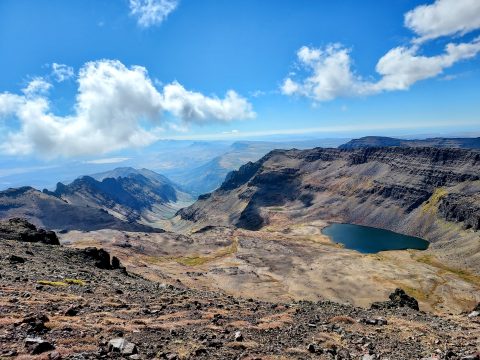
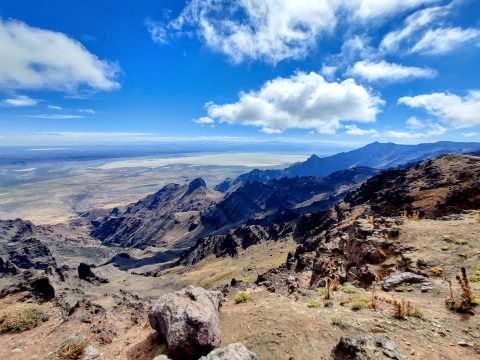
My destination was the Steens Mountain summit proper though I had fun with many side trips. Coming from Frenchglen, I drove about 25.3 miles on the loop road to a four way intersection. Going left leads to the East Rim Overlook which shouldn't be missed- it has a much better view of the Alvord Desert than Steens Mountain's summit. I went straight through the 4 way intersection to the summit parking area about 2 miles further. This section was the steepest of the loop road but not tricky. There was parking for about a dozen or so cars at the top.
There's two trails which depart from here. The trail headed left is for the summit and the one to the right goes to Wildhorse Lake. Its essentially a gated access road for the antennas on the top. The hike is only 1 mile round trip with about 200' of gain. That makes it the easiest summit of its size in Oregon. I enjoyed the hike but wish it was something more substantial.
The Wildhorse Lake trail is a bit more demanding. Starting at the parking area, the trail descends 1,000' over about 1 mile as it enters Wildhorse Canyon. There are fantastic views the whole way and Wildhorse Lake is a splendid alpine gem. The area is well protected and sees few visitors, especially compared to the more popular Steens Mountain Trail. Worth the effort!
Kiger Gorge Overlook
The Kiger Gorge is the Eastern Oregon version of Yosemite Valley with a similar natural history. This U shaped valley spans over 1 mile and is 2,000-ft deep, obviously carved from glaciers in the not-so-distant geological past. It's a very easy side trip from the summit.
The Kiger Gorge overlook is best accessed from the northern entrance of the Steens Mountain Loop Road. Drive 22.4 miles up the road and look for signs on the left for the overlook. Take the left and then take a right after about 1/4th a mile. There's plenty of parking at the trailhead.
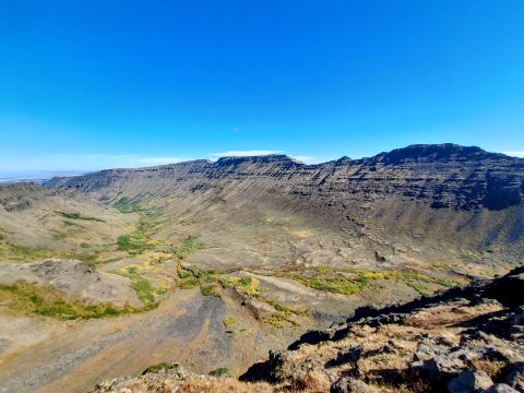
Similar to the summit, there's not much actual hiking involved. The best overlooks are within a few hundred yards of the parking area. There's no guard rails or signs so choose your own adventure. I enjoyed meandering around the rim but wished there was a longer hike.
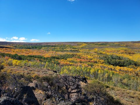
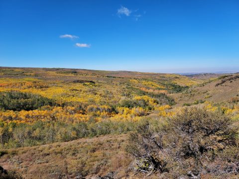
Little Blitzen Canyon and Big Indian Creek Canyon
The southern section of the Steens Mountain Loop seems less traveled than the northern section. This is probably because most stick to Kiger Gorge and the summit which are better accessed from the north. However there's some great sights in the southern loop and longer hike options:
- Descending from the summit road junction, overlooks abound. About 7 miles down the road there's at least two pull-outs overlooking the glacially carved Little Blitzen Canyon and Big Indian Creek Canyon.
- At 11.2 miles from the summit road junction lies South Steens Campground and two great trailheads. The Little Blitzen Gorge Trail heads north from the campground. The trail eventually connects with the loop road but a spur simply dead-ends in the canyon about 9.5 miles from the trailhead. Similarly, the Little Blitzen Gorge Trail (leaving east from the campground) goes up the canyon, eventually topping out on the loop road over about 10.6 miles. Both trails are better described as routes and rarely see visitors. I unfortunately ran out of time to do any significant hiking in this part of the wilderness but its worth returning for
The Steens Mountain Loop road rejoins the pavement about 30.4 miles from the summit junction.
Had I more time, I would have spent the entire weekend wandering the area. However one of my major destinations on this particular road trip was Sacajawea Mountain, the highest mountain of Eastern Oregon and hence had to leave a little early. However, I hope to return to Steens Mountain for more hiking in the future!

No Comments