


Sacajawea Peak is the highest peak of the Wallowa Mountains of Eastern Oregon and one of the most isolated summits in the United States. This ultra-prominent summit has been on my list for over a decade. Something about its isolation and relative obscurity compelled me to design a trip around a successful summitting.
Getting to Sacajawea Peak’s Trailhead
In terms of absolute difficulty getting to the trailhead, Sacajawea Peak is pretty easy. There’s no long drive over questionable roads to reach the established trailhead. Unless you live in eastern Oregon, it involves a long, long drive. The best way to get to the trailhead is to essentially set your navigation to Joseph, Oregon. This lovely, frontier town is encircled by the wild Wallowa Mountains and abuts the famously scenic Wallowa Lake. Joseph, Oregon feels like a cross between Switzerland and Montana. From Joseph, set your destination to Hurricane Creek Trailhead. This is located at the end of a forest service-maintained road. It involves about 3 miles of well-maintained dirt roads accessible by any vehicle. There’s nearby camping at Hurricane Creek Campground on the route.
Although the parking area is a fee area, there’s places to park just outside if you want to avoid paying. When I visited in October 2022, there weren’t any payslips available at the iron ranger so my visit was free.
My Route
Here's a GPS of my route which is the standard route. Total distance was exactly 15 miles with 4,852' of altitude gain. It took me about 6.5 hours of moving time to hike the route with about an hour of stops. I did this hike in early October which made for exceptionally favorable conditions. Temps were pleasantly cool and there were no bugs/mosquitos. There were patches of snow on north facing slopes but none that impeded my travel or required traction. I brought microspikes just in case. Water sources were abundant.
Sacajawea Peak Trip Report
Like usual, I agonized over every possible outcome of my trip. The lower volume of successful trip reports was a bit foreboding. In the end though, Sacajawea Peak was a straightforward hike with some challenging but easily overcome route-finding difficulties.
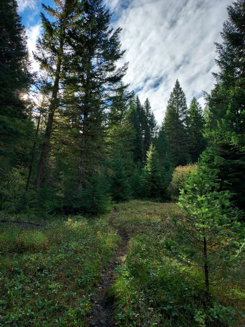
Starting at Hurricane Creek Trailhead, I quickly made my way up the first 2.1 miles of trail. I paralleled a well-trodden trail to a junction. The “Y” was obvious if you were looking for it but obscured if you were not. Here I went left, crossed the creek and followed some herd paths. This section was the most ambiguous- there were many herd paths and hiker trails which made route finding difficult. I’m glad I had a pre-loaded GPS as finding the appropriate route from here was challenging. After a bit of bushwhacking and doubling back, I found a beaten path and continued onwards.
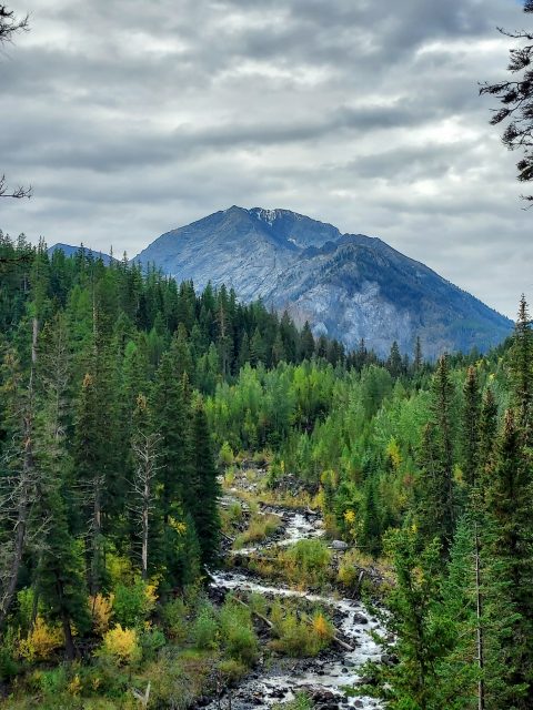
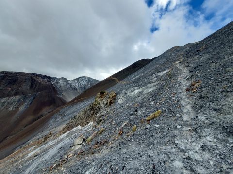
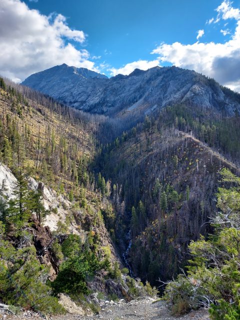
This path ascended a sinuous and switchback route up a nameless ridgeline. The grade must have exceeded 20% in some sections. Slowly but surely I made my way up the next 2 miles to the meadows between Hurricane Divide and Sacajawea Peak. Glimpses of the summit percolated the climb.
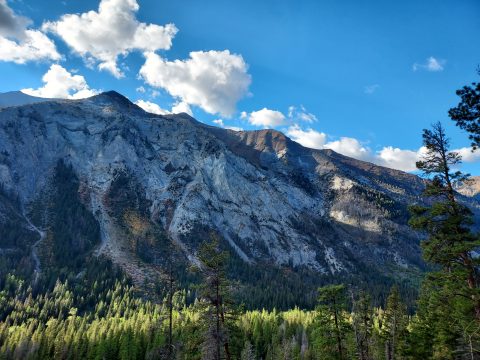
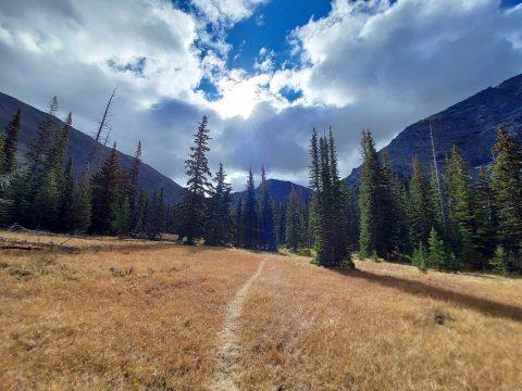
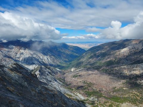
I descended through some previously burned forests to eventually reach the meadows which were obvious. A small creek ran through the center of a valley creating a heavenly view. I stopped for lunch here and wished I had backpacked and spent the night. The next mile was surprisingly flat as I moved through the valley. Several creek crossings made it interesting.
Final ~2,200' to the summit
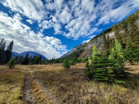
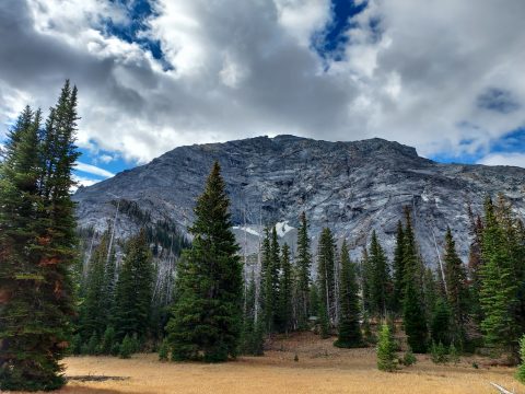
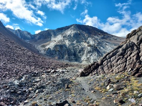
At the head of the valley, I saw a very clear hiker’s pat leading West. The treeline was obvious and I ascended further up. The hiker’s path took a turn to the right and ascended an amphitheater-like area. I worried this was going to be a long scramble up scree from here. However, the path made itself very clear and I slowly trudged upwards. Views opened up further as I climbed.
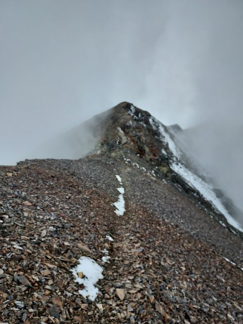
The last 1,000ft to the summit are steep but straightforward. Really no scrambling was needed though some spots were slippery. Just 200ft below the summit are a few false summits to keep things interesting.
Summit and Descent
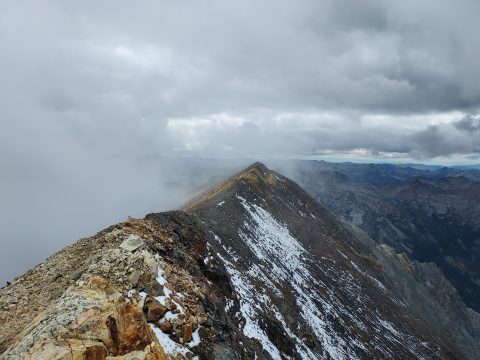
When I finally gained the summit, clouds impacted much of the views but that didn’t deter my relief and celebration. I must have been a sophomore in college when I first heard of this mountain- finally I achieved a climb. The summit itself was surprisingly inconspicuous- no marker, no register and plenty of points that looked like they could be the high point. I double checked my GPS and peakbagger to confirm I made the high point. I’d hate to expend all this effort only to later discover I didn’t get the high point. Then again, this is the kind of place worth returning to.
After a few obligatory photos and some lunch, I began the hike down. On steep ascents like this one, down hiking/climbing requires the same amount of effort. I passed the time musing about my next ultra-prominent adventures. Back down to the meadows, I took another breather and basked in the alpine glory. Part of me wished I’d backpacked to this point and spent the night. It was just so peaceful. Alas, I had other adventures to purse. I slid my way down the ridgeline and reconnected with the formal trail back to the start.
Sacajawea Peak was absolutely outstanding. For a peakbagger, it’s a prize but it left me wishing I’d planned more time in the Wallowas. Next time I’ll bag Aneroid Mountain and Eagle Cap.

No Comments