


Onward with my goal of climbing all the California County Highpoints! I bagged Eagle Peak, Hat Mountain and Mt Ingalls in about 48 hours and rounded out this most recent foray with Mt Lola and Mt Lola, North Peak. Mt Lola proper is 9,148' and the highpoint of Nevada County. The county line runs just North of the summit and its easy to bag the Sierra County High point less than a mile away. This unnamed peak simply called "Mt Lola North Peak" is 8,844'. The only difficulties of the latter is that its off trail. However, its an easy enough bushwhack for those accustomed to county high pointing. Here's my account in June of 2020.
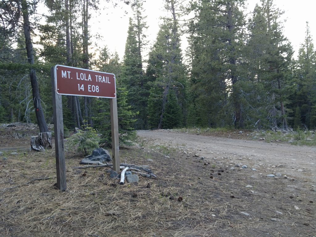
Mt Lola Trailhead
The Mt Lola Trailhead is easily accessesed from CA-89 running north of Truckee. I simply plugged in the spot to Google Maps and got there without issue (although I came from the North). From the South/I-80, its 14 miles North on CA-89 to Little Truckee Summit and the main turnoff from the highway. From the turnoff, I drove on Jackson Meadow Road (paved). I turned left at an obvious intersection, crossed the bridge over the Little Truckee River, then drove another 0.7 miles to a four-way intersectiin with Henness Pass Road. I turned right here and took the congested but very rocky dirt road another 3.4 miles West until I came to the marked parking lot for Mt Lola. Clearance wasn't an issue- I doubt any car would have trouble. However its slow going on the rocky sections of the road.
There was no parking fee when I arrived and plenty of space, even on a hot summer weekend. Here's a map of my hiking route-
I've included my stats on the route above.
Mt Lola Trailhead to Cold Stream Crossing
This hike took about half a day for me. Total distance was 10.4 miles and although steep in some sections, it was never difficult.
From the trailhead, I followed the well-trod path South and eventually paralleled Cold Stream. The path gained altitude slowly and there was abundant shade; a pleasant way to start. After about 1.2 miles of hiking, the trail almost intersected an old logging road. It was a little confusing as I thought the road was now the trail but the path followed alongside the road for another 0.8 miles.
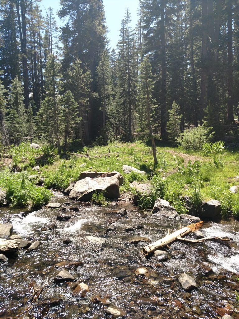
Two miles after the start, the trail clearly intersected the road and continued along the road a hundred yards to the crossing of Cold Stream. During June of 2020, the crossing was a bit precarious but not dangerous. Early in the season however, I can imagine it being impassable.
Cold Stream Crossing to Mt Lola Summit
For the first two miles, altitude gain was practically imperceptible. After the stream crossing, the trail generally steepened. The next mile also felt more alpine. There was a lovely meadow alongside cold stream which was quintessentially Sierra Nevada- green, lush and full of mosquitoes.
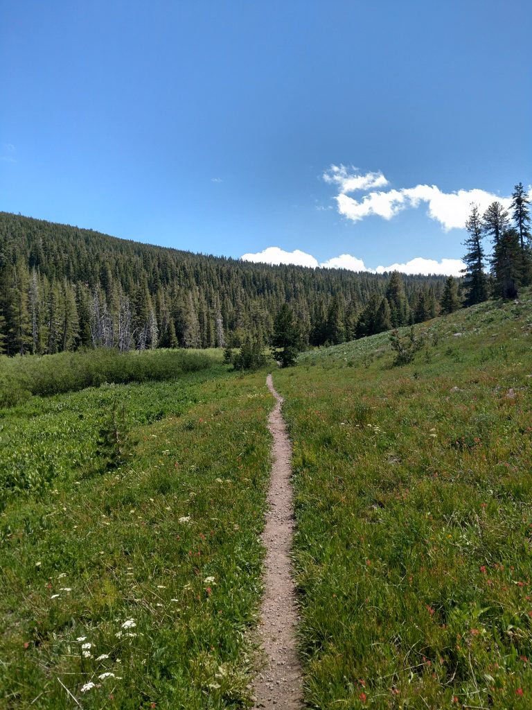
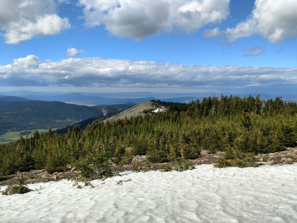
Past the meadow, the trail gains about 1,000' over a mile and a half on the way to the summit. I hit some large snowbanks that seemed nearly perennial at around 8,500'. Naturally the North-facing slopes hadn't melted, even in a low-snow year and June 2020. I negotiated these sections just with boots and poles. However, I'm glad I brought crampons as you just never know when it comes to the Sierras.
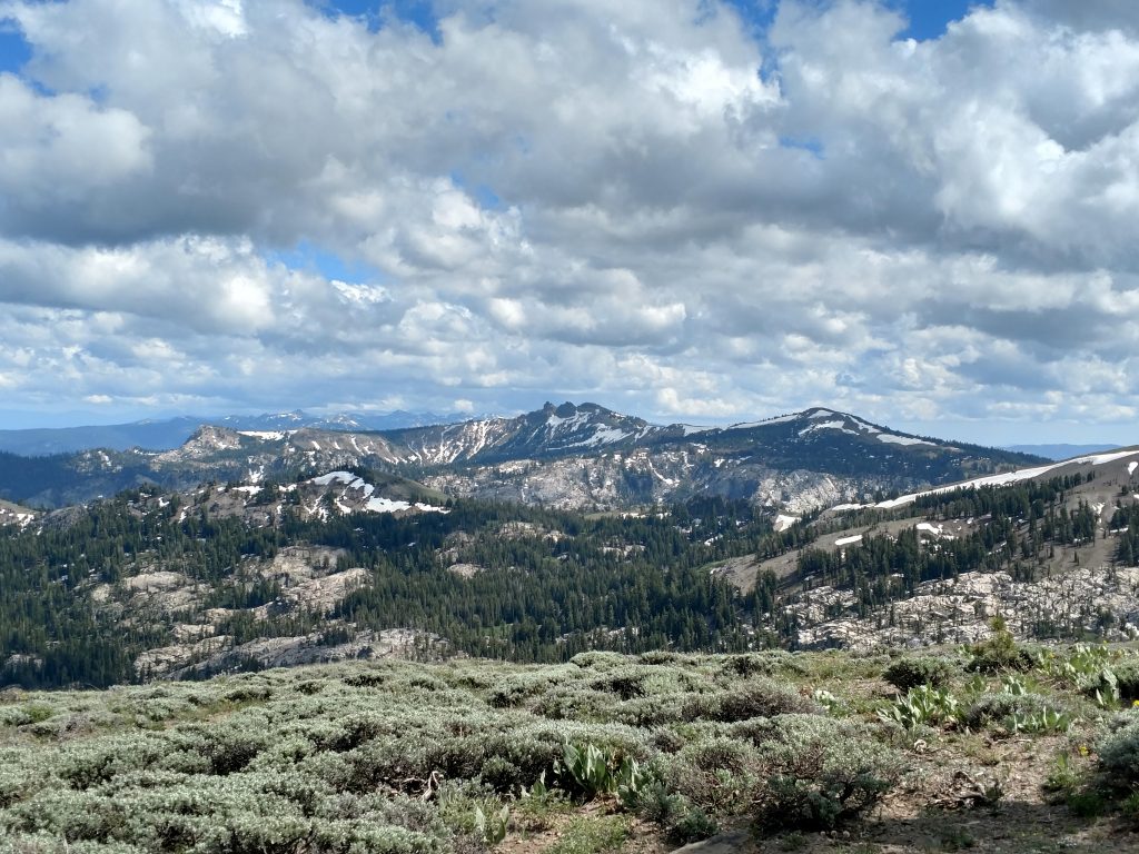
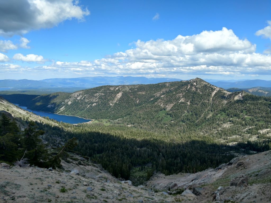
The summit is marked with a sign and a massive collection of rotting summit registers. Clearly this is a popular place. Nevertheless, I had the summit to myself due to my late start time. Views were outstanding of course-
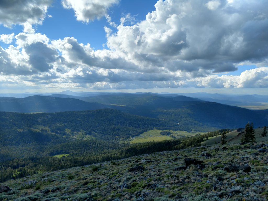
Mount Lola to North Peak
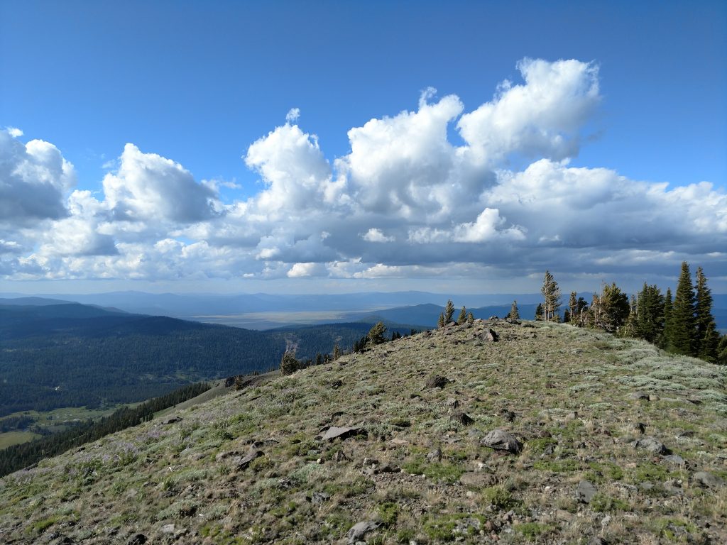
I took a nearly direct line from Mount Lola proper to the North Peak and highpoint of Sierra County. The distance between the two was about 1.2 miles. There's a very faint trail from time to time but for the most part its an open walk. There was one particularly nasty section of navigating a section of krummholtz.
Other than a well-concealed summit register, I never saw any indication that I'd crossed into Sierra County, much less reached its high point. The actual highest part is little more than a bump on the northern arm of Mt Lola. But, this summit register was far more fascinating than the previous- 100% of the names were crazy peakbaggers like myself. I love reading their stories and how far along they are on California's County High Points.
Descent and Return
The real bushwhack of this trip is the descent from Mt Lola North Peak to the trail. In the way of bushwhacks, it wasn't too bad- there's not a lot of thick underbrush to contend with. However, its very steep with very loose footing.
I picked my way down the slope, using my GPS for guidance. There was no herd path or cairns marking the way so I basically just took the most direct route possible. On Google Maps, it almost looks like there's a road halfway down but I did not find that true. Certain sections looked like there was once a road present but its long been reclaimed by the land. I inched my way down, sliding half the time and made my way back to the meadow from earlier in the day.
The descent on the trail was otherwise non-descript. I got back right around sunset.
Mount Lola itself was an excellent hike and there's plenty of reasons to make the trek to this lesser traveled part of Tahoe. Mount Lola's North Summit was less spectacular and not necessary if not a County High Pointer.

No Comments