


As I wrapped my way East in my home state, I turned my sights to a summit that's long been on my radar: Eagle Peak. Located in the far-flung Northeasternmost part of California, Eagle Peak has exceptional relief compared to its surroundings and is one of the most prominent summits in the State. Its part of the Warner Mountains at the Western edge of the Great Basin. My climb was non-technical but challenging and required a lot of driving into the wilderness. Hope this trip report helps if you do the same!
Getting to Eagle Peak's Patterson Trailhead
There are several ways of hiking Eagle Peak from all cardinal directions. I chose Patterson Trailhead due to the straightfoward drive. Although mostly on dirt roads, there's no part that needs high clearance or 4x4.
I first drove to Alturas, California which is the only major town in Modoc County. Filling up on gas and coffee, I drove South on Route 395 to the town of Likely, California. At the town's only intersection, I turned left on County Road 64/Jess Valley Road. This is a paved road.
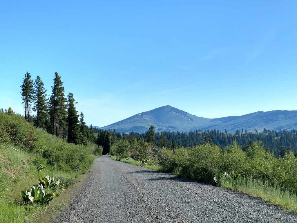
I took this road for about 9.3 miles to a fork and turned right on "Blue Lake Road". It was paved but in somewhat deteriorating condition. I took this road 14.3 miles to the obvious trailhead/sign for Patterson campground. The last half of this drive is unpaved but on excellent quality gravel/dirt. Plenty of low-clearance vehicles were at the trailhead.
There are campsites and pit toilets at the trailhead. Note that the trailhead was a little obscured at first but after driving around the campground I found the information board and path.
Here's my map which includes driving directions from Likely, CA to the trailhead and then the route I took. Note that I bagged two separate peaks that were totally off trail and these are not necessary if the only destination is Eagle Peak.
Eagle Peak Hike Overview
From the Patterson Campground, using the Summit Trail and an off-trail route to Eagle Peak, the out-and-back distance is about 17 miles. The trailhead is roughly 7,200' in altitude and the summit is 9,892'. The first 8 miles of the trail gain 1,300' over modest steepness with some up-and-downs. The final section is off-trail and a very steep ascent over loose rock and scree. I gained 1,400' in about 1.0 mile.
My route above included 2 side peaks that I bagged for fun- Emerson Peak and Peak 8742. Although neither have any significance, I anticipate peakbaggers have interest in these two P300s. However the vast majority of hikers in this area are only interested in Eagle Peak.
Eagle Peak: Trailhead to Emerson Peak (8,989')
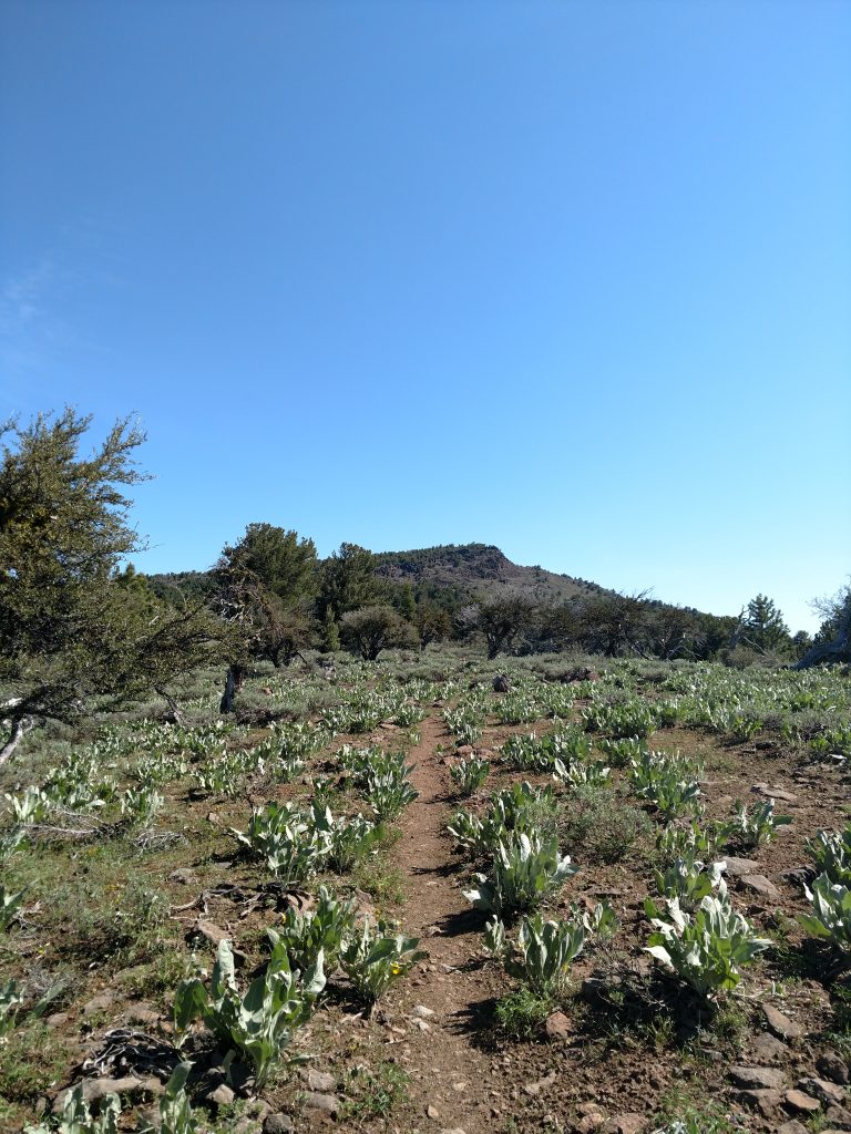
Departing the trailhead, I followed a path alongside an old wooden fence to the wilderness boundary, marked by the classic, rounded pentagonal sign. From here, the trail was really more of a herd path. I frequently lost the actual trail the further I traveled from the trailhead.
Early on, I came across a few junctions but Eagle Peak was clear in the distance and as long as I took the path that generally lead in that direction, I didn't worry about the junctions.
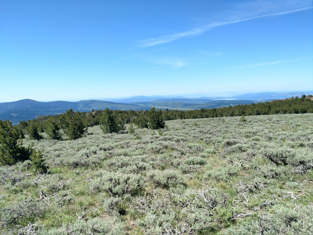
Hiking the Warner Mountains took me through an unusual contrast of landscapes. The mountain range lies at a junction in California where the Great Basin clashes with the extreme eastern edge of the Cascade region. As I walked along, sandy basins in the distance clearly pointed towards the regions aridity. Thick carpets of sagebrush dominated the landscape. However, it also felt like a sky island with flourishing forests of junipers and ponderosas.
Emerson Peak was on my list for this hike so I took a 45 minute detour to tag the summit. If you're not interested in this summit, the trail simply bypasses this arm of Eagle Peak.
I briefly departed the trail at a small cairn and bushwhacked to Emerson Peak, a Western States Climbers Peak. Whacking through the sagebrush was initially unpleasant but I found my way through and summited.
Emerson Peak to Trail Departure
I picked my way through the forest back to the Summit Trail and pressed on. Between Emerson Peak and my departure from the trail to Eagle Peak, it was a mix of up-and-downs and flat hiking. I flew by this section with ease.
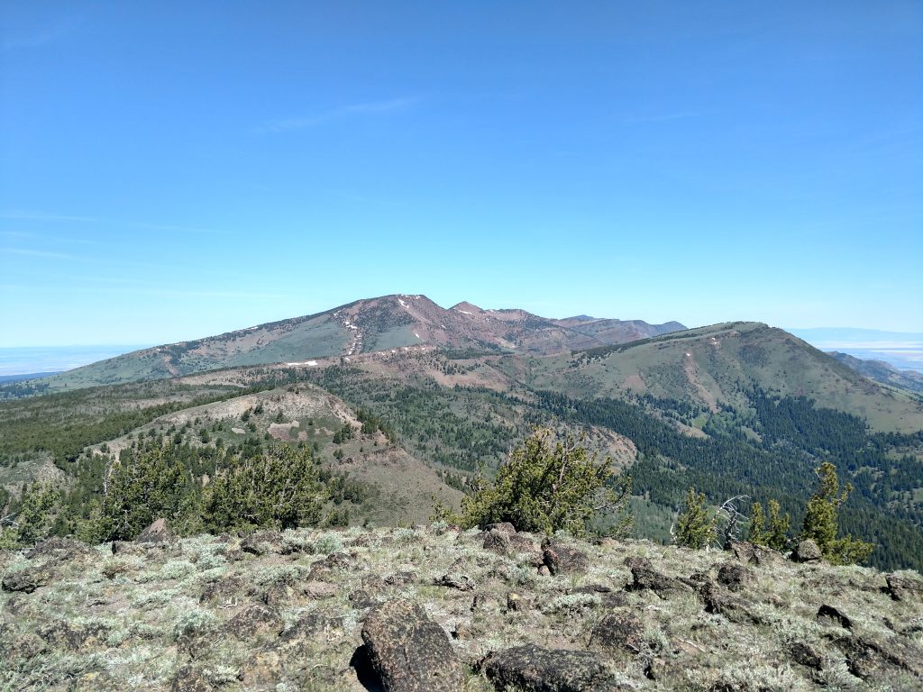
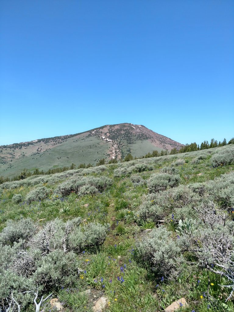
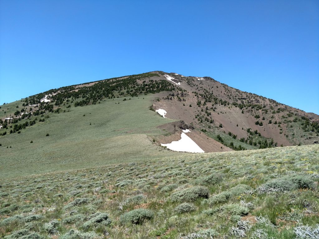
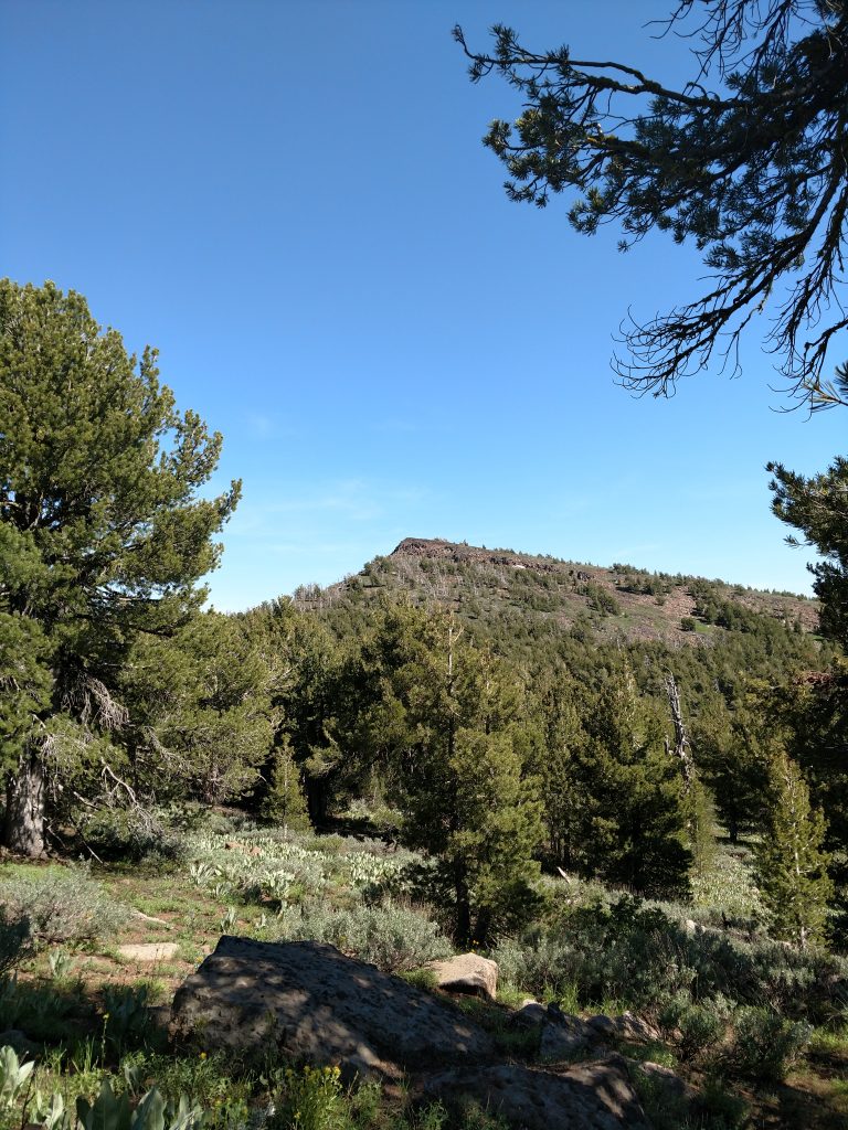
Eagle Peak's relief came into closer view as I headed North. Fortunately there was no snow although depending on the year, it can persist well into July. Some patches dotted the summit's east-facing slopes but I wouldn't need any protection or crampons.
Scramble to the Summit
I didn't do great research before this hike and thought it was a simple trail too the summit. However, as I kept following the "summit trail" (as its marked on maps), I realized Eagle Peak wasn't a part of it. The trail makes its way near a pass South of the summit but it became clear I had to go off trail.
Taking another "sagewhack", I made a brief descent and then gazed at the final 1,400' to the summit. From a distance, it doesn't look so bad. Up close, it was clear this would take a while.
This final section involved a lot of scree climbing. If you haven't heard of scree before, imaging climbing a 1,400' pile of gravel. Its not unlike climbing Mt Shasta during a low snow year or very late in the season.
Two steps forward, one step back was the name of the game for the next hour or so. Eventually I reached a small forest of stunted pines which helped a little with the scree. Slopes eventually gave way to the summit which was narrow but flat.
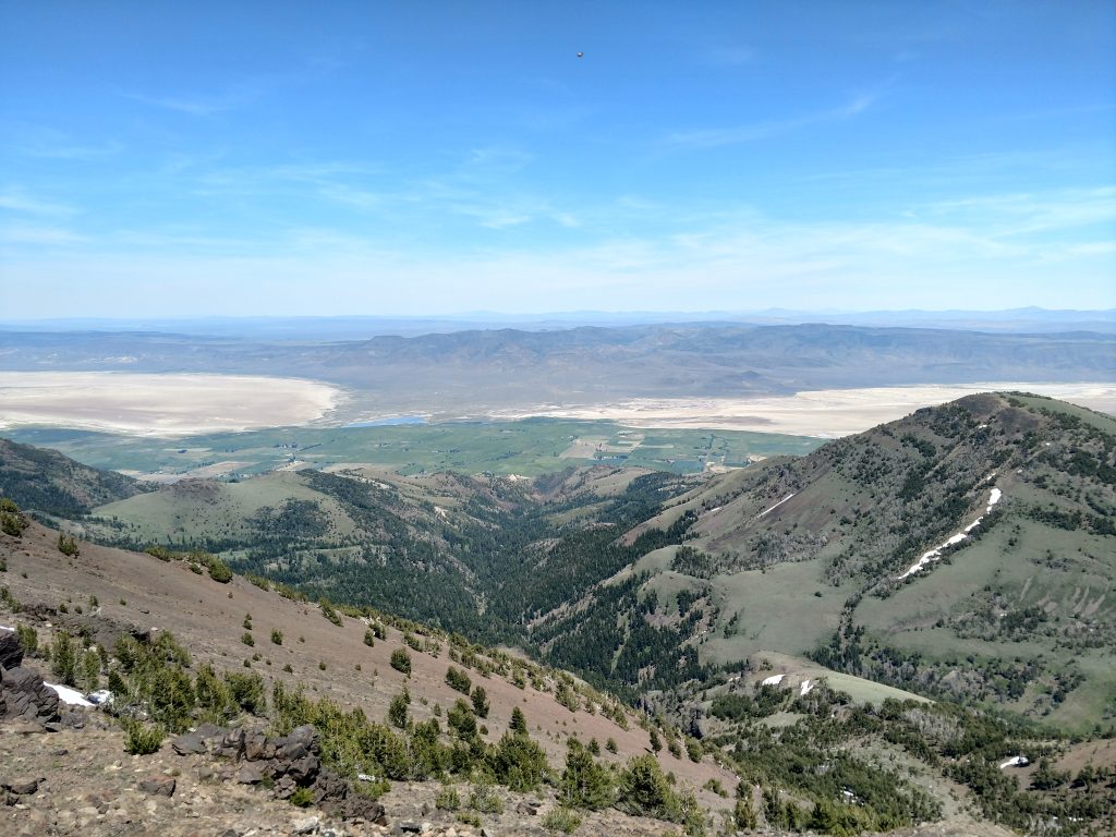
The first, most noticeable high point had a summit register filled with other county highpointers. Views were naturally glorious and nearly every major summit of the Warner Range and several of Northeastern Nevada were in view. It was a little hazy on the day I hiked so Shasta and Lassen were but faint outlines.
There were also swarms of various insects on the summit but none of them were the biting or stinging kind, thankfully.
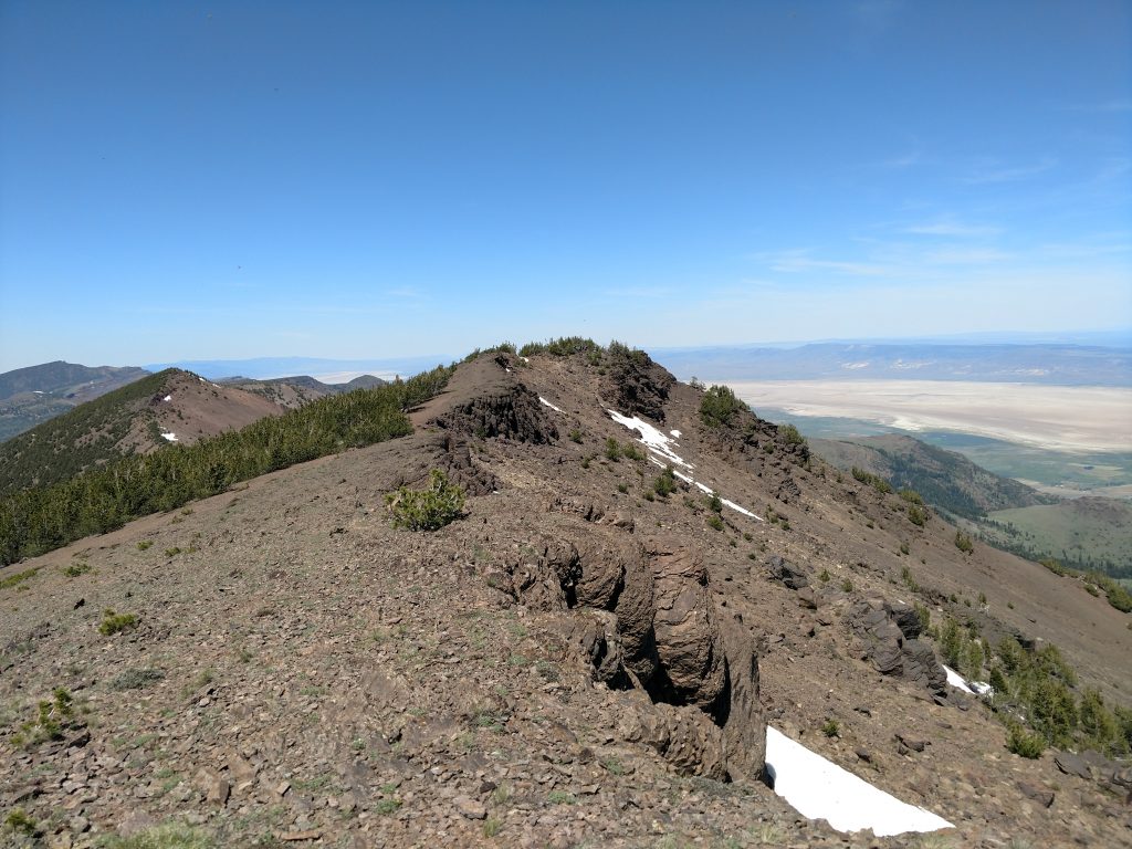
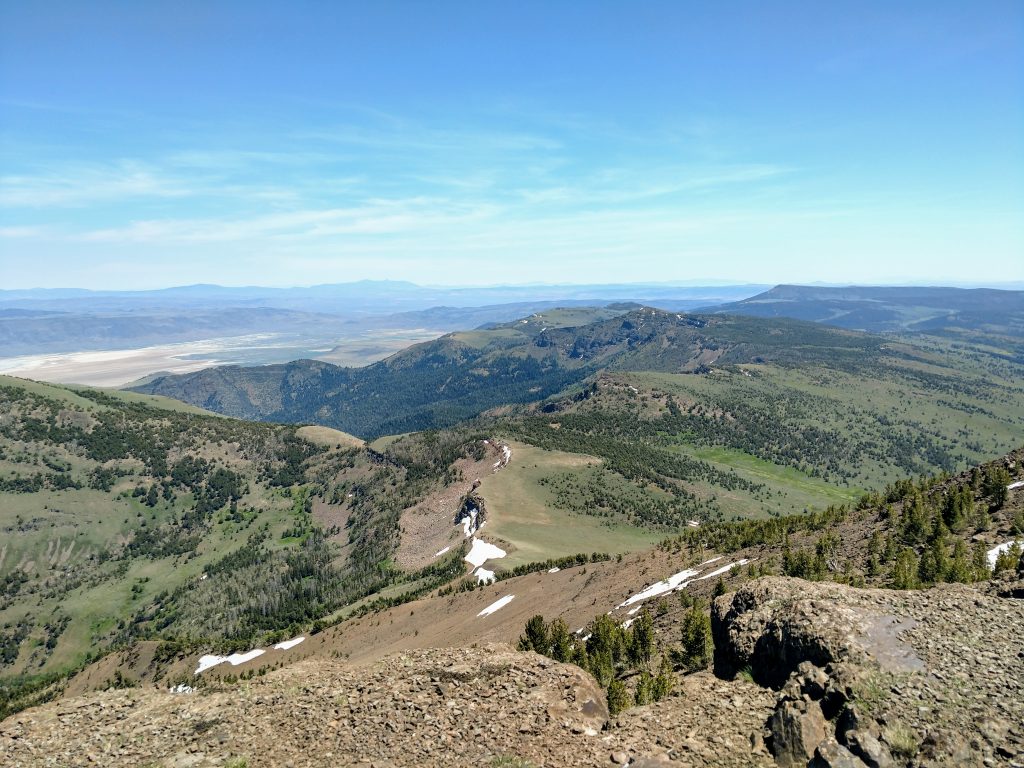
Just about 200 yards from the summit register to the North was another candidate for high-point. Although not hard to get to, the view of the Central and Northern Warner Mountains was exceptional. It was worth the minimal effort.
Descent and Tagging Peak 8742
Most probably go with the out-and-back option of Eagle Peak and there's on a few things to say about the return. Mainly, the trail is particularly faint in some sections- having a GPS track loaded beforehand was abundantly reassuring. Its doubtful any experienced hiker would truly become lost here given the openess of the range and the fact that heading South eventually takes you to the only main road through this part of the range. Nevertheless, even with a GPS I got a little turned around here and there.
I felt compelled to climb Peak 8742 given my proximity to it. This was another unpleasant scramble. There was a lot of talus and prickly vegetation on the way to the top. Although scarcely adding more than 0.5 miles to my total trip, this section took at least an hour. Views at the top were nice but nothing compared to Eagle Peak or Emerson Peak.
I got back to the trailhead after about 8 hours of hiking. Taking advantage of the fee-less site, I camped out at Patterson Trailhead where I was surprised to see a half dozen other parties.
Eagle Peak was an outstanding introduction to this remote hiking destination of extreme Northeastern California. I hiked Hat Mountain while I was in the area but look forward to further ascents in the future.

No Comments