


Mt Dana, at 13,061' is the second tallest mountain in Yosemite and an easy bag considering its altitude. My Lyell, just to the Southwest, is the true highpoint of the park but a much more complicated climb. Mt Dana was on my radar as a major prominent peak in California but its views and ease of access are probably why most climb it.
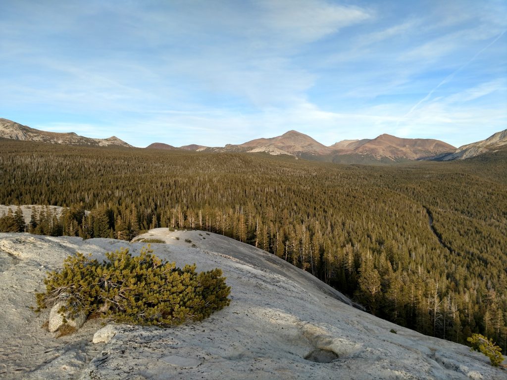
I took a recent trip to Yosemite as a last climbing trip in the high country before all the passes shut down. This trip included an awesome climb of Mt Conness and Mt Hoffman.
Hike Overview
Although Mt Dana is a straightforward hike (for a mountain of its prominence), there's some things to consider. First, there's no official trail although years of hikers have left a fairly clear route. Mt Dana is mostly above treeline and therefore subject to inclement weather all year. Finally, though most take 1/2 a day to hike it, some may need a full day, especially if not acclimated.
Here's my stats:
- Starting Altitude: 9,943' (Tioga Pass)
- Summit Altitude: 13,061'
- Gain: ~3,100'
- Loss: Negligible
- Round Trip Distance: 6.0 miles (some sources claim 7 miles)
- Hiking Time, including stops: 5 hours 15 minutes
Here's the route I took:
Mt Dana Trip Report
I started at a comfortable 930AM on this hike; there wasn't any snow this time of year so no need for an alpine start. The rangers at the Tioga Pass directed me to the use trail that begins just off the highway, a few steps outside of the park entrance.
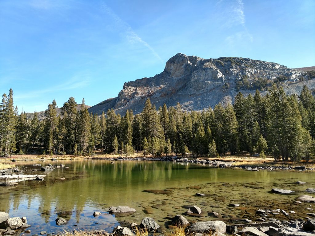
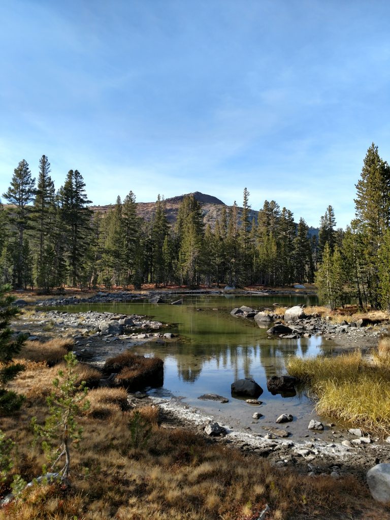
The first half a mile was like hiking in Tuolumne Meadows; gorgeous alpine ponds and stunted conifers with sharply rising summits created a mythical scene. I slowed down considerably as I took photos.
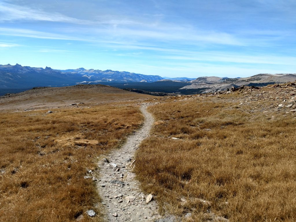
I reached the prominent western slopes of Mt Dana and started climbing the use trail for about 1,000'. Once above treeline, I could already see all the way to Mt Conness to the North and Tuolumne Meadows to the West. The weather was a comfortable 50 degrees with light wind; perfect weather for hiking the high country.
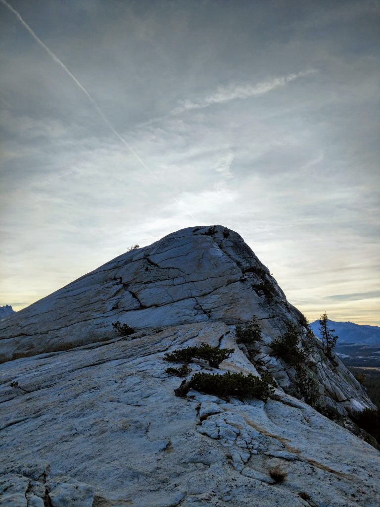
About an hour into the hike and at an altitude of 11,200', the trail flattened out and I noticed a few cairns marking the way. I took a snack break and snapped some photos of Mt Dana's impressive summit.
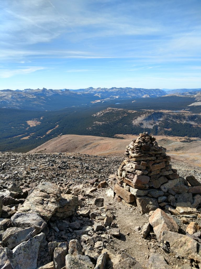
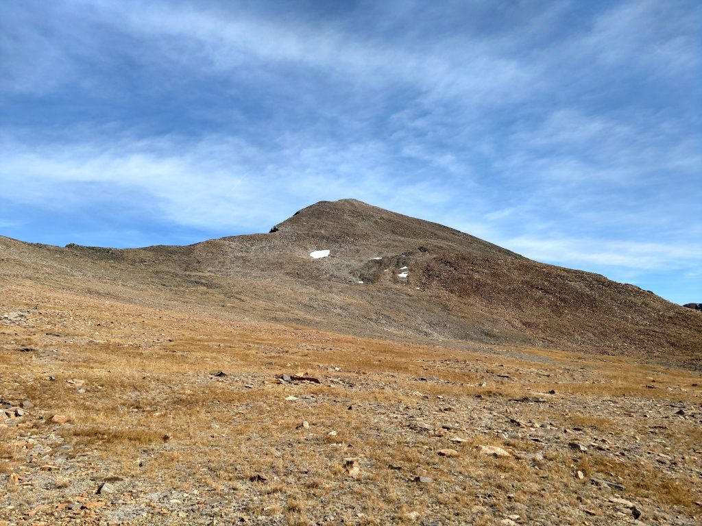
The final 1,900' of hiking and rock hopping are slow but straightfoward. You can see the whole route from the photo above. Other's have written about the main trail getting vague in this section but I had no trouble. It took me about an hour an a half to finish from the flat section.
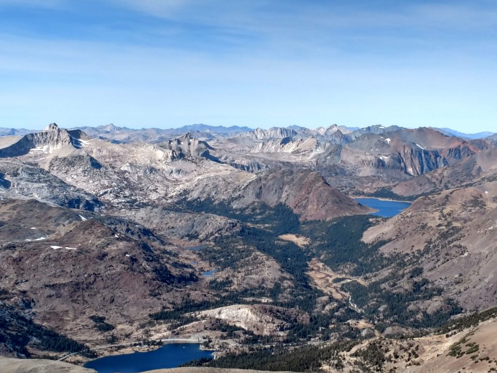
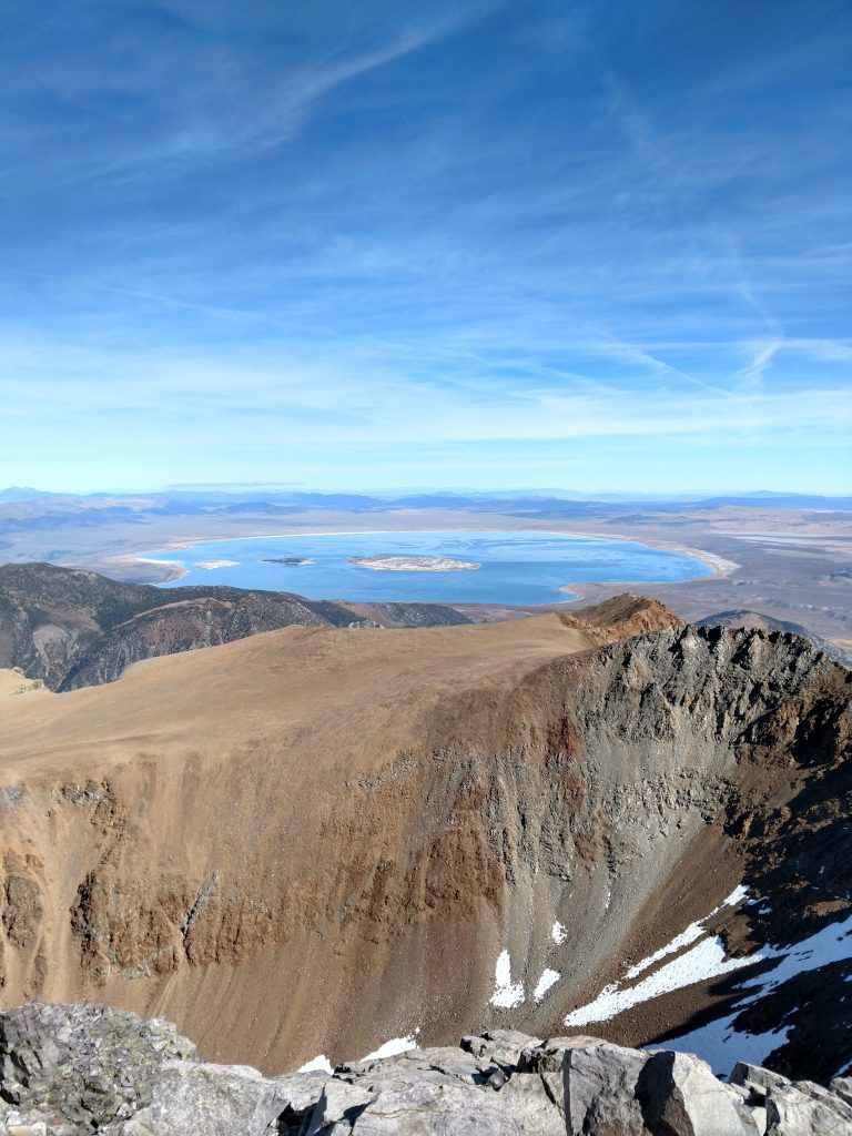
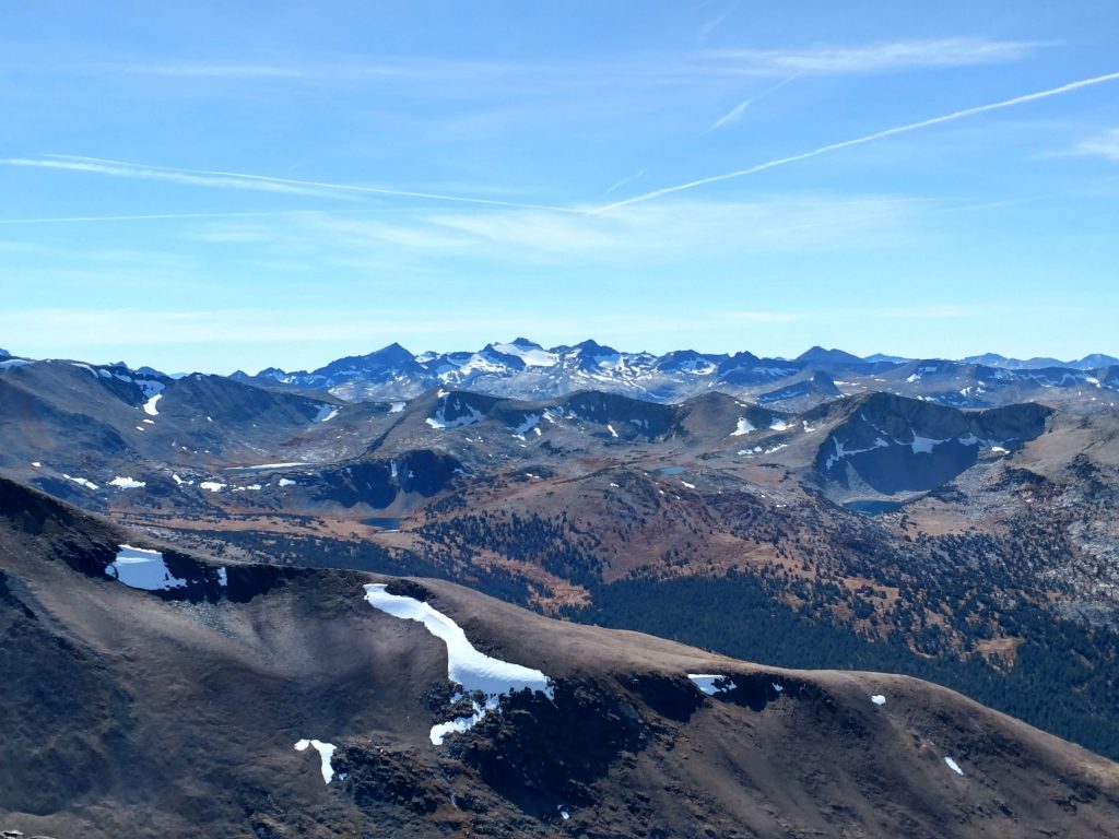
Mt Dana's summit had incredible views of several Eastern Sierra landmarks. Mono Lake's massive size could only be appreciated from this altitude; it looked like an inland sea. Most of Yosemite National park was visible including every major summit on the Sierra Crest. Truely outstanding-
Other summits nearby
The climb down Mt Dana was straightforward and enjoyable. I didn't encounter any scree or loose rock to speak of. It took about 1/2 a day, total.
I breifly considered scrambling down Mt Dana's South-westerly arm to the saddle between it and Mt Gibbs. Mt Gibbs is on the famous Sierra Peak Section and more dedicated climbers go for a combination of Dana and Gibbs. I felt the scramble down was far too hazardous and settled on climbing Mt Gibbs from the more straightforward West Slope approach.
As I had several hours of daylight left, I drove back to Tuolumne Meadows and bagged Lembert Dome, a nice 3 mile hike with an interesting scramble at the end. I caught a great view of Mt Dana again in the sunset-

No Comments