


Mt Hoffmann is a 10,850' mountain located smack dab in the middle of the park, close to May Lake. After an excellent ascent of Mt Conness on the Eastern boundary, I needed another climb that wasn't going to take as long. Lo and behold, Mt Hoffmann was a short detour on my way back to the Bay Area. I settled on a sunrise hike.
Mt Hoffmann Overview and Trailhead
This hike/scramble is located off May Lake Road, accessed by Tioga Pass Road. As many know, Tioga Pass is closed during the winters which last from approximately late October through May, varying seasonally. (I snagged it in late October!)
May Lake Road is accessible to most vehicles but bumpy and unpaved. There's plenty of parking at the trailhead and pit toilets.
My hike's stats:
- Starting Altitude: 8,855'
- Summit Altitude: 10,850'
- Gain: ~2,000'
- Loss: Negligible
- Round Trip Distance: 5.6 mile
- Hiking Time, including stops: 4 hours
Note that after May Lake, its more of a route with several use trails eventually leading to the summit. Here's my hiking map:
Trailhead to May Lake
Although it's about a half day hike, a predawn start was excellent for views and crowd avoidance. I easily found the road up to May Lake and set off from the trail near the bathrooms. The trail was in excellent condition.
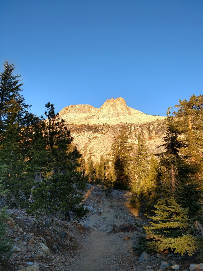
From the parking lot to May Lake, its a little less than 1 mile and with 500 feet of elevation gain. The trail is leisurely at first as it meanders through the woods. The imposing East-facing slope of Mt Hoffmann looked so close.
This early in the morning I saw not a soul. However, later on in the day, I discovered how popular this trail is. Not quite as congested as Half Dome but certainly not a backcountry trail.
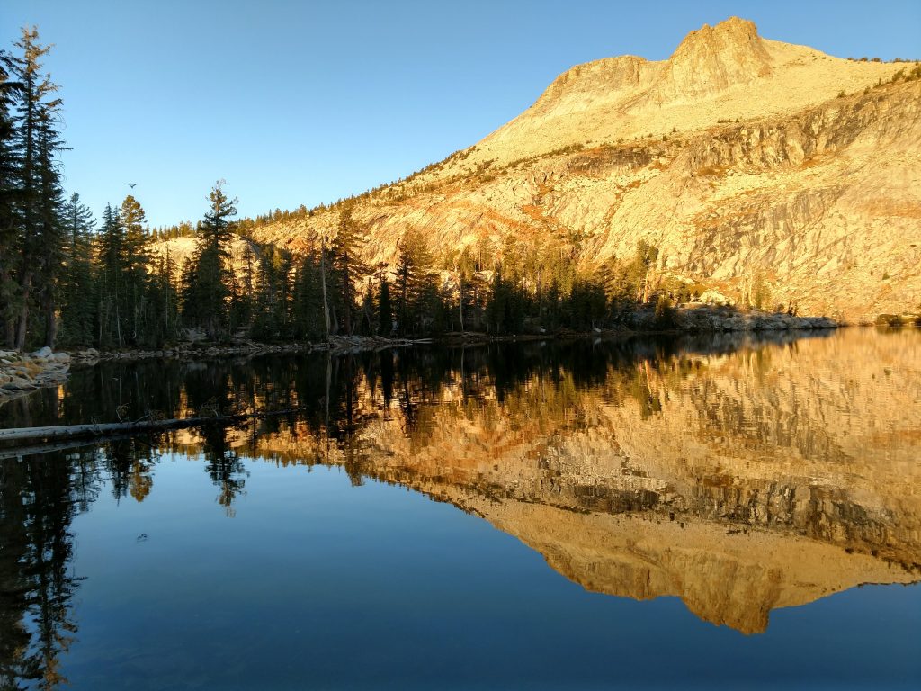
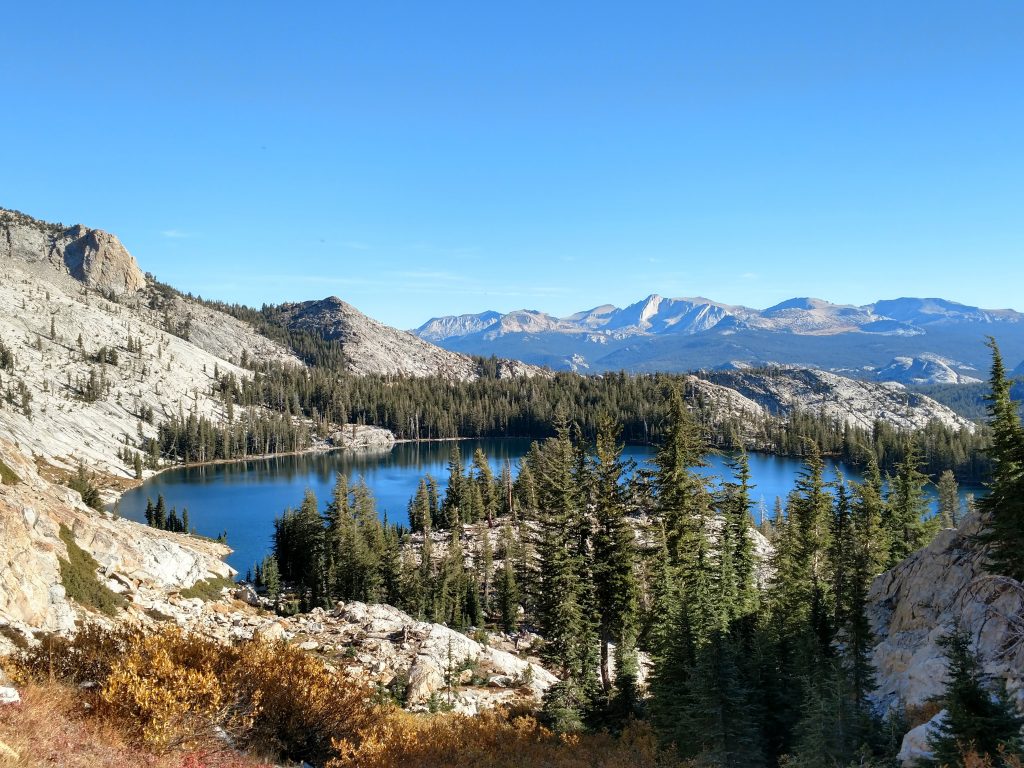
After about 30 minutes of hiking, the trail leveled out and I arrived at May Lake. It created a perfect mirror of Mt Hoffmann in the morning.
May Lake to Mt Hoffmann's Summit
It was slightly trickier after this. There are no signs for the trail to Mt Hoffmann so I'm glad I familiarized myself before getting here. A well-worn use trail circles the Southern shore of May Lake before gently ascending in a Southwesterly direction. I was completely fooled by the false summit but I continued on the use trail until I was sure I was off track.
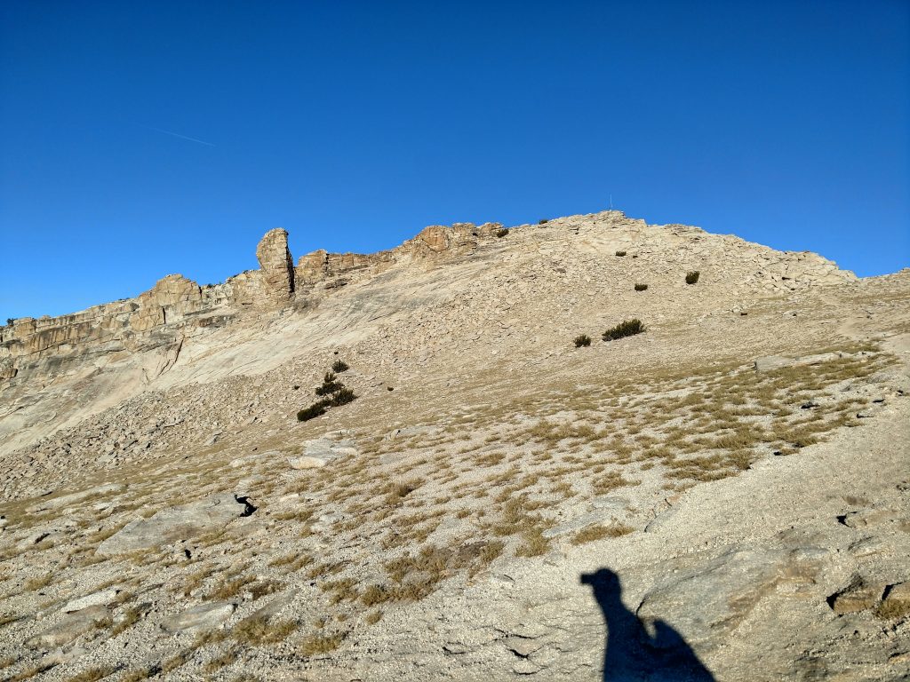
At just about 9,600' the use trail reaches a flat, bench-like area, loses a tiny bit of altitude and then dog legs into a straight ascent of Mt Hoffmann's East-facing slope.
Up until this point, the use trail was quite clear. It becomes faint and splits off into multiple routes from here but as long as I kept the same bearing, I found my way. Fortunately I wasn't fooled by the false summit.
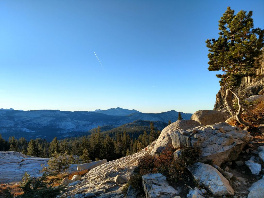
Steadily I climbed until reaching a noticeably flatter section with a clear route to the top. I followed a clear path to the summit block. The last 100-150ft involves some non-technical and unexposed scrambling. It took no greater than 20-30 minutes to navigate this final section-
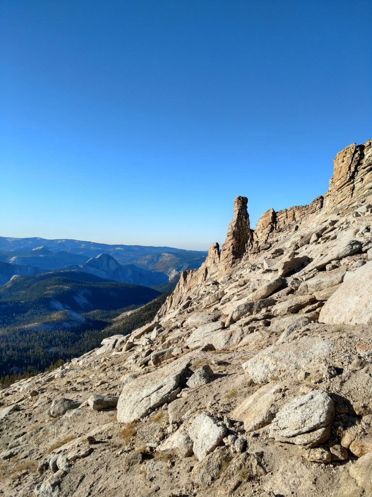
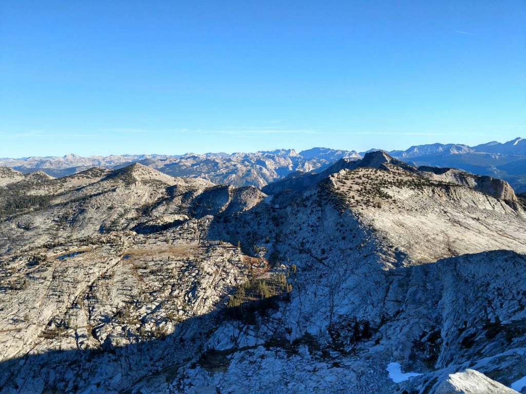
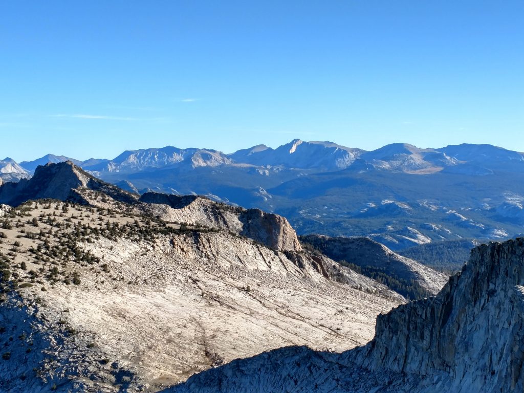
Mt Hoffmann Summit Views
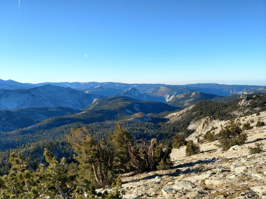
Wow what a panorama I had at the top! Every major landmark in the park was visible including Yosemite Valley, Half Dome, Clouds Rest, Hetch Hetchy Valley, Tuolumne Meadows, Tenaya Lake, Red Peak and Mt Lyell. A few less well-known but still classic summits rose in the distance too including Tower Peak, Mt Conness and Mt Dana. It was totally clear, no smoke or clouds in the sky.
I searched for a summit register but found none- probably too visited to keep a continuous log.
Back Down
It was mid-morning by the time I descended. Though I was alone for the whole trip up, I ran into about a dozen hikers on the way down. Glad I was up early!
May Lake was just as glorious, now reflecting the Eastern Sierras with midday sun-
I made it back to the trailead at about 1030; the only thing that slowed my pace was all the photos. Despite the glorious weather on a Saturday, there weren't a lot of people in the parking area; October is clearly the secret to Yosemite without the crowds. Hope I'm back before Tioga Pass closes!

No Comments