


Tecate Peak is an intriguing summit located just 3,000 feet from the international border. Despite being so close to the otherwise heavily monitored boundary, its surrounded by wilderness and is surprisingly accessible. While at a conference in San Diego, I ventured out to this curious corner of San Diego county and hiked the road to the summit.
Driving Tecate Peak
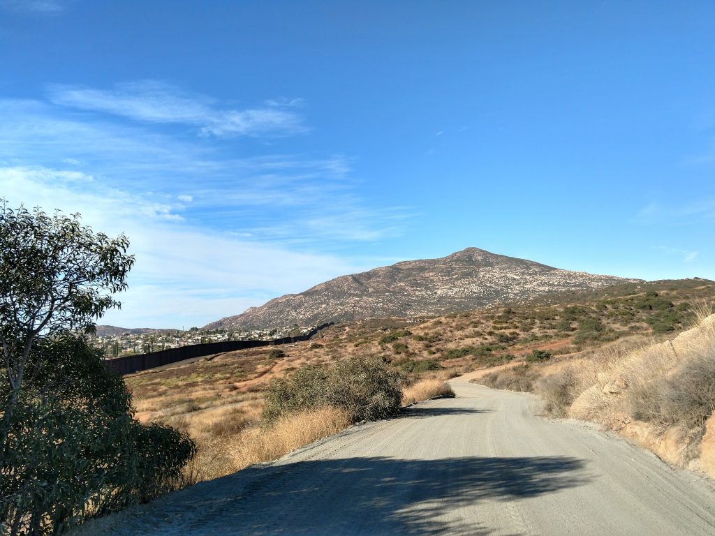
This mountain is located about 1 hour from downtown San Diego, just outside of the small California town of Tecate. Its named after the far larger and more infamous town of Tecate, Baja California, Mexico. There's a formal border crossing nearby.
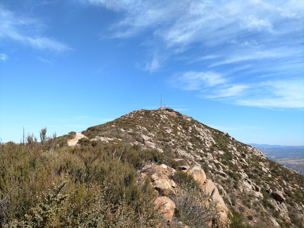
Tecate Peak is 3,888' tall and rises sharply above the surrounding, mountainous terrain. A radio tower sits at the top and a well-graded dirt road climbs its slopes. No doubt the road is kept in excellent condition by the ever-present border patrol.
Its possible to simply drive to the summit but I was in a rental and wanted to hike anyways so I pulled off to the side and hiked most of the way. Here's my map:
Driving Tips- If you google driving directions to Tecate Peak, you'll most likely see a route that approaches from the North via Bowmens Road. When I came here in November of 2019, the road had a no trespassing sign. I continued on State Route 94, turned Right on State Route 188 and followed it to Tecate, California. At the sign saying "International Border 1500 Ft, I turned right and then made an immediate right on a road labeled as "Tecate Mission Road" on Google Maps. I followed this road as it paralleled the border and drove as far as I felt comfortable.
Generally speaking, the road was in excellent condition. Low clearance vehicles would have trouble but most vehicles should not.
My Route up Tecate Peak
My hiking stats were the following:
- Distance: 7.5 miles
- Duration: 2 hours, 45 minutes
- Average Speed: 2.7 mph
- Minimum Elevation: 2467 feet
- Maximum Elevation: 3880 feet
- Total climb: 1515 feet
- Total descent: 1490 feet
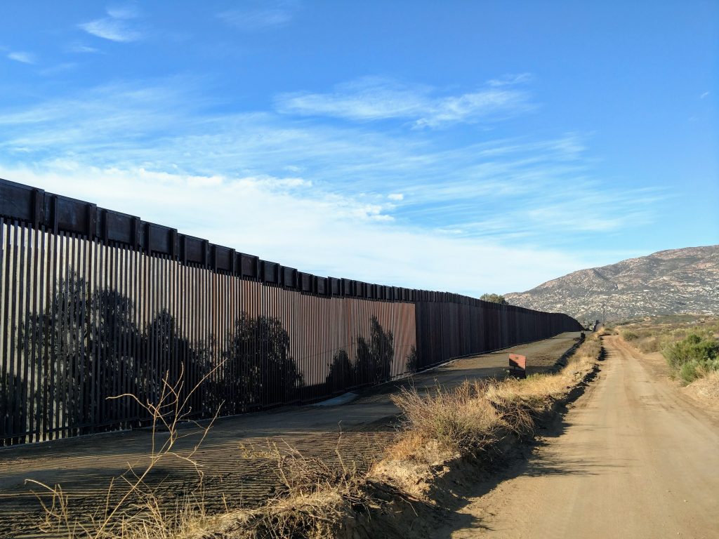
Ditching the car at a clearing off the side of the road, I set off. The road is steep but switch backed, making for fairly straightforward hiking. As I gained altitude, I saw the international border fence extending for miles to the East. However, as you see above, it abruptly terminates in this mountainous region.
A mountain biker and a few border patrol folks passed me as I climbed. Nobody really paid any attention to me; guess a guy hiking alone with a hydration pack doesn't really flag any warnings.
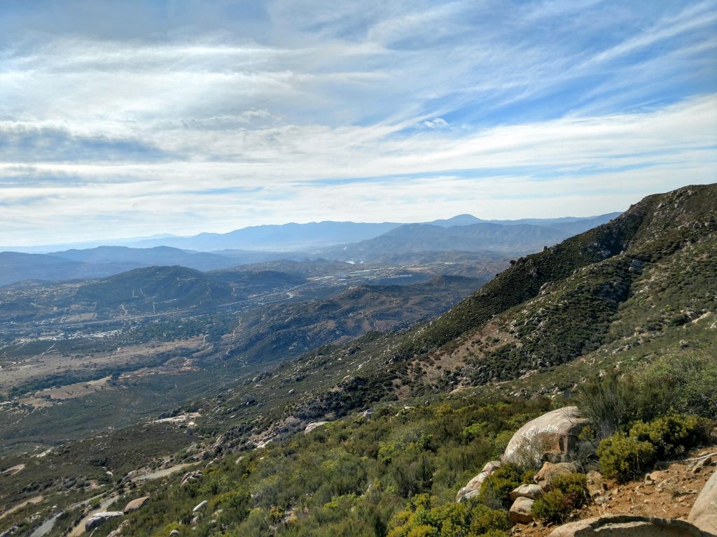
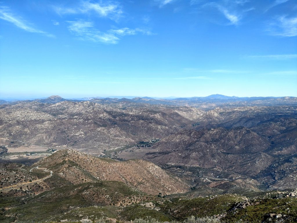
The views really open up towards the top. To the South, the endless summits of Sierra de Juárez stretched into the distance. Although I was less than 25 miles from the ocean, the environment was firmly desertous- I think Tecate Peak is in the rain shadow of Otay Mountain to the West.
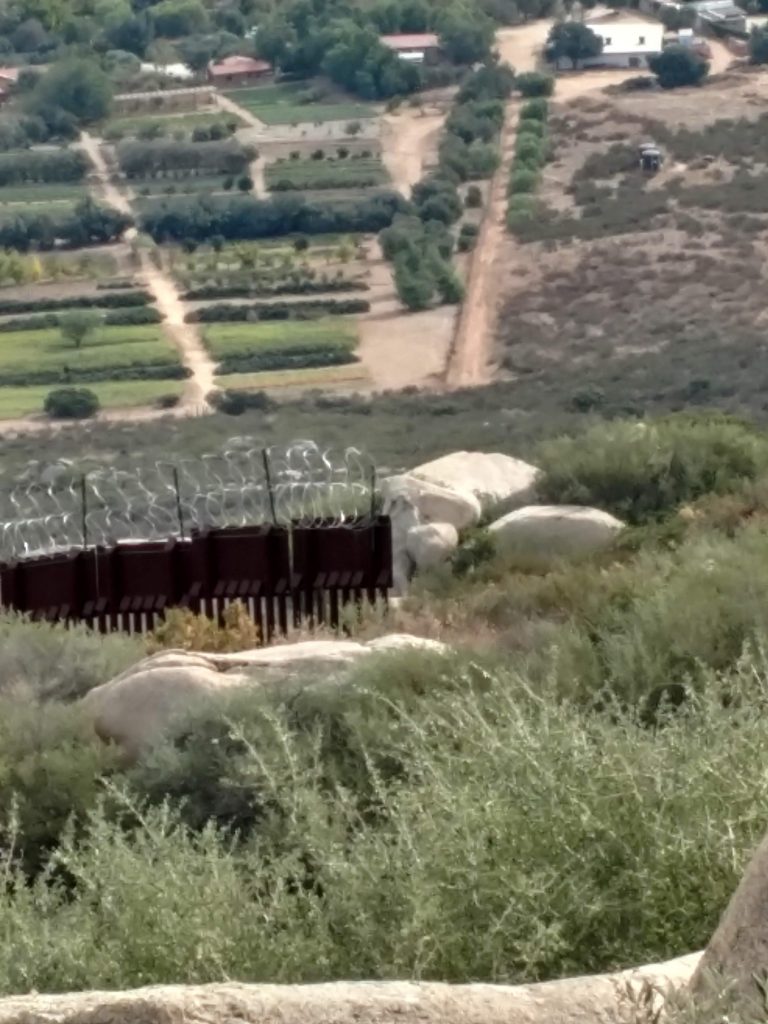
Towards the summit, the road gets within 200 feet of the border and I saw a few herd paths heading South. It made me wonder who might use them.
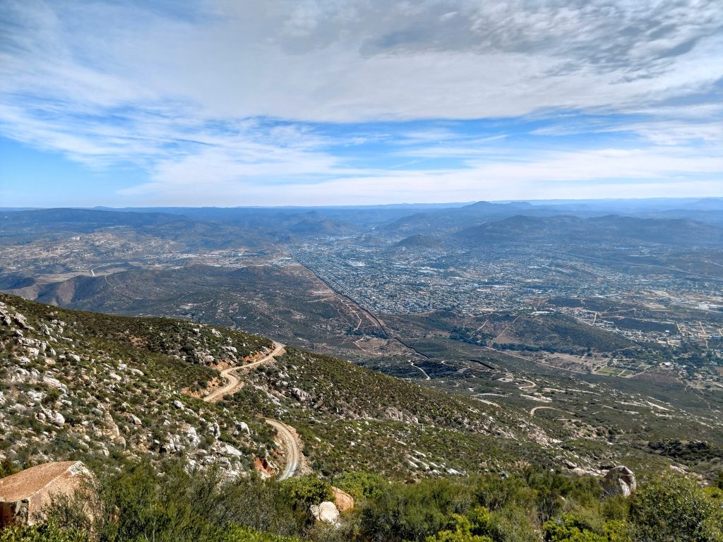
I gained the summit within about an hour of starting. There were incredible views of nearly all the major summits of San Diego County including Mt Cuyamaca and the Laguna Mountains. I'm fairly certain I could see Hot Springs Mountain way off in the distance.
The summit has a lot of radio towers and some border patrol cameras. I didn't find a marker nor a summit register. I'm sure BP would frown on the latter.
On the way down, I ran into the same border patrol officers but no other hikers or bikers. It was an oddly solitary place. Overall, Tecate Peak was a beautiful though rather bizarre place to hike

No Comments