


Chocolate Peak and Chocolate Lakes are hiking and off-trail trekking opportunities in the Eastern Sierras. Both are easy day hikes near Bishop, California
On a recent weekend trip to Bishop, California that included White Mountain Peak, I was dead tired from the 14 mile trip to 14,000'. Although I wanted a climb in the Sierras, I didn't have the energy for something significant so the ranger directed me to Chocolate Peak, 11,682. This is a subpeak of the Bishop Pass area and is literally overlooked by the taller summits of Cloudripper and Mt Goode. Nevertheless, its a nice summit in itself and shouldn't be neglected by hikers in the area. Even if I somehow missed the peak, the Chocolate Lakes area great hike too.
Chocolate Peak and Chocolate Lakes Hike Overview
This is a half to 3/4ths of a day hike for experienced hikers. Its a good experience to off trail travel too with a little bit of route finding and scrambling. Here's the stats I had on this hike:
- Total Distance: 6.3 miles
- Total Time with Stops: 5 hours (lots of photo-taking!)
- Altitude Gain: ~1,800'
- Altitude Loss: Negligible
- Starting Altitude: South Lake Trailhead, 9,825'
- Highest Altitude: Chocolate Peak, 11,682'
Getting to South Lake, Chocolate Peak Trailhead
The trailhead is near South Lake which is about a 21 mile, 45 minute drive from downtown Bishop. Here's the directions. Overnight stays require elusive permits from Inyo National Forest and are hard to come by with same-day reservations. The parking lot at South Lake also frequently fills up on holiday weekends so get there early!
Here's a map of the route I followed:
Trailhead to Chocolate Lakes Side Trail
It helps to have a great map of the area and I recommend Tom Harrison's Bishop Pass North Lake-South Lake Loop. They sell them at the Bishop Inyo National Forest Ranger Station.
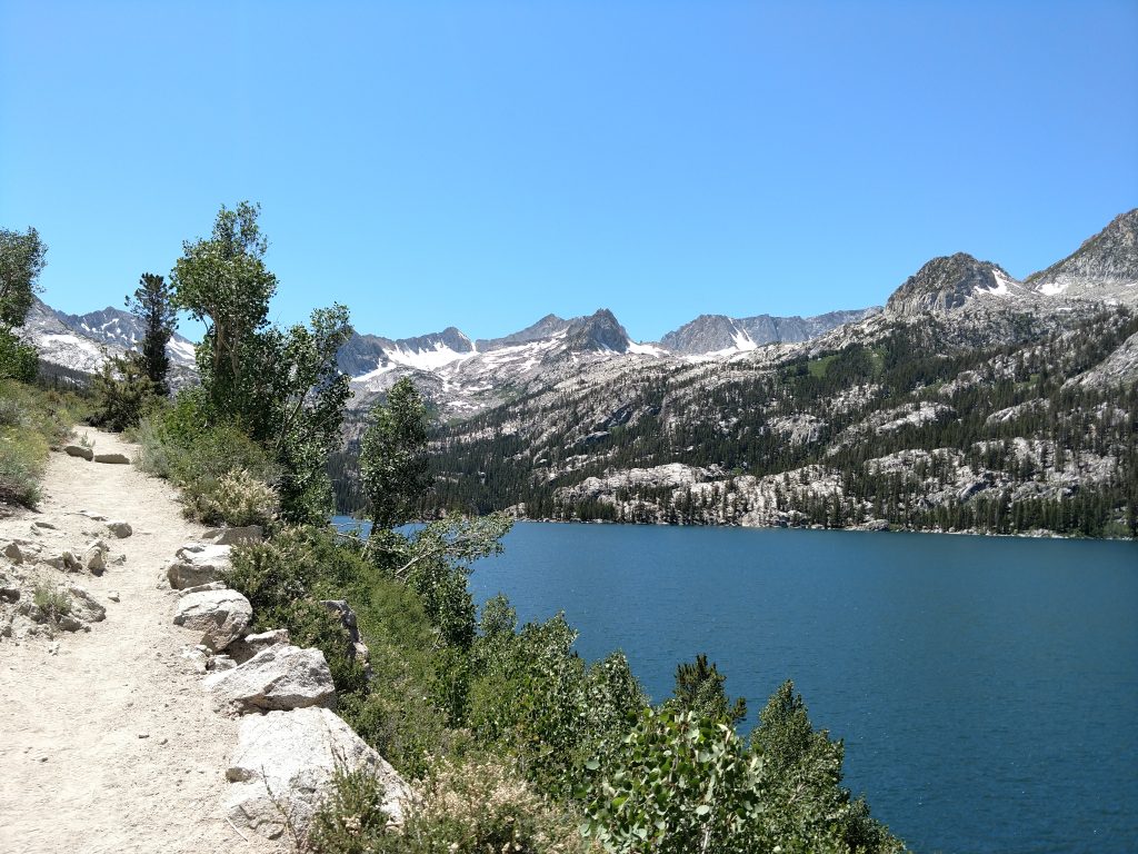
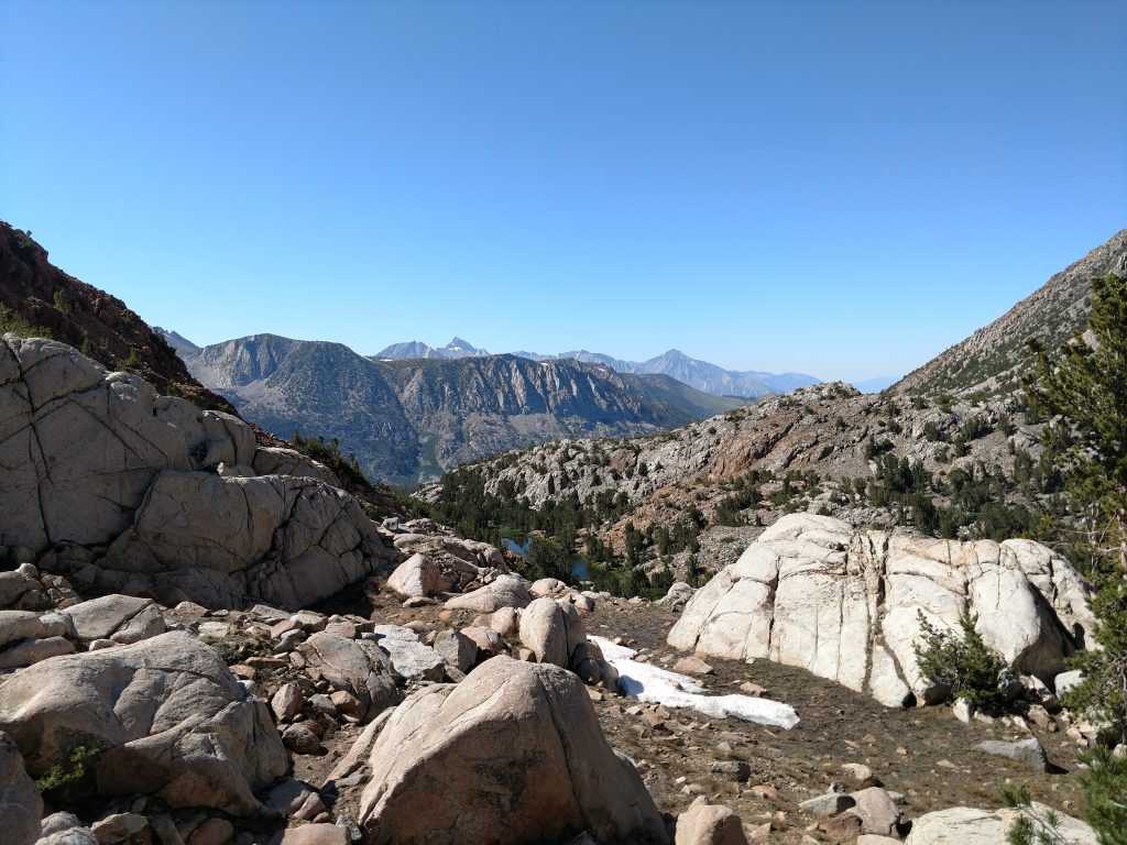
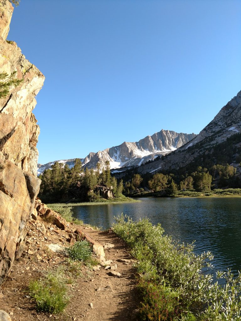
Starting at the South Lake Parking lot, altitude 9,825', I went South for 0.8 miles, steadily gaining altitude as the trail overlooked the lake. All the classic glories of the Sierra Nevada were already in view; crystalline lakes, jagged summits and lingering snow above.
At the first junction, I continued on the Bishop Pass trail for alnother 0.6 miles to the junction with the marked herd path to Marie Louise Lakes. I hiked another 0.5 miles to the less-well marked junction for Chocolate Lakes. The altitude was now 10,720'.
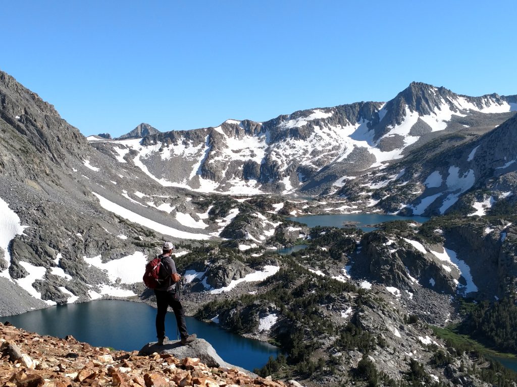
Chocolate Lakes Route to Cloudripper Pass
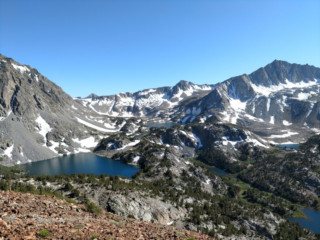
The trail for Chocolate Lakes heads east and immediately comes upon Bull Lake. Without wind, it created a perfect reflection of my destination. I skirted around the North side of Bull Lake and followed the increasingly faint trail to the chain of three Chocolate Lakes.
It was confusion from here on up. The map makes the trail thread from the South shore of the first lake the North shore of the Second lake and the West shore of the third. However there's a very boggy section between Bull Lake and the first Chocolate lake that I confused as the first lake. Eventually, I settled on a chose-your-own-adventure Path and rounded the South shore of the two first Chocolate lakes. There's a few scattered cairns and herd paths all along the way so I just relied on my map, compass and GPS.
Shortly after the second lake, the route disappeared as did all the cairns. I was on my own. I found a scrambling route and finally made my way to the pass separating Cloudripper and Chocolate Peak. My GPS indicated the pass was roughly 11,300'. Total distance between the junction with Bishop Pass Trail and the pass between Cloudripper and Choclate Peak was a little over 1 mile.
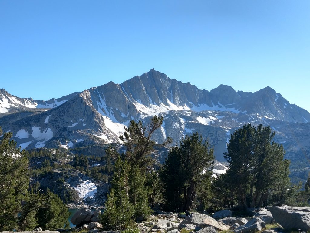
Final Scramble to Chocolate Peak
The last section was a class I-II scramble to the summit. It was only another 0.2 miles with 300' of gain. Several paths existed and I picked up the cairns again. It took no longer than half an hour to get to the summit from the pass.
There's a 360-degree panorama at the top that includes most of the lakes and summits near South Lake. I could see deep into the Bishop Valley too. For an 11,000' peak, it sure wasn't a difficult ascent!
Chocolate Peak to Ruwau Lake and Bishop Pass Trail
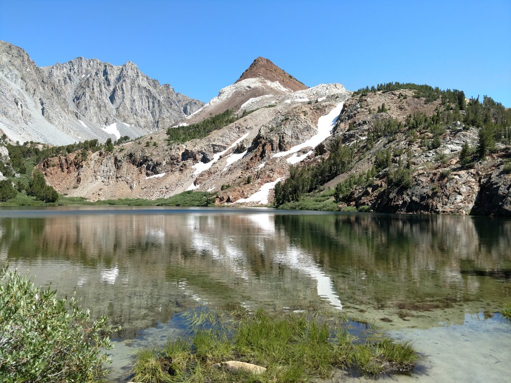
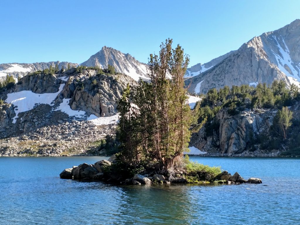
I traced my steps back to the Pass, then found a descent herd path to Ruwau Lake. This was the finest lake. Sitting at 11,044' , the lake had an island that seemed artistically placed. I spent 20 minutes trying to capture a good photography:
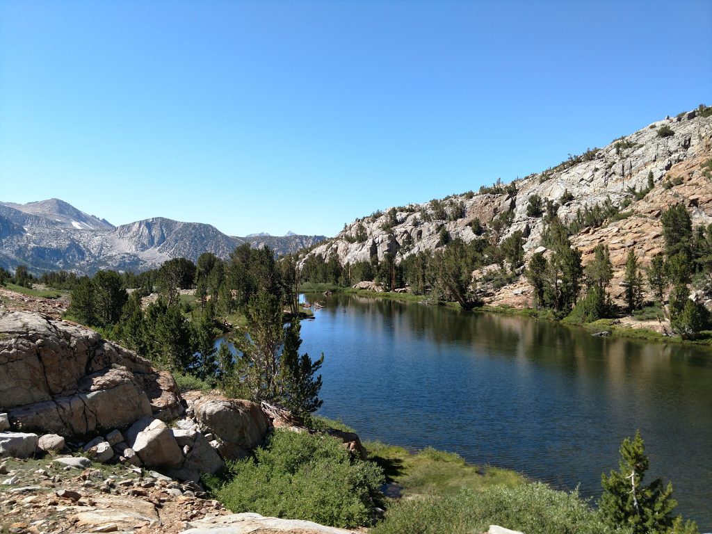
From Ruwau Lake's North Shore, I followed another herd path about 0.5 miles back to the Bishop Pass Trail. The altitude was now 10,800' exactly.
Bishop Pass Trail back to South Lake Parking Lot
This trail never let up in the views. I followed the Bishop Pass trail North back to South Lake and followed the serene shoreline of Long Lake. Several fishers were still out as the sun was setting.
It was 0.9 miles from where I picked up the herd path at the Bishop Pass trail back to the original turnoff (see the map above). Then I followed the 1.9 miles of the Bishop Pass trail back to the trailhead. With the dimming light, the trail was a bit ambiguous in some sections so the GPS was comforting.
Well this wasn't too hard of a hike! It took me about 5 hours, mainly due to the constant picture taking. But its an excellent 1/2 day hike in an area littered with options. If you're in the Bishop Area, put this one on your list!

No Comments