


White Mountain Peak stands at 14,252' and is the highest summit of the White Mountains of California. It's frequently climbed in preparation of Mt Whitney.
Though it towers over one of the deepest valleys on the continent, White Mountain Peak is still overlooked by hikers preferring the Sierras. Nevertheless, this summit is actually a great adventure and the range known as the White Mountains of California is a less crowded alternative to the Sierras. Its also a fantastic introduction to hiking at altitude. When a friend and I couldn't secure a permit to climb Middle Palisade, we turned our sights to this glorious summit.
Getting to White Mountain Peak's Trailhead
Perhaps one of the reasons for White Mountain's relative obscurity is the difficulty of getting to the trailhead. By 4-wheel drive standards its relatively tame but the road up is certainly remote.
The nearest town of any size is Big Pine, California and it took us about 1.5-2 hours to get to the trailhead. We drove up CA 168 for 12.9 miles and instantly lost cell phone reception once we got in the mountains. We turned left at the well-marked White Mountain Road with signs for the Ancient Bristlecone Pine Forest and drove 10 miles to the visitors center. The first 10 miles are paved. After the visitors center, we drove 13.5 miles on a fairly good quality dirt road to the Patriarch Grove, then turned left at the fork and drove the final 2.8 miles on a deteriorating road to the locked gate.
At the gate, a bunch of paranoid drivers had the hoods of their cars up, thinking this would prevent marmot problems (apparently Marmots go for the radiator hoses and the sweet-smelling scent). From what I hear from the rangers, this is entirely unnecessary. The whole tarp covering your car is unnecessary here.
We got a flat on the way down- the road has sharp rocks that are unavoidable and flats frequently happen up here.
Map of White Mountain Peak Trailhead and Driving Directions:
White Mountain Peak Trail to Barcroft Station and Saddle
Starting from the locked gate, we began the 7 mile trek to the summit (14 miles round trip, obviously). Instantly we felt the elevation. The trailhead is at 11,800' and better prepared hikers spent the night either here or at a similar altitude for this hike. I spent the previous night at sea-level so shame on me. I sucked wind the whole hike up.
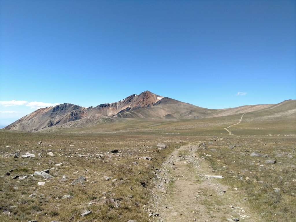
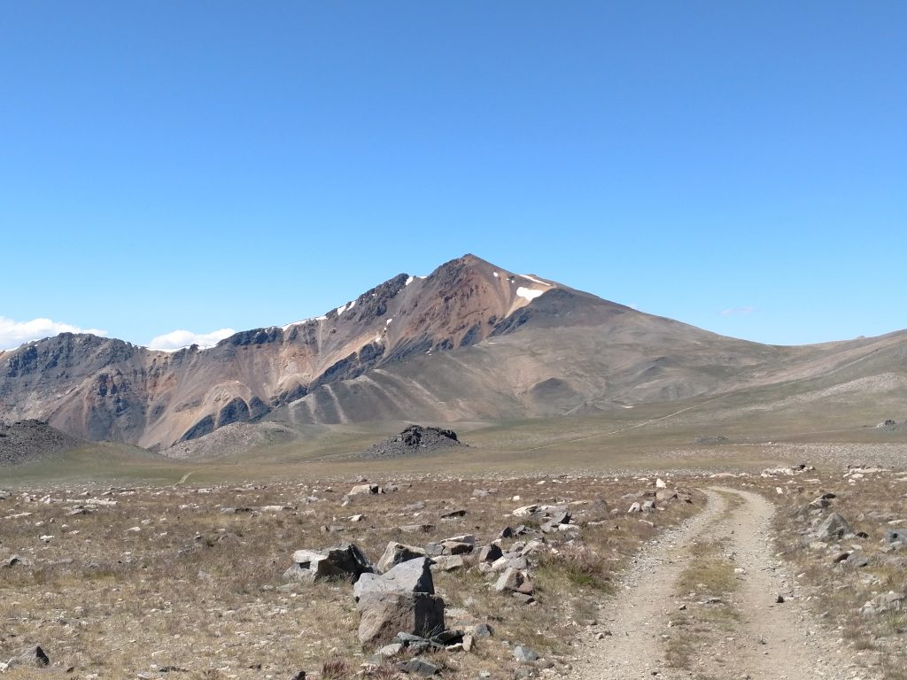
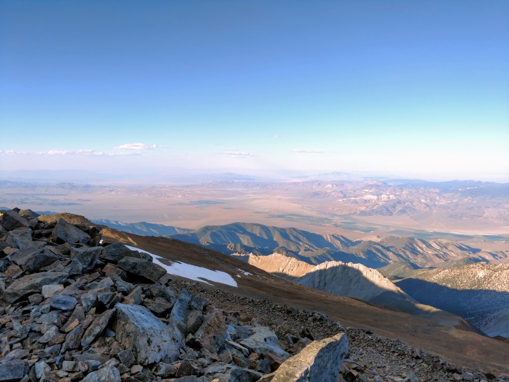
The first 2 miles up to the Barcroft Station are pleasant enough with views but rather steep. Its a gain of about 745' to the research station which is closed to the public. In another 0.5 miles we reached the saddle of Mt Barcroft and got our first view of White Mountain Peak. The altitude was 12,750' and we stood about
Barcroft Saddle, Up-and-Downs to 13,180'
The rugged and martian landscape was a sight to see on the way to the summit. I don't know if I've ever seen a more barren landscape. Without any point of reference, the mountain appeared much closer than it actually was
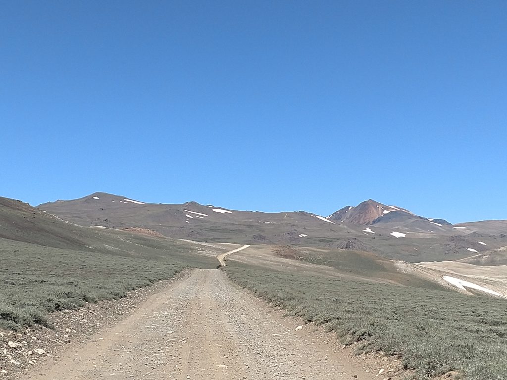
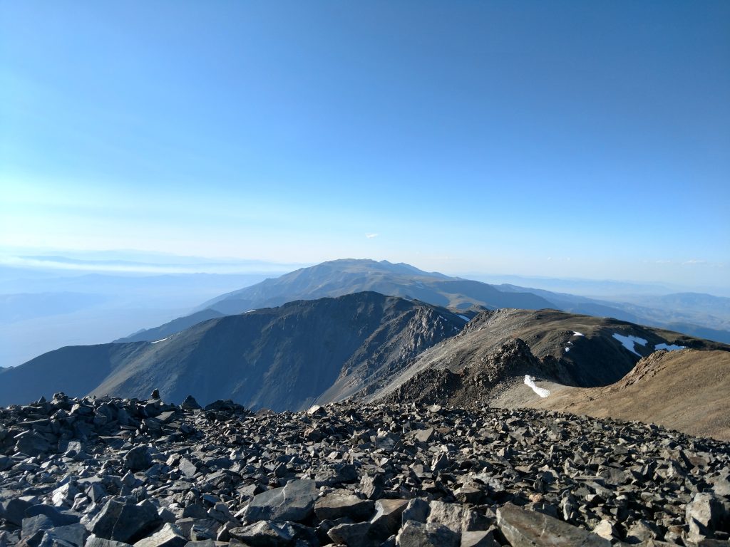
We made the infamously frustrating descent from the Barcroft saddle to a point 1.0 mile away and at an altitude of 12,500'. We lost a total of 250' which we immediately regained on a steep section to roughly 13,180', 5.0 miles from the trailhead. For all our effort and struggle with thin air, the mountain appeared no closer.
At the obvious sub-summit of 13,180', White Mountain Peak looms nearly 1,000' above.
Final 2.2 miles to White Mountain Peak's summit and back down
The final miles of the trail were a brutally steep ascent. The trail is mercifully switchbacked which takes the sting of the final 1,260 feet of climbing. Nevertheless, I probably stopped every 100 feet or so to catch my breath.
This final section took about an hour and a half. Boy had I ever wished I'd acclimated! But at the top I forgot about all that- the views were incredible.
Snow persisted well into August at these altitudes. It was a wet winter. I met a very rugged camper at the top who set up his tend in the wind and freezing temperatures; he planned to spend the night. I don't suppose there's a higher campsite in California.
The summit register was literally littered with detritus. I hate it when people leave random crap at the top. But I signed it, along with dozens of others who hike this summit daily (in the summer). A few really bold hikers make a traverse of the entire range, from White Mountain Peak to Boundary Peak in Nevada.
I lost daylight on the way down and muttered a few profanities on the up-and-downs. Thankfully the night sky was clear and I saw endless numbers of stars. We returned to the Bristlecone Pine Forest and simply slept in our cars for the evening.

No Comments