


Anderson Peak is another prominent summit of the San Bernardino Mountains, topping out at 10,840'. Hiking Anderson Peak along with East San Bernardino Peak, San Bernardino Peak and Shields Peak offers one of the most sublime alpine experiences in Southern California
Anybody who’s followed my ramblings long enough knows I lived in Southern California for quite some time. It's been over 10 years since I lived in Southern California but one of the things I miss the most was being close to truly alpine mountains like San Jacinto and San Gorgonio. I was back recently for a wedding and had some time after the wedding to do some hiking. I wanted to do something alpine again but I hiked San Gorgonio so many times. So, to switch things up a bit, I hiked a lesser visited part of the San Gorgonio Ridgeline - Anderson Peak, Shields Peak, East San Bernardino Peak and San Bernardino Peak.
The San Gorgonio Wilderness is a fascinating place. Its altitude tops at 11,600' and it rarely dips below 8,000'; otherworldly when compared to Southern California's deserts. Recently designated as a national monument, "Sands to Snow" is a fitting name.
The San Bernardino Ridge-line and Hike Overview
Running East-West, the backbone of the San Bernardino Mountains begins with San Bernardino Peak and has about 7-10 summits between there and the highpoint of San Gorgonio. Daring hikers go for the "9 peak challenge" which includes every named summit in the sub-range. I'm not sure all of them are true summits but it sounds like a great trip for later times.
I settled for a hike of half of the named summits which I hadn't previously hiked; Anderson Peak, East San Bernardino Peak, San Bernardino Peak and Shields Peak. My stats were as follows:
- Total Distance: 18.1 miles
- Total Time with Stops: 9 hour 15 minutes
- Average Moving Speed: 2.5mph
- Average Speed: 2.0mph
- Starting Altitude: Forsee Creek Trailhead, 6,765'
- Highest Altitude: Anderson Peak, 10,840'
There's no special gear needed for this day hike although I recommend 4 liters of water; there's very little natural sources along the way, especially in late summer. Always be prepared for snow!
Here's a map of the trails I took:
Start of Hike, Forsee Creek Trailhead to Jackstraw Springs
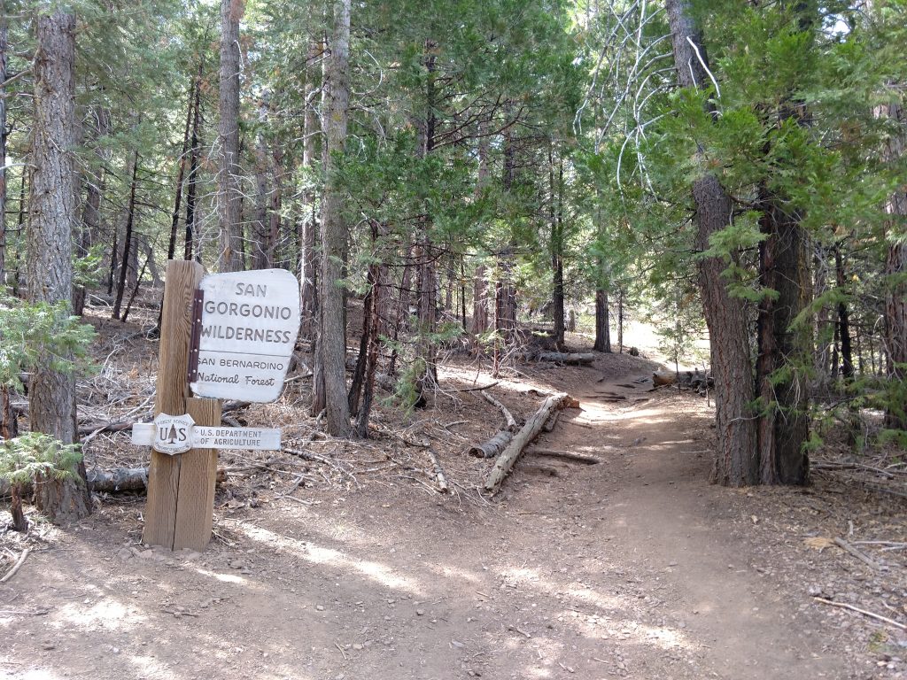
Getting to the Forsee Creek Trailhead was not too difficult from the Mill Creek Ranger Station. I picked up my necessary permit at the ranger station and was delighted to hear there wasn't a fee.
The road into the mountains is steep but paved. Route 38 ascends 16.6 miles from Mill Creek to the marked turnoff for Jenks Lake. I took this road about 0.3 miles to a right turn for Forsee Creek. It was just about 0.5 miles from there to the trailhead on a rough dirt road. Lower clearance vehicles will have difficulty on this road.
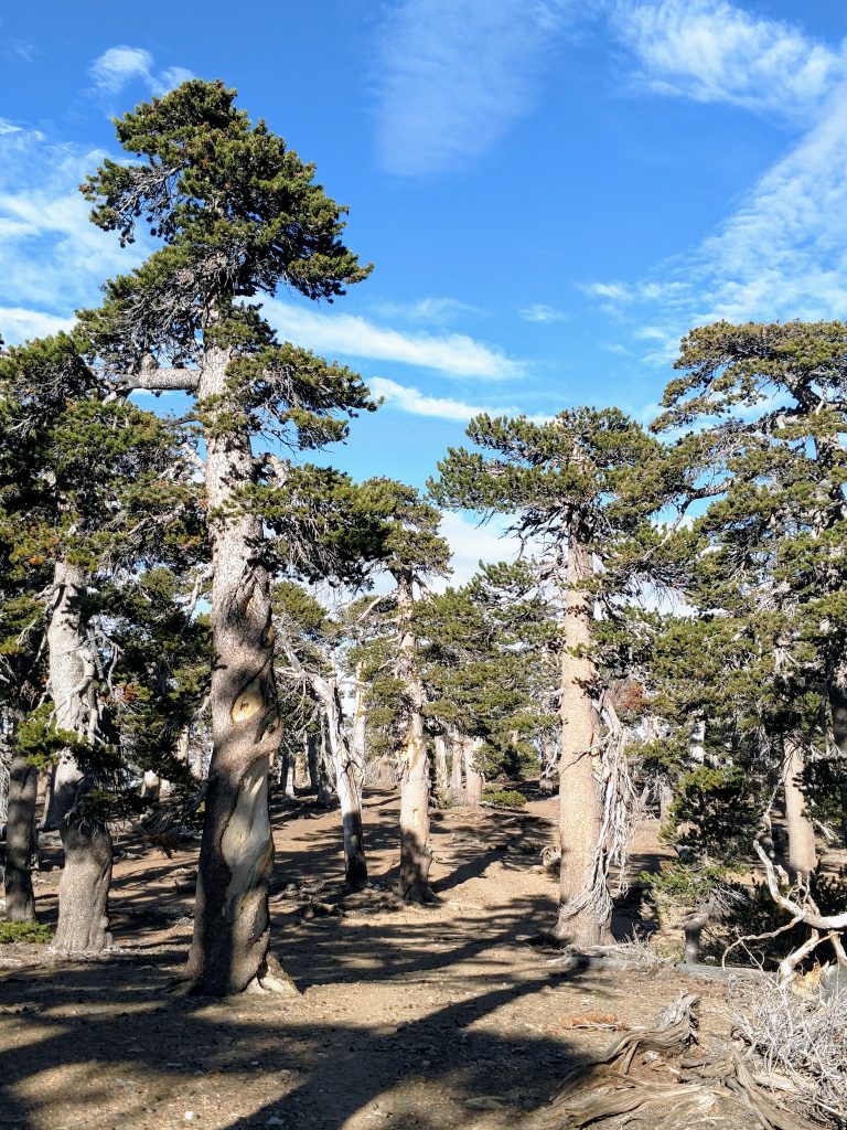
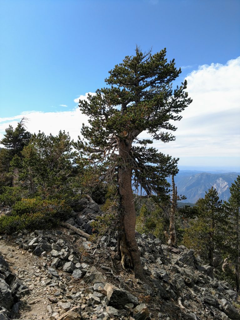
From the parking area, its 4.0 miles to Jackstraw Springs camp and about 2,500' of altitude gain. The trail is relentlessly steep but shaded and beautiful. Along the way I encountered massive pine trees. Some of them resembled redwoods in their size and girth. There's been no recent burns of this area so it feels much like walking through an old growth forest (but it probably was logged at some point).
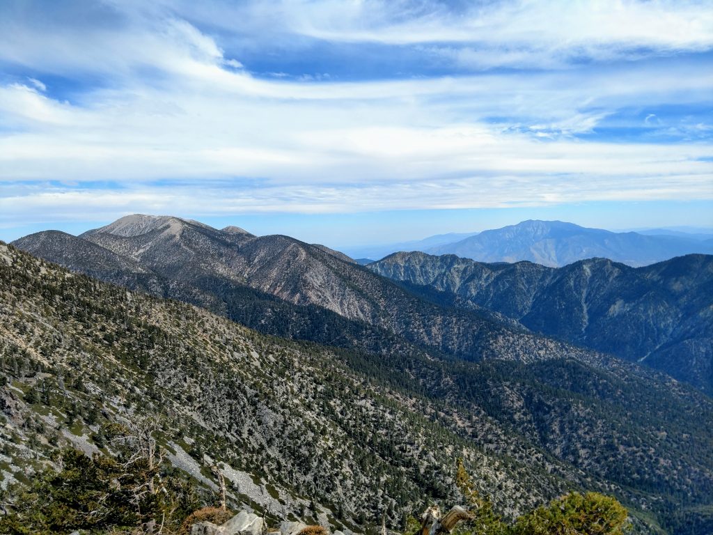
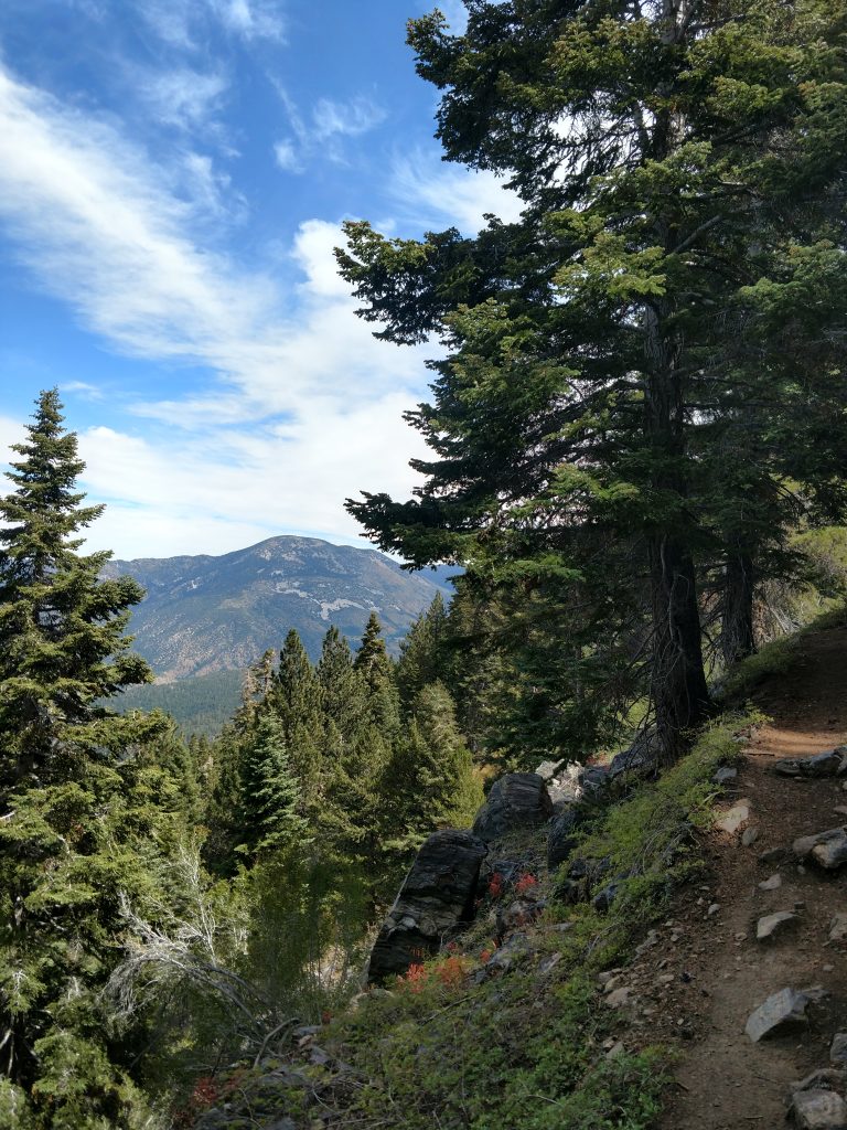
The trail is very discrete and easy to follow. Steep, switchbacks take the sting out of the ascent. The views open up along the way, eventually allowing glimpses of nearby Sugarloaf Peak and Big Bear Lake.
Jackstraw Springs to San Bernardino Ridgeline
Its another 1.8 miles from Jackstraw Springs to Trail Fork Springs and the main route across the San Bernardino Ridgeline. The first section is mercifully flatter but starts climbing altitude to the junction at about 10,400'. Total elevation gain from Jackstraw Sprigs to the Trail Fork is about 1,100'
Jackstraw Springs sits at an altitude of about 9,200' so I climbed over half of the total ascent in the first part of the hike. The trail continues through increasingly spaced out trees allowing even greater vantages of the alpine environment. Harsher climate and winds resulted in much shorter, stouter trees than the lower altitudes. I enjoyed this section immensely.
San Bernardino Ridgeline to East San Bernardino Peak
Once at the ridgeline, the trail flattened out considerably. I took a right at the junction and hiked 1.2 miles with 340' of altitude gain to East San Bernardino Peak. The trail undulates a little on the way but is certainly less of a struggle than the previous 6 miles!
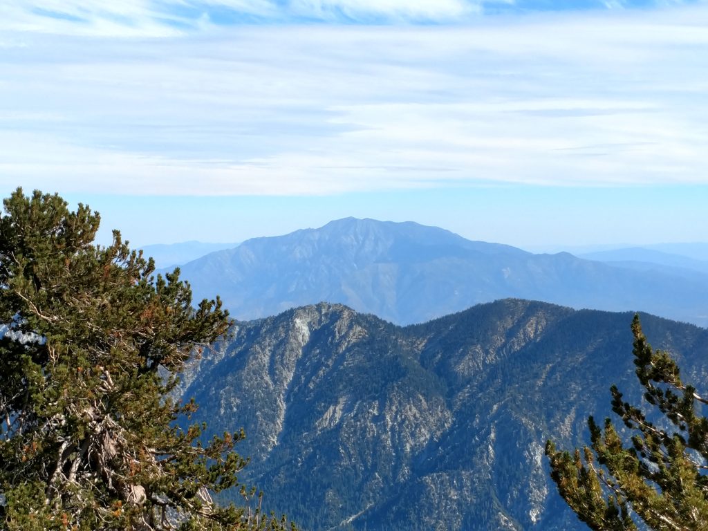
Wow, what a view! East San Bernardino Peak had a panorama of the ridgeline, Anderson Peak, San Gorgonio and San Jacinto as well as the entire Inland Empire. Unfortunately the summit register was destroyed so no signature on that one.
East San Bernardino Peak to San Bernardino Peak and back to Anderson Peak cutoff
I hiked another 1.0 mile from From East San Bernardino Peak to San Bernarino Peak with 240' of loss and 220' of gain. The altitude hit me a bit in this section but I continued making great time.
San Bernarino Peak is a very popular hike from the trailhead in Angelus Oaks and the summit register had hundreds of names. The view wasn't as good as previous so I tagged the summit and retraced my steps to Anderson Peak
Anderson Peak Bushwhack/Open Walk
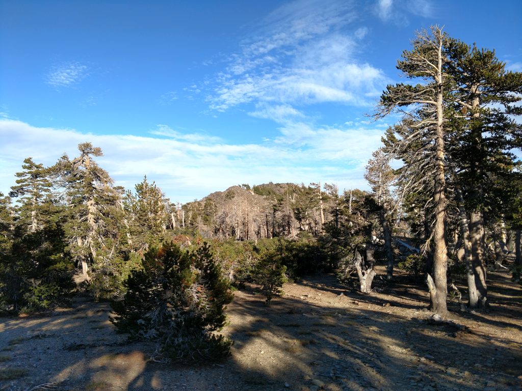
Back at the junction of Forsee Creek and the San Bernardino Peak Divide Trail, I took the divide trail until it stopped gaining altitude. The divide trail doesn't cross the summit of Anderson Peak and its an open, off-trail walk through the woods. The forest is thin at this altitude so its not a bushwhack in the truest sense of the word.
I measured 0.8 miles with about 200' of altitude gain in achieving the summit of Anderson Peak. The views are fairly obscured for the most part. There's a summit register that's infrequently signed.
From the summit, I descended through the woods back to Anderson Flat Campground and headed off to Shields Peak
Shields Peak
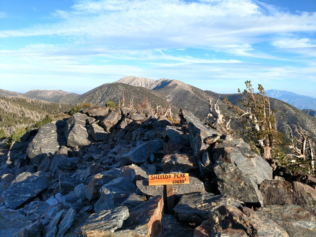
Although its a named summit, by most measures Shields Peak is but a sub-summit with minimal prominence. However its the most barren of all the summits allowing exceptional views. Its about 0.5 miles from Anderson Flat to Shields Peak with about 80-100' of altitude gain.
Like Anderson Peak, the trail doesn't cross the summit so its another brief -off-trail scramble. The summit is essentially the tallest point on a talus pile. There's a sign and register at the top.
Return down Forsee Creek Trail
Back at Anderson Flat, I took the Forsee Creek Junction return to Trail Fork Springs and made the arduous descent back to the trailhead. By the time I made it to Jackstraw Springs, the sun was setting but I snapped a few cool photos-
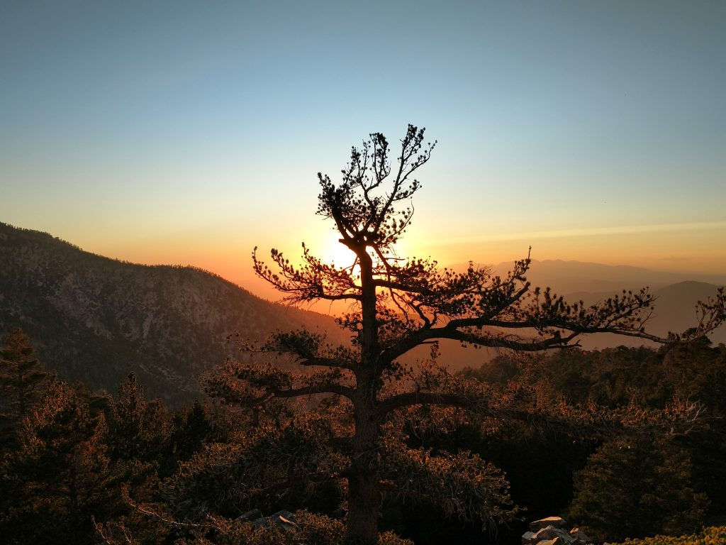
I realized I saw the last sunset of summer - fall officially began the next day.
I made it back to the trailhead well after dark and was one of the only cars left in an otherwise crowded parking lot. Eighteen miles and 5,000' of altitude gain made me quite sore but also nostalgic for my time in Southern California.

No Comments