


Twin Peaks and Waterman Mountain are summits in the near center of the San Gabriel Mountains and offer fantastic hiking. Although fairly close to Angeles Crest Highway, they lie within the San Gabriel Wilderness and are often overlooked by higher, more famous summits to the east. With a recent visit to Southern California, I made a point of hiking these two summits which became my favorites within the range. Here's a description of my trip
Twin Peaks and Waterman Mountain Overview and Directions
Waterman Mountain, at 8,038', is the highest point in the San Gabriel Wilderness and one of the principal summits of the entire range. On its northern slopes is the tiny, homegrown ski resort of Waterman Peak. Twin Peaks East is slightly shorter at 7,761' though has a far more rugged and remote character. Both Twin Peaks and Waterman Mountain can be hiked in a challenging day hike. Both summits also register on the Sierra Club's Hundred Peaks Section Star Emblem Peaks. Like most summits in the San Gabriels, you must purchase an Adventure Pass from the forest service for a $5 day fee. No passes are sold at the trailhead and its best to purchase them in advance at a local gas station.
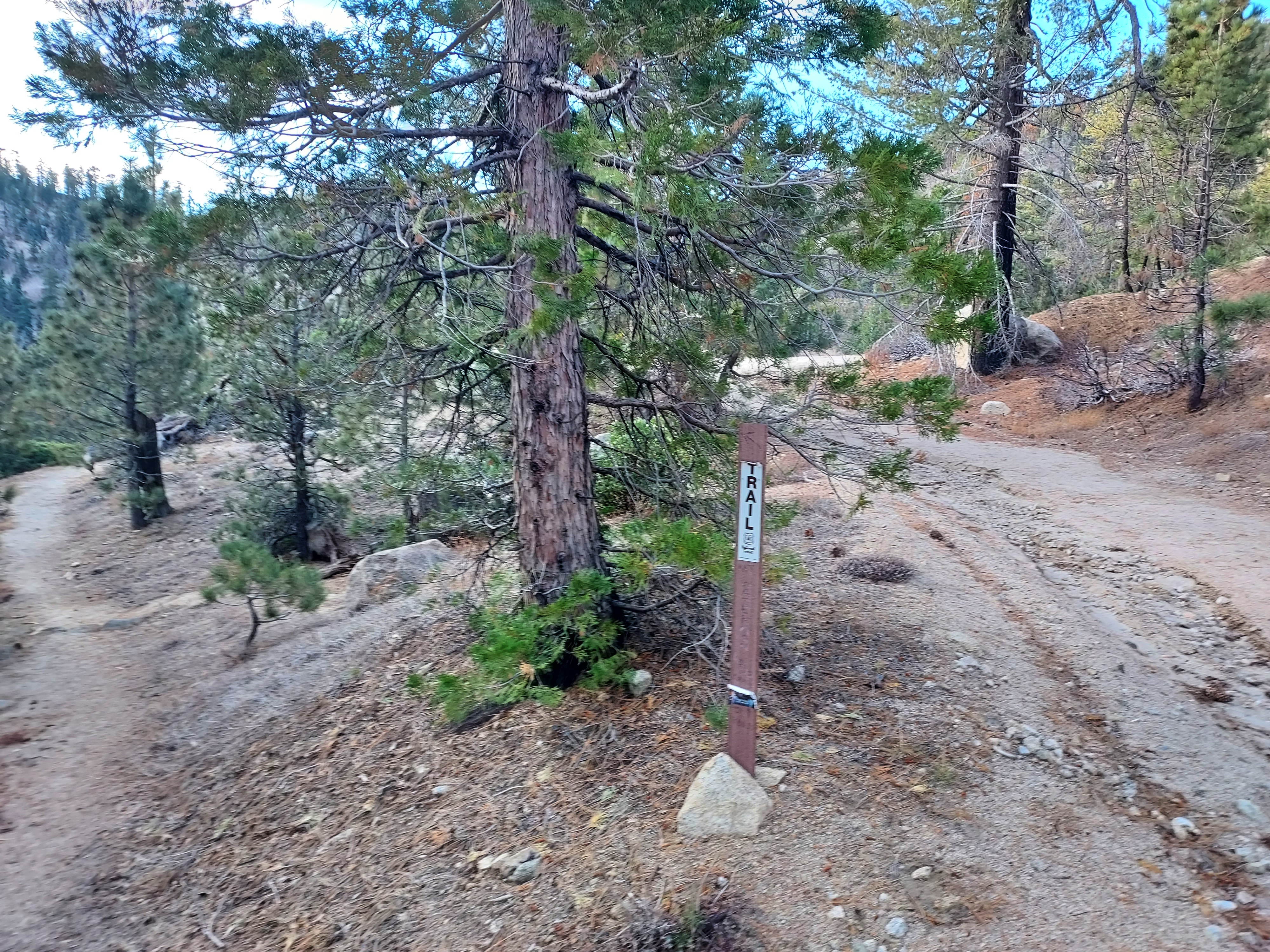
Trails greatly permeate the area and there's plenty of option options for both summits. My route was not the most direct but allowed for a partial loop when tagging Waterman Mountain. I found the trails fairly overgrown and ambiguous, especially on Twin Peaks. Both summits involved some light scrambling and some route finding.
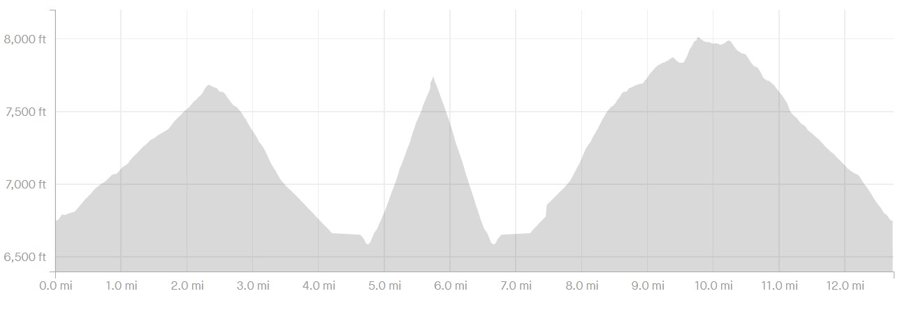
Total distance was 12.75 miles with 3,570' of gain. Here's a map
Here's a plot of distance and elevation, according to Strava-
Twin Peaks and Waterman Mountain Trip Report/Field Notes
Buckhorn Day Use Area to Twin Peaks Summit
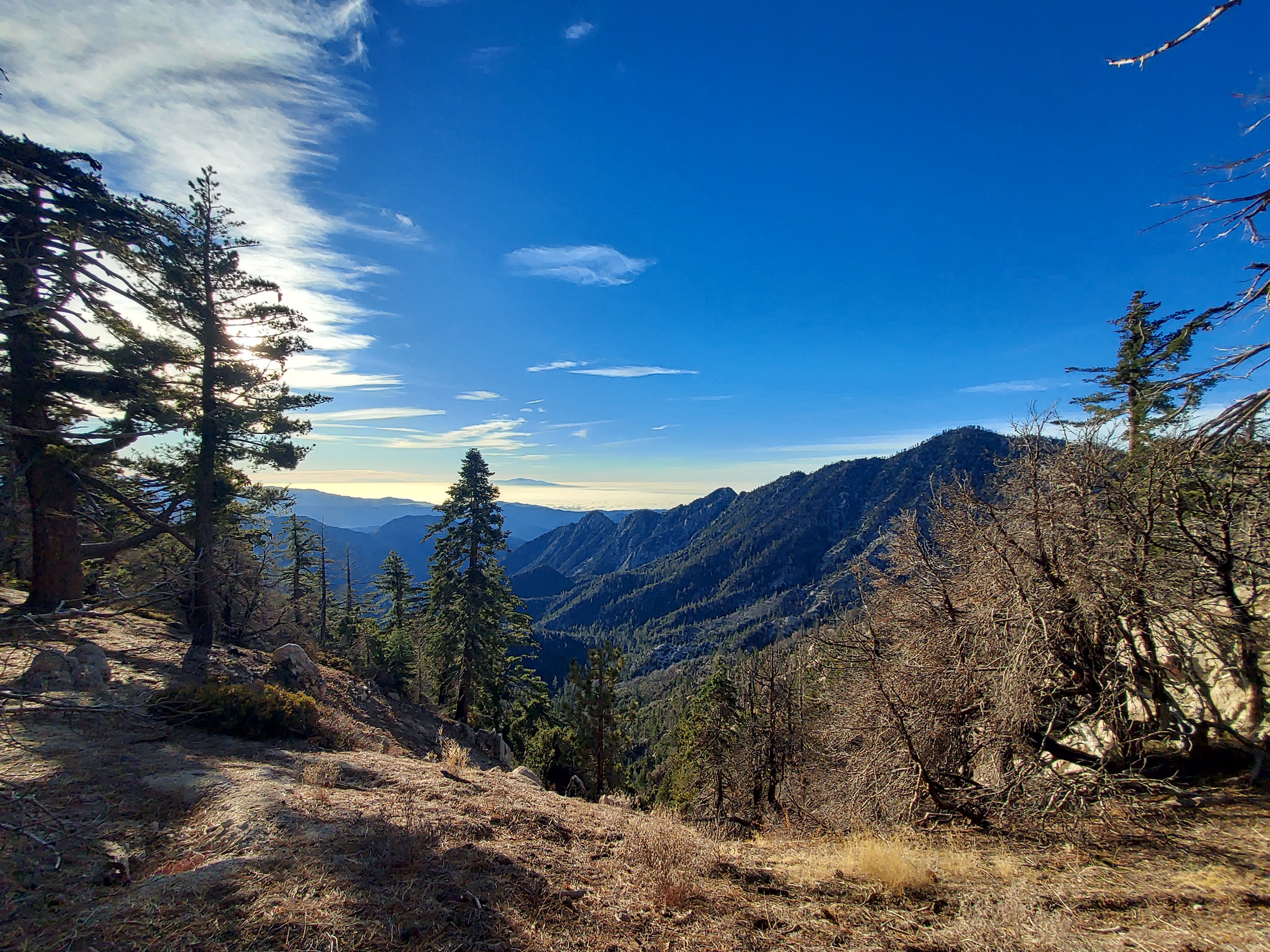
I parked at Buckhorn Day Use Area just to the east of the ski resort at an altitude of 6,750'. In the winter, there was plenty of parking and the vault toilets were open. Crossing the highway, I walked about 100 yards up a gated but unmarked dirt road before turning off on the unmarked Waterman Peak trail. From here, I climbed about 1,100' over 2.3 miles to a junction. Though steep, the trail was pleasant with views of the undercast Los Angeles Basin to the south.
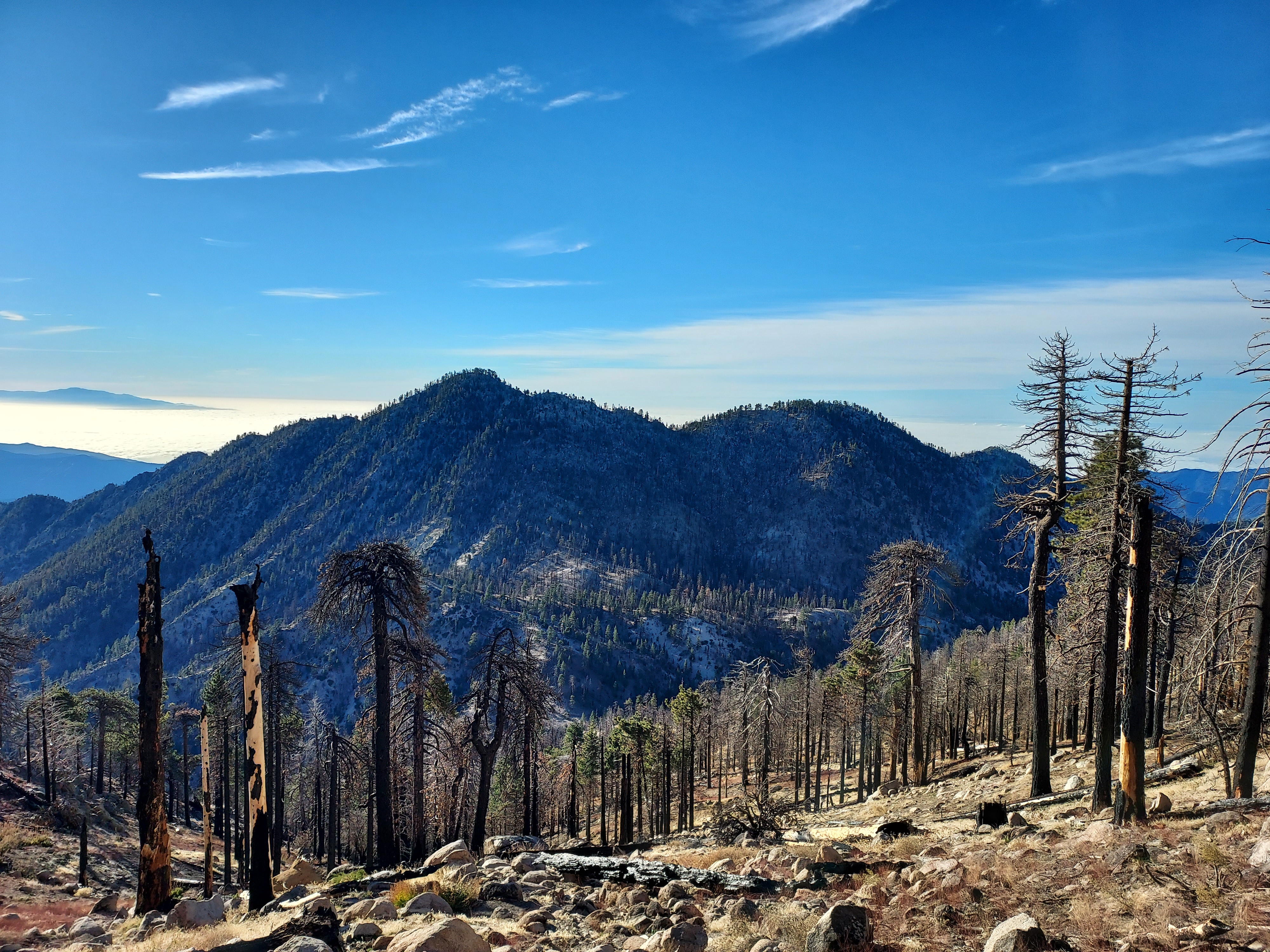
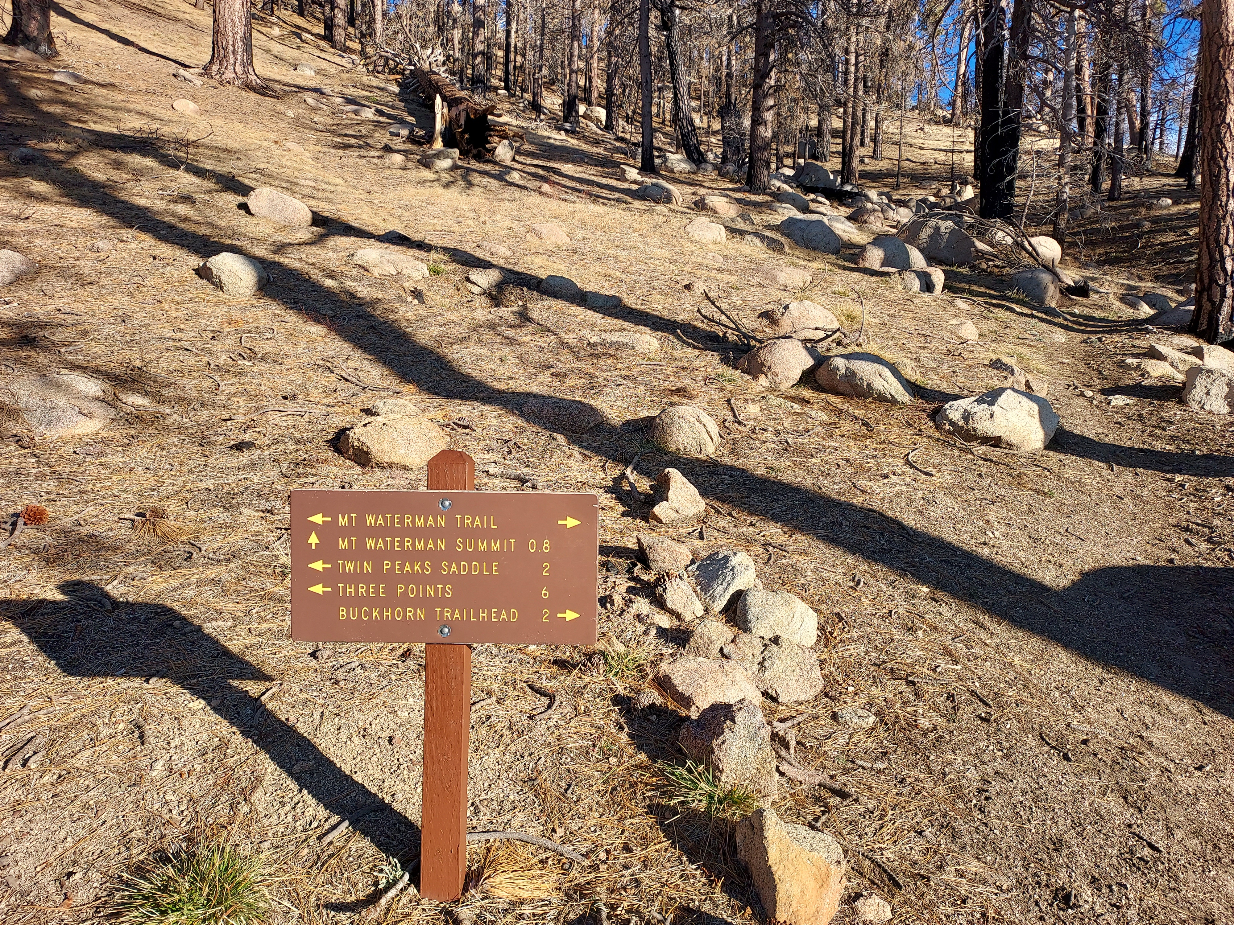
From the junction, I descended about 700' over 1.1 miles to a second junction. Going left or east, I continued on the Twin Peaks trail. Fire damage was evident everywhere and the trail was very overgrown. Long pants were helpful. From the junction to the saddle I lost another 400' over 1.3 miles. The saddle between Twin Peaks and Waterman Mountain is the low point of this hike.
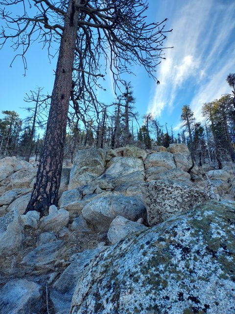
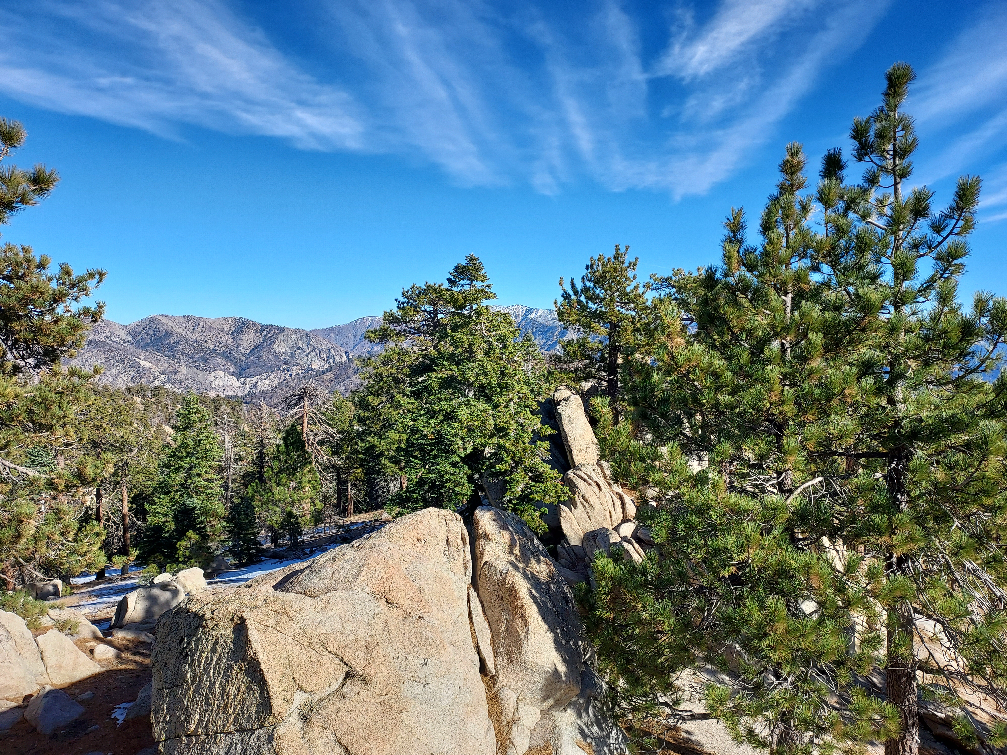
I thought I was making great time before coming to the actual push up Twin Peaks. From the saddle, its a mere 0.9 miles away. However its a grueling, loose scramble up 1,100'. Furthermore, there's not much of a trail and I basically chose my own adventure. At times it was easier to hop up and down the steep rocks over trudging up loose dirt and soil. Slowly I made my way to the ridgeline separating Twin Peaks East and West. The summit was easily gained after that.
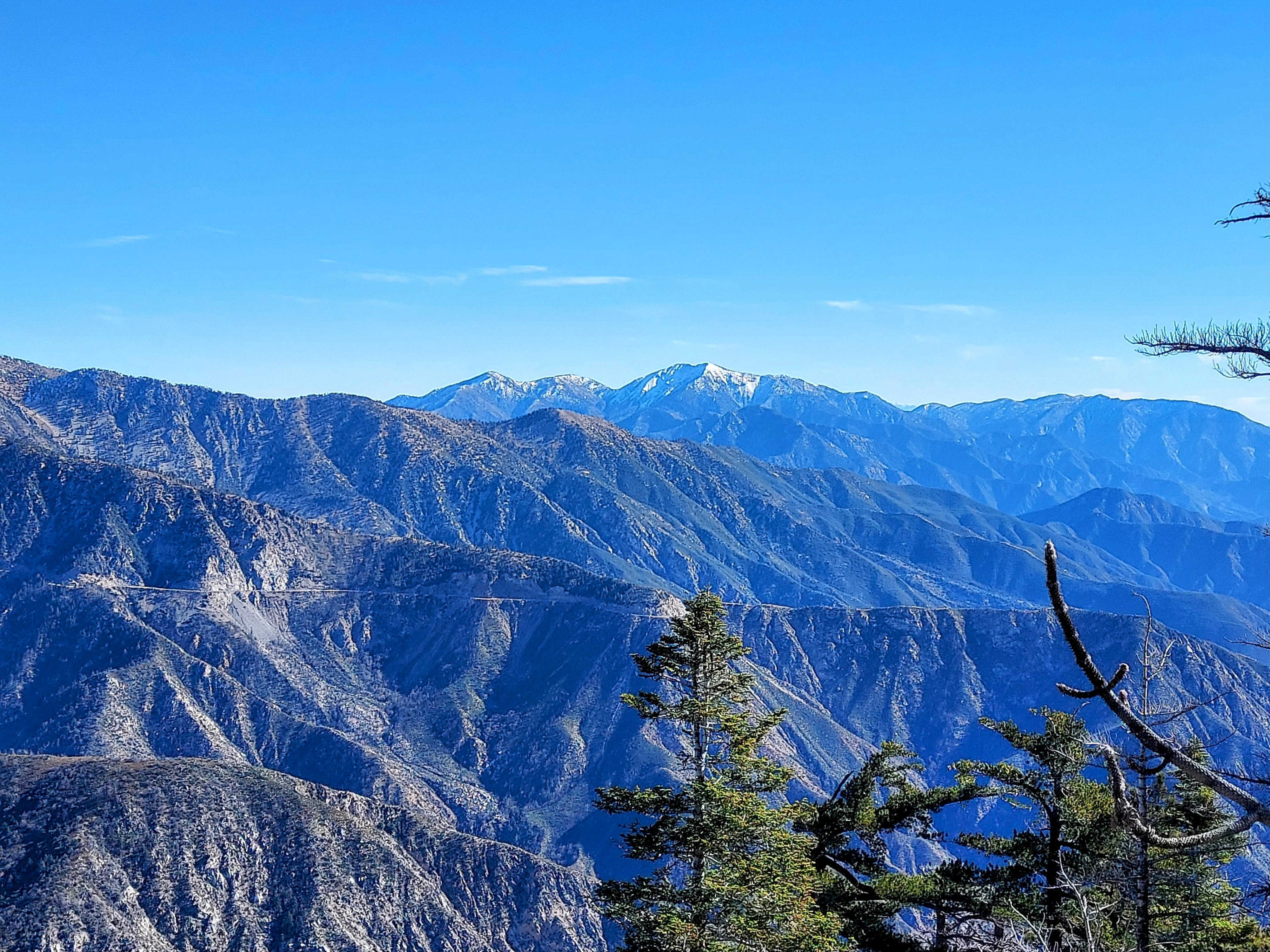
Atop Twin Peaks East, I settled down for a snack and some great views. Mt San Antonio and Baden Powell loomed over the eastern horizon. Also to the east were the faint summits of San Gorgonio (65 miles away), San Jacinto (80 miles away) and Toro Peak, (102 miles away). What a grand view!
Twin Peaks to Waterman Mountain
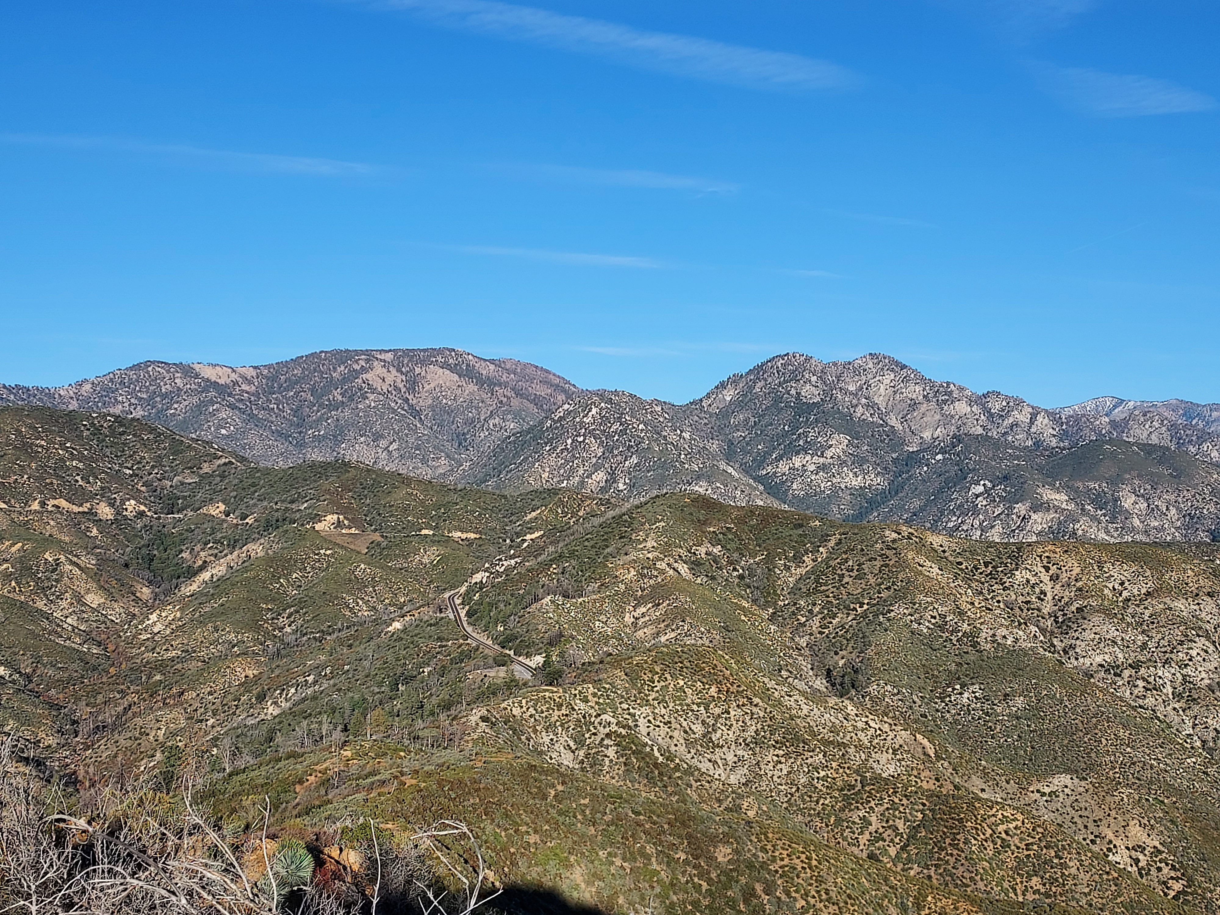
Though close to halfway in distance I was only a third of the way effort-wise. About 3.9 miles of trail and lots of descending and ascending lay between Twin Peaks and Waterman Mountain. Descending off Twin Peaks back to the saddle was trying in itself. I skated down the loose terrain eventually back to low point. Re-ascending the 1,200' back up to the first junction was not an easy task either.
It was a comparatively gentler mile from the junction to the summit of Waterman Peak. There were some modest ups-and-downs along the way but the forest was pristine. Apparently this area was saved from the infamous 2009 Station Fire.
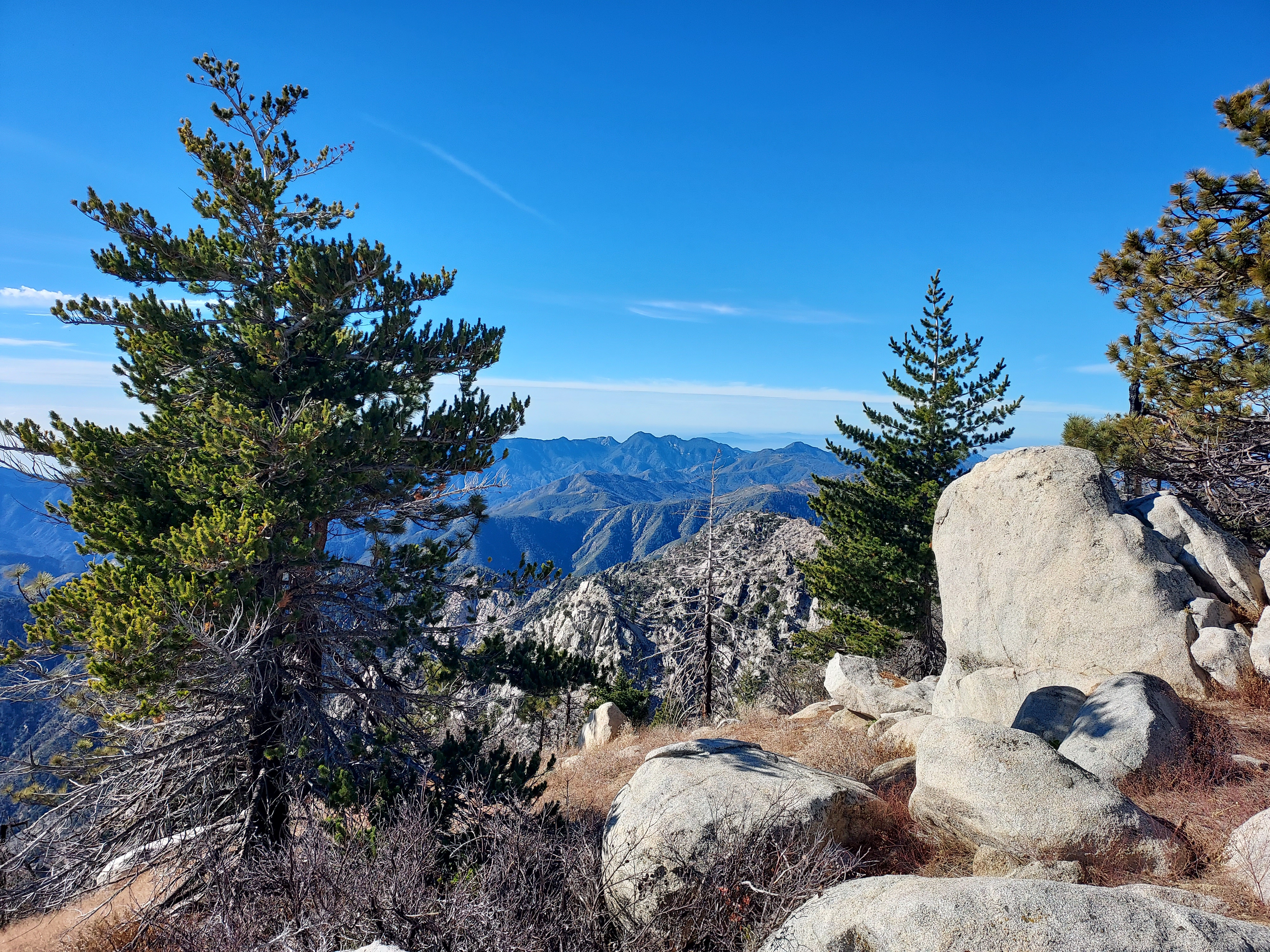
Eventually I found an outcropping of rocks which seemed to be the highpoint. I scrambled up a few of them before discovering the marker denoting the summit. Views were similar to those of Twin Peaks though the (mercifully) preserved forests allowed for a less panoramic viewshed.
Descent back to the trailhead
Although it added a little distance, I decided on descending via the Waterman Mountain trail loop. The shaded and northfacing slopes of the summit had about 2 inches of snow on the ground though traction or snowshoes were not necessary. I followed the obscured trail as best I could before reaching the top of Mt Waterman Ski lifts. From there, I basically followed the dirt access road down another 2.5 miles to where I parked.
All in all, the hike took me about 6 hours and 45 minutes, accounting for some longer stops to photograph all the views. It was a lovely hike and held true wilderness character in spite of its ease of access from the LA basin. I'd totally hike it again.

No Comments