


After climbing 9 14ers in Colorado and running out of good weather, I headed out to Utah for a hike of Abajo Peal and to watch the solar eclipse. Abajo Peak is not exactly a lofty summit by Utah standards though its remote and quite prominent. This is one of those summits I've always wanted to do but didn't want to make a special trip simply for the hike. Given its proximity to the 2023 annular eclipse, it was a much more worthy affair. Here's my trip report and field notes.
Abajo Peak Overview
This is a peakbagger's kind of peak; one that ranks highly on sought after attributes (elevation, isolation, prominence) but is not particularly inspiring to the average hiker. Abajo Peak is 11,368' and the tallest summit of the Abajo Mountains. This range is isolated about 40 miles from the taller and more imposing summits of La Sal Mountains. Its topographic prominence is 4,550' making it one of the top 100 most prominent summits in the contiguous US. A well graded dirt road leads from nearby Monticello to the summit which is littered in communication towers.
Hiking options are somewhat limited in spite of the vastness of the range. One can simply drive their vehicle to the summit (the preferred approach). I was driving a rental so didn't want to fool with running in to trouble far from civilization. So I settled on a hiking option. Of course, I could have just walked the road to the top. But I found a different way. Here's my map-
The route I took is not a standard route by any means. I bushwhacked from the old ski area to the summit. Wanting to avoid the bushwhack on the way down, I took a combination of poorly maintained trails and dirt roads to get back to the car. The advantage of this route is it would be entirely possible any time of year. The road to Dalton Springs is paved and possibly plowed through the winter.
Here's the distance and elevation stats from Strava-
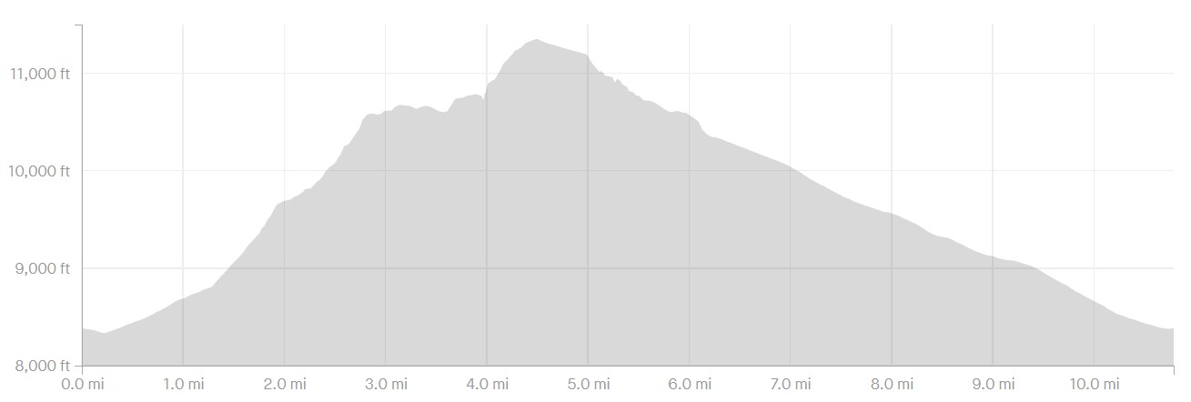
Abajo Peak; Bushwhack + Hike
Dalton Springs Campground to Summit
I parked at the Dalton Springs Campground at an altitude of 8,380'. From there I walked east on the highway to Ski Lift Road. Not knowing what the conditions would be like on Ski Lift Road, I simply walked from the highway up to the old parking lot. Note that any vehicle could drive this section and park at the end. This would have saved me 1.2 miles of walking; oh well. The altitude of the ski area was 8,780'.
From there, I climbed the old ski bowl to the top. Although it was clear of trees, the old runs are covered in brush. Glad I was wearing long sleeves and pants. I made it to the top of the resort at 9,440' and 1.8 miles from the campground.
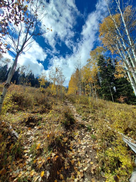
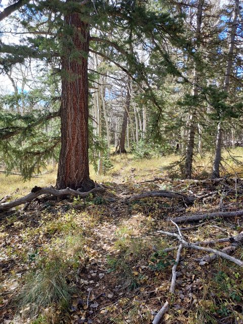
The bushwhack part began in earnest from here. From the top of the ski resort, I picked my way through the woods occasionally finding herd paths. It wasn't one of those rough, impenetrable whacks but it was brushy and ambiguous in sections. As long as I stayed on the ridgeline things went relatively well. Once I hit 10,300' route-finding became easier.
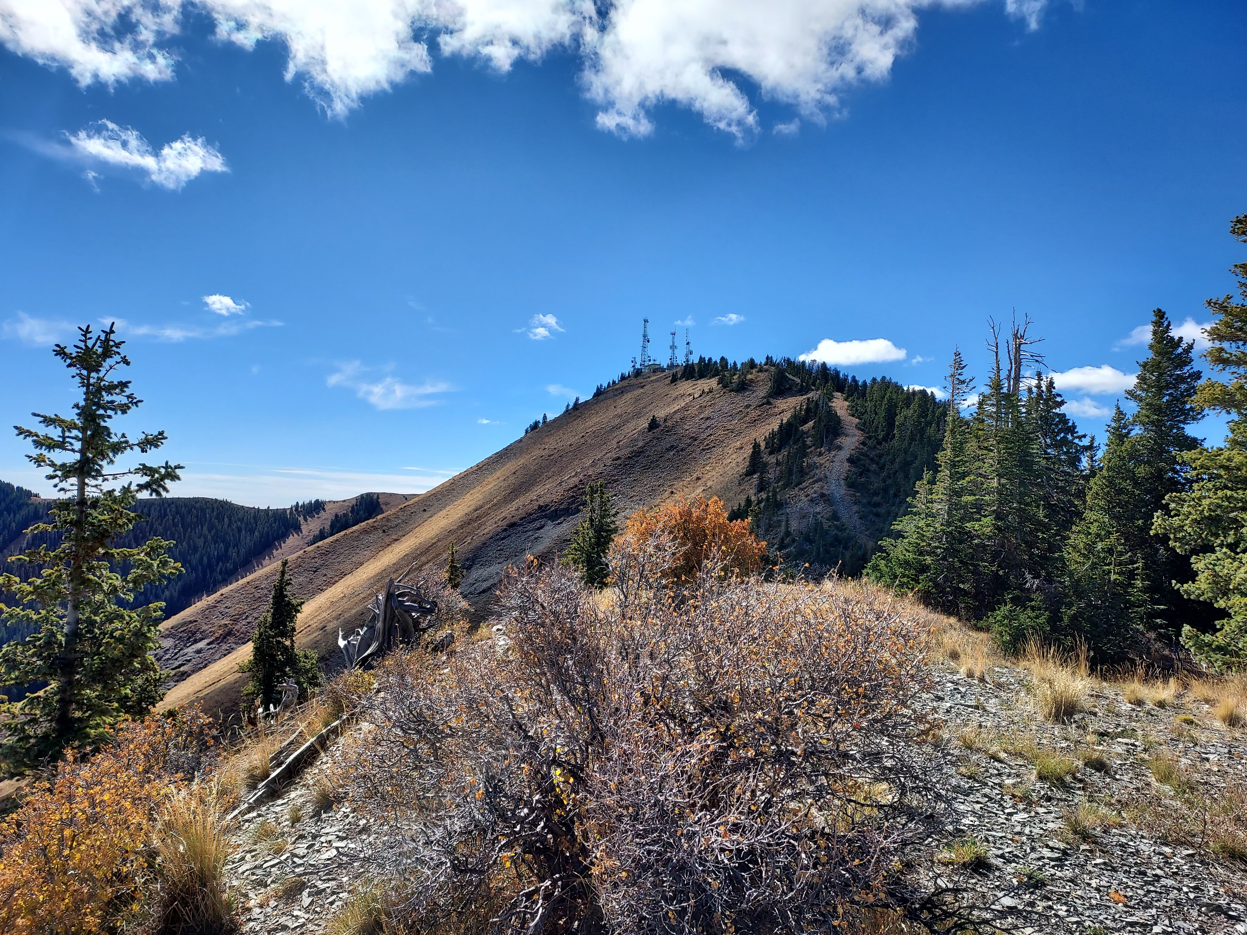
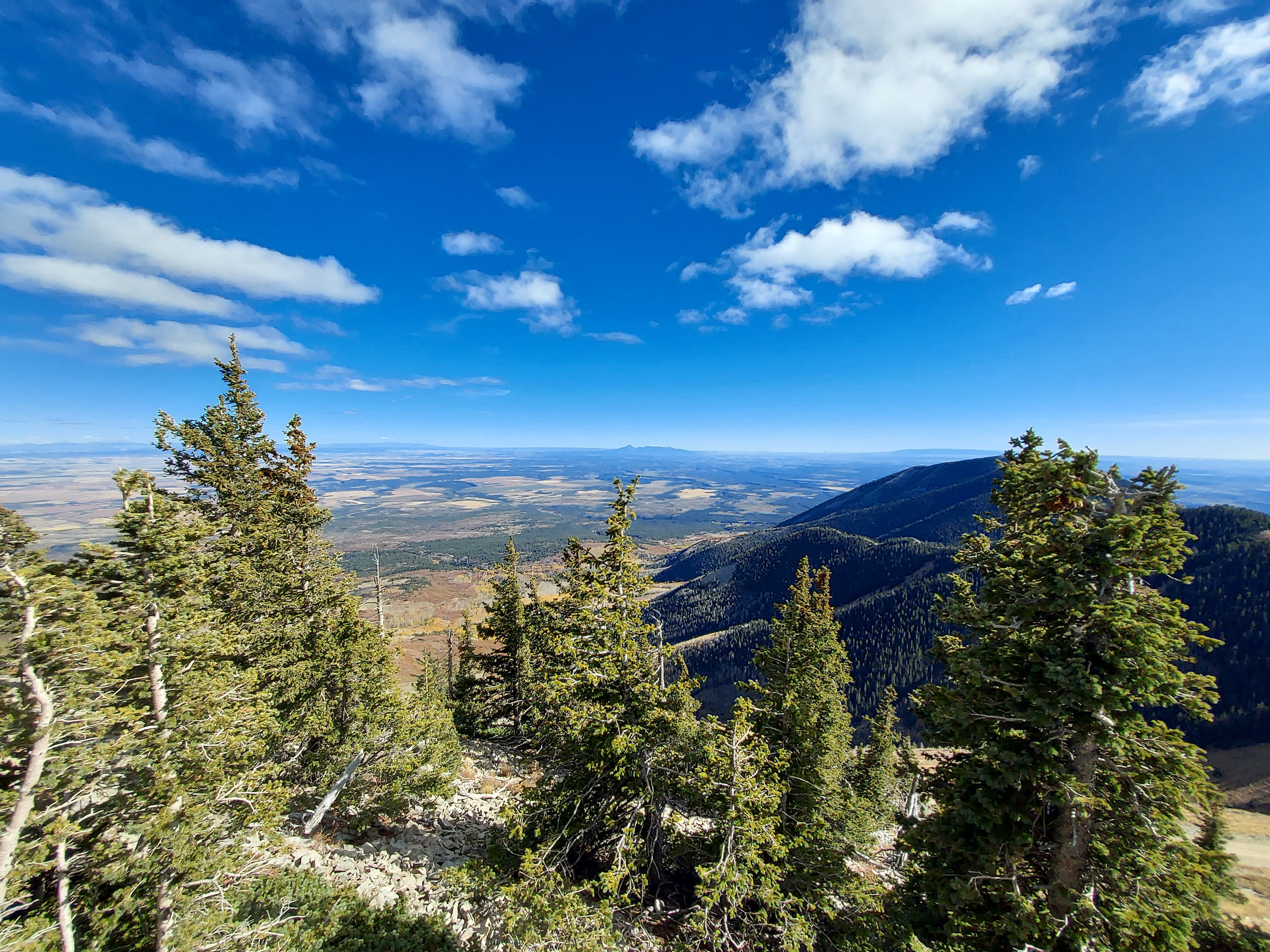
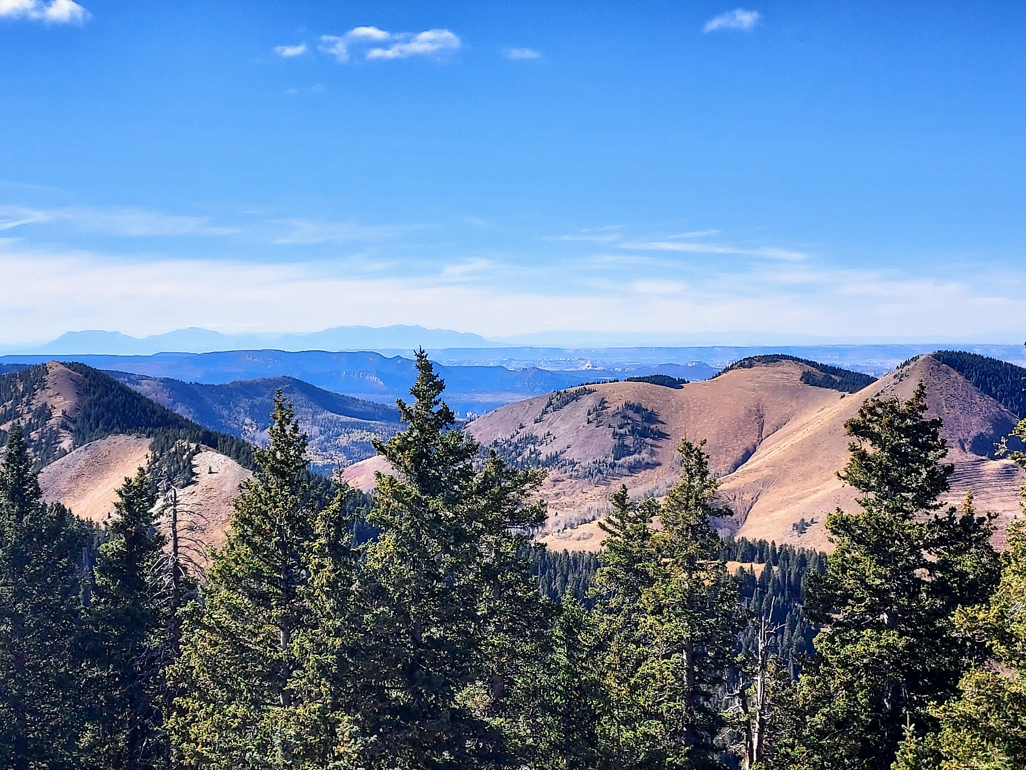
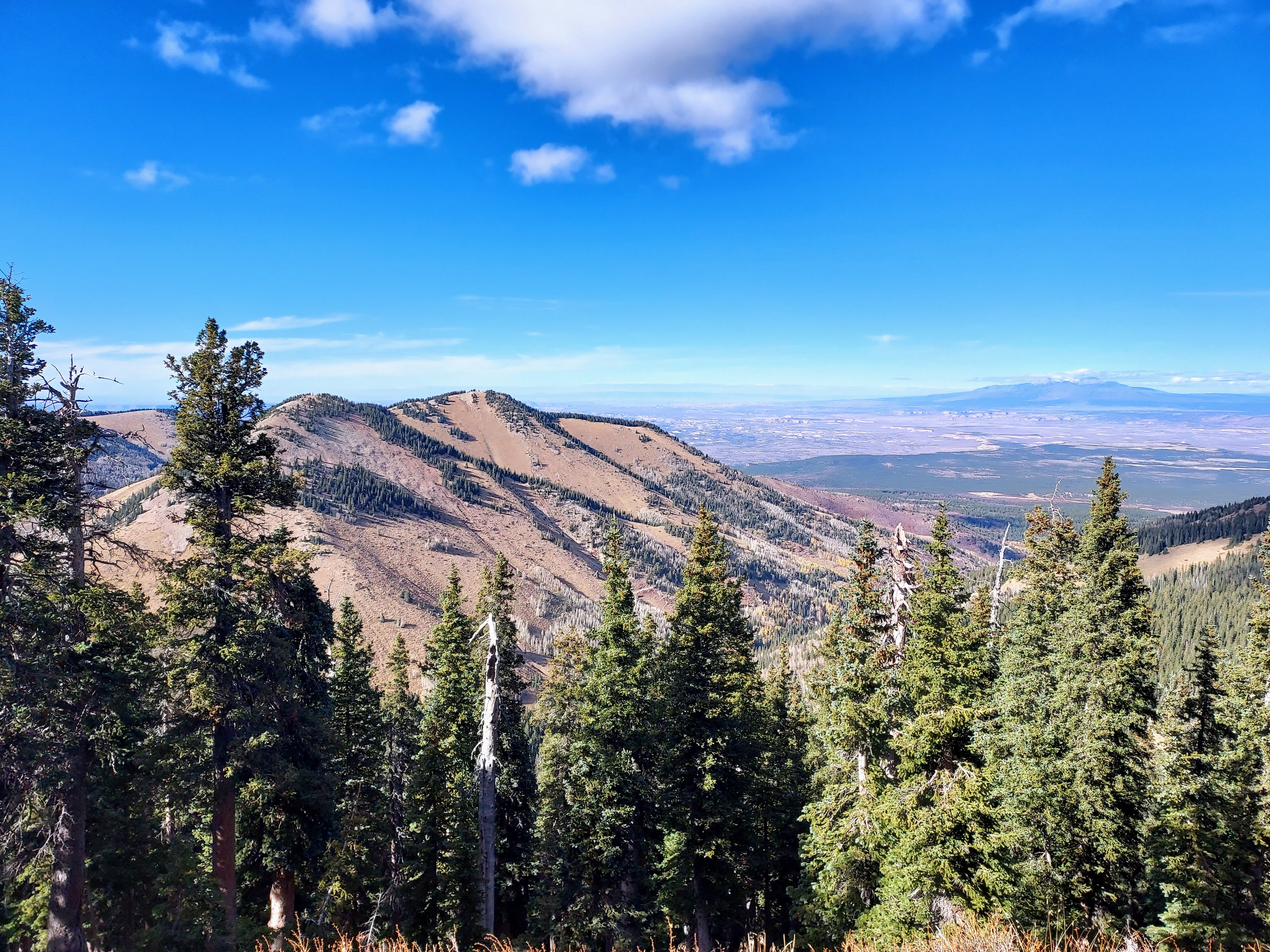
At about 10,500' the route takes an undulating course over plenty of false summits and minor bumps. However the views opened up from here. It was a remarkably clear day and I could see summits 100 miles afield. Pastora Peak, Sleeping Ute Mountain and the very distant San Juan Mountains were all visible from the ridgeline.
I continued crashing through brush until 10,800' and the summit became visible. The last 600' or so below the summit were steep but open. Eventually I popped out on the summit road and walked to the highpoint. The views were just phenomenal. Four states and hundreds of miles of desert and mountains were visible that day. The furthest point I could identify was over 130 miles afield. All the monarchs of the region were visible including the La Sal Mountains, Shiprock, Mount Hesperus, Monument Valley, Navajo Mountain, Capitol Reef and the Henry Mountains. Many of those summits I've visited or climbed before which added to the experience.
Down a Different Way
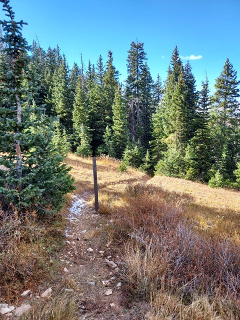
The bushwhack to the summit involved some steep, brushy and slippery terrain. I wasn't enthusiastic about returning that way so I opted for the roads. I descended down the road about 0.4 miles to a small saddle between Abajo Peak and a subpeak. Here I discovered a vague path descending into the woods. It looked as if it would eventually meet back up with the road near North Creek Pass. If nothing else, I'd just be bushwhacking back to the road anyways.
This trail I found wasn't very clear but it was better than a bushwhack. I followed it along for about 1.4 miles, eventually popping out at a parking/pullout on Indian Creek Road. Some sections were ambiguous and I believe there's some old logging road that intersect with the trail. In any case, taking the path of least resistance was the solution
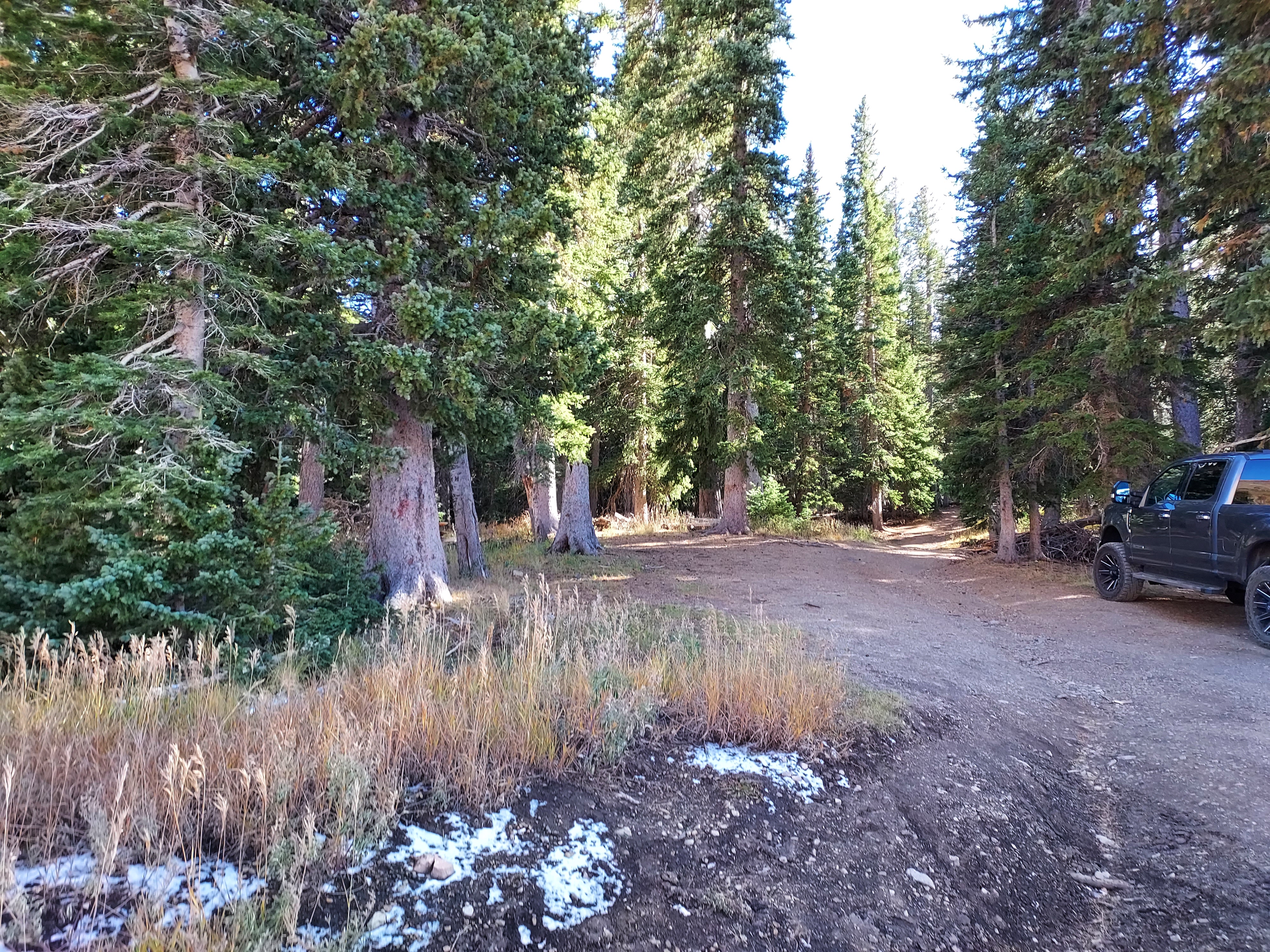
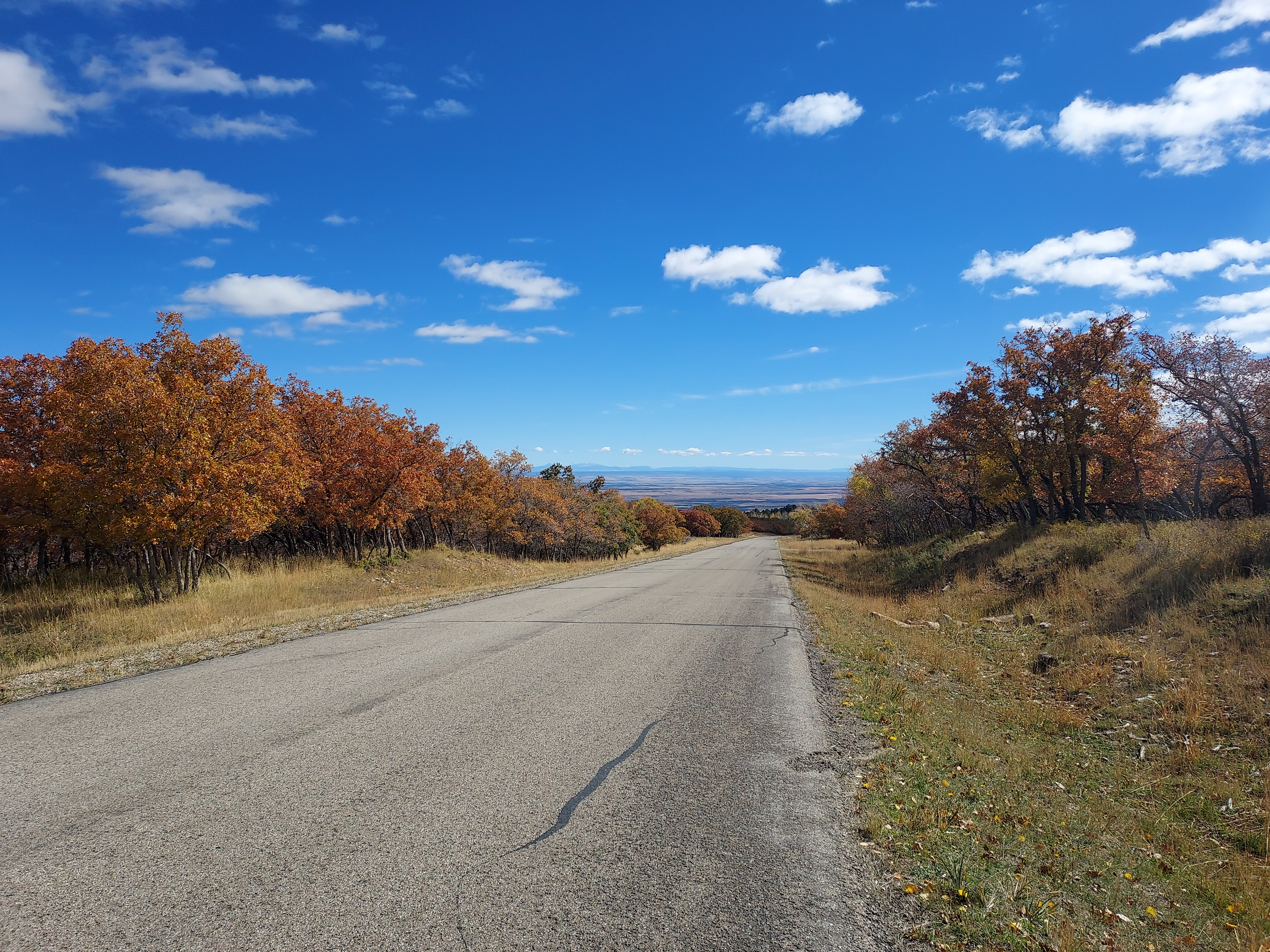
North Creek Pass is at an altitude of ~10,330' and there's enough space for a few cars. In retrospect, this would also be a fine place to park and hike the peak. Any car could get up this road to that point in my view. As for me, I simply jogged/power walked down the road about 4 miles to the highway. I noted several primitive drive-up campgrounds along the way.
While I can't say the hike I did was the most efficient or inspiring route up Abajo Peak, it did offer a nice day in the backcountry. And it warmed my peakbagger heart to hike such a remote, prominent mountain. Onward to the eclipse.

No Comments