


Cone Peak, soaring to an impressive height of 5,155 feet, stands just 3 miles away from the Pacific Coast, solidifying its reputation as one of California's most dramatic mountains. This summit has been on my list for a decade plus but its remote location within the Ventana Wilderness/Big Sur has posed significant challenges to reaching its summit. The vicinity's unpredictable wildfires, treacherous mudslides, and frequent road closures had thwarted my previous attempts. Nevertheless, determined to conquer this elusive peak, I picked a weekend and figured "what the heck". If I didn't get it, at least I'd have some beta.
However, fortune smiled upon me when the road to Memorial Park Campground reopened recently, opening the gateway to my long-awaited adventure in June 2023. Without further ado, here is my comprehensive guide to this mountain.
Cone Peak Overview and Trail Options
Cone Peak is located within the Ventana Wilderness of Los Padres National Forest. Its under the Monterey District with a ranger station in King City. The ranger I called before going was incredibly helpful. As of June 2023, several sections of Highway 1 and Big Sur are closed due to road repairs. This includes Limekiln State Park, the usual approach for Cone Peak. Nacimiento-Fergusson Road is the closes paved road to the formal Cone Peak Trailhead but it's been closed forever as well.
So there's basically two options for hiking Cone Peak right now. The more common approach is Vicente Flat off Highway 1. This is a 21+ mile hike with about 6,200' of elevation gain that's typically done as a backpacking trip. Parking is also unpredictable. That left me with the comparatively straightforward Carrizo Creek Trail. This turned out to be about 15.4 miles with 4,300' of gain. This route has the advantage of being close to the Junipero Serra Peak trail which I did the day before.
Here's a map of my hike-
Getting to the Trailhead
I used basically the same approach to get to Carrizo Creek Trailhead as I did for nearby Junipero Serra Peak and recommend reading my piece on it. "Road 6" is roughly marked on google maps and off the road leading to Memorial Park. The map above shows where I parked. I didn't have much trouble getting to the trailhead in a stock Subaru. Here's some notes on the driving-
- Mission Road is the main road leading to Mission San Antonio de Padua. It is paved up to the mission. Instead of turning towards the mission, continue straight on a well-graded dirt road, which may be labeled as 'Milpitas Road,' 'Mission Creek Road,' or 'Mission Road.'
- Milpitas Road (or whatever it's called) is a dirt road, but passable by any vehicle as of June 2023. Be aware that it is a military road, so refrain from stopping or engaging in any unnecessary activities. Travel along this road for 9.6 miles until it eventually connects with the open section of Del Venturi Road.
- Once you're back on Del Venturi Road, it is paved, although it may have potholes, all the way to Memorial Campground.
- From the intersection of Milpitas Road and Del Venturi Road, the road remains on military property for 4.3 miles before entering the national forest. Once you enter the national forest, open camping is permitted.
- I have marked campground areas on the map above. There are plenty of spots available, but be aware that it tends to attract a rowdy 4x4 crowd. The roads leading to the campgrounds are unimproved and may be challenging for regular passenger vehicles.
I strongly recommend checking in with the rangers of the Monterey District before traveling as conditions change often. Their phone number is (831) 385-5434. They were extremely helpful when I called.
Cone Peak via Carrizo Creek Trail
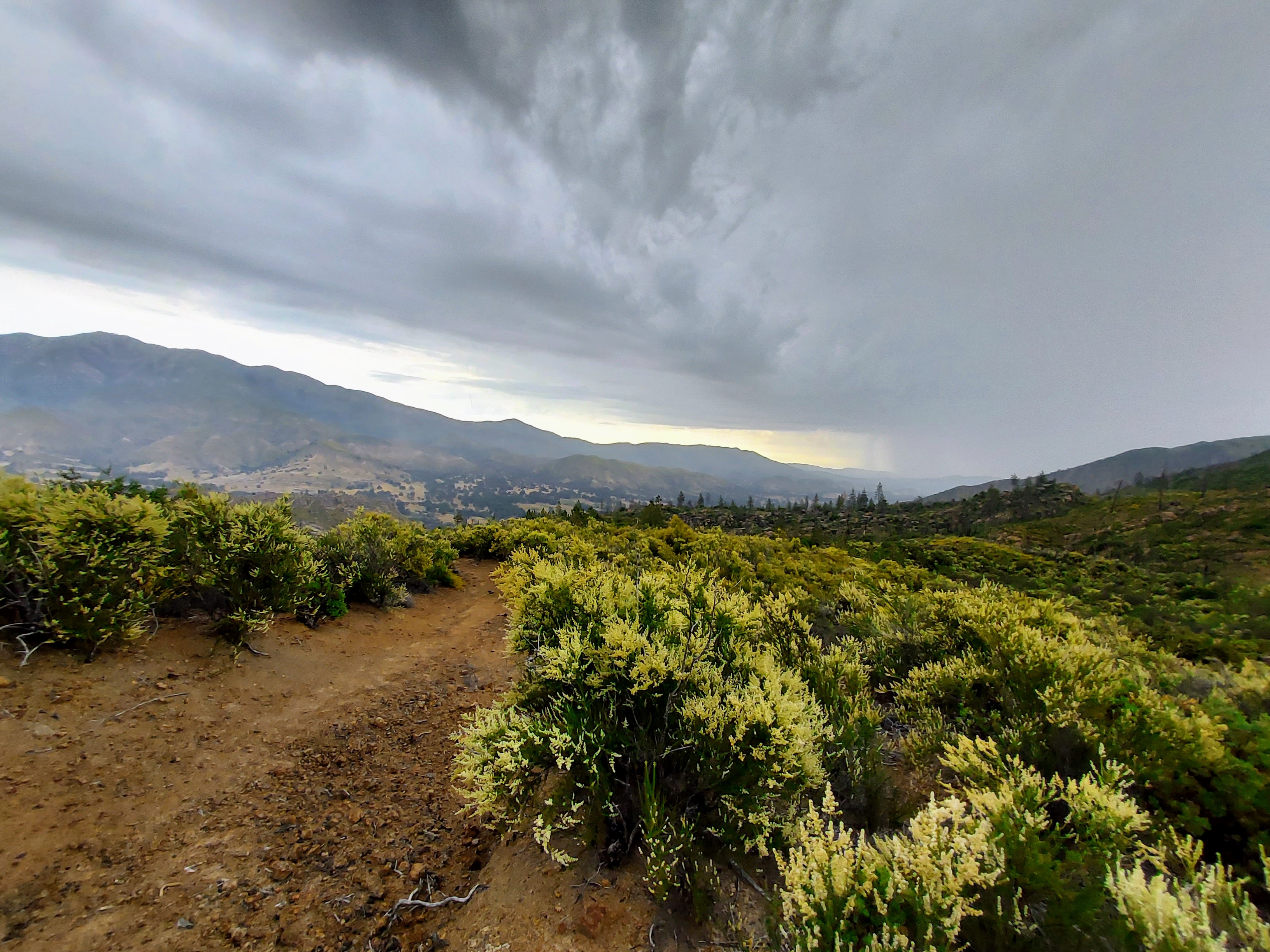
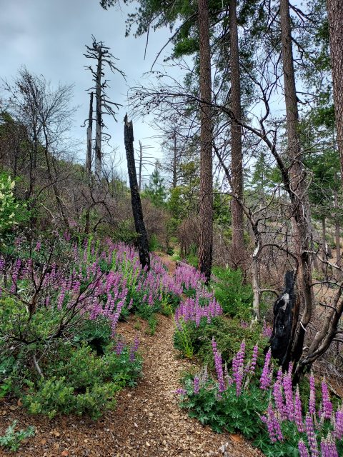
I parked at some indiscriminate place where I could camp then walked to the end of Road 6 (here's the link in google maps). I crossed the bridge over the creek then took an immediate right to start the climb. The first 3 miles to Carrizo Creek Camp were steep and a bit brushy. It's roughly 15-20% grade with 1,900' of gain to the camp. There was very little shade although a thunderstorm kept temperatures relatively cool. Carrizo Creek Camp itself was shaded and with a water source. A half a mile further the trail tops out at a small saddle.
The trail descends for a bit before resuming its relentless climb. Between miles 3-5 there was more shade. However the trail became a bushwhack around 4,200-4,500'. My pace slowed considerably. I recommend having a pre-loaded GPS
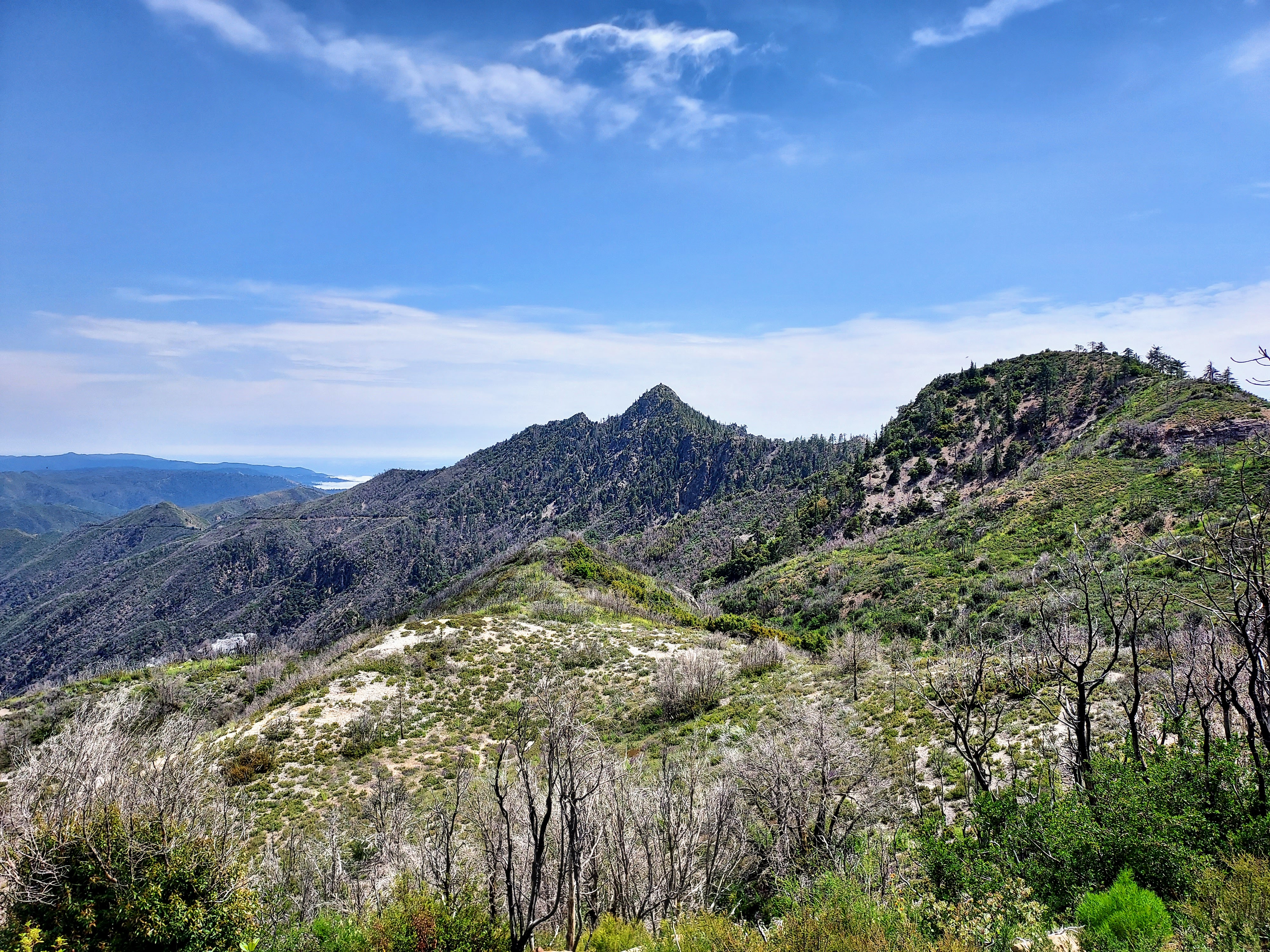
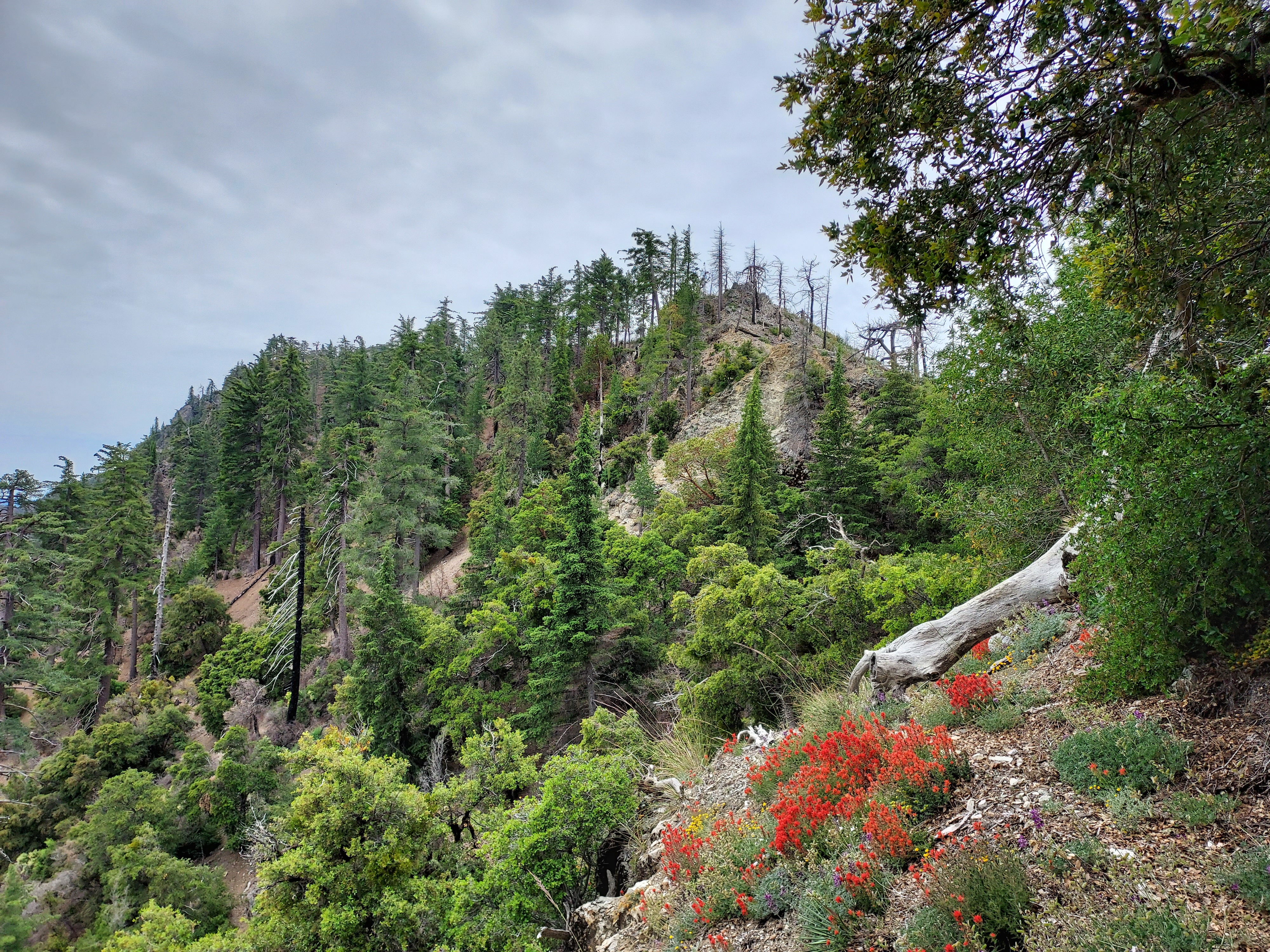
The trail climbs towards the northern spine of Cone Peak before toping out at at about 4,700'. It descends a little before intersecting with the North Coast Ridge Trail. A faint and worn sign marked the junction. A few hundred yards later the trail intersects with the Trail Camp Trail. I stayed on the North Coast Ridge Trail. I continued losing altitude until about 4,500' where a herd path departed from the main trail. Had I not had a pre-loaded GPS or knew of the herd path, I would have missed it.

Scramble to the Summit
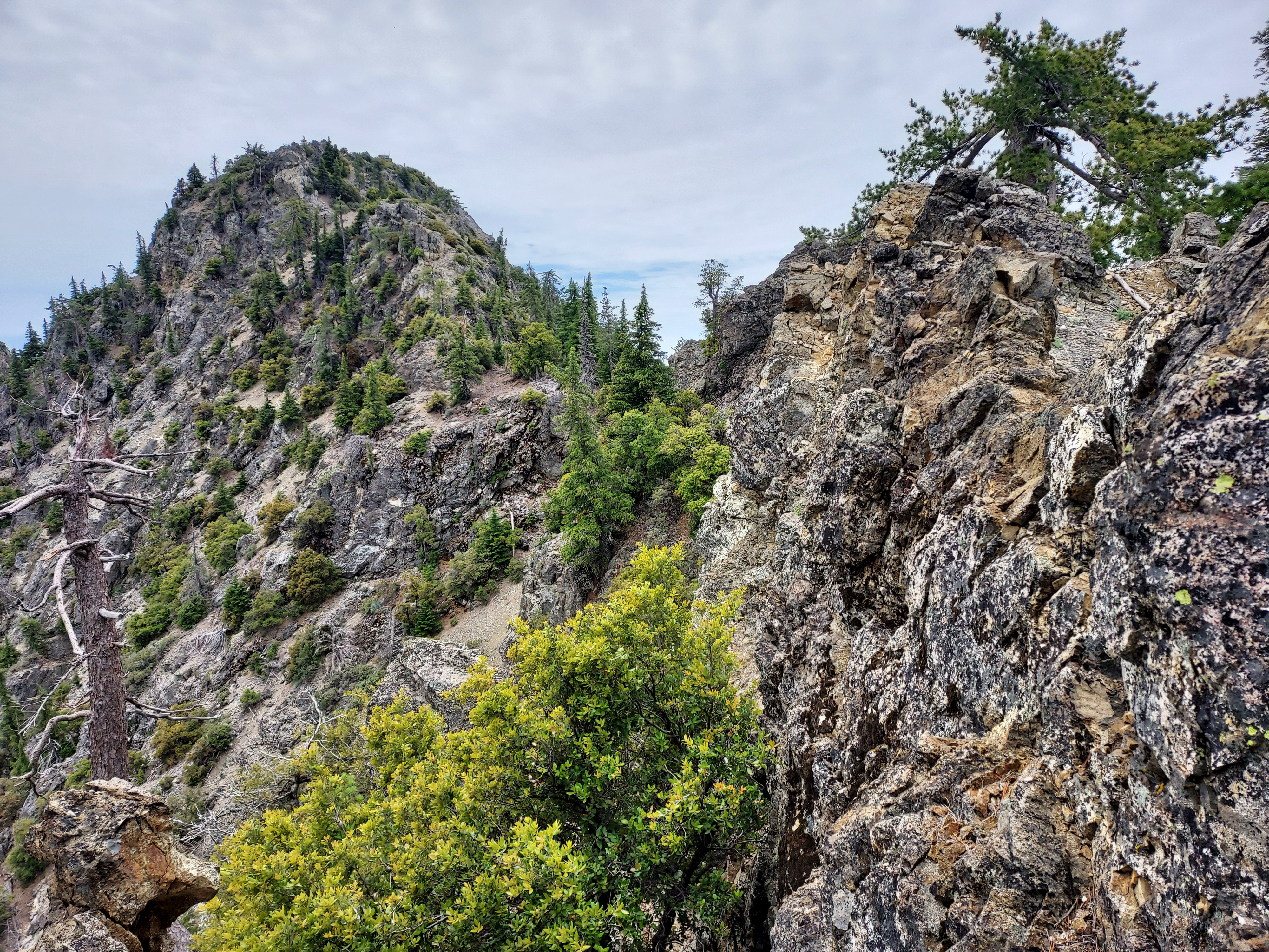
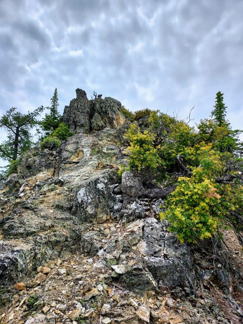
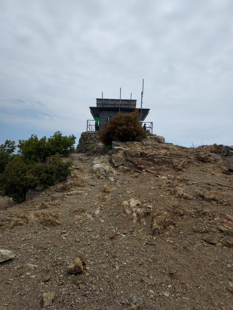
The final 0.9 miles to the summit follow an established route though no trail. I basically followed the path of least resistance along the ridgeline heading south towards Cone Peak's summit. At times, there were easier ways that deviated briefly from the ridgeline. It was steep and a bit scramble-y but not terribly exposed. There was one very rocky section with a class II-III move here and there. It took about 45 minutes to cover the last mile and there were a few demoralizing up-and-downs.
Eventually I topped out at the summit and was treated to a glorious view-

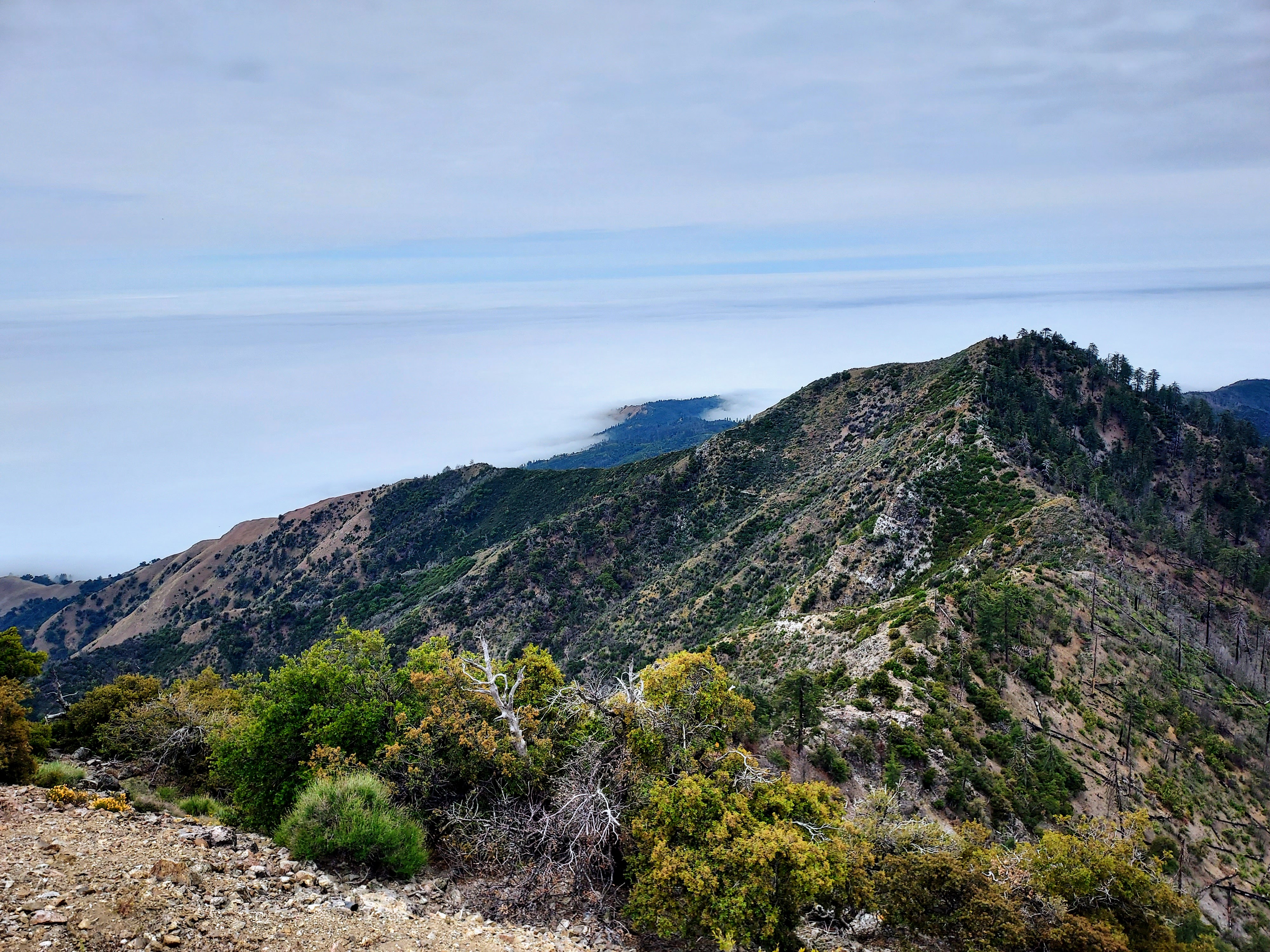
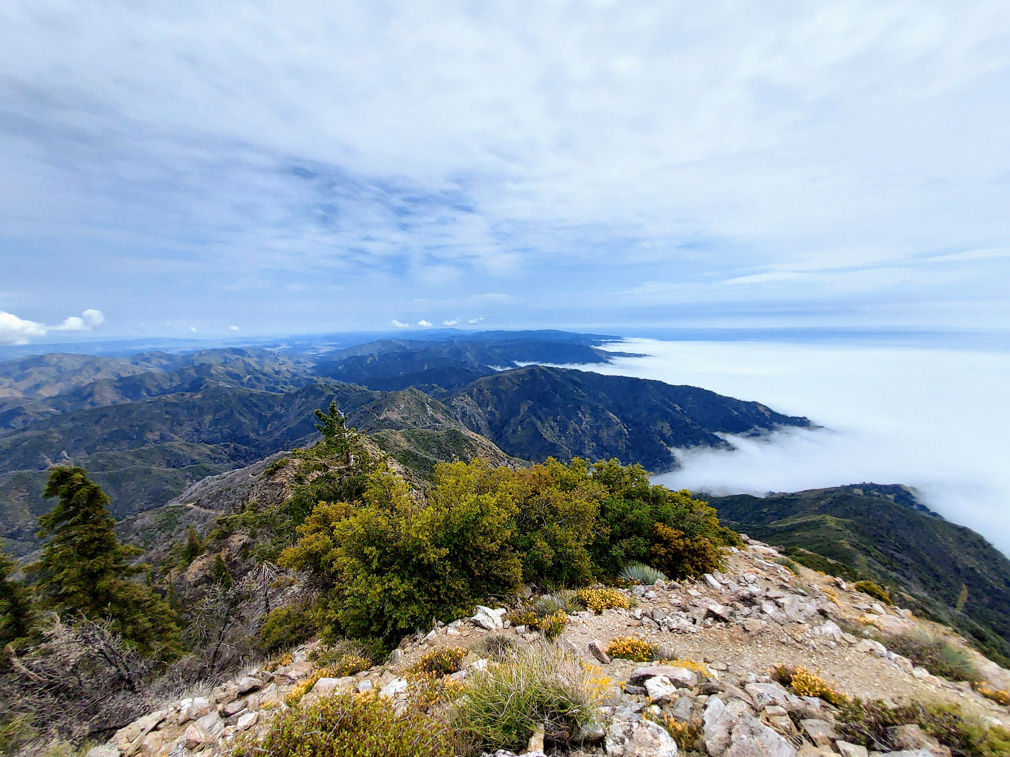
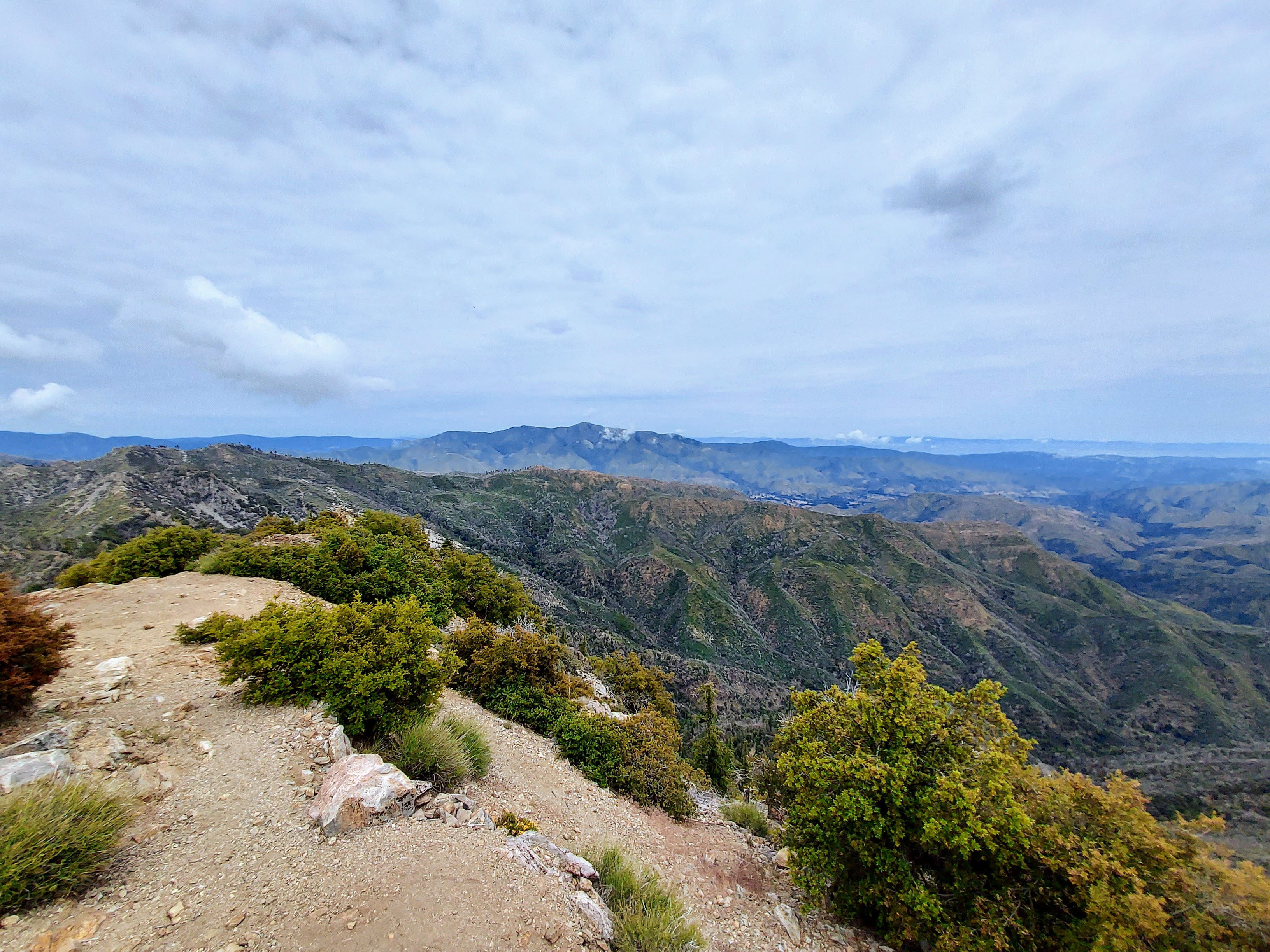
There were a remarkable number of people on the summit. Nearly all of them hiked it via the Vicente Flat Trail. I ran into one trail runner who took my route although opted for the Trail Camp Trail approach rather than the scramble for the final climb.
After signing the summit register, I descended the same way I came. My moving time was approximately 6 hours and the total hike took about 7.5 hours. Overall it was a very challenging hike due to the faint and overgrown nature of the trail and the scramble at the end. However it was much more enjoyable than Junipero Serra Peak. If county high pointing isn't your thing, Cone Peak is undoubtedly the better hike of the two.

No Comments