


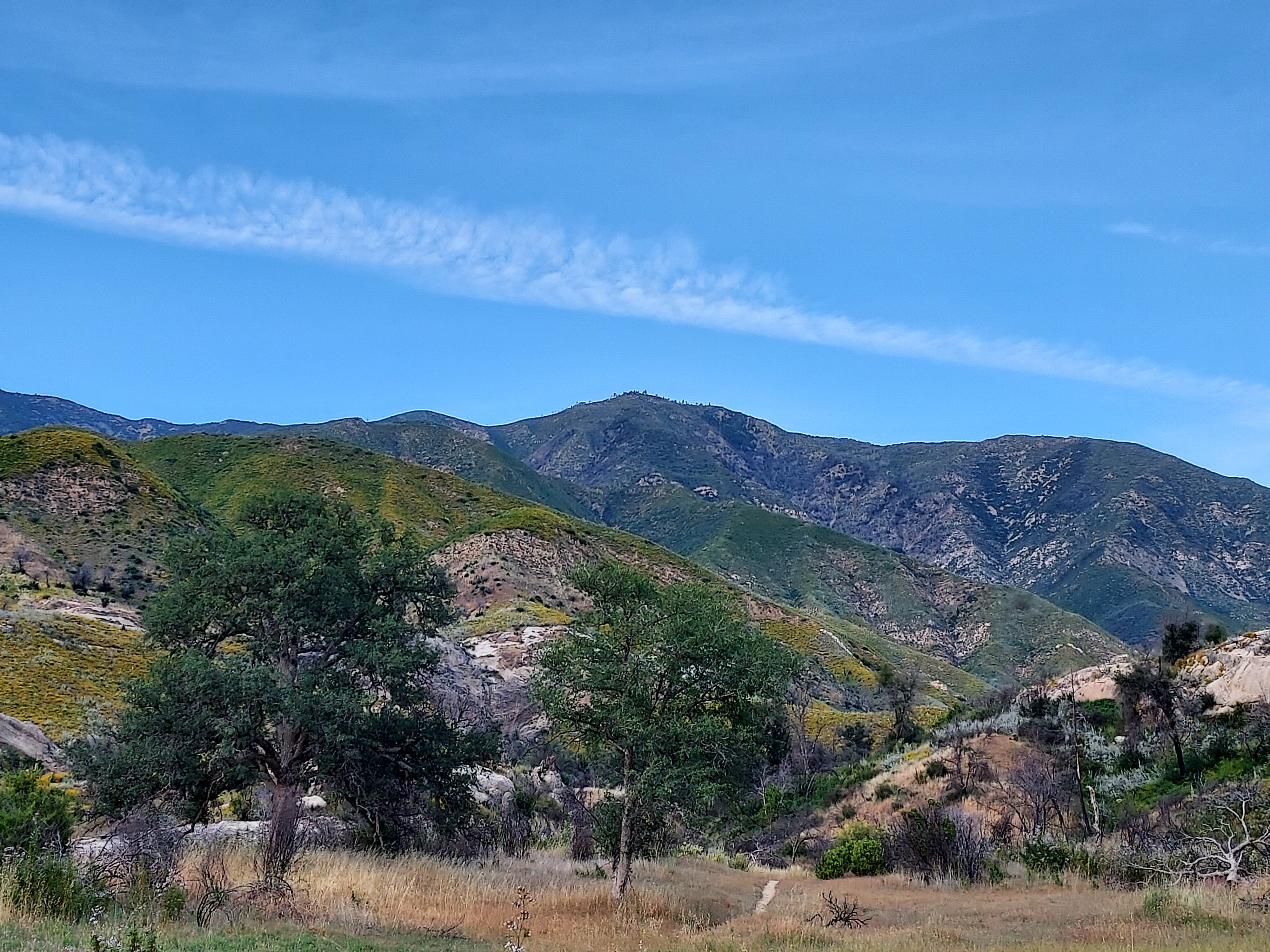
"Junipero Serra Peak has been on my list for at least a decade. This far-flung summit stands tall in the heart of the Ventana Wilderness and is extremely isolated. By California standards, it's a relatively low summit. However, by peakbagging standards, it's a trophy. Chiefly, it holds the distinction of being the highest mountain in the Ventana Wilderness, also known as Big Sur. It is also the tallest peak in Monterey County, with over 4,000 feet of topographic prominence and a remarkable 131 miles of isolation (ranking #28 in the contiguous US). Access to the peak has always seemed ambiguous based on online information, compounded by periodic wildfires, mudslides, and forest closures that further hinder trips. On an auspicious day in June, I finally decided to go for it, despite my uncertainty about reaching the summit. Here's my trip report and guide.
Getting to Junipero Serra Peak
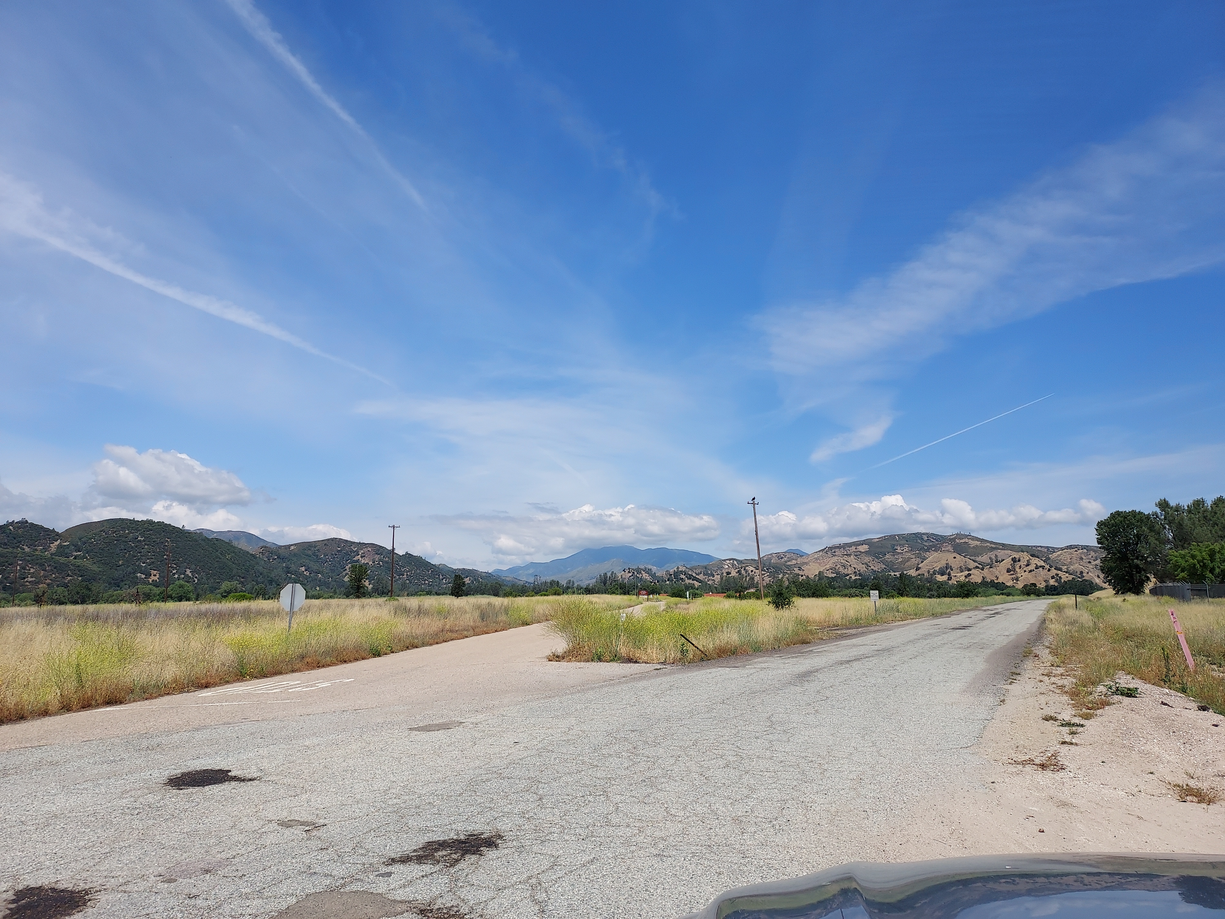
The trailhead for Junipero Serra Peak is just before Memorial Park Campground in Los Padres National Forest. Getting to this spot is not straightforward. All the roads leading to the destination pass through Fort Hunter-Liggett, an active army base. Initially, I had concerns about traveling there due to potential access restrictions. The COVID-19 pandemic also caused significant delays in executing any plans. Fortunately, as of 2023, driving through the base is unrestricted. However, there is an additional complicating factor. The 'main' route to the campground is via Del Venturi Road, which, while paved, involves water crossings. In certain years, it may not be possible to cross these sections with a standard vehicle. In June 2023, the road was completely closed, necessitating a detour via unpaved Mission Creek/Milpitas Road.
Coming from the North, I relied on Google Maps to navigate to Jolon, California. King City is the last location with reliable cell phone reception and gas, so I made sure to stock up there. Driving south from King City, I arrived at Jolon and followed the route outlined below to reach Memorial Park Campground:
Route Notes and Photos
A few things to note on the route-
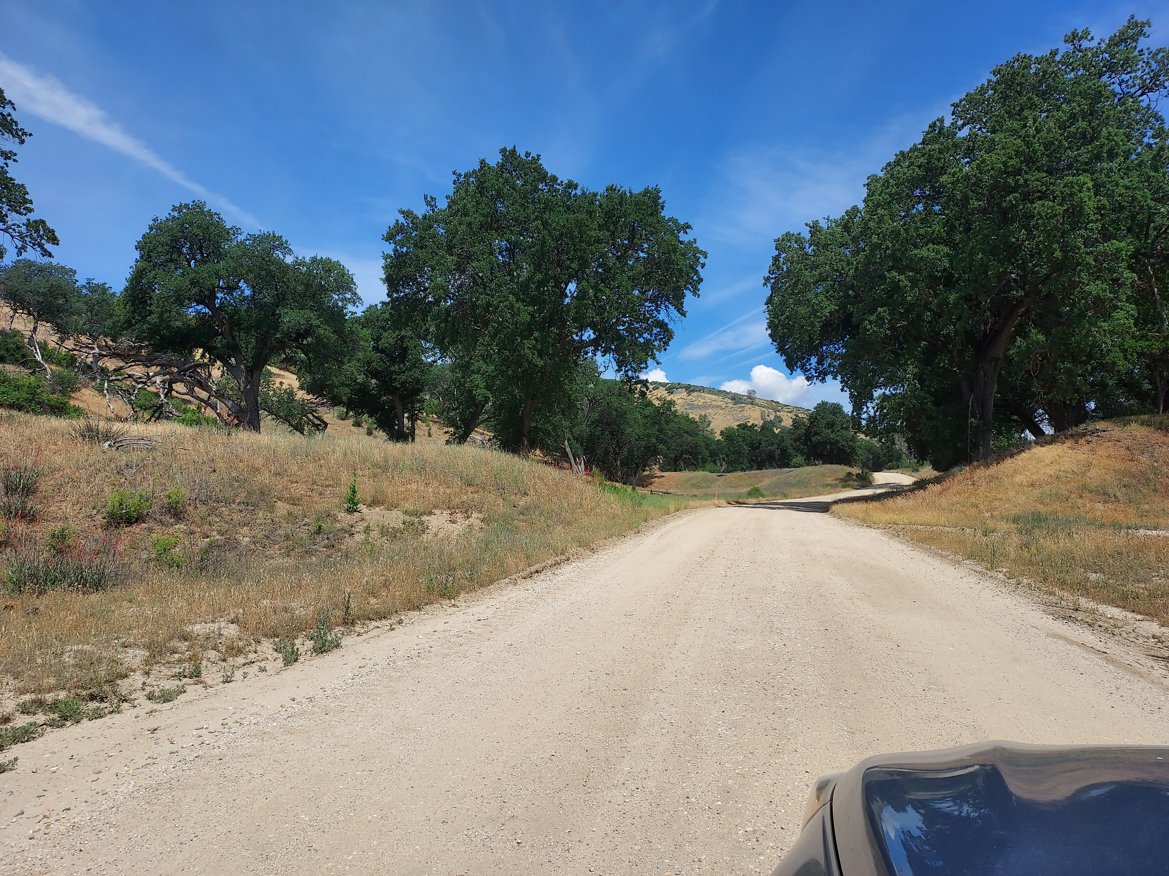
- Mission Road is the main road leading to Mission San Antonio de Padua. It is paved up to the mission. Instead of turning towards the mission, continue straight on a well-graded dirt road, which may be labeled as 'Milpitas Road,' 'Mission Creek Road,' or 'Mission Road.'
- Milpitas Road (or whatever it's called) is a dirt road, but passable by any vehicle as of June 2023. Be aware that it is a military road, so refrain from stopping or engaging in any unnecessary activities. Travel along this road for 9.6 miles until it eventually connects with the open section of Del Venturi Road.
- Once you're back on Del Venturi Road, it is paved, although it may have potholes, all the way to Memorial Campground.
- From the intersection of Milpitas Road and Del Venturi Road, the road remains on military property for 4.3 miles before entering the national forest. Once you enter the national forest, open camping is permitted.
- I have marked campground areas on the map above. There are plenty of spots available, but be aware that it tends to attract a rowdy 4x4 crowd. The roads leading to the campgrounds are unimproved and may be challenging for regular passenger vehicles.
- The road essentially ends at Memorial Park Campground.
- Keep in mind that Google Maps may not always provide the most reliable directions.
I strongly recommend checking in with the rangers of the Monterey District before traveling as conditions change often. Their phone number is (831) 385-5434. They were extremely helpful when I called.
Junipero Serra Peak Hike Overview
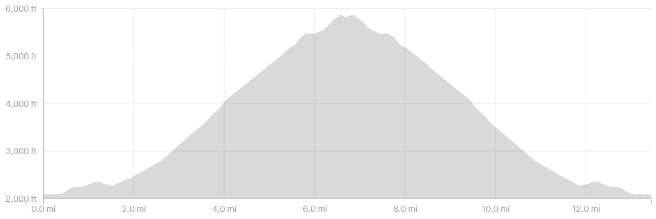
Junipero Serra Peak is a challenging hike, any way you slice it. By my GPS measurements, it was a 13.9 mile hike with 4,000' of altitude gain and loss. What made it most challenging was the characteristically thick brush that covers much of the trail. It was practically a jungle bushwhack in some sections. In some parts the trail was so faint it was easy to lose it. I used a pre-loaded GPS route just to be certain. Although it was a wet year, none of the water crossings were too challenging. I doubt water sources are dependable in dry years. Abundant tics and poison oak added to the challenge.
Here's the route I took:
Camping Options and Weather Notes
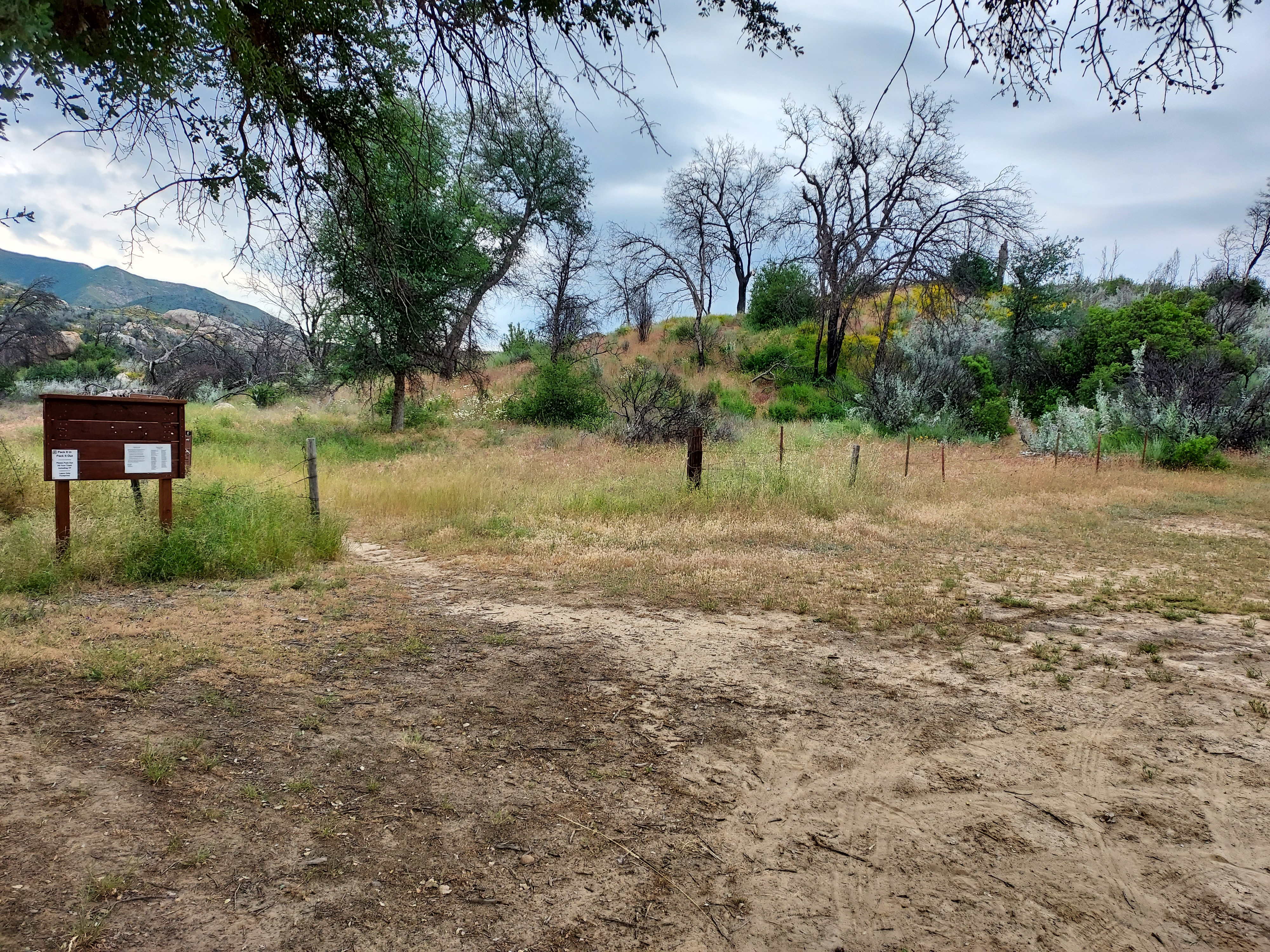
Once within the National Forest Service area, there is an abundance of backcountry camping options available. Numerous unmarked and somewhat rugged dirt roads branch off from the main road leading to Memorial Park Campground. I was able to easily find a spot with an established fire ring (remember to check for fire restrictions before starting a campfire). During a pleasant summer weekend, I noticed several dozen groups camping along the creek.
Memorial Park Campground itself has only 8 sites and 7 can be reserved. Many of the Los Padres National Forest Campgrounds were closed by severe weather from the 2023 winter. Don't expect to find an open site at Memorial Park on the weekends or busy holidays.
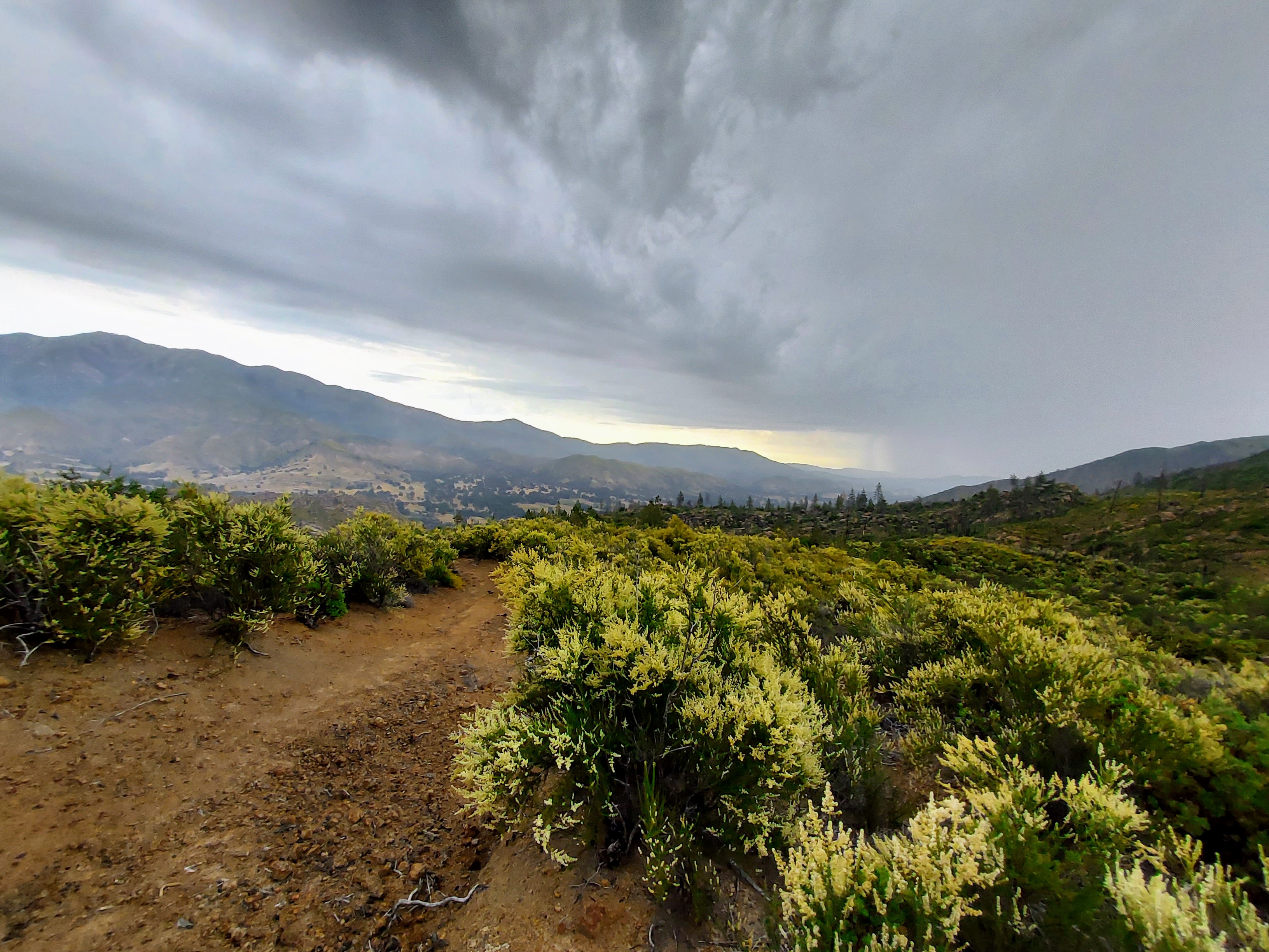
The weather in this particular area of the park is characteristically unpredictable. In most years, Junipero Serra receives snowfall in the winter. Of course, in 2023, the peak received substantial snow with the historic winter. While summers tend to be mostly dry, I personally encountered a thunderstorm while hiking in the area.
Trip report
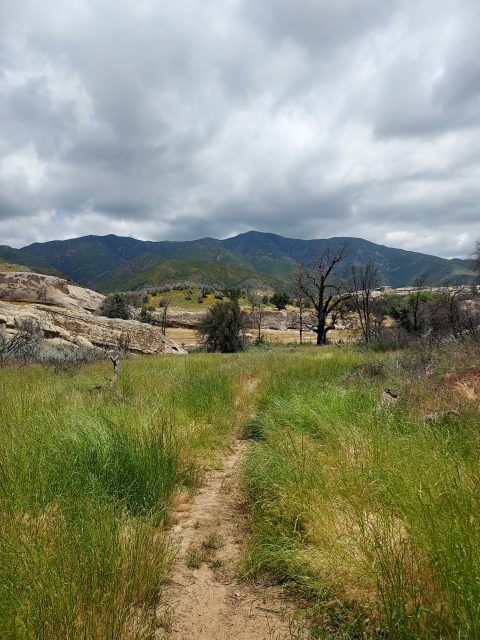
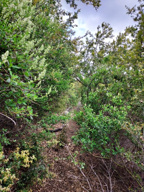
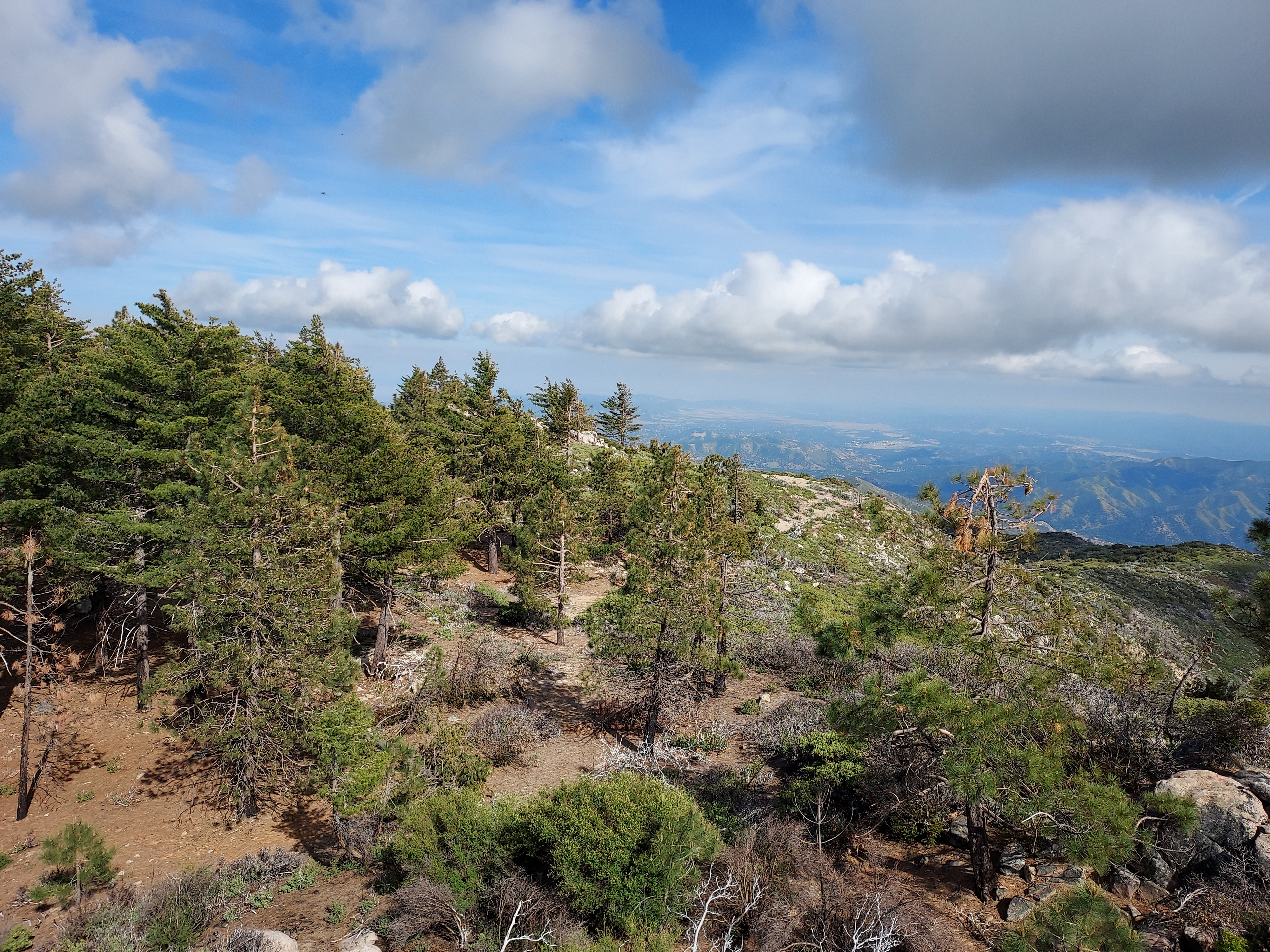
Starting from the unmarked trailhead, there was only one trail to follow. Immediately, it became apparent that the trail was overgrown with thick brush. The presence of itchy tall grass made me grateful for wearing long pants. In the initial 1.8 miles, the trail meandered up and down, gaining a modest 400 feet of elevation considering the overall climb. The trail was particularly faint in certain sections, especially around water crossings, and I could see how easy it would be to lose my way.
After 1.8 miles, the trail abruptly veered towards Junipero Serra Peak, marking the beginning of a steep climb. The next two miles were just nasty—I can't think of a better way to describe it. The brush became dense, sections of the trail were muddy, and I had to constantly fend off ticks (I immediately and liberally applied 100% deet). My confidence in reaching the summit wavered.
At approximately 4.1 miles from the start, at an altitude of about 4,100', I reached the only junction on the hike. It provided a welcome opportunity to take a break and assess my progress. While Junipero Serra Peak loomed tantalizingly close, I knew better than to believe the hard part was over.
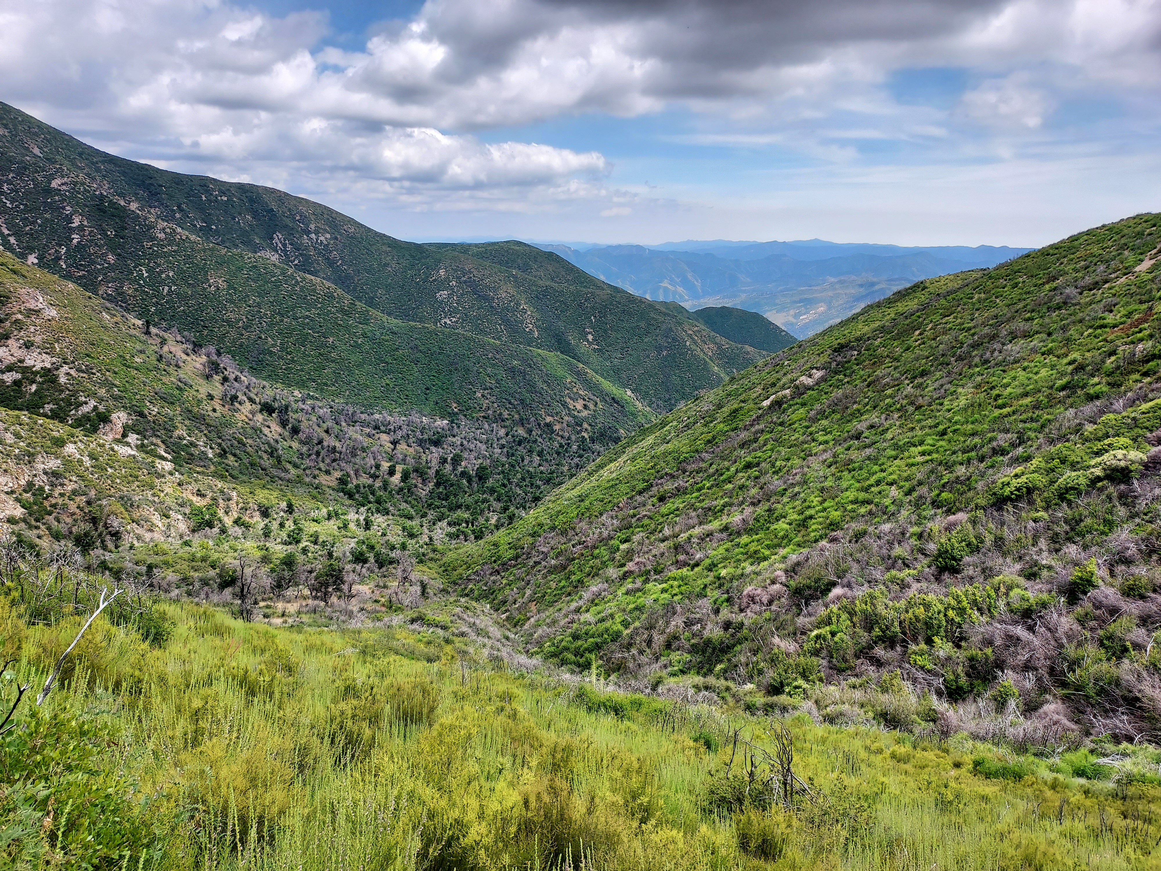
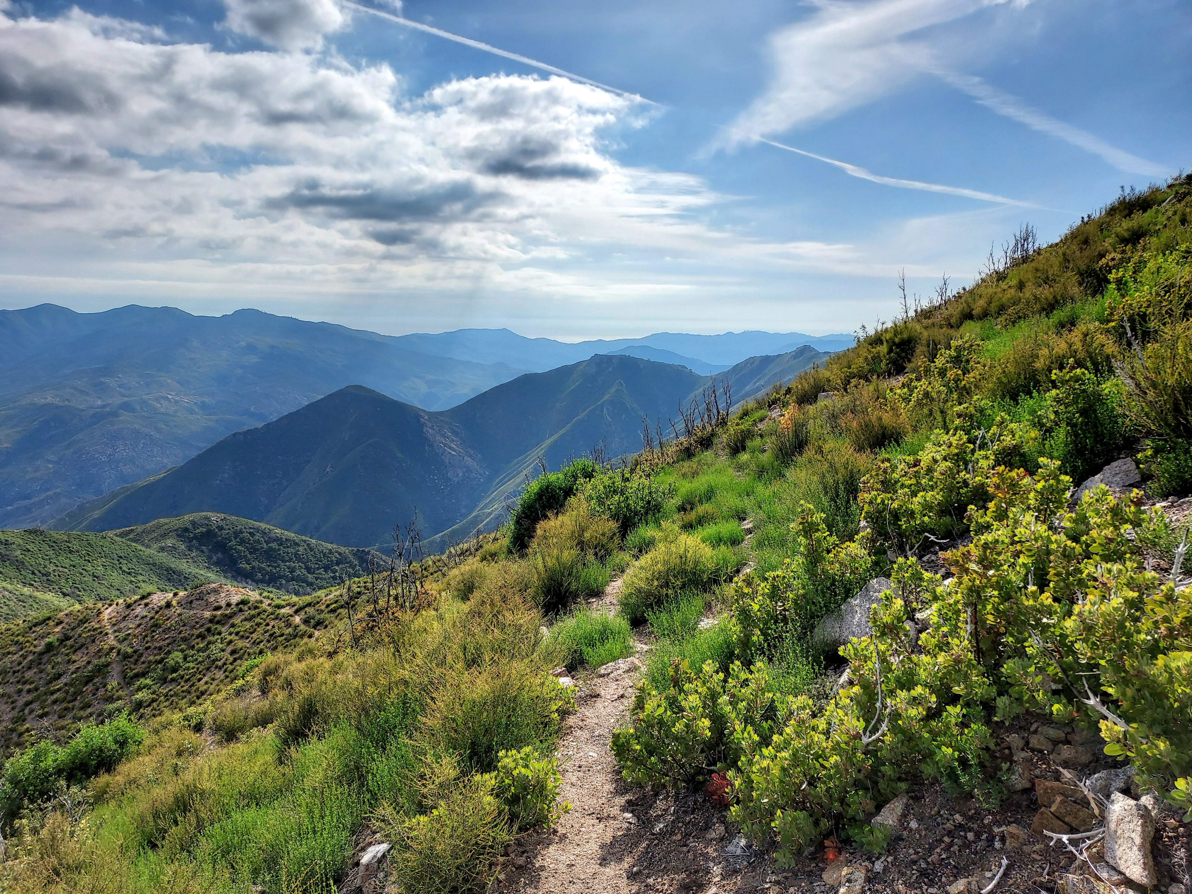
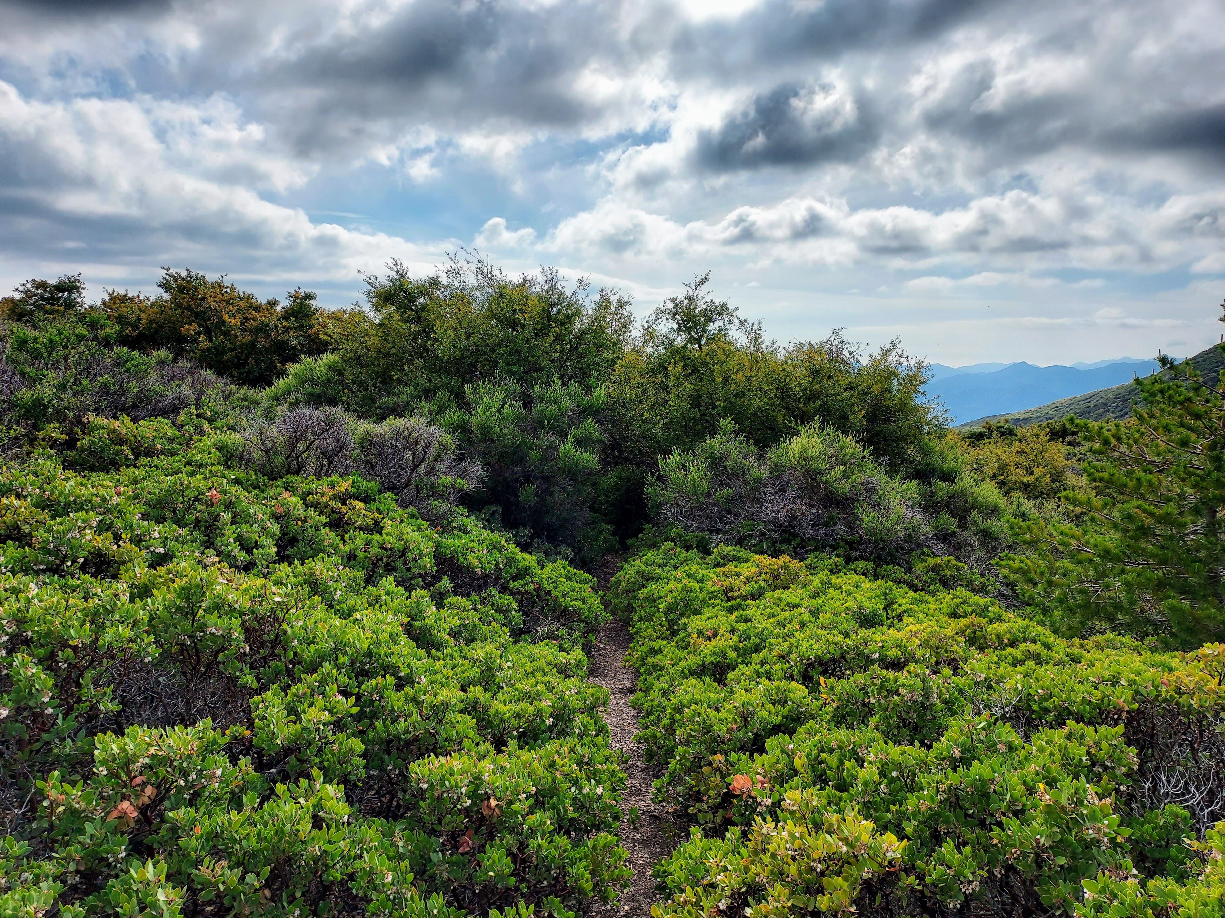
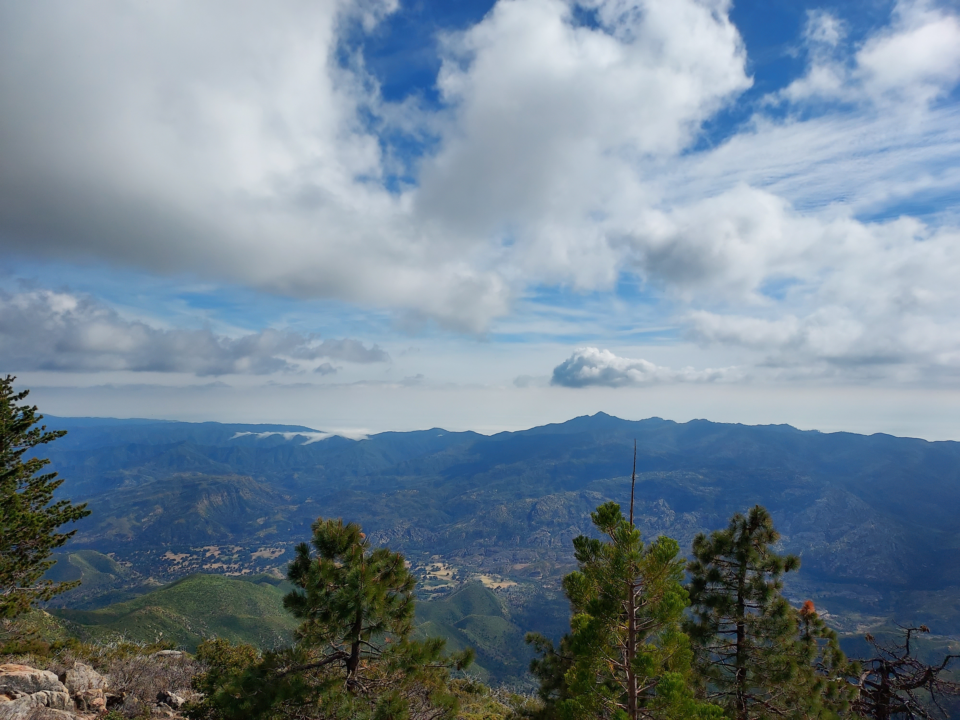
Although I still had around 1,700' of elevation gain ahead of me, the brush thinned out for the next mile or so, offering considerably more expansive views to the south. The distinct profile of Cone Peak became strikingly apparent. This pleasant respite eased some of the difficulty associated with the climb. However, at approximately 5.2 miles and an elevation of 5,400', the trail led me through an incredibly dense section of manzanita. This portion brought about more scrapes, ticks, and profanities...
The final half a mile to the summit at least added variety to the affair. There's a forest of stately sugar pines that adds an alpine feel to the last push. The actual summit is about a quarter of a mile east of the long derelict fire tower. There's a modest monument and a summit register.
After spending a little time on the summit, I returned the same way. Given all the brush, the descent took almost the same amount of time as the ascent.
Final Thoughts
The Ventana Wilderness certainly isn't for the faint of heart. While I felt accomplished after the hike, I can't call this one enjoyable. I ended up hiking slightly shorter and more remote Cone Peak the next day and the trail was ironically more clear. Be prepared for slow going on this one!

No Comments