


I'm discovering all kinds of hikes in Big Sur that are devoid of crowds lately. Brazil Ranch and Sierra Hill are easily accessible from the highway but seem off the radar to the casual day hiker. This is curious considering they're right next to the famously photographed Bixby Creek Bridge. This is a fantastic 1/2 day hike that I did on my way back from nearby Andrew Molera State Park.
Brazil Ranch Overview and Directions
Brazil Ranch is a small tract of public space in the Los Padres National Forest - Monterey District of Big Sur. It is a relatively recent addition to the public lands, having been purchased in 2002. Though I'm not certain about the timing, I believe it was once only open to docent-led hikes. These days, access seems unrestricted, although some websites offer ambiguity. I had to visit Big Sur Station in person to confirm with a ranger that the place is free and open to the public.
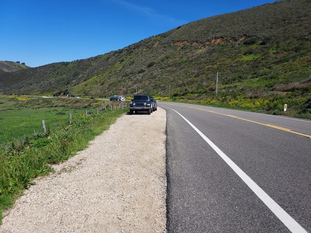
Getting there is relatively straightforward. There's a parking area off Highway 1 with space for 5-8 cars. Its just 0.6 miles south of the parking area for Bixby Bridge. There are no fees nor permits required. Note that there are no signs nor anything to note the parking area is for Brazil Ranch. Note you must jaywalk across Highway 1 to access the ranch (not an easy affair on a busy summer weekend).
The hike itself is simple enough. Its about 5.3 miles with 1,300' of elevation gain. Here's a map of the route I took-
Brazil Ranch/Sierra Hill Hike / Trip Report
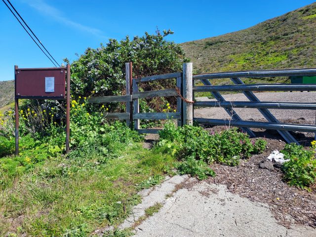
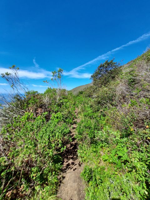
After finally finding a break in the traffic, I hurried across Highway 1 and began hiking. The route starts on a paved road, and there's a metal gate preventing vehicular traffic. After about 0.1 miles, I found a clear but unsigned path to the right and took it. This steep, overgrown path zig-zags up for about a mile and gains about 600 feet in elevation. At about 1 mile from the parking area, the trail crosses a cattle gate and enters a very scenic section. However, there are plenty of cattle, so I kept an eye out.
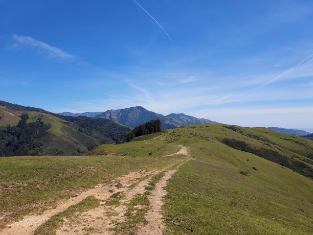
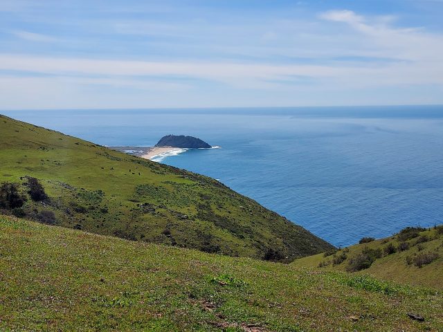
The trail continues gaining altitude past the gate, though it becomes noticeably less steep. I encountered several unmarked herd paths and old cattle roads, which made wayfinding a little more difficult. However, since I was on an open ridgeline, it really didn't matter which path I took, as long as I headed in a generally southeastern direction. Interestingly, on the way back, I ended up taking a different route, but it brought me to the same place.
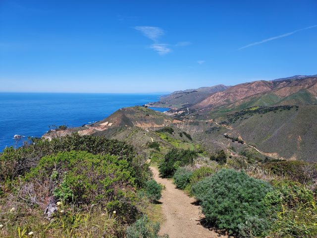
The final mile to the top offered phenomenal views. Pico Blanco stood tall in the distance, its conical visage creating an illusion of even greater height than it actually possesses. Point Sur and its lighthouse loomed in the distance, vaguely reminding me of my former hikes in Maine. After about 1 hour of hiking, I reached the "summit" of Sierra Hill. Despite its grandeur, there was no sign or summit register marking the top, so I simply enjoyed the quiet respite. My GPS indicated 2.5 miles of travel to the top.
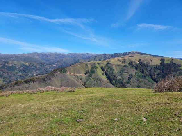
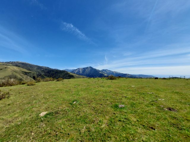
I hiked back but lingered along the ridgeline, trying to fill up on central coast vibes before leaving. But it didn't take me too long to get back to the car. Altogether, the hike took me about 2.5 hours with 2 hours of moving time. This one is worth repeating- I'm sure I'll be back.

No Comments