


My final large mountain of the winter road trip was Telescope Peak in Death Valley National Park. I've attempted this mountain a few times in the past and been denied. Finally, in February of 2020, I successfully climbed it. My trip also included short side climbs of Rogers Peak and Bennett Peak, nearby. Here's my winter trip report, hopefully benefiting those who wish to do the same.
Some Background on Winter Climbs of Telescope Peak
Telescope Peak is a hard hike/climb any time of year. In the best of circumstances, the route is 14 miles round trip and has roughly 3,000' of elevation gain. This is the trail from Mahogany Flat Campground which is only accessible by high clearance vehicles. During most of the colder months, the road is gated and hikes must start from the Charcoal Kilns, adding 3.2 miles to total distance and another 1,300' of altitude gain. The trail has no reliable water sources. Although at altitude, the potential hazards include that of desert hiking and high altitude hiking. People frequently turn back.
The season for climbing is similarly difficult. It can be hiked or climbed any time of year. Early summer (May-June) and fall (September-November) result in the most successful ascents. July's murderously hot temperatures across the region generally reduce crowds though Telescope Peak is somewhat pleasant that time of year. Any winter ascent is more of a snow climb than a hike.
Here's my winter route which included climbs of Rogers Peak and Bennett Peak nearby:
Telescope Peak: Charcoal Kilns to Mahogany Flat
My climb of Telescope Peak occured in early February 2020. The winter had been somewhat dry this year so there was no snow below 6,900'. The road from Emigrant Campground was thankfully clear. Its dirt for the last few miles or so but easily passable by any vehicle. The road from the Characoal Kilns to Mahogany Flat was gated. I packed 3.5 liters of water and drank every drop of it on my 13 hour hike/climb.
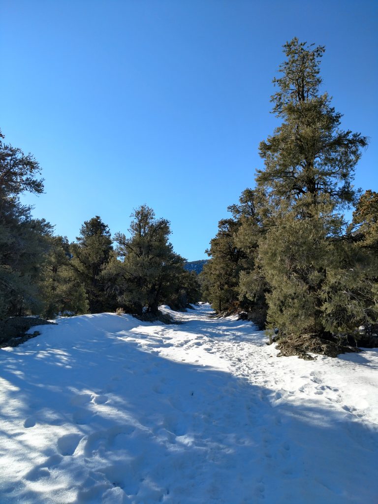
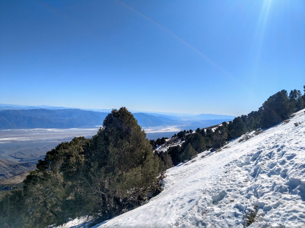
It was a very steep and slow hike from the Kilns to Mahogany Flat. The road was entirely covered in snow but people cut a path over time creating a firm, "monorail" to the campground. Views opened up behind me almost instantly. I saw the more popular Wildrose Peak looming to the North. Of course, its summit was a full 2,000' lower than Telescope Peak: a telling reminder of the distance I had still to cover.
Again, its 1,300' of altitude gain over 1.6 miles to Mahogany Flat from the Charcoal Kilns. I covered it in about 1 hour.
Telescope Peak: Mahogany Flat to Rogers/Bennett Saddle
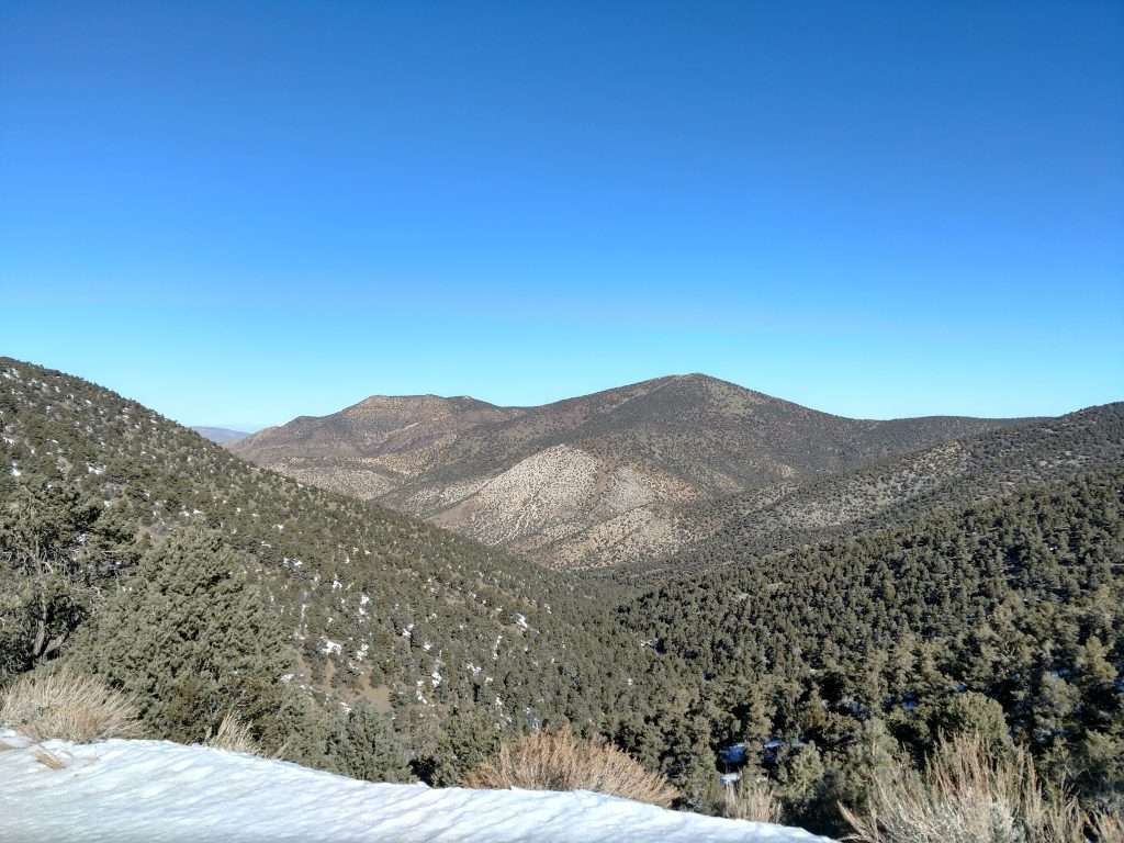
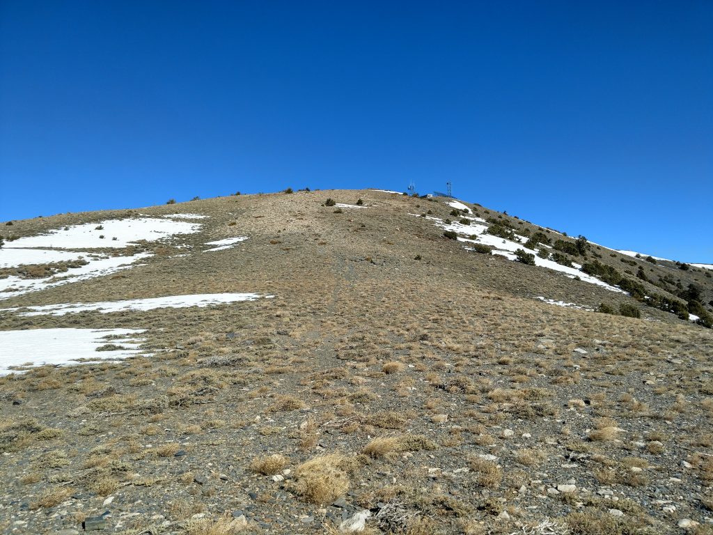
From Mahogany Flat, the true trailhead for Telescope Peak, I pressed on. I noticed a road veering off to the right which is apparently an access road for the towers atop Rogers Peak. To my knowledge, its open for hiking in the winter. Taking it does not save you any climbing nor mileage and most people simply continue on the trail.
The trail takes a relentlessly steep route from here. Windling along the Eastern flanks of Rogers Peak, the views are continuous. In the winter, it was also very, very icy. I'm glad I brought microspikes for this section.
In 2.3 miles, the trail rounds to the saddle South of Rogers Peak and North of Bennett Peak. It gains about 1,500' before briefly descending to a flattened area that served as a nice rest area for me. Wind started picking up however.
From Rogers Peak Saddle to Telescope Peak Saddle
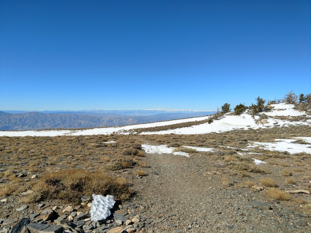
The next 2.1 miles from one saddle to the next were aggravatingly undulous. Within that distance, I went up and down 1,000' of altitude. It seemed like a ton of effort to simply remain at around 9,600' and still remain 1,500' lower than the summit.
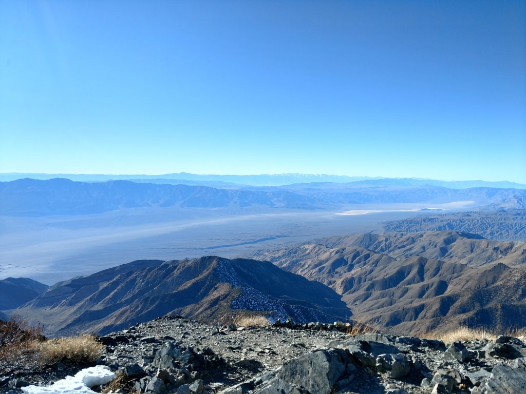
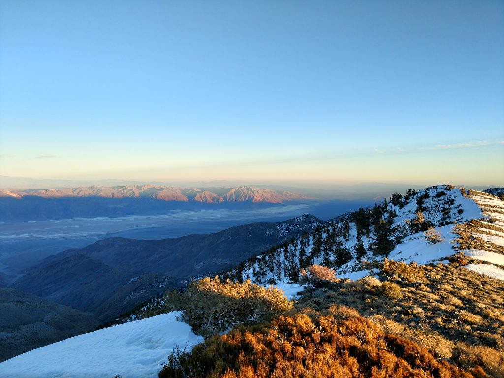
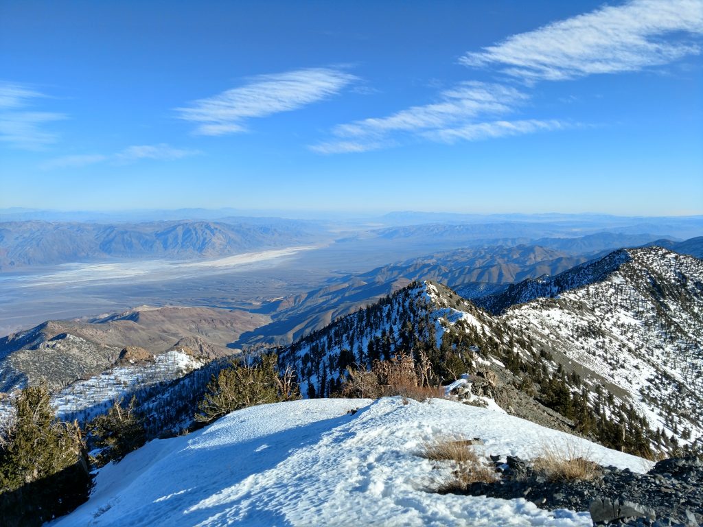
One pleasant aspect of this section was the Western facing views of the Sierra Nevada. Panamint Valley was also below, a lesser explored side of the National Park. When it was dark, I could see car headlights over 20 miles away. It sure it a desolate place...
Telescope Peak: the final 1,500'
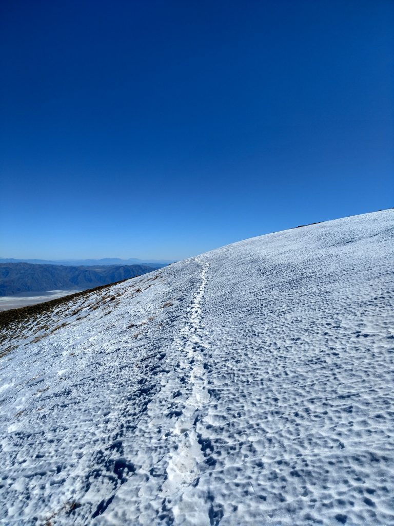
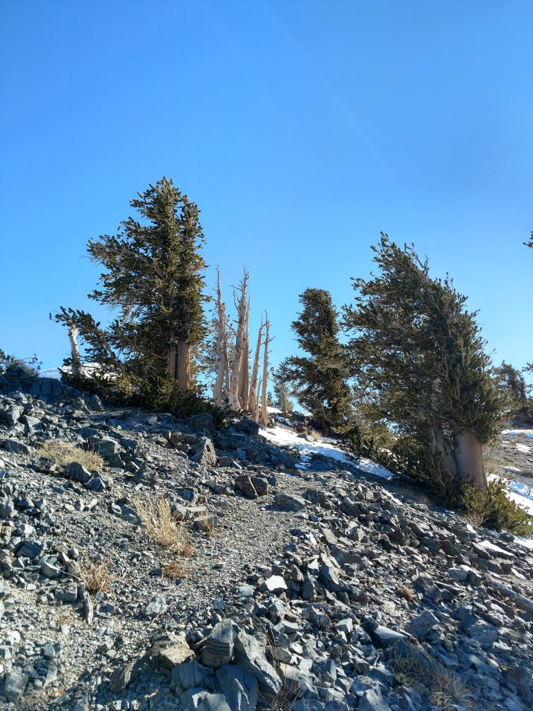
Finally with the icy summit within reach, I trudged up the last slopes. At this point, there was no sign of a trail and no sign that anyone had been up here recently. I switched from microspikes to crampons and an ice axe. It was class II terrain for the most part but there was exposure.
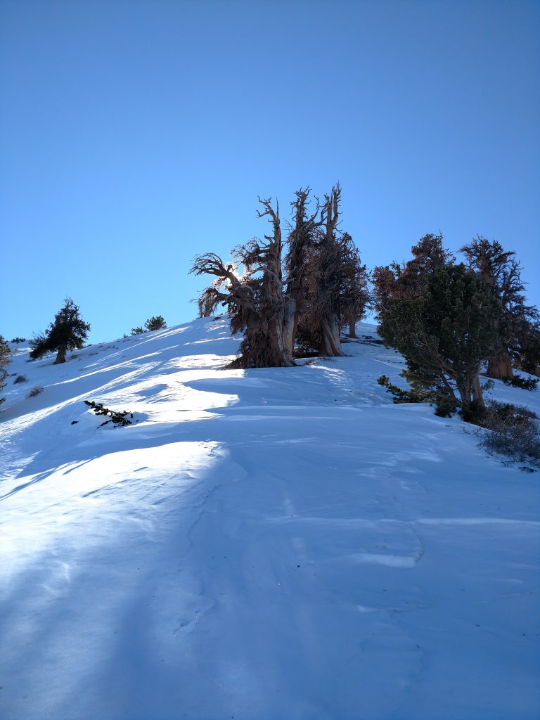
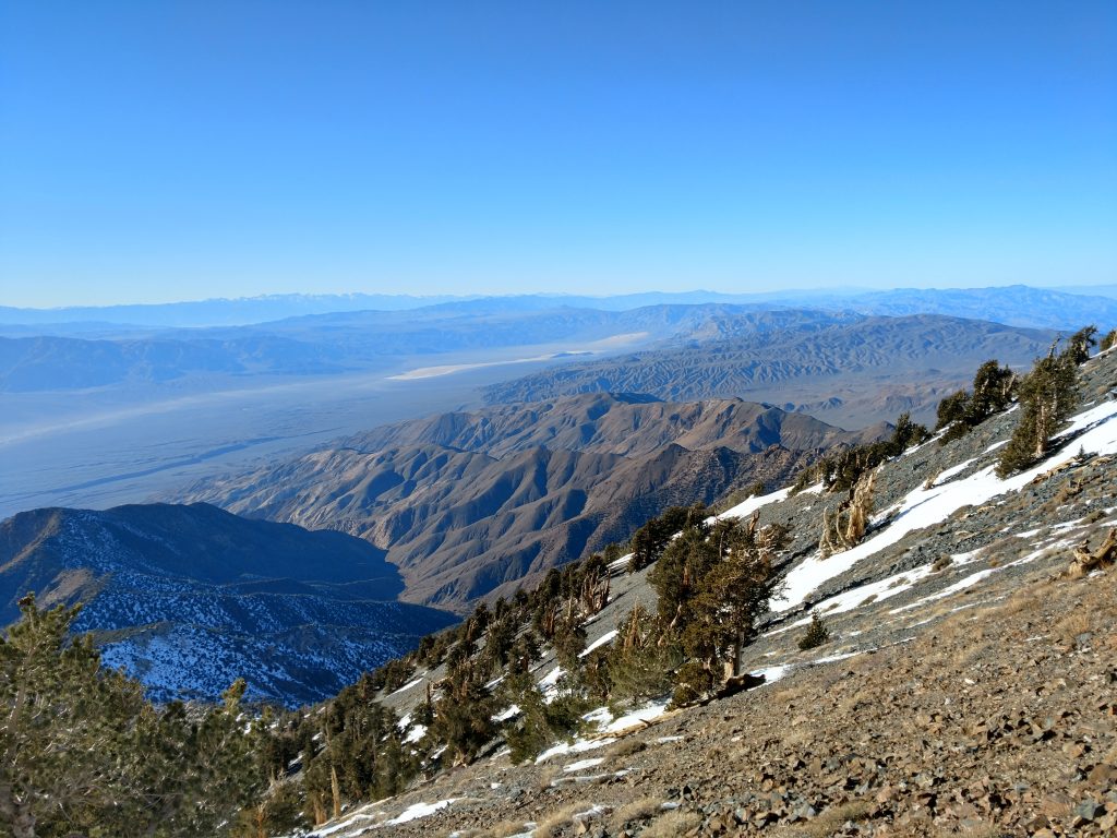
At the highest reaches of the trail and just below the summit, I walked through a forest of Ancient Bristlecone Pines. These gnarly looking trees grow only at these altitudes and for several thousand years. They're the oldest non-clonal organisms on Earth. I'm fascinated every time I see one.
Telescope Peak Summit
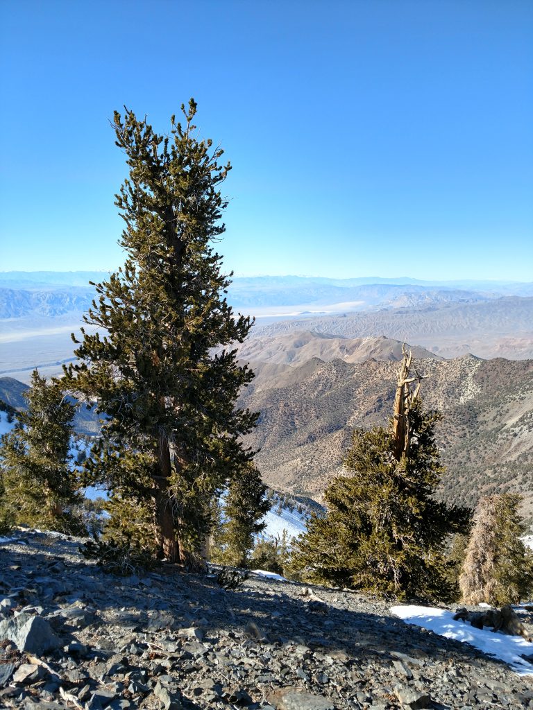
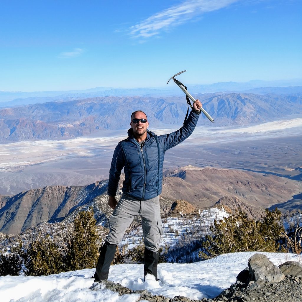
After 5 hours and 20 minutes of hiking/climbing, I made the summit. I felt an incredible sense of accomplishment given the 10 years it took to climb all of California's Ultra Prominent Summits. Predictably, the view at the top was unreal; I'm pretty sure I could see all the way to San Gorgonio Mountain about 140 miles away.
There's a great summit register at the top and I found out I'm not the only one who dared a climb in February. November seemed was the most popular month.
After a number of victorious photos, I began my way down, knowing I would be climbing in the dark.
Rogers Peak and Bennett Peak on the Way Down
I took a slightly different path on the way down which included a climb of Bennett Peak and Rogers Peak. Both have enough prominence to be considered individual summits and both end up on various desert peakbagging lists.
- Bennett Peak, 9,980' is just North of Telescope Peak. To climb it, I simply took a direct route up its South-facing slopes, going off trail. It added about 500' of gain to my trip but did not involve any significant increase in distance. My off trail route essentially cut off the trail which circles the West-facing slope of the mountain. I dipped back down to the original saddle between Bennett Peak and Rogers Peak
- Rogers Peak, 9,960' is just North of Bennett Peak. To climb it, I kept heading North on a direct route from the saddle. There was a herd path that lead to the 4x4 access road. With a combination of the two, I easily gained the ugly radio-towered summit of Rogers Peak. There was no register at the top. This side-trip added no real distance to the whole trip although it added 300' of gain.
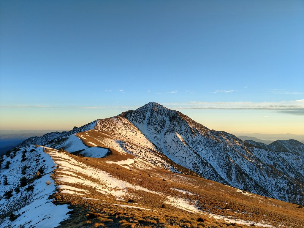
Bennett Peak was far more worthwhile than Rogers Peak. The sharp profile of Telescope Peak in the evening light was splendid- see the first photo of this post.
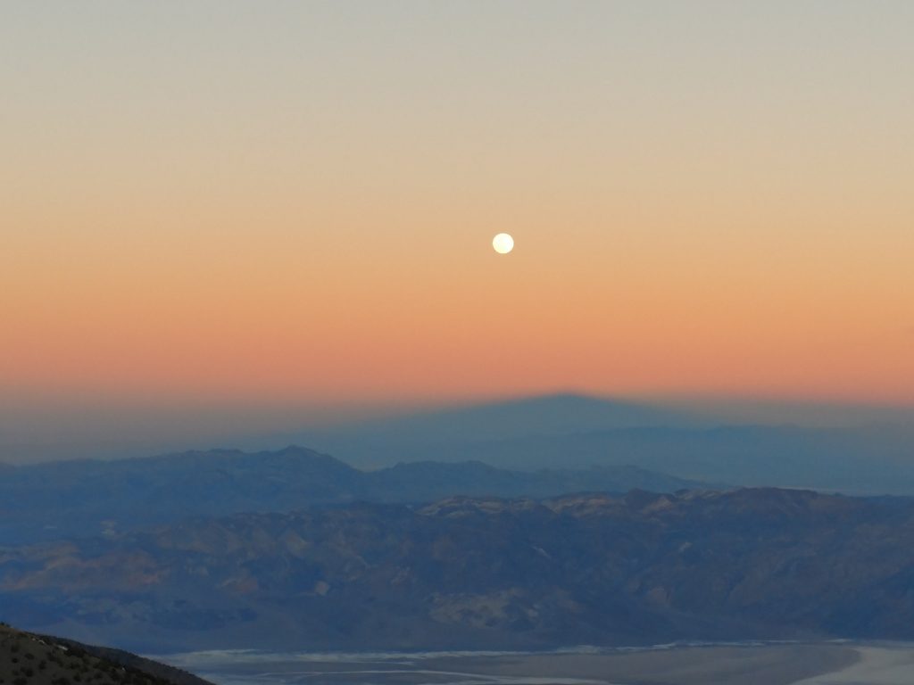
I ended up taking the service road down to Mahogany Flat. It wasn't a great way; deep, powdery snow covered most of the road and I was postholing for most of the way. By the time I began my descent to Mahogany Flat and the Charcoal Kilns trailhead, night had fallen. I caught some great photos of the moon and continued descending by its light.
It took me roughly 13 hours to cover 16ish miles on this modified winter hike of Telescope Peak. It was very strenuous but lovely at the same time. Hopefully a climb of Telescope Peak from Shortys Well is in the cards down the line!

No Comments