


After a short but lovely hike of Red Mountain, I still had plenty of daylight left. I originally wanted to hike Kendrick Mountain but during the winter, all approach roads are either closed or essentially closed to non serious 4x4 drivers. Bill Williams Mountain is Kendrick Mountain's little brother; shorter in altitude and distance but still as lovely. I hiked the trail near Williams and Flagstaff, Arizona.
Getting to the Trailhead
The main trail head for Bill Williams Mountain is located next to the Williams Ranger Station. Plug in these coordinates to your mapping app for the trailhead.
Compared to many Arizona trails, getting to this one is easy. The Williams exit on I-40 is about 34 miles West of Flagstaff and the I-17/I-40 interchange. Exit 161 for Historic Route 66 and make a left after exiting to go under the freeway. Drive a short distance and make a right on Frontage Road, near the Best Western. Drive half a mile to South Clover Road and make a left where you see signs for Williams Ranger Station. Pass the large forest service station and park behind it in a paved lot with a vault toilet outhouse.
Here's a map of the hike for reference:
Hike/Snowshoe of the Bill Williams Trail in the Winter
Overall, this is a straightfoward, 8 mile hike with 2,200' of gain. I found the trail/route easy as long as I took the most obvious trail and path of least resistance to the summit. It took me five hours noting that I was slowed considerably by deep snow in some sections
I climbed Bill Williams Mountain in February. Worried the trail or mountain was closed, I checked with the Ranger Station first and there aren't any winter restrictions. However, I recommend checking any time of year as they can be closed for fires and forest operations from time to time.
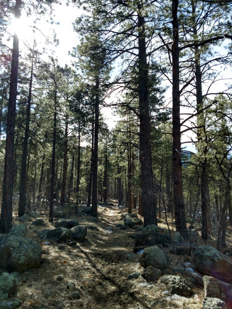
Starting at the Clover Spring Trailhead, I walked the path a short distance and went right at the fork. The trail starts gaining elevation with a few switchbacks as it climbs through a forest of firs. Its not particularly dense but by Arizona standards, its a jungle. I enjoyed the respite from the desert.
The trail continued in an almost uniform Southerly direction as it flattens around 7,200'. Evergreens essentially obscure any view of the mountain or summit for most of the way.
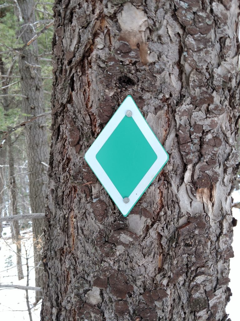
In February, snow obscured the trail but I noticed Green Diamonds along the way and was never more than a hundred yards from one. The markings helped considerably given the trail is all but obscured otherwise. As I reached the halfway mark, I found myself in a canyon which made route finding easier.
Deep Snow in the Canyon
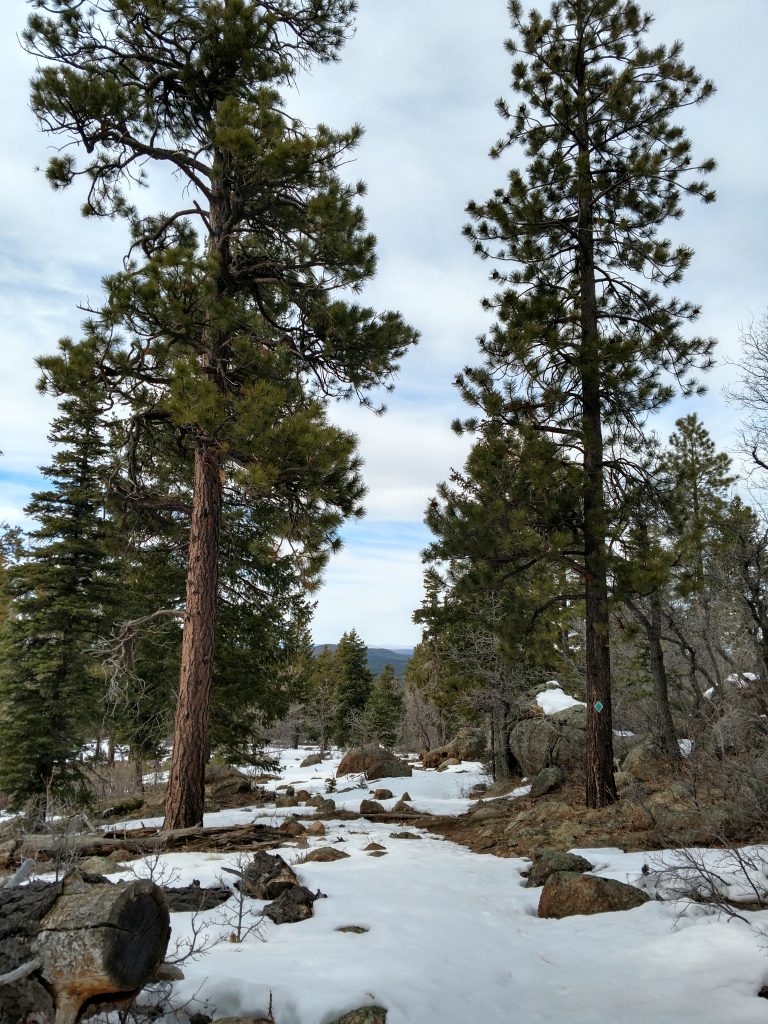
At around 7,800' the Bill Williams Trail enters a ravine and begins the bulk of the ascent up to the lookout road. As expected in February, there was tons of deep, powdery snow to negotiate. Naturally, it was frustrating at times.
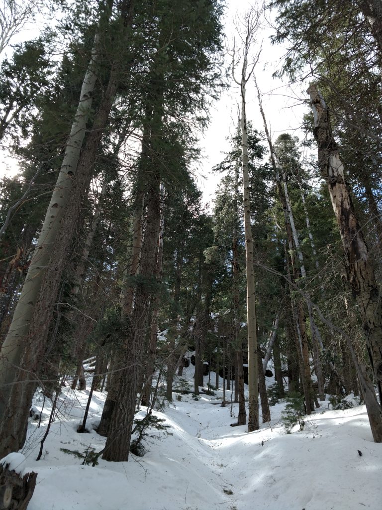
My pace slowed to about 1.0 mile per hour in the canyon. Although I had winter boots and traction, snowshoes would have been better. I trudged along but was grateful for the green diamonds illuminating the way.
Between 8,400' and 9,000', it was obvious the trail was switch-backing; I tried my best to follow it. After what seemed like an eternity, I reached the access road to the summit's fire tower and radio stations and took a breather.
Fire Tower Road and Bill Williams Summit
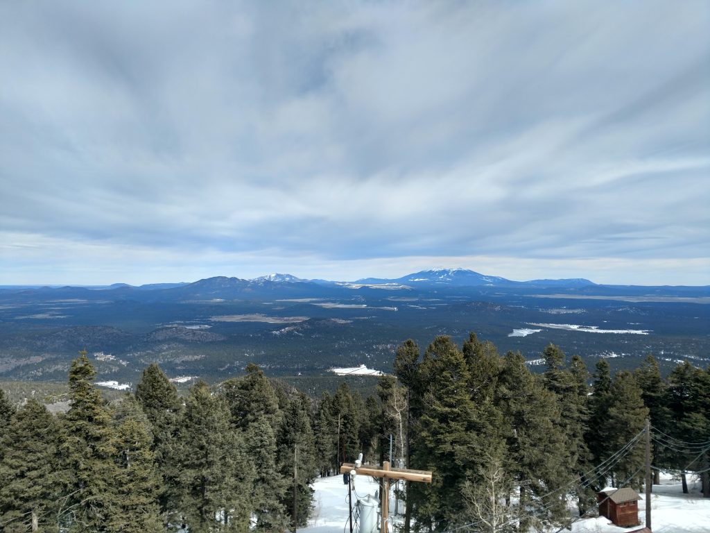
Even in the dead of winter, the access road seemed well traveled. I believe the shear number of radio towers at the top makes it imporant all times of year. I walked up the last 0.5 miles between the end of the Bill Williams Trail and the summit with ease.
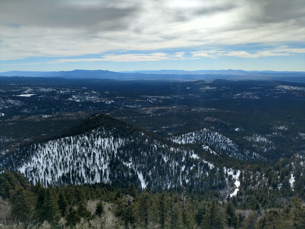
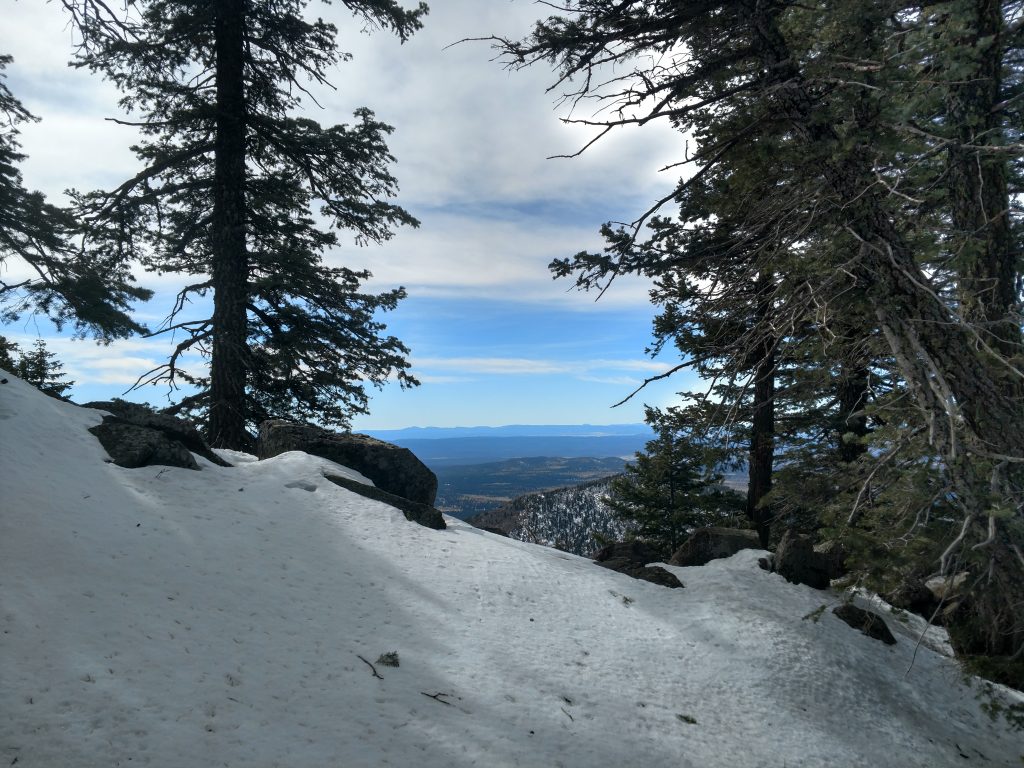
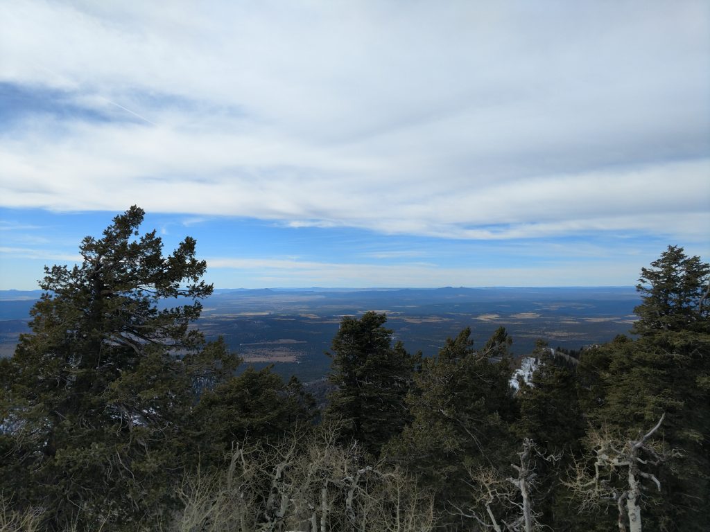
Views at the top were exceptional although the radio towers made the summit itself a bit pedestrian. My favorite views were to the East and South. Looming summits of the San Francisco Peaks looked Himalayan this time of year. I appreciated the tremendous relief of the Mogollon Rim visible from the summit. Oak Creek Canyon and Sycamore Rim looked enticing from the top; wish I had more time to hike them! I could also see Woodchute Mountain looming in the distance, a hike I completed just the previous day.
I found the benchmark near the highest radio tower but no sign of a summit register. Wouldn't be surprised if there simply wasn't one; I'm sure the summer brings a far more crowded summit and people climbing the mountain in 4x4s and ATVs ect.
Overall, Bill Williams Mountain was a great winter workout and a unique Arizona hike. I think nearby Kendrick Mountain would have been better but I'm glad I got my last high altitude experience in the state before heading back home to California. Hopefully I'll return soon; already had to cancel a repeat trip to Arizona due to COVID19...

No Comments