


If you've followed along, I'm recounting my last major road trip through a lesser explored side of Arizona. From Pinal Peak, I basically paralleled the Mogollon Rim all the way to Cottonwood. Along the way, I hiked Aztec Peak. This summit has greater than 2,000' of topographic prominence, making it a "major summit" in the world of compulsive peakbagging. It was also one of Edward Abbey's major destinations; he manned the firetower for a few seasons during his extensive time in the American Southwest.
More than enough reasons for me to climb it!
Getting to Aztec Peak's Trailhead
Aztec Peak can be accessed by most vehicles although there's some dirt/gravel road travel worth considering:
- First of all, Google Maps won't get you all the way to the parking areas. However, just plug in these coordinates and you'll get most of the way, at least to the major turnoff.
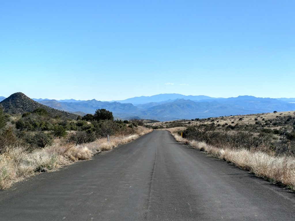
- The peak is accessed off State Route 288. The junction for the forest service road that climbs Mt Aztec is just over 25 miles from the junction of State Route 288 and State Route 188.
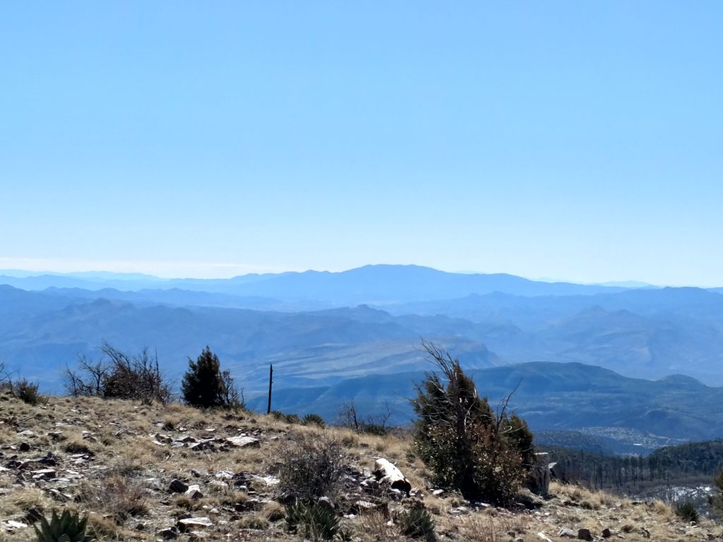
- State Route 288 is a very remote highway that eventually terminates in Young, Arizona. Cell service is fairly good (Verizon) for the first 2/3rd to 3/4ths of the highway until it gets close to the pass. There are incredible views the entire route. Keep an eye out for Crested Saguaros as well.
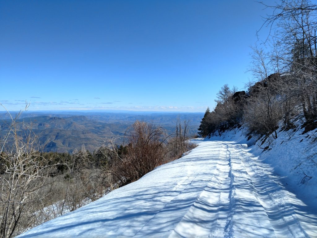
- The final section that climbs the pass is unpaved but in excellent shape (as of 2020)
- After dropping off the North side of the pass, cell phone service is non-existent
- The road becomes paved again around some remote residences on the North side of the pass.
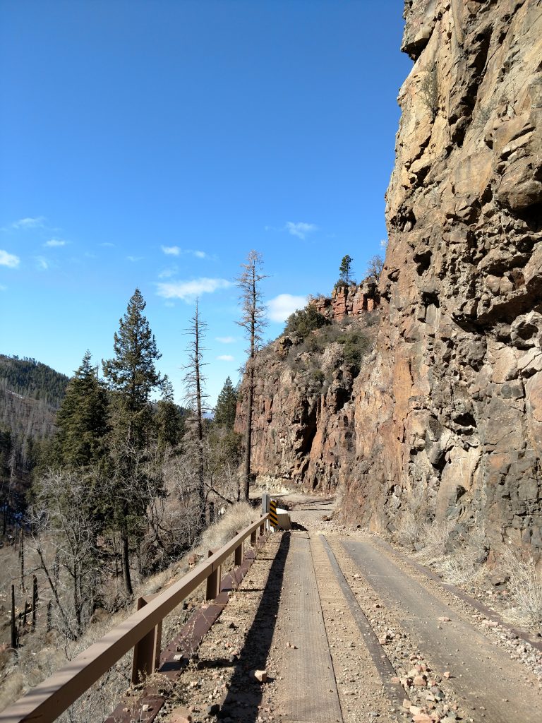
- The Forest Service Road to Workman Creek Falls is bumpy, rocky but probably passable by most vehicles. You pass by a youth camp and several campsites on the way to Workman Creek Falls
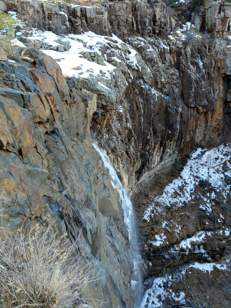
- Just before the falls, there's a newly re-worked section of the road that hugs the cliff. This is where I parked as in the winter I couldn't get further with ice/snow.
- Workman Falls is probably the best place to stop for non 4x4 vehicles. Those with experience and the vehicle can make it further.
Like any foray into the wilderness on forest service roads, there's bound to be unexpected conditions, so be prepared.
Here's a map of the area and the hike I took:
The Hike up Aztec Peak
Based on the few recent trip reports in 2019-2020, the previous trail up Aztec Peak no longer exists. I discovered the same thing on my hike. Abbey's Way appears clear on the map but in practice it is densely overgrown and difficult to follow. I don't recommend attempting it.
I started following Abbey's Way trail and found a clear path for less than 0.5 miles. Although overgrown, the trail was initially clear. It was the next ~1.0 ish miles that were horrible; at times I'd pick up a path but for the most part it was prickly bushes. Truly miserable.
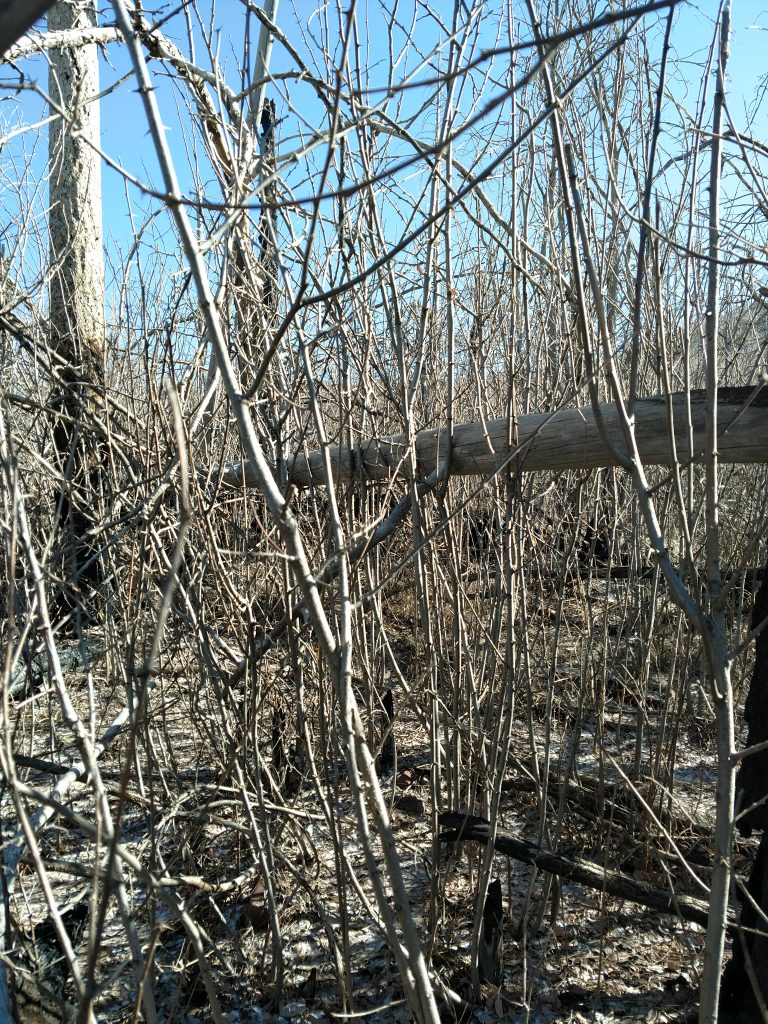
A few hundred vertical feet below the summit, I finally picked up the actual trail again. It was still overgrown but thankfully clear. I followed it to the top. Total distance from where I parked to the summit on this very unclear hike was 2.0 miles and it took close to 2.5 hours due to the scrub and brush.
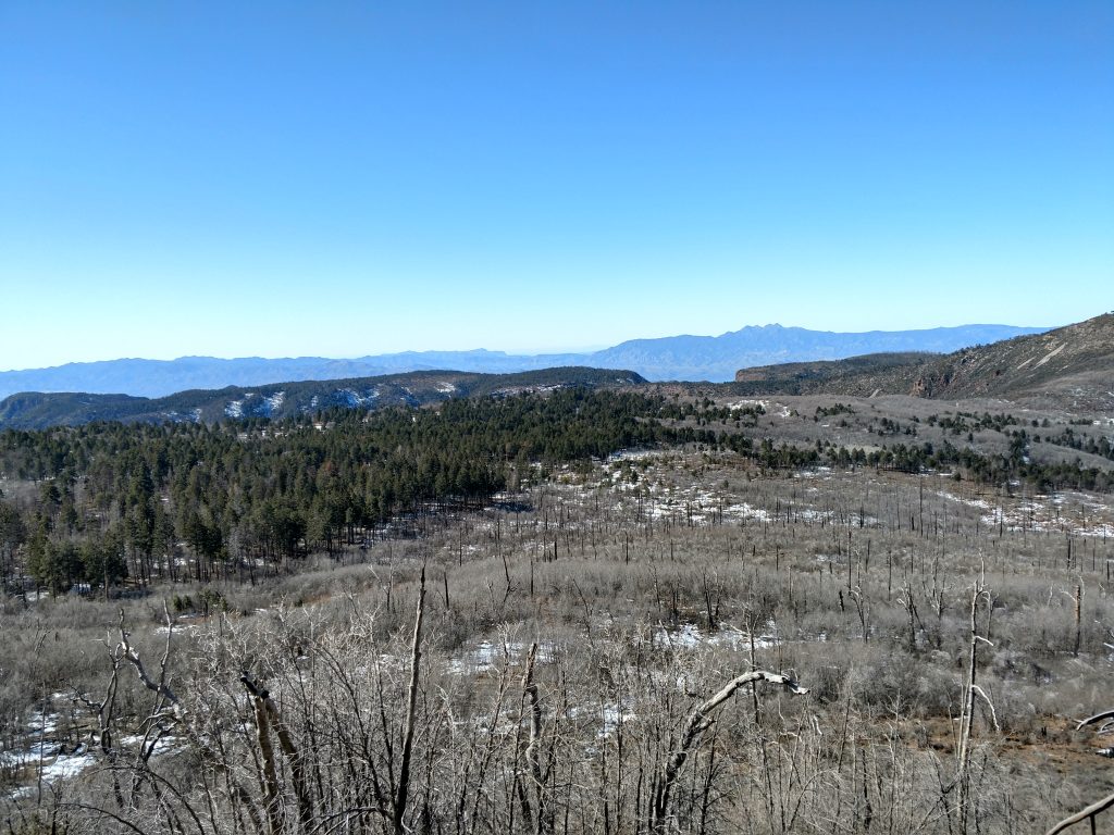
On the summit, there was a fire lookout that was boarded up. It remains active in the summer and perhaps this year the trail will be cleared. Views were fantastic in every direction so I took 1/2 for photos. I didn't find a summit register.
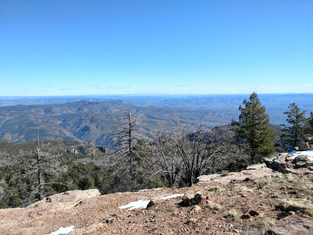
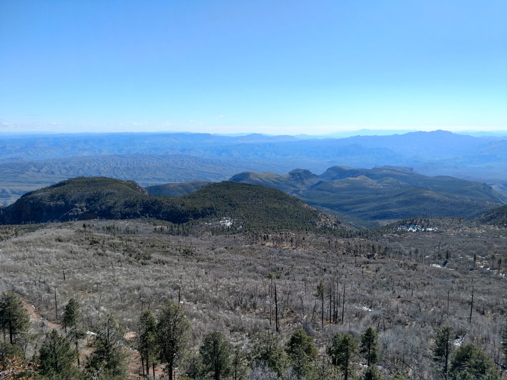
I see why Aztec Peak inspired Edward Abbey. It was a lonesome place, made even more isolated by the winter. Other than the fire tower and the road, there was no sign of civilization. Maybe in a different life I was one of those solitary fire tower watchers.
A different way down
Not wishing for more bushwhacking, I took the Forest Service Route 487 all the way back to the car. Sometimes abbreviated as FR487, this is the main access road for the fire tower.
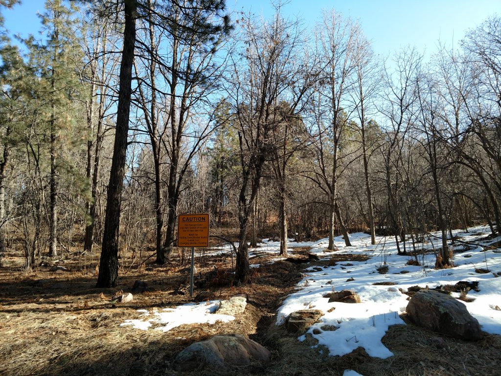
When I hiked in the winter, most of the road was covered in snow. There was evidence that somebody actually drove up the road recently although that seemed quite treacherous. I didn't need any traction or special equipment for the route down.
Notably, the road takes a somewhat meandering way back to Workmans Falls. There are no junctions or side trails to speak of on the way back. It was about 2.0 miles from the summit back to the Workman Falls.
Overall, the hike up and down the summit was not terribly interesting but the views were worth it. Not so bad for a P2K! Hope this information is helpful.

No Comments