


As I began working my way back West from New Mexico, I spent some time in Southern Arizona. Like Las Cruces, the city of Tucson is literally surrounded by mountains. For a long time I believed Mount Lemmon was the highest in the region. However that honor belongs to the Santa Rita's Mount Wrightson. At an altitude of 9,456', Mount Wrightson is the highest mountain near Tucson. Surely that's enough of a reason to hike it but the real draw is the Madrean Sky Island environment which is exceptionally unique. In February of 2020, I hiked the Old Baldy Trail to the summit.
Directions to Mount Wrightson and Hiking Basics
Mount Wrightson is most often hiked from Madera Canyon, North of the summit. Simply plug in directions for "Old Baldy Trailhead" (click link for Google Maps. The road into Madera canyon is paved and open all year. Its a popular place for hiking, camping and bird watching so its best to get there early, any time of year. From Tucson, the drive takes about 1 hour, one way.
The hike I did was the Old Baldy Trail, the most popular and shortest route up the mountain. Some climb the Super Trail which is a little longer. Innumerable trails permeate the Santa Rita Mountains and there are perhaps dozens of other way to reach the summit.
Regarding the Old Baldy Trail:
- The trail clearly begins at the Old Baldy Trailhead, at the end of Madera Canyon
- Round trip distance is about 10.1 miles
- Total elevation gain is roughly 4,200 with minimal loss on the way to the summit
- There are usually water sources on the summit from springs but bring enough for a full day
- Hike is typically completed in 1 day
Here's my map:
Mount Wrightson: Trailhead to Josephine Saddle
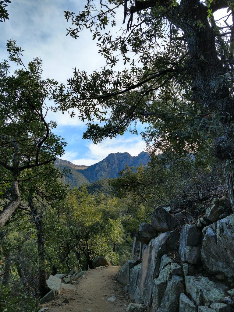
From the trailhead, I followed signs for Old Baldy trail which heads off to the right from the parking area. For 0.3 miles, the trail was essentially an old road until arriving at the first intersection. I turned left there for the Old Baldy Trail. It was 2.4 miles from the trailhead to Josephine Saddle with about 1,600' of altitude gain.
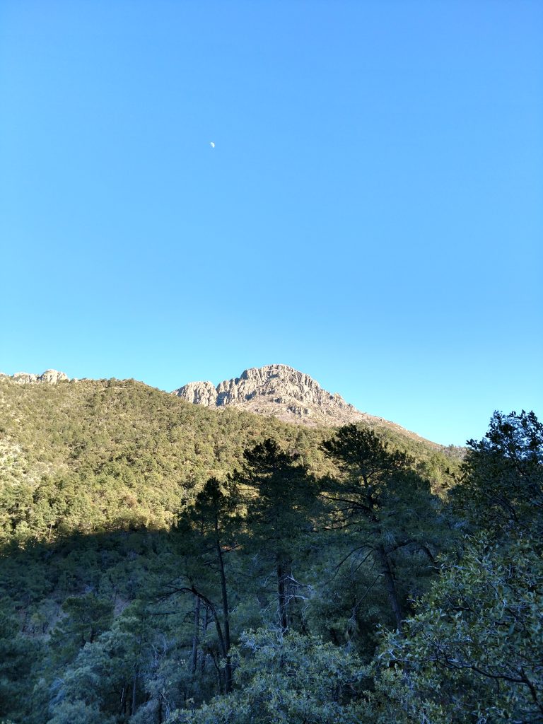
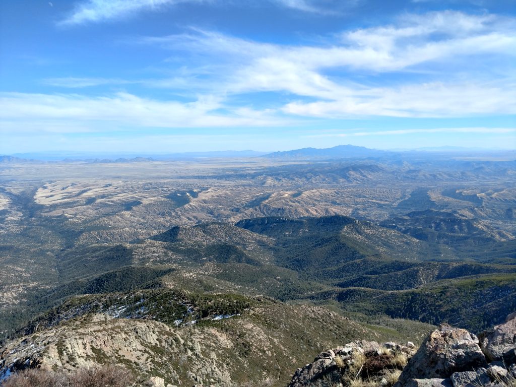
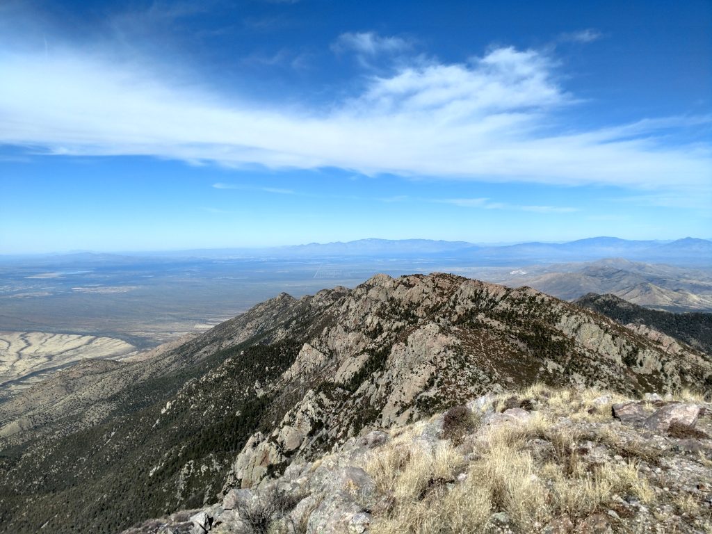
Almost immediately after that junction, I encountered the wilderness boundary. The remarkable preservation of the region was evident from here to the summit. Although the trail was steep for the next 2.1 miles to Josephine Saddle, there were endless views of Mount Wrightson's summit and the desert below.
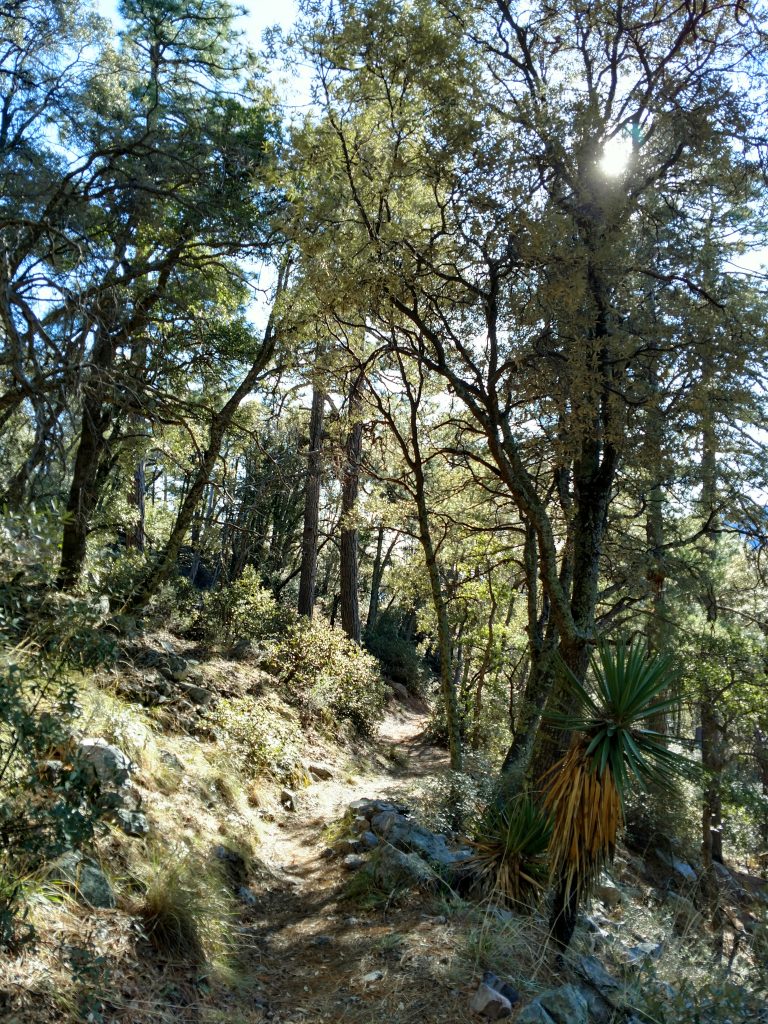
A wonderful curiosity of hiking the Sky Islands is the mixture of high alpine forests with low desert flora. Cactus and yuccas grow alongside thick junipers and firs. With each 100 feet of climbing, I felt like I experienced an entirely new environment. Were I a real naturalist, I could have better identified and appreciated the flora that typically only grows in Mexico.
Josephine Saddle, at approximately 7,120' was a good spot for a break and assessment of progress. There's a memorial for a few unfortunate Boy Scouts who were killed in a freak early winter storm some 50 years ago while hiking. Take head.
Josephine Saddle to Baldy Saddle
At the saddle, five trails intersect but there's a number of signs making the way to the summit evident. I essentially followed the signs that marked the Old Baldy Trail and/or Mount Wrightson summit. From Josephine Saddle (7,120') to Baldy Saddle (8,780'), its about 2.0 miles.
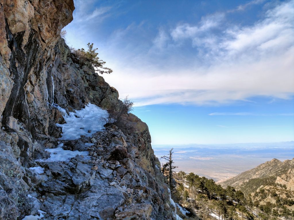
I hiked this in the winter so, no surprise, there was a lot of snow past Josephine Saddle. Although Tucson is a haven for snowbirds loving the 70-degrees-in-February days, this part gets the full brunt of winter. Thankfully, I was prepared with microspikes. Don't hit this trail during the Fall, Winter or Spring without them!

Its almost impossible to know when and if there's snow on the Old Baldy Trail; conditions change quickly. As of February 2020, I encountered snow at approximately 7,800' and it was packed and icy. I ascended the very steep trail running up the Western face of Mount Wrightson and couldn't imagine making it up without some sort of traction. This side seemed quite protected and shaded from the sun so I'm sure it remains cold and icy throughout the winter months.
It took well over an hour of slow going to make it to the Old Baldy Saddle. Switchbacks take some of the bite out of the ascent.
Old Baldy Saddle to Mount Wrightson's Summit
This final section was short but strenuous given the altitude. From Baldy Sadde (8,780') to the summit (9,456') was about 0.9 miles.
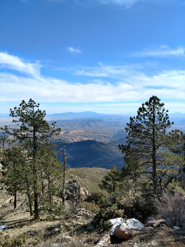
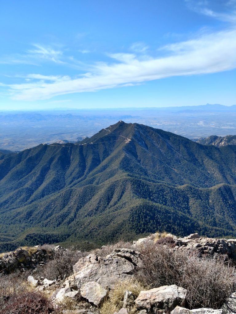
The last 700' of climbing involved further snow and ice but the views into the Mexican desert were sublime. The trail wraps around the Eastern and Southern tip of the summit creating and incredible panorama.
The summit itself is broad and flat. In the ruins of some previous structure, presumably a fire tower, there's an ammunition canister and summit register. Even in the middle of winter on a Superbowl Sunday, there were plenty of other hikers at the top.
It took about 4/5ths the time to descend as it did to ascend. Ice and snow made the descent somewhat slow and precipitous in some sections. However, I made it back before sunset. Overall, this is a difficult but doable for most experienced hikers in the winter. Thankfully, no technical gear beyond microspikes is needed!

No Comments