


Just outside of Las Cruces, New Mexico, there are several mountain ranges and canyons worth exploring. During my recent road trip to the area, I explored more of the region and was delighted. I'm not sure how I came across this one but the Leasburg Slot Canyon was a fantastic find and a great short hike. I decided to extend the hike and get to the summit of Robledo Mountain though most will be satisfied with the hike alone.
Slot canyons are a particularly unique and wonderful rock formation seen in the American Southwest. Utah, New Mexico and Arizona are practically littered with these canyons known for being narrow, twisted and mysterious. Thankfully for those living in Southern New Mexico and West Texas, you don't have to travel far to experience one.
Getting to the Leasburg Slot Canyon Trailhead
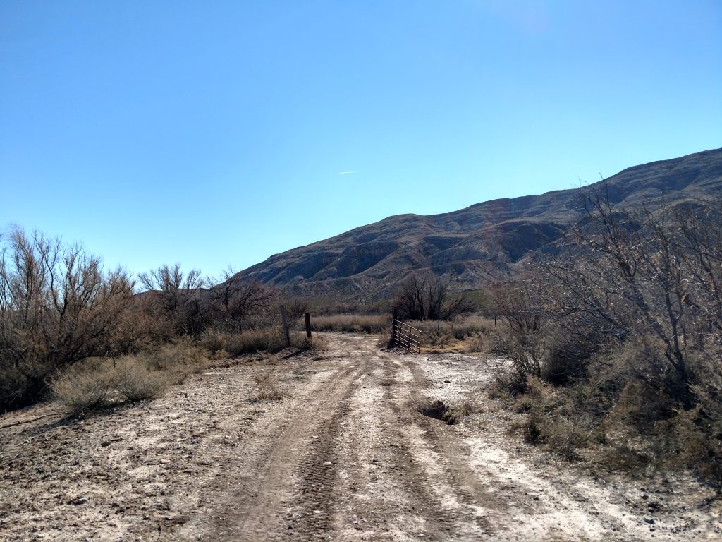
In spite of its increasing noteriety, the Leasburg slot canyon is not well marked and the roads getting there are confusing. My suggestion is to plug this point into your mapping app on your phone and accept the directions.
Here's a few things to know about the drive-
- Coming from the South (El Paso and Las Cruces), I took the exit for NM-320 approximately 3.5 miles North of the I-25/Highway 70 interchange
- I took NM-320 to NM-185. From that intersection, I drove 5.4 miles North to Hope Road.
- Hope road is a good, gravel road and I took it for 0.7 miles to an intersection with an unnamed dirt road that was also a levee for the Rio Grande.
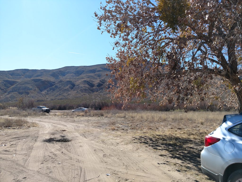
- I drove on the levee for 0.4 miles, passing the trailhead and took a hard left turn, nearly a U-turn and parked beneath a large tree.
- There were a few cars parked at the trailhead but no signs or information. I almost thought it was private or restricted but I ran into locals who reassured me that it was public.
A few things to know...
The Leasburg Slot Canyon (sometimes referred online as the Las Cruces Slot Canyon) is partially a hike, partially a bushwhack and involves crossing the Rio Grande. Here's a few things to know before going
- Although the Rio Grande is heavily diverted in this part of New Mexico, rain and seasons may make the crossing impossible. Check with local sources before going.
- The ideal time of year is late fall through early winter; spring can make the river impossible to cross depending on snowmelt. Summer is typically too hot
- There are no signs or markers on the trip
- Its helpful to have a pre-loaded GPS route before going
- There's a particularly nasty walk through underbrush on the way to the slot canyon after crossing the river. Bring sturdy boots and long, tough pants!
Here's a map which I hope is helpful. Note that this map also includes my overland route to Mt Robledo after the slot canyon terminated. I marked the beginning and end of the Las Cruces slot canyon hike:
Leasburg Slot Canyon Approach
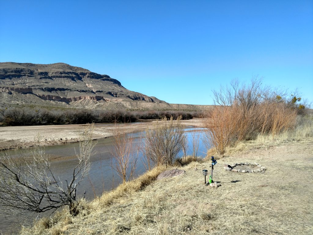
From the parking area, drop a waypoint on your GPS for the crossing of the Rio Grande. I also noticed the tree I parked under was the tallest in the area and was a great reference when returning. Find your way across the Rio Grande; in February, it was ankle deep but muddy.
After popping out on the other side, there's a number of herd paths all leading generally West. I picked my way through the brush and after a short time arrived at the unnamed road paralleling the Rio Grande. From here, I went South about a hundred yards until encountering a corral. This also served as a great reference point in the bushwhack.
Here's the somewhat difficult section- from the corral to the entrance of the slot canyon is just over 1/4th a mile (the way I went). However this involves a lot of bushwhacking through ankle to waist-high desert scrub. For the most part I avoided the really prickly things but I got scratched up none the less. Thank goodness I was wearing boots and long pants!
The entrance to the Leasburg slot canyon is at these coordinates (follow link for Google Maps).
Into the canyon
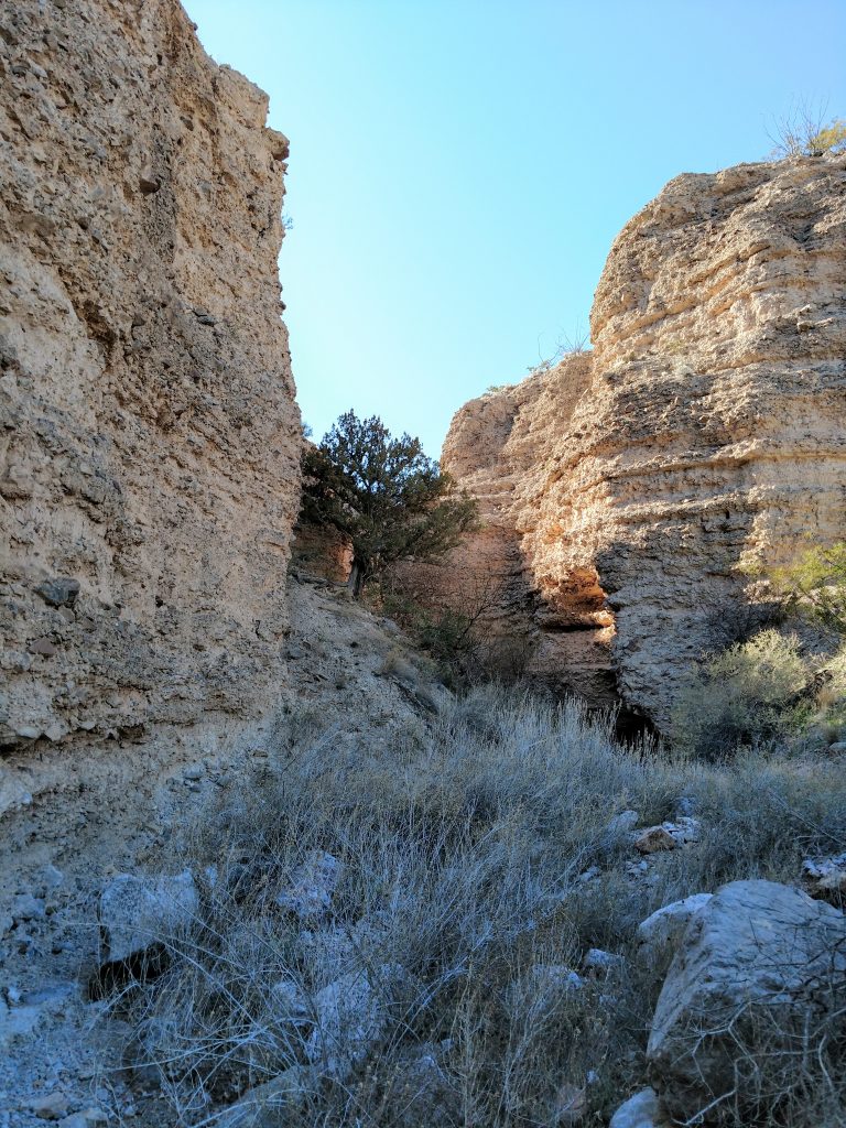
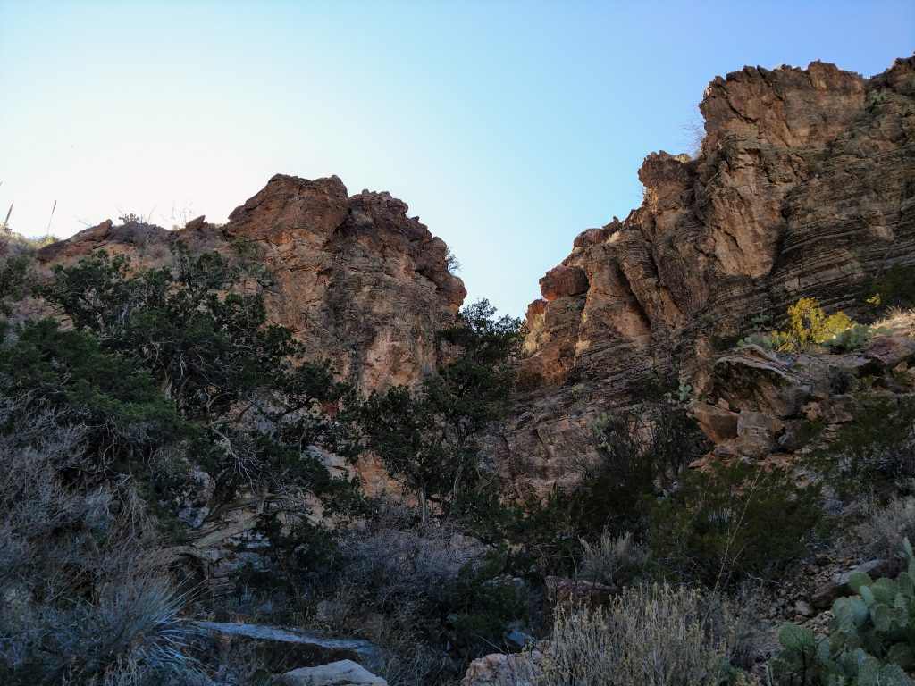
Although it was less than a mile from the parking area to the entrance of the canyon, it was not obvious until just before entering the canyon. I almost thought I had the wrong canyon until it quickly slotted up just after the entrance.
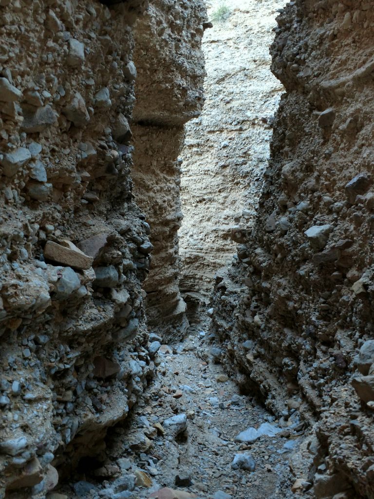
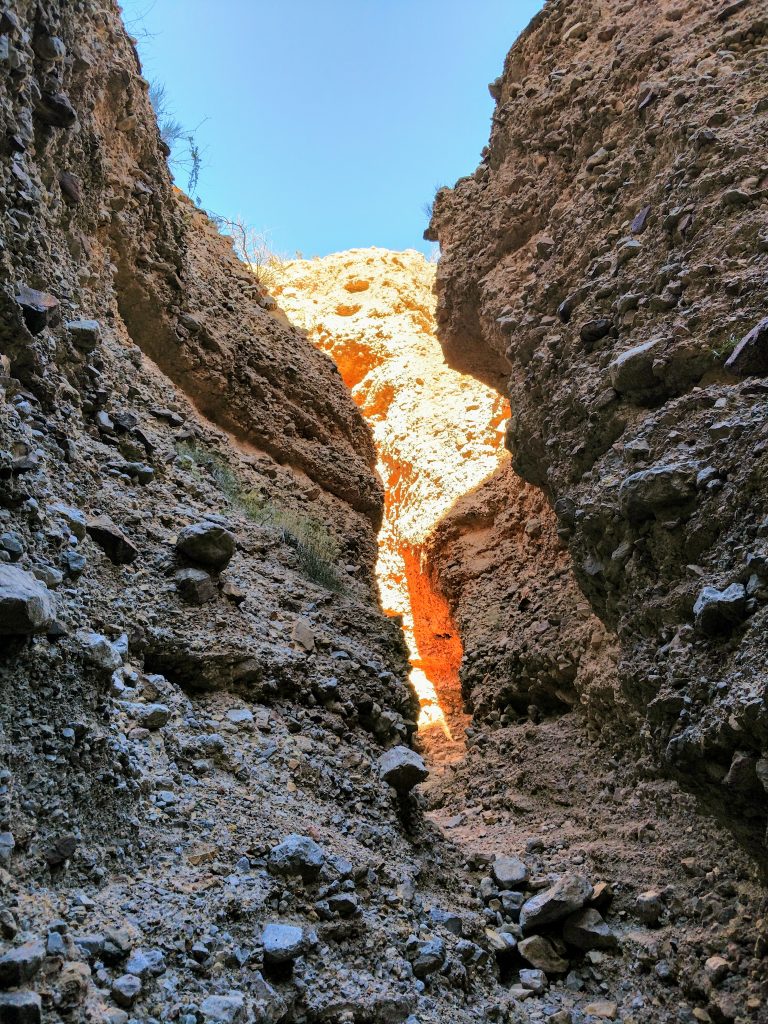
From there, it was to die for! The walls were very tall and the canyon was no more than 10 feet wide in some sections. Water eroded some cavern-like features. The slot was also wide enough at some points to support some lush vegetation which added to its magical feel.
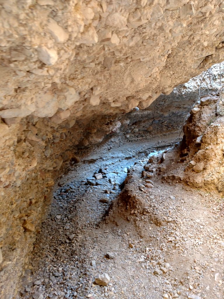
It took about an hour to hike from the beginning to the obvious end of the slot canyon. Towards the back, it becomes more of a traditional canyon rather than a slot.
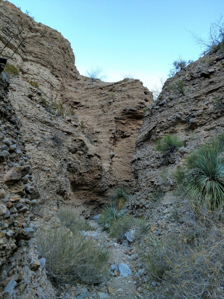
The point where most people turn around looks like this:
(here are the GPS coordinates for this location)
Bushwhack of Robledo Mountain
At this point I recommend turning back unless you want to climb Robledo Mountain. For me, I'd already climbed the Organ Needle and the high point of the Doña Ana Mountains . If I climed Robledo Mountain, I would have climbed all the major mountains of the Las Cruces area.
From the end of the slot canyon, I found a route heading South out of the canyon. The rock and dirt was very loose but I made it to a North-South oriented ridgeline. Standing on that ridgeline, I saw a very clear route involving this rideline which intersects with a perpendicular ridgeline leading to the summit.
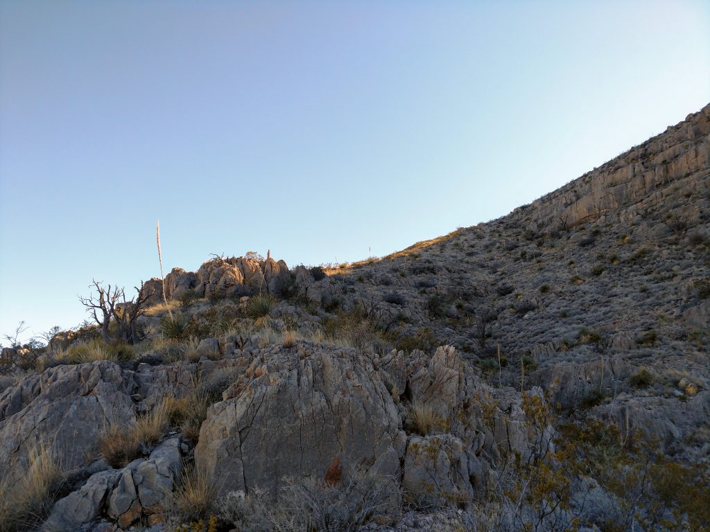
It was a desert scramble so plenty of sharp rocks and sharper cactus. However there wasn't anything too precipitous or exposed. It was Class II scrambling and some loose rock at its worst.
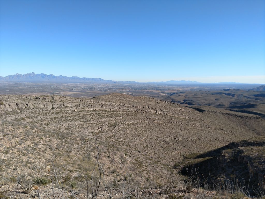
I gained the perpendicular ridgeline at an altitude of roughly 5,400' which was about 500 vertical feet shy of the summit. A clear route lay before me:
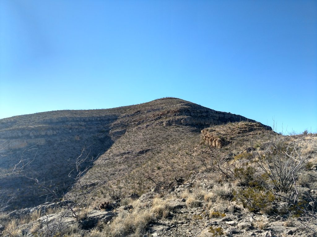
This next section was short but certainly steep in some sections. It was slightly more exposed but nothing compared to Organ Needle. In the above picture, I basically worked my way along the ridgeline right of center and skirted my way up the cliffs until the summit.
The summit has exceptional views of the many mountains and valleys of Southern New Mexico:
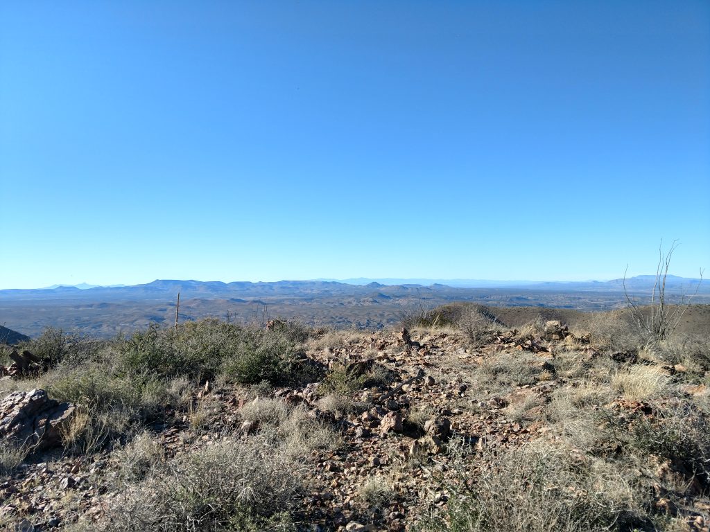
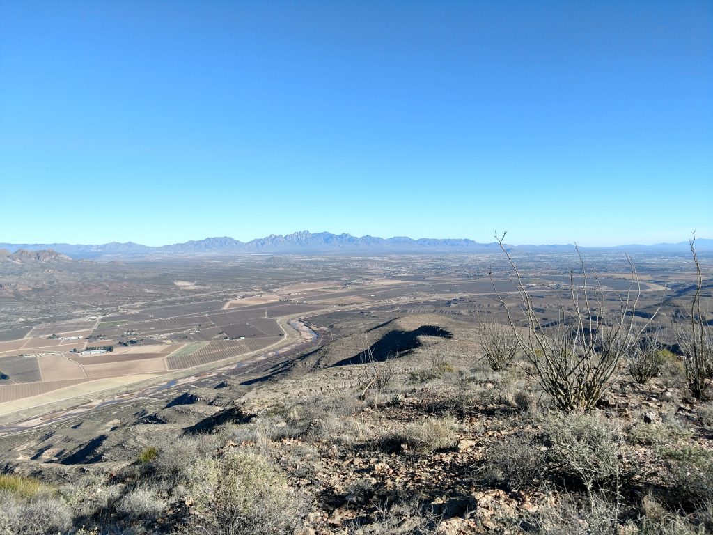
There was no summit register at the top but three summit markers.
Descending Robledo Mountain
Descending was straightforward though the loose rock made it just as difficult as the climb. I made it back to the entrance of the Leasburg Slot canyon without too much difficulty and took more photos of the canyon in evening light.
Eventually I made it back to the car around dusk- the total time of hiking the canyon and Robledo Mountain was about 4 hours for me, taking into account extensive time taking photos!
Note that most, if not all, people will simply hike the canyon- there's not a lot of reason to hike the summit itself unless you're a manic peakbagger like myself!

No Comments