


The Doña Ana Mountains are the mountain range just North of Las Cruces, a town literally surrounded by mountain ranges on all four sides. In my quest to climb all the major ranges of Southern New Mexico (and for that matter, New Mexico) I set my sights for these summits- Doña Ana Mountain and unnamed peak known as Peak 5840.
If you're reading this, I assume you're as crazy of a peakbagger as I am so I'll go off on this unusual side note. It appears people assumed the "Doña Ana Peak" was the high point of the range but on closer examination, there are three contenders. Doña Ana Peak stands at about 5,840' but so does its very close, unnamed neighbor and another peak known as Summerford Mountain. The climber consensus is that the unnamed neighbor referred to as "Peak 5840'" is the highppint. So, I climbed both Doña Ana Peak and Peak 5,840'
Getting to the Doña Ana Mountains trailhead
Although dirt roads in this area are hard to judge from afar, I found road access to these peaks fairly straightfoward. If you plug in "Chirhuahan Desert Nature Park", you will likely get there without a problem as I did.
There's a few things to note about the drive:
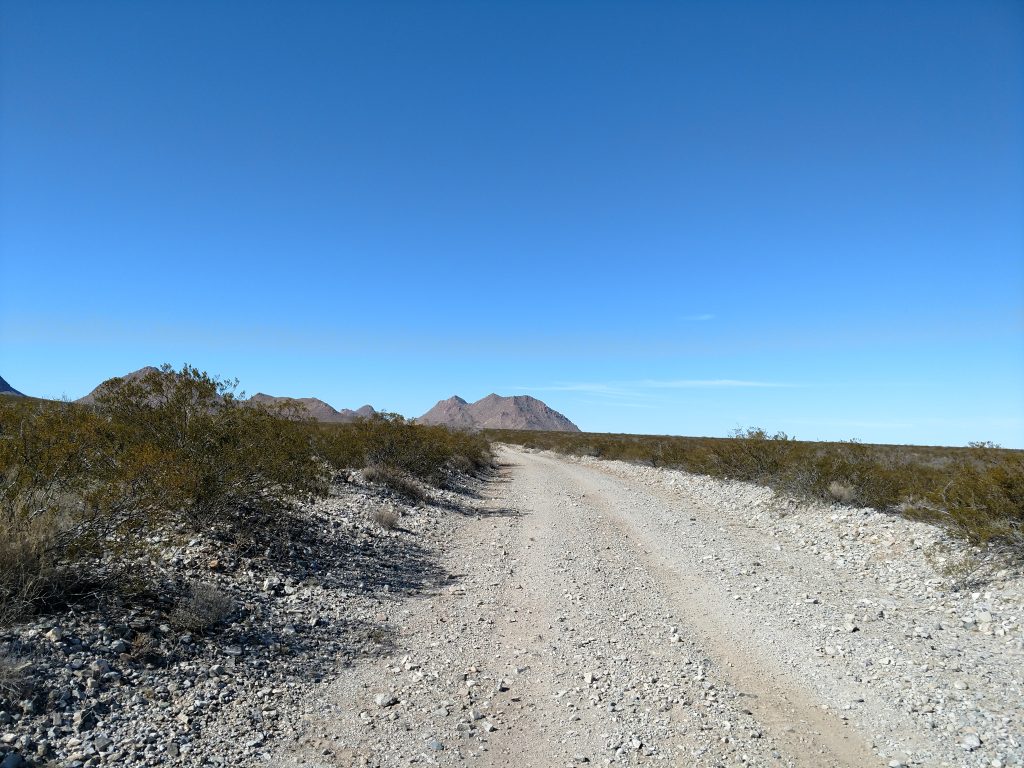
- Jornada Road, leading North from town, is the main access road in the area. Google and some sources also call it D064. It becomes dirt after Mesa Middle School but is in generally excellent quality. I doubt any car would have trouble with it.
- About 4.1 miles after the pavement ends, there's a sign for Chirhuahan Desert Nature Park- Google maps doesn't have this road listed. Follow the sign through a gate and along a winding but good quality dirt road to the park itself.
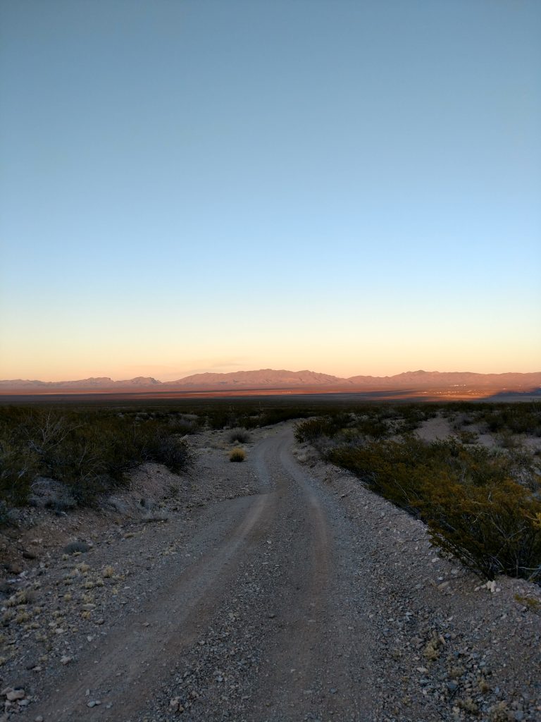
- Important! I finished my hike late and was locked behind the gate! If this happens, there's a number you can call and the guy will give you alternative directions out. If locked behind the gate after hours, the road out is high clearance- not recommended for passenger cars!
Map of my route:
Road hike to base of Doña Ana Mountain and Peak 5,840
Parking at the large lot for Chirhuahan Desert Nature Park, I began my road walk. After about 1.1 miles, I encountered a vehicle barrier but no fences otherwise- not sure if this is meant to deter hikers- if you are aware of this, let me know.
Having a map and GPS was essential, obviously as there's a hodgepodge of roads in the area that are unmarked. After the vehicle barrier, I continued on the main gravel road in a westerly direction for another mile. At an unmarked fork in the road, I took a left with the summits of Doña Ana Mountain and Peak 5840 now clearly visible.
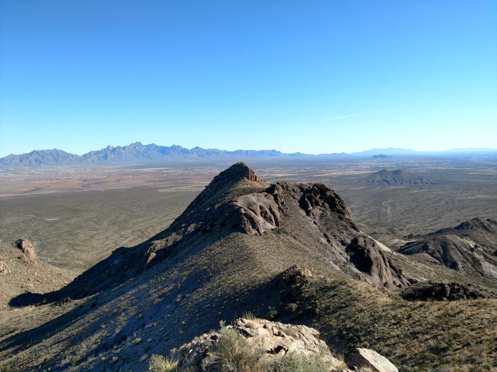
From the fork in the road, I hiked about 1.2 miles along an unnamed road which lead into a a"v" shaped canyon. On the right was Doña Ana Mountain and on the left was Peak 5,840'
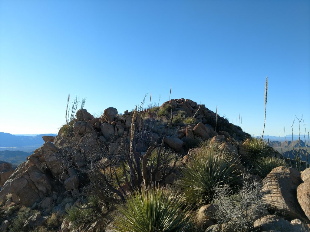
Doña Ana Mountain Scramble
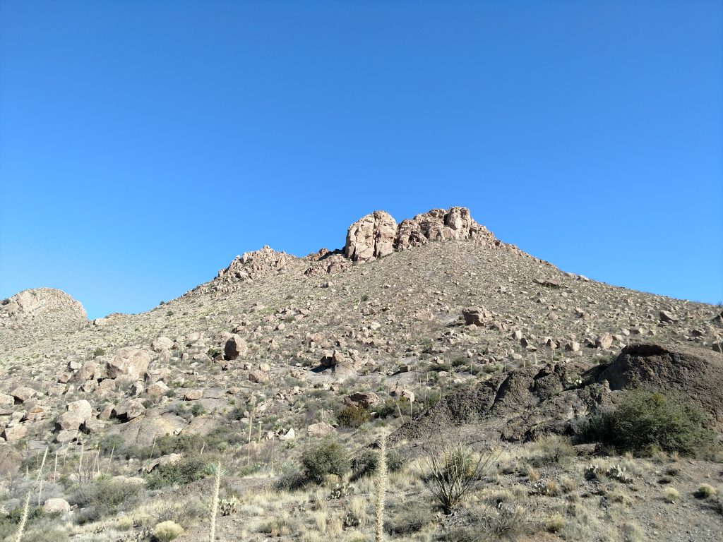
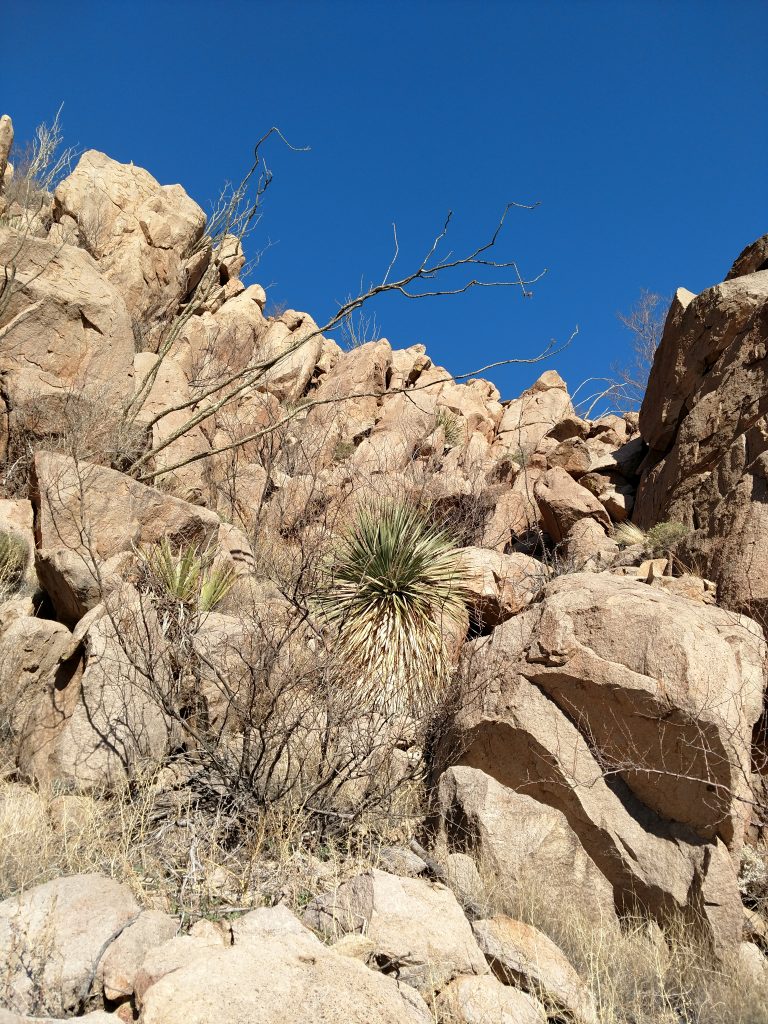
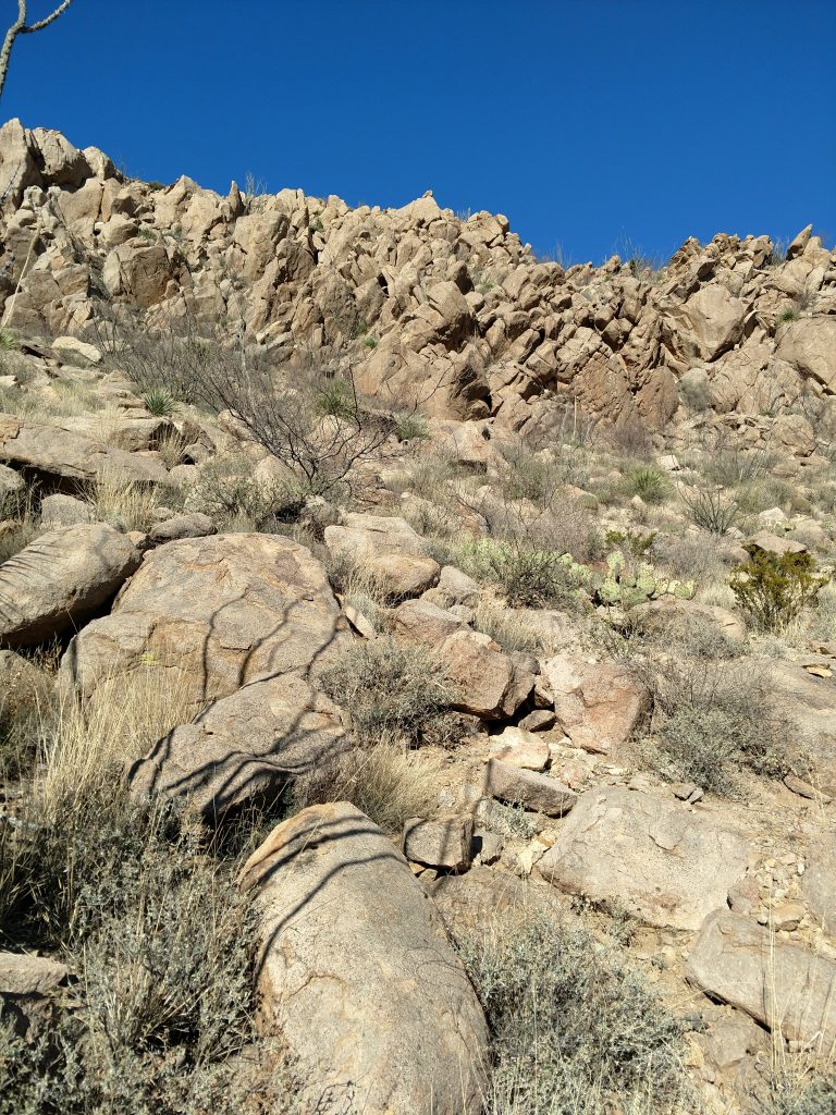
At the abrupt terminus of the road, I began a rather arduous bushwhack up the mountain. I did not find a great route- mine consisted of plenty of cactus and loose rock. I got a little bloody on the way up. Though I was unhappy with my route, I don't think there's a better one.
Its about a Class II scramble on the YDS- fortunately no exposure or trickiness other than the loose rock and cactus. It took about 45 minutes from the end of the road to gain the summit.
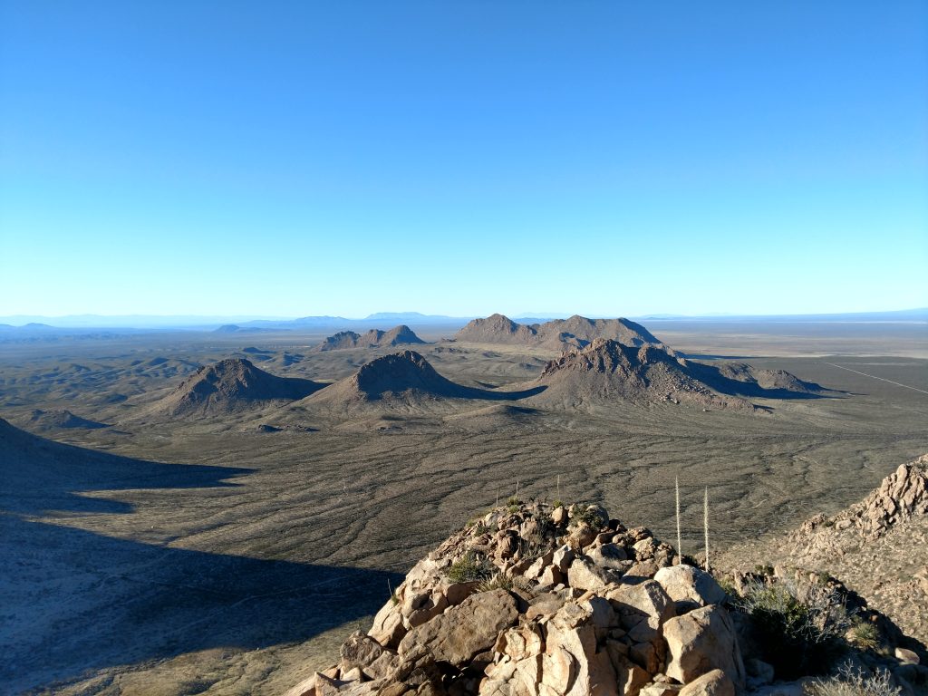
The peak itself was magnificent. Every major mountain in the area was visible and there was no wind at the top. I scarfed down a lunch, read and signed the summit register.
Descent from Doña Ana Mountain to Saddle and Peak 5,840
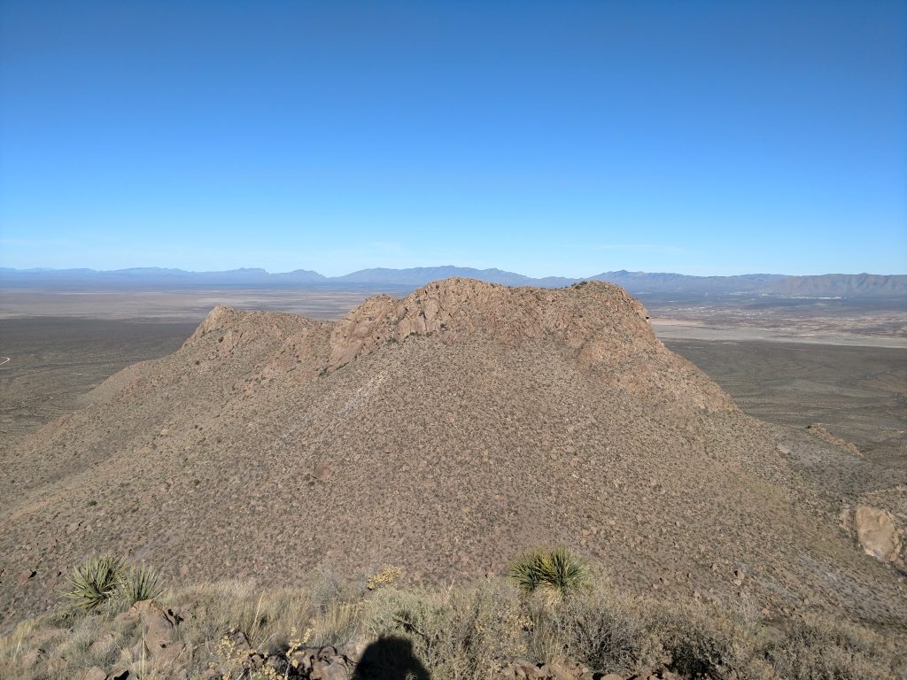
I made a fairly direct descent from Doña Ana Mountain to the saddle which was about 500' below the summit. As I scrambled down, I looked for a good route up Peak 5840. It appeared daunting.
The route I ended up taking was fairly direct to the summit with a few sections of skirting around exposed rock. It was standard Class III scrambling and the rock quality was good. Some sections had loose dirt and exposure but I wasn't as typically nervous as I am scrambling.
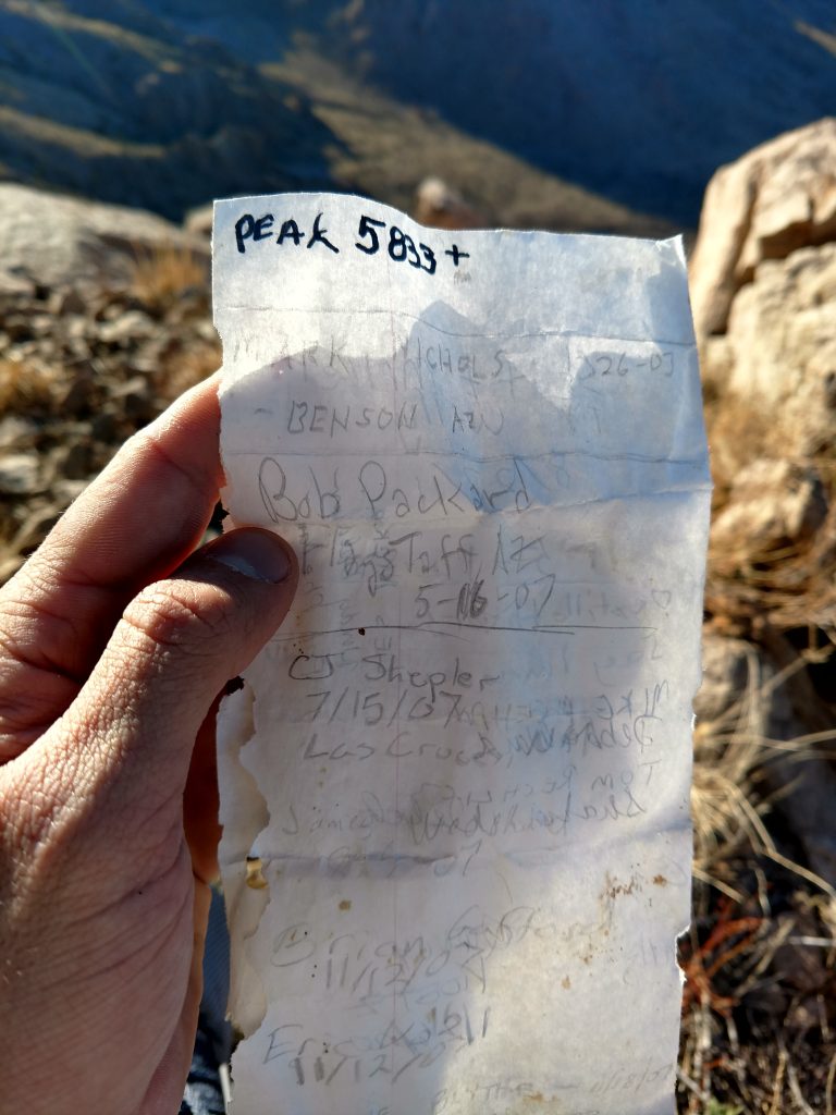
Slowly but surely I gained the ridgeline and then the summit. This time the register was in an old medicine bottle and had a single sheet of paper. There were less names in this one, obviously! However there were some famous peakbaggers who'd been this way.
On the descent, I thought I scouted a better route that departed the summit, followed the ridgeline for about 100 yards and then took a direct line back to the roads. This proved to be insufferable as well- much loose rock, cactus and exposure marked my way. Oh well- I made it but wished there was some easier way down.
It took about an hour and a half to descend Doña Ana Mountain to the saddle, climb Peak 5,840 and then make it back to the road. Bloody from some falls and cactus, I made my way back to the car.
Overall it was a good off-trail adventure to a range highpoint. I'm not sure I would do the scramble up Peak 5840' again but Doña Ana Mountain was somewhat enjoyable. It was great preparation for my later climb of the Organ Needle.

No Comments