


I can't believe I've lived in the Bay Area for 2 years and never been to Henry W. Coe State Park. Its the largest state park in Northern California and has a massive backcountry rivaling that of a national park. The terrain is exceptionally rugged and high enough to receive snow in the winter. Trips range from short hikes to week-long backpacking trips. We decided on a trip up Willson Peak (sometimes incorrectly written as Willson Peak) as a foray into this part of the Bay.
Willson Peak Hike Overview
Mt Willson is a hike near Morgan Hill and one of the more accessible summits of Henry Coe State Park. It is on the Sierra Clubs list of Nifty Ninety, some of the finest summits in the region with public access. At 2,651', its a modest altitude for the region. Highlights of the hike include phenomenal views to the Monterrey Bay and much of the interior Diablo Range. Mt Willson has a number of hikes for summiting but I liked the route I took:
My stats were as follows:
- Distance: 6.7 miles
- Duration: 3 hours, 25 minutes
- Average Speed: 2.0 mph
- Minimum Elevation: 854 feet
- Maximum Elevation: 2651 feet (Willson Peak itself)
- Total climb: 1897 feet
The Trailhead and a Steep Start
We started at Hunting Hollow parking area, just inside the park entrance. We have a state park pass but if you don't, there's a nominal, cash-only fee. There are port-a-potties at the trailhead but no water.
I recommend downloading this map for an accurate lay of the land.
There's one main jeep trail extending from the far side of the parking lot, near the port-a-potties where all hiking begins. We followed this for about 300 feet before coming to the first junction on the left and took it up.
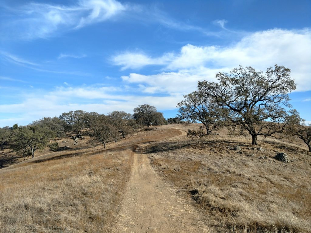
We were now on the Steer Ridge Trail, a steeply ascending route that terminates near Mt Willson. Our pace slowed to a crawl with some sections having very loose footing. Trail running shoes might not be the best here- wish we had brought hiking boots.
This trail extends for about 1.4 miles and gains 1,300' in that distance. Thank goodness the views opened up almost immediately! We finally came across our first junction with the Jim Donnelly Trail. It would be another 1.6 miles to the summit from here but we only had about 550' of gain.
We went straight for another 0.4 miles to another junction with the Spike Jones Trail and simply followed the signs for Mt Willson. As long as we stayed on the most beaten path, we had no trouble finding the route.
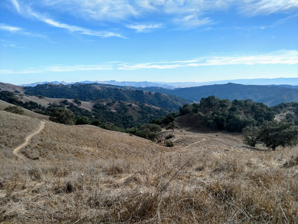
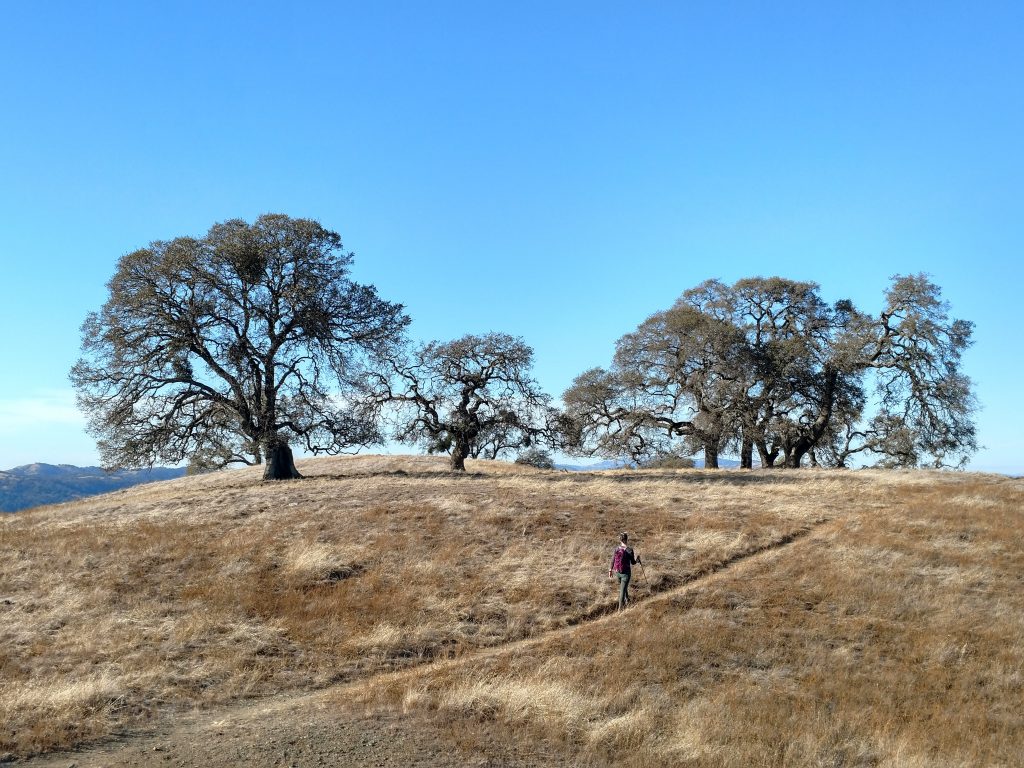
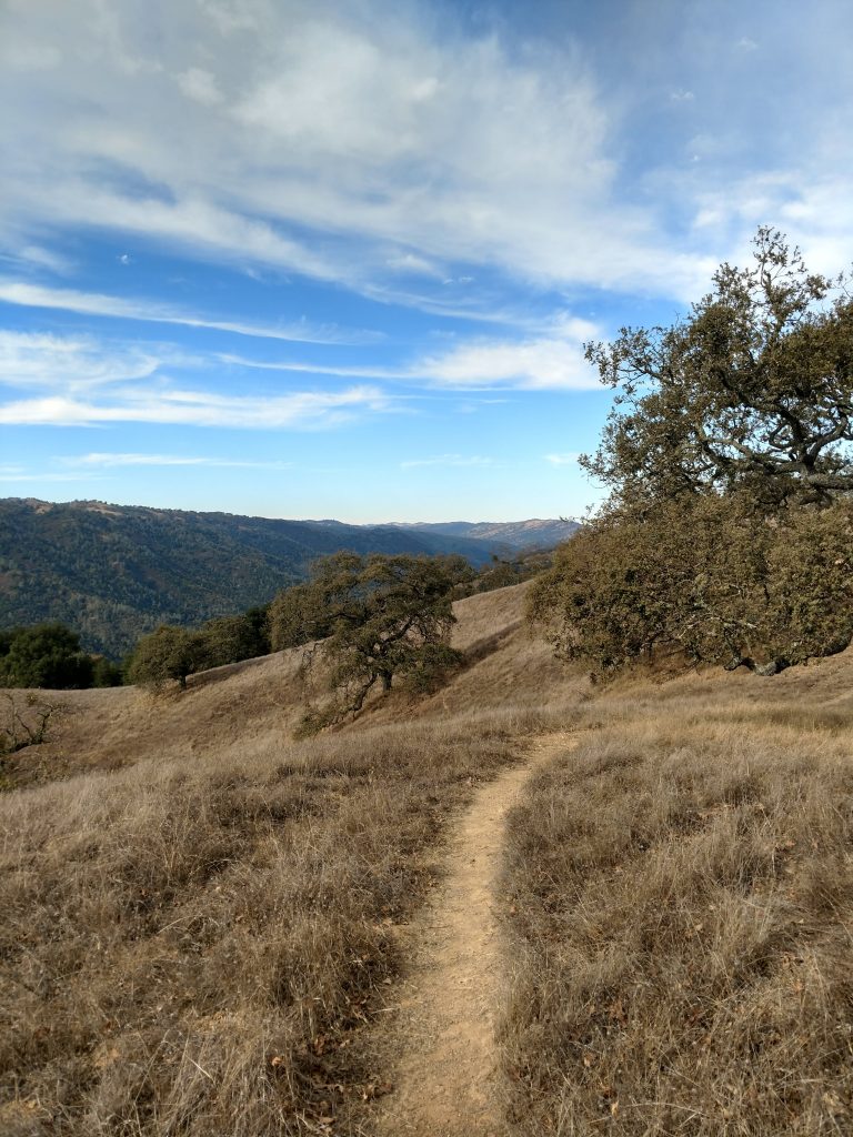
The next mile after the intersection with the Spike Jones Trail was wonderful. We were now high up on the ridgeline and enjoying 50 mile views in most directions. Elevation gain was minimal at this point.
We arrived at the intersection of Steer Ridge Trail and Middle Steer Ridge Trail, the latter which we would take down the mountain. By going left, we easily found the summit 0.3 miles later. Signs made it obvious.
The Summit and Way Down
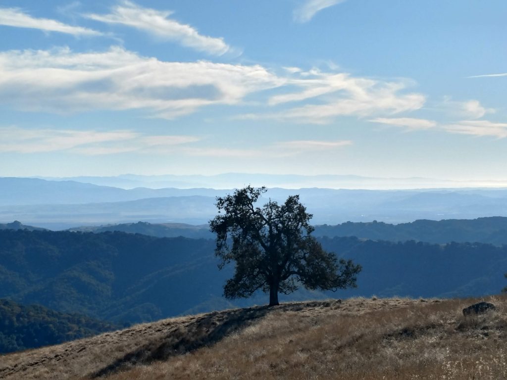
Mt Willson's summit was fantastic. Views were unobstructed except for a few stately California Black Oaks. We saw all the way to Mt Stakes, the highpoint of Stanislaus County and Mt Copernicus, the highpoint of Santa Clara County. To the South we saw the sharp summits of Pacheo Peak which is unfortunately on private land. Then, to the West was the shimmering waters of Monterrey Bay. FAll is a perfect time for these long-range views.
We didn't find a summit register.
Back at the junction of the Steer Ridge Trail and Middle Steer Ridge Trail, we began our precipitous descent. There wasn't an easy way to do it; Middle Steer Ridge was just as steep as our ascent.
We carefully made our way down the first 0.6 miles to the first junction, stayed on our trail and slid down the next 1.7 miles. The trail was extremely loose in some sections; hiking poles were a must.
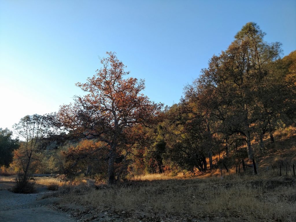
After about an hour of slipping and slidding down Mt Willson's South flank, we finally made it back down to the valley. Even in late November, fall was still clinging on and several trees blazed with oranges and yellows. It was a nice treat at the end.
The final 0.7 miles follows a jeep trail through the valley, back to the trailhead. Before the winter rains, the trail was as dry as a bone but I'm sure there's some water crossings after the rain.
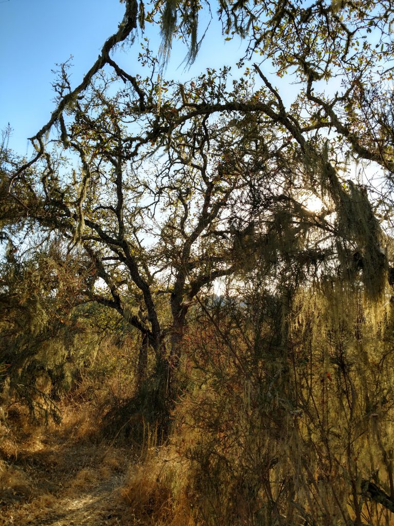
One brief side note that I found interesting; the picture above is of a common, draping lichen in the Coast Ranges of California and Mt Willson. I thought it was just Spanish Moss but I was wrong. With a photo search, I discovered its Lace Lichen, California's state lichen. I guess we're the only state that has such a thing. Fun fact!

No Comments