


Middle Palisade is one of California's infamous 14ers. Most only climb California's more classic 14ers such as Mt Whitney, White Mountain Peak and Shasta. After that, the others typically require more mountaineering skills and route-finding. Middle Palisade is probably the 5th or 6th most climbed 14er after the considerably easier Mt Langley (14,026ft) or even Split Mountain (14,065ft). Nevertheless, I've discovered its a demanding climb. When I had the time and excellent conditions, I set out for a climb up the standard route.
My Overall Thoughts on Middle Palisade
Simply put, Middle Palisade by any route is a demanding climb. I don't think I appreciated this enough before setting out. Here's a few things I found out:
- The Route is Class III according to most descriptions. After climbing, many (myself included) feel its at the upper limits of Class III with some definite class IV moves here and there. Its also very sustained Class III scrambling with limited options for protection, even if you lug the gear. The final push to the summit involves about 1,200' of climbing in about 2/5ths of a mile of distance if that helps.
- Only about 20% of the people who happened to come on the weekend I climbed successfully summited.
- The glacier can conceivably be avoided but it helps cut back on difficult loose rock and talus climbing.
- In October 2019, I didn't have much use for my Ice Axe and didn't bring snowshoes. Crampons were a must for the glacier. Microspikes were helpful for lingering snow but I didn't need them
- It took a full day and some night time descending for me to make it from Finger Lake to the summit and back to Finger Lake. I was planning on getting back to the trailhead after returning to the lake but I hadn't the time. In fact, I spent an unexpected, but prepared night out at Finger Lake.
- I don't recommend this as a first time scramble. I found this route harder than standard routes up Mt Shasta and the Mountaineer's Route up Whitney if that helps.
That's my two cents on the subject
Access and Permits for Middle Palisade
The long climb to Middle Palisade's summit begins from the Big Pine Creek Trailhead, and the end of Glacier Lodge Road near Big Pine, California. The road is paved, plowed throughout the winter and in excellent quality. The route crosses into John Muir Wilderness of Inyo National Forest with limited overnight permits available in the summer. Obtain permits here and don't be surprised if its full through most of the summer. A certain number of permits are available on a walk-in basis but that requires arriving the day before during business hours and those aren't guaranteed.
I happened to snag a permit for Big Pine, South Fork's area in the John Muir Wilderness on the same day (rare). That's probably because it was later in the season and temperatures were frigid overnight.
Map of Middle Palisade Route
I also recommend using Tom Harrison's Palisades Map which was very accurate and helpful. (this is not a paid endorsement!)
Northeast Face Route Approach to Finger Lake
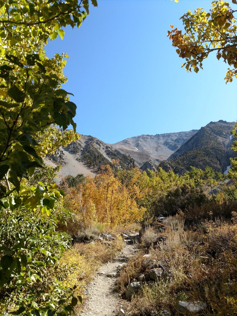
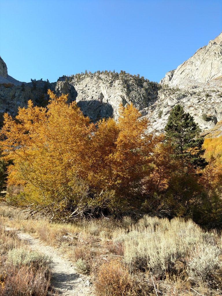
The route starts at the end of the road where there's limited parking. I had to park on the side of the road about a fourth of a mile away. Altitude at the trailhead is roughly 7,680' (compared to the summit at 14,018'). There's a well-established, 4.0 mile long trail departing from the road, following South Fork of Big Pine Creek to the wilderness boundary and up to a basin near Willow Lake. From there, the trail deteriorates to a herd path for another 1.0 mile to Brainerd Lake. Primitive campsites dot the North Shore.
From Brainerd Lake, there's a less-obvious use trail that departs from the North shore, briefly circles the West shore and then climbs the talus/boulder fields to Finger Lake, altitude 10,800'. Finger Lake is the preferred overnight spot for ascents of Middle Palisade.
My Notes on the Approach
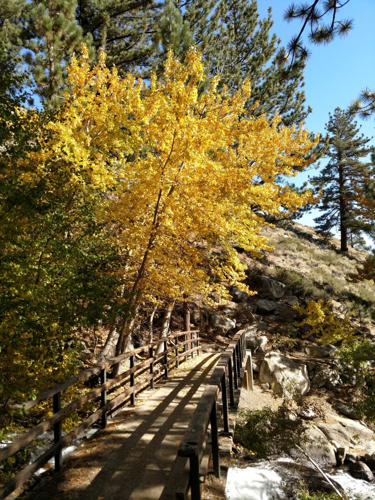
My experience of this approach was fairly typical. I left around 12PM from the trailhead and kept about a 2.0 mile per hour pace. I was laden with a large pack given my solo climb. Nevertheless, brilliant fall colors lined South Fork which took the sting out of ascending.
I found the trail fairly straightforward and easy to follow on my way up to the Wilderness Boundary. After that, the trail begins a very steep ascent with many switchbacks to an altitude of about 9,800' before descending into the pleasant alpine valley near Willow Lake.
Past the junction for Willow Lake, the trail was less easy to follow but not terrible. As the light noticeably diminished, I made it close to Brainerd Lake and found my way up to Finger Lake.

One note about the climb from Brainerd Lake to Finger Lake; though the route is very direct, many people skirt the Eastern shore of Brainerd Lake to Finger Lake which looks absolutely miserable. I heard a few climbers who did this, thinking they were saving distance and it cost them hours. Don't make that mistake!
Camping at Finger Lake
Though it was a busy holiday weekend, I had no trouble finding a campsite at Finger Lake. All of them are informal but its easy to find a flat spot and a view. I watch the sunset over White Mountain Peak from my spot.
There must have been 2 dozen or more climbers at Finger Lake which was interesting. I chatted up with many of them and got entirely conflicting answers; some said it was impossible to climb without an ice axe and crampons, others had no trouble doing it in trail runners. I gathered there was a great deal of inexperience on Middle Palisade which was concerning.
Please note, there are no camp fires allowed at this campsite!

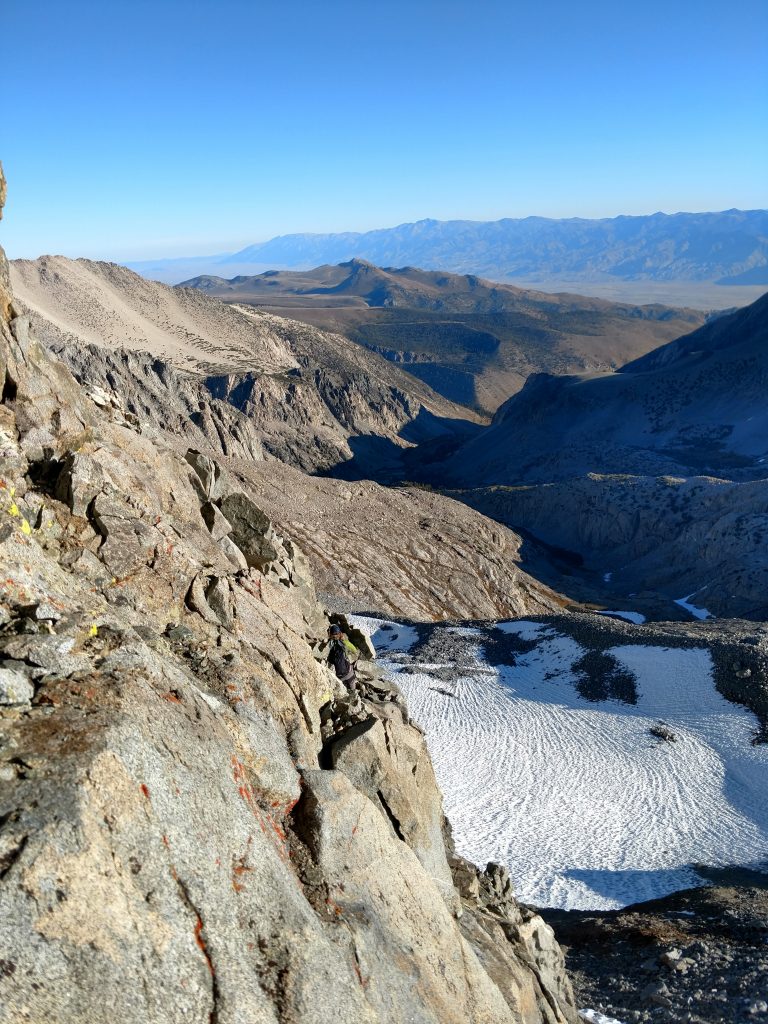
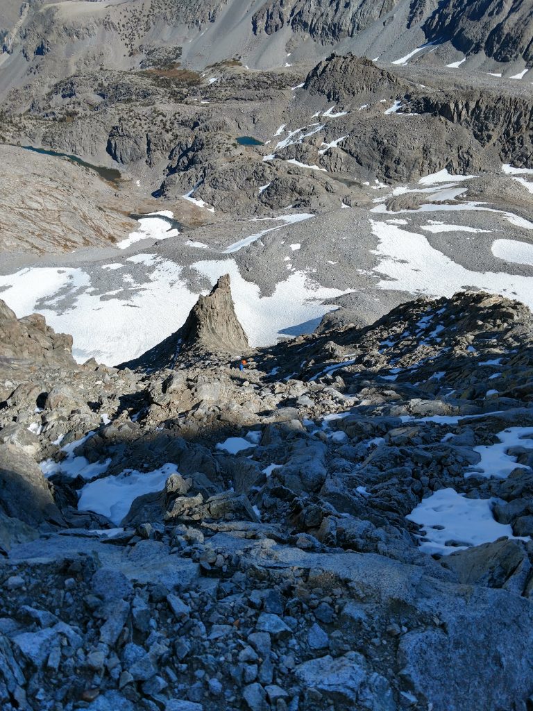
Finger Lake to Middle Palisade Glacier
Up at 330, I hit the route a few hours before sunrise. I followed a vague use trail crossing the North outlet of Finger Lake and crossed near a small tarn before climbing a steep slope. Occasionally I crossed cairns but I essentially followed a line to a small, unnamed lake directly above Finger Lake. From here, it was a lot of tedious and slow side climbing around 11,500-11,800', attempting to get to the glacier.
I encountered no snow along the way and arrived at the glacier about 3 hours after starting.


Middle Palisade Glacier to Northeast Face
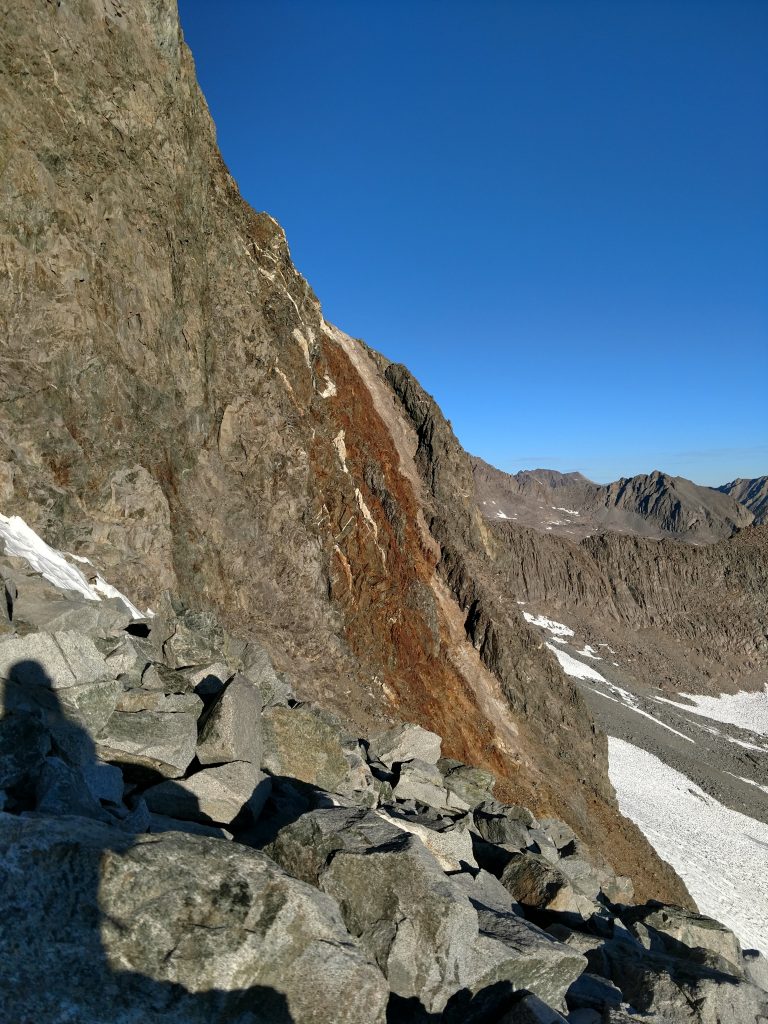
We had a very snowy and long lasting winter in 2019. Middle Palisade glacier's terminus was therefore nebulous. Some climbers ahead of me preferred minimal glacier travel but I preferred avoiding knee-hammering talus. I strapped on my crampons and took out the ice axe for the crossing. The glacial terrain had plenty of penitentes and suncups which were as sharp as blades in some sections. I probably didn't need the ice axe but I felt a little safer.
After about 45 minutes to an hour, I arrived at the looming wall of the Northeast Face.
The Crux- Red Rocks or Secors Chute/Secors Route
Here's where things got dicey and about 80% of the people of the day turned back. There's a small ice-free section between the two lobes of the Middle Palisade glacier that leads like a ramp to the wall. I read many times about the standard "Red Rock Route" but from my vantage point, I saw people struggling greatly against very loose rock. I spoke with them later and they didn't think it was too difficult. However I decided against the red rocks route.
With some collective knowledge of other climbers attempting to summit, we discussed the elusive "Secors Chute" or Secors Route which involves a class III-IV chimney. Three of us approached the wall, looking for the chute. Conditions change on a weekly basis here, depending on how much the glacier's moat against the rock changes. From the ridgeline, I went left about 100-200 yards and eventually found the chimney. However, its very difficult to describe the exact route I took finding the chimney. Here's some photos-
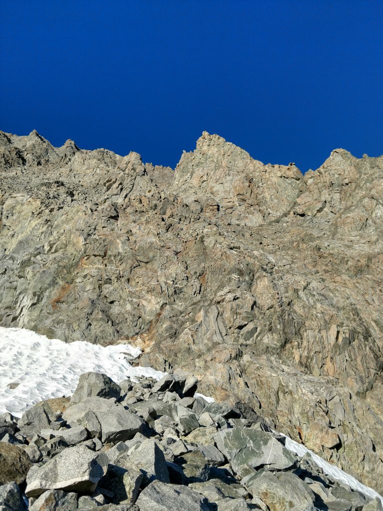
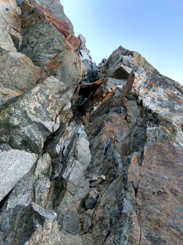
I slithered my way up the Class IV chimney and was delighted finding cairns at the top. Of course, the way I view cairns these days is either I'll find the right route or a couple of skeletons of the a******s who put up the wrong route.
While the chute was the crux, I had a very, very long scramble ahead.
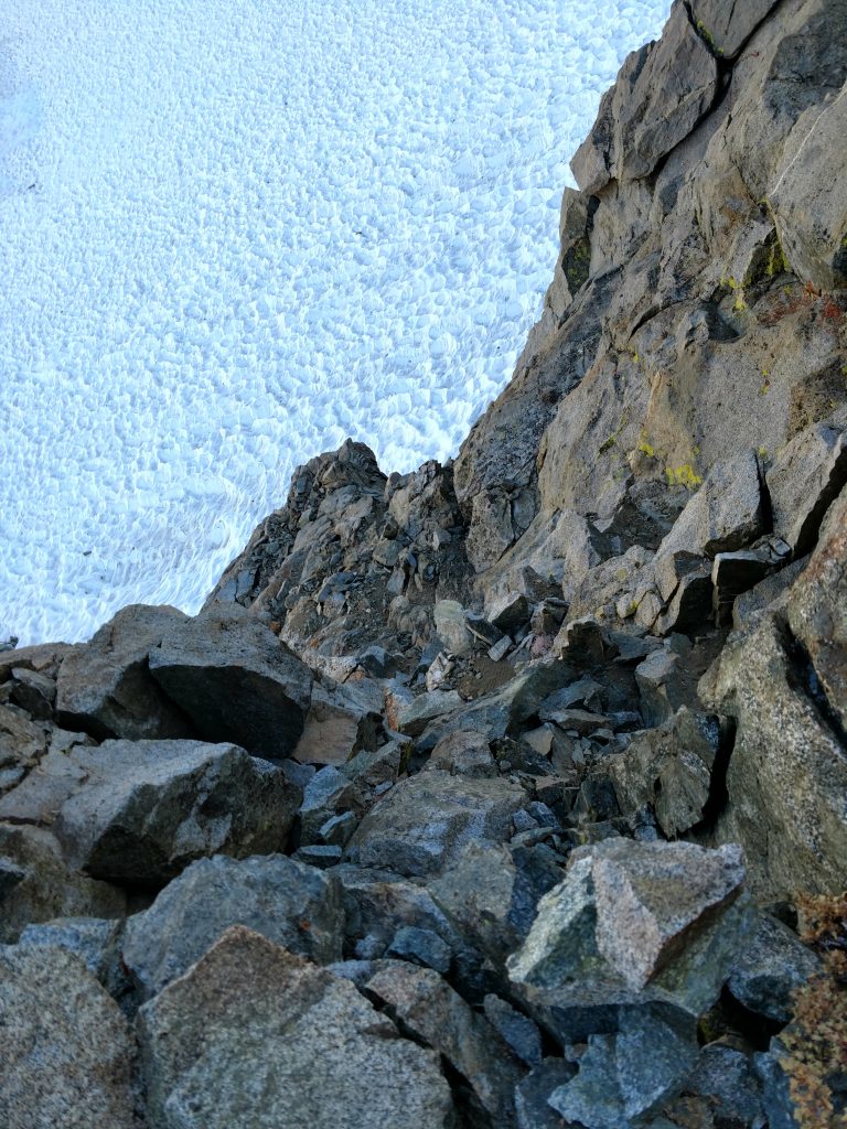
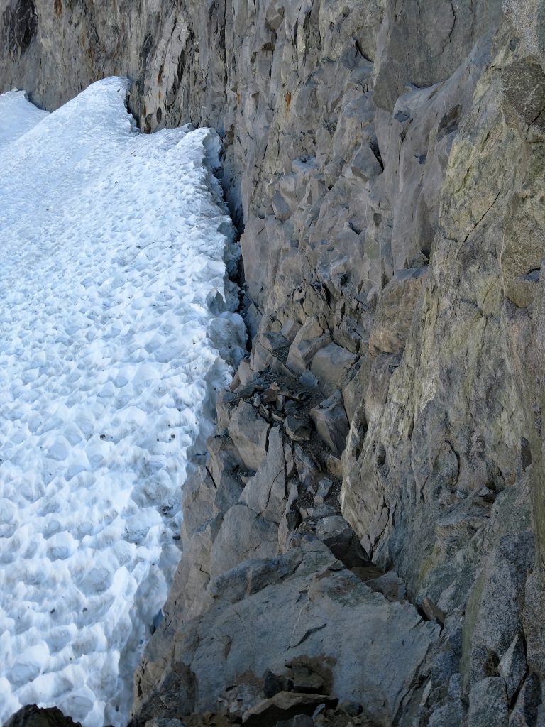
Final Scramble up the Northeast Face
Its kind of straightforward from here. Numerous chutes parallel each other, eventually terminating at Middle Palisades' Ridgeline. I hope this map below makes it a little more clear that a description.
I scrambled my way up the first chute, coming to a saddle between this prominent bump in the ridgeline. Rock was fairly good and I was never far from a good hand-hold or foot-hold.

I rejoined the main chute. At the saddle above, its about another 1,000' of vertical to Middle Palisade's summit. Its continuously class III with some class IV moves from here. While not exposed, it pushed my limits of scrambling.
About 2/3rds of the way up, the chute forks and going left seemed obvious. The final 400-600ft seemed steeper and slightly more exposed. I was practically crawling at this point.
Just before the chute terminates at the ridgeline, I took a sharp left and ascended the final hundred feet to the top. This section was equally relentless and routefinding was challenging. Fortunately I was close to a few other climbers and with some scouting, we found the best path to the summit.
Success on the Summit!
Middle Palisade's summit was phenominal. I gazed down at the Palisade lakes I crossed many years ago on the John Muir Trail. Half of California's 14ers were visible from these lofty heights. The summit register, placed by the California Sierra club, had about 4 dozen names per year for the past several decades. In spite of the notoriety, this summit has a high fail rate.
Everybody commented like I did- "Is this really class III?", "This is going to be a beast coming down". I spent almost no time at the summit given these thoughts.


The Descent
There's not much more to say about the descent other than it was about as hard coming up. Route finding down was notoriously difficult. My pace down climbing was about the same as the ascent. Ugh.
One more thing- if I didn't have a GPS, I think finding my exact route down the chimney would have been impossible. Thank goodness I dropped tons of waypoints!
In the end, it took almost 13 hours climbing the summit from Finger Lake and returning. Many hike out on summit day but I was too exhausted. I spent an unintentional night out at Finger Lake and hiked out the next day.
Well, lots of lessons learned on that one. Not sure I'd want to climb Middle Palisade again... but I'm sure I will!

No Comments