


The Pu'u O'o Trail is my new favorite on the Big Island and I nearly missed it. I recently scheduled a three day window on the Big Island for a hike of Mauna Kea. The best weather was on my first day so I had two more to spend hiking. After doing Volcano National Park I had a hard time figuring out my last day. The local I was staying with told me about the Pu'u O'o Trail and I decided to go for it. Here's my trip report and guide.
Trailhead, Overview and Map
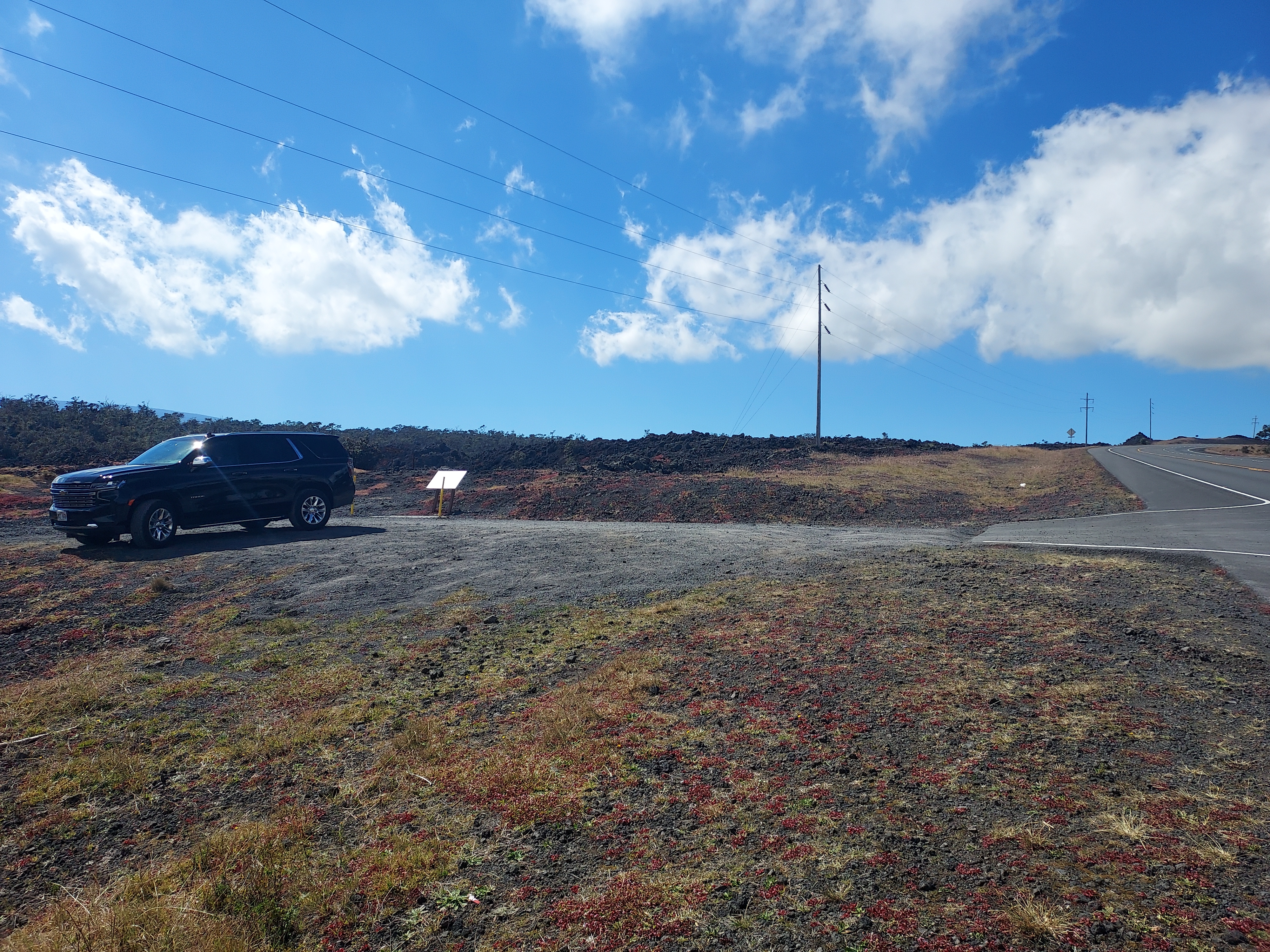
The Pu'u O'o Trail is not to be confused with the more famous Pu'u O'o volcano that erupted continuously between 1983 and 2018. This trail follows historic paths and connects with the former Powerline Road that crosses part of the island. The trailhead is off of Saddle Road. I found the formal trailhead sketchy - its a gravel lot without much marking, easily missed and very hard to get in and out of. I was a little worried my dinky rental car would bottom out given the high lip with the highway. Ultimately I parked at Kaulana Manu Trailhead, just a little further afield. I figured my loop hike of the Pu'u O'o Trail and Powerline road would involve road walking so it didn't really matter which trailhead I parked at anyways.
The trail itself has several options. Most opt with an out-and-back hike of the Pu'u O'o Trail alone and go a few miles in before turning around. A more adventurous hiker may hike the full length of the trail to Powerline Road, then hike back for a 9 mile hike, out-and-back. I always prefer loop hikes, hence my somewhat unusual hike included the Pu'u O'o Trail, Powerline Road, a brief road walk and the Kaulana Nature trail: a 10-mile loop with about 650' of altitude gain/loss. The trail is rough, rocky, ambiguous in some sections and not the best for novice hikers.
Here's my map-
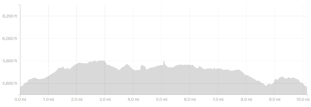
Here's my distance and altitude, per Strava
Trip Report
Kaulana Trailhead to Pu'o O'o Trail
From the Kaulana Nature Trailhead, I hiked the old, closed highway back to the Saddle Road. I then walked the Saddle Road about 0.8 miles to the proper trailhead. I preferred to get the nasty road walking done and have the rest of the day be wilderness.
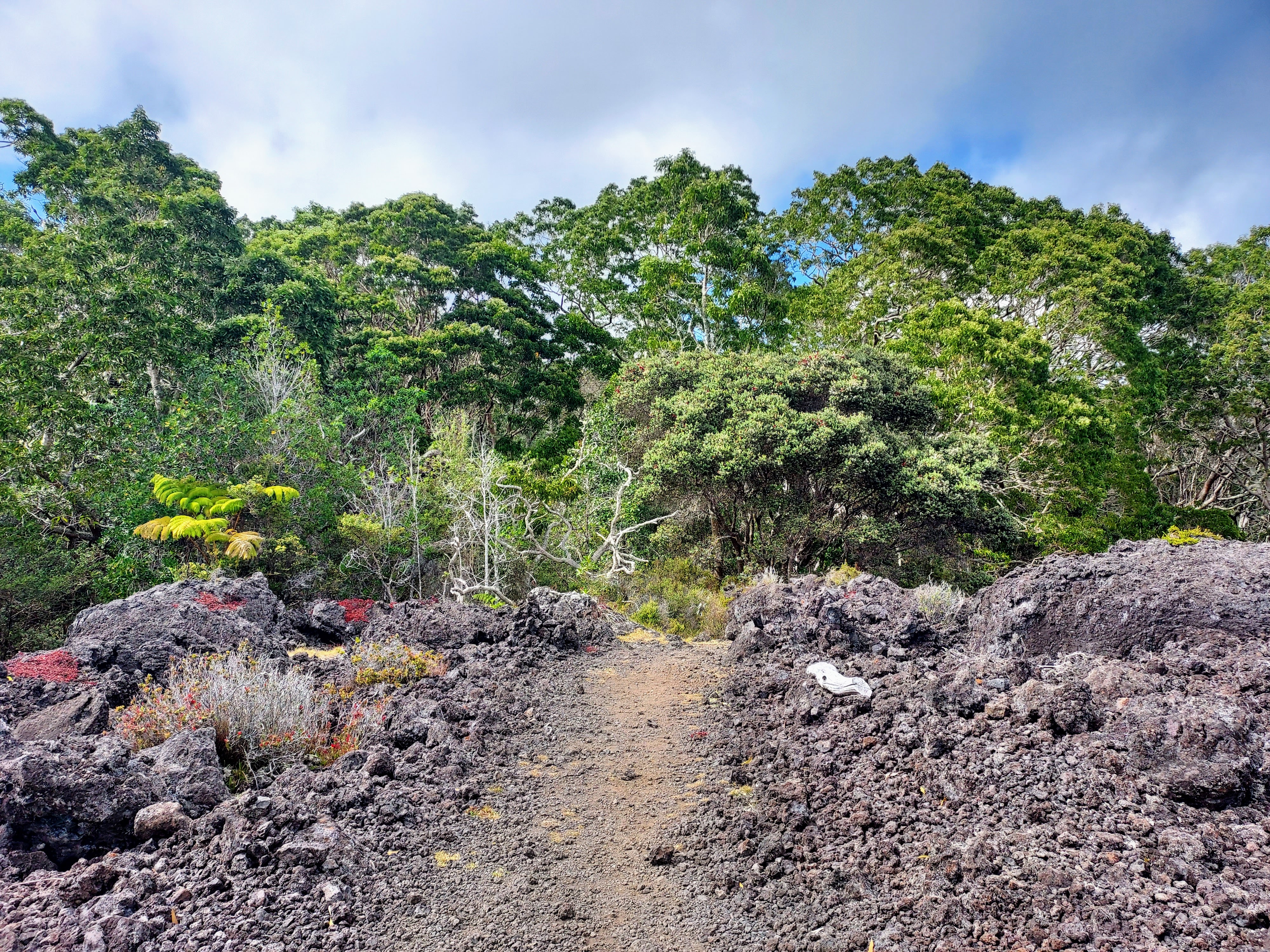
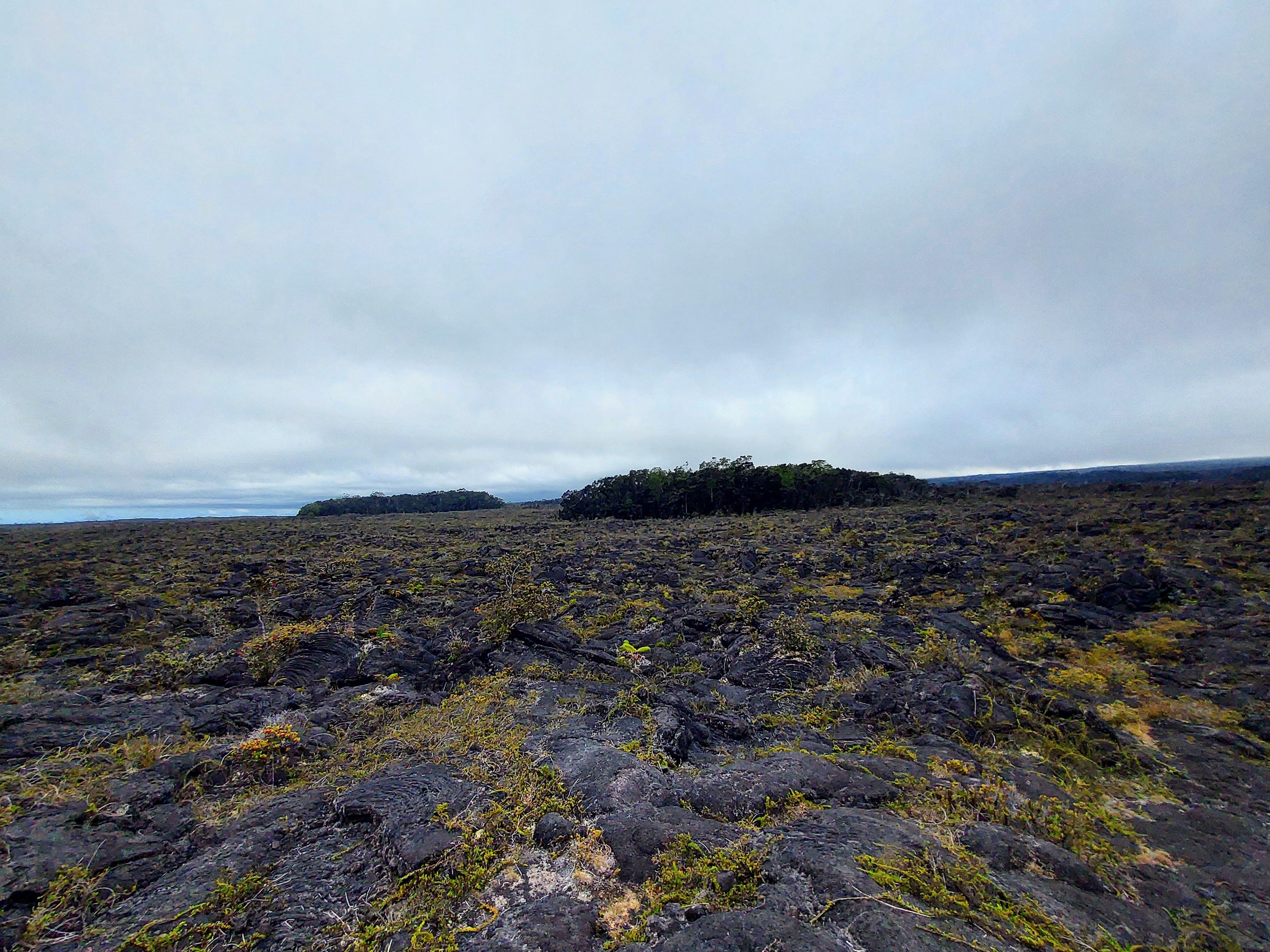
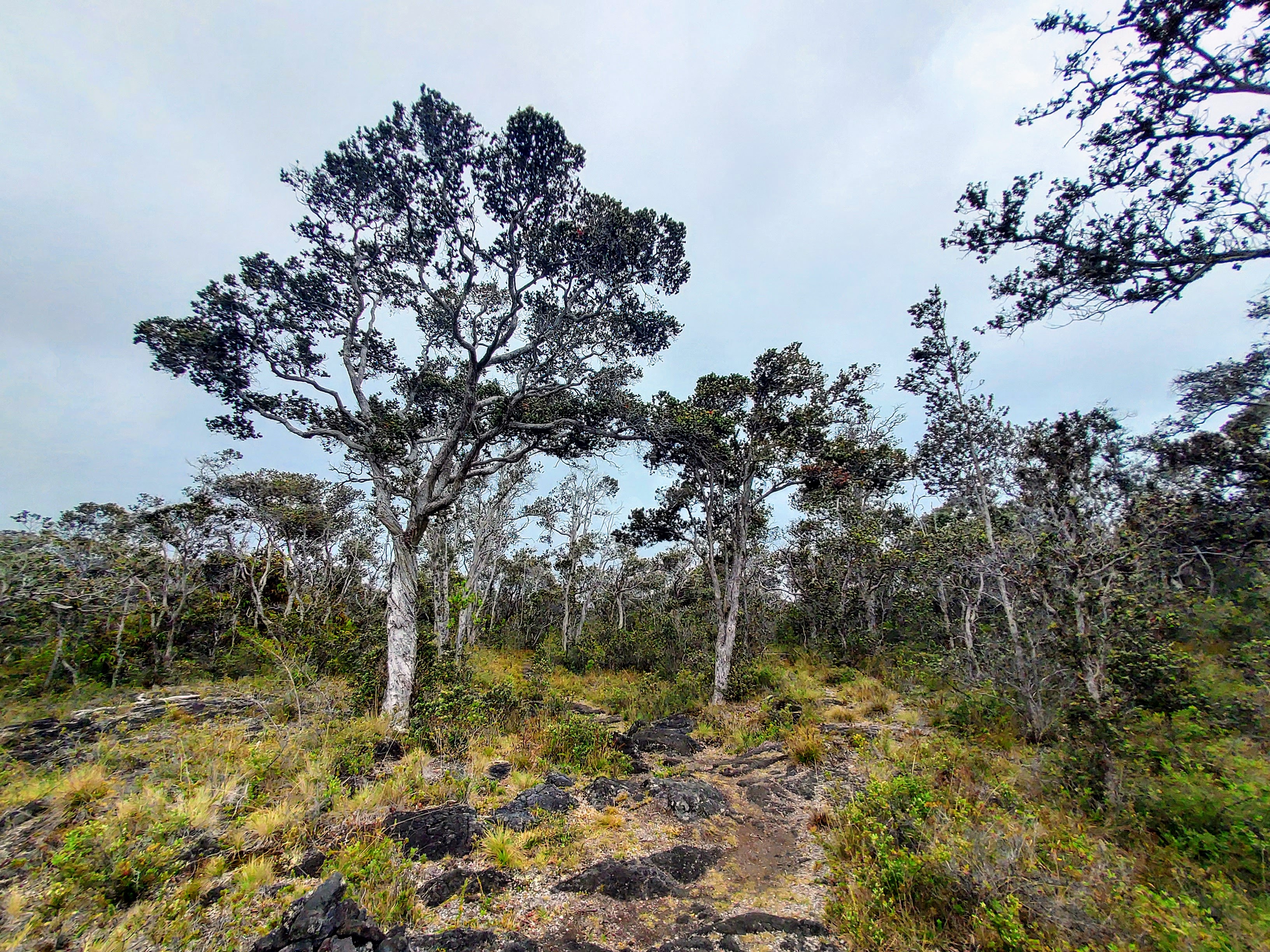
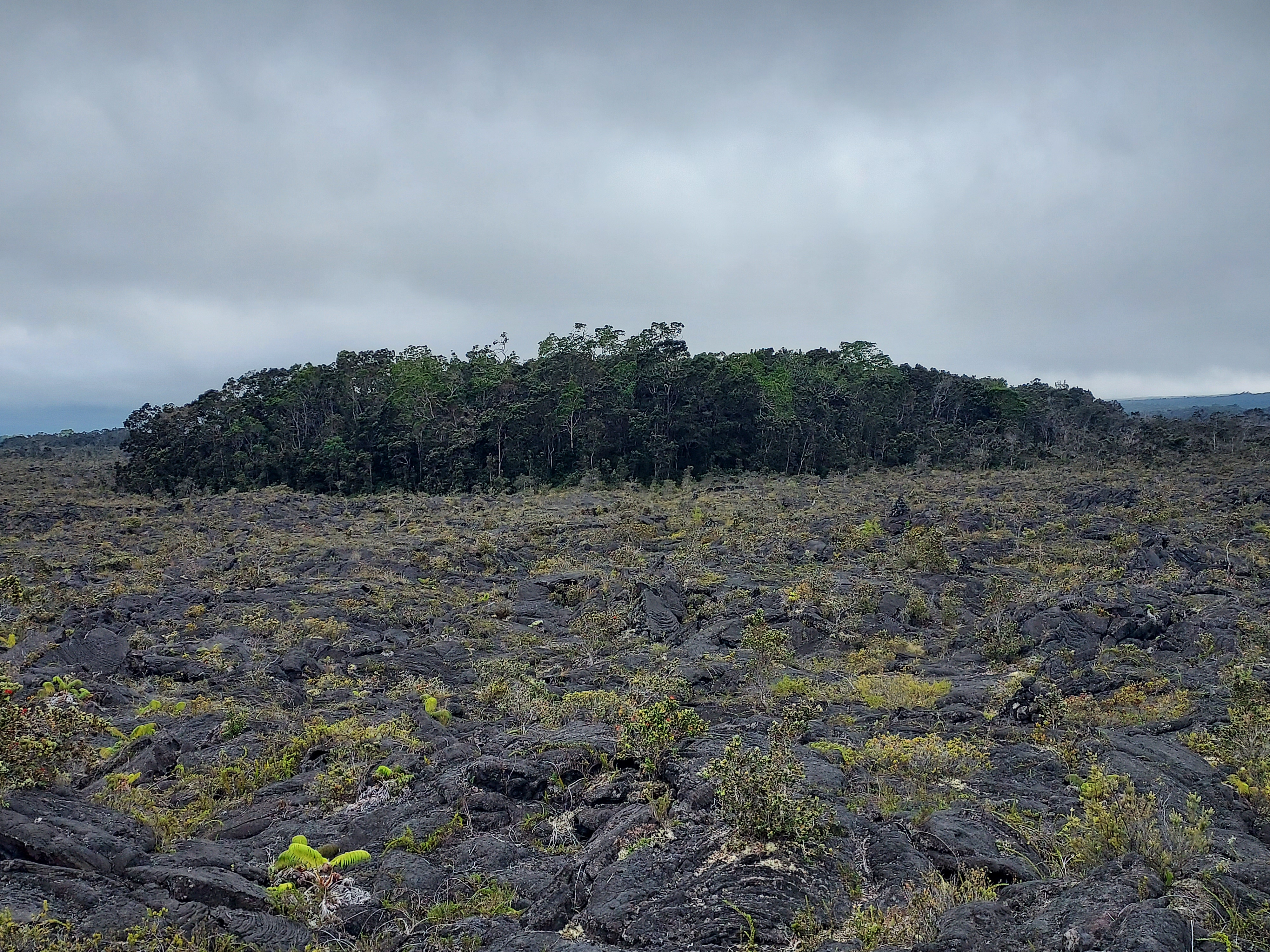
The trail then took me through some incredible natural scenery. It zigzags through areas covered by recent lava flows from Mauna Kea, mixing in sections of desert-like landscapes where only tough, bushy plants manage to survive. The most interesting parts are the kīpukas – these are areas of old-growth forests that have been spared by the lava. Surrounded by hardened lava, these spots of dense forest are almost like islands of green in a sea of black rock. Interesting how these devastating lava flows actually protect these bits of forest by surrounding them with natural barriers. There's far greater presence of native species among the kīpukas.
Though there's no way to really describe it, the bird songs in the kīpukas were utterly magical. They were so loud and numerous my birding recording app crashed. I couldn't believe it.
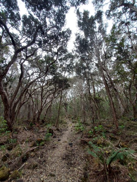
The trail was notably rough and ambiguous in some sections. It helped to have a pre-loaded GPS track. Periodic cairns mark the way but I imagine its an easy place to get lost. From an altitude standpoint, the trail hovered around 5,000' with lots of ups and downs to make the hike strenuous.
After about 4.5 miles from the proper trailhead and 6.2 miles from where I parked, I reached the intersection with the Powerline Road.
Powerline Trail to Traihead
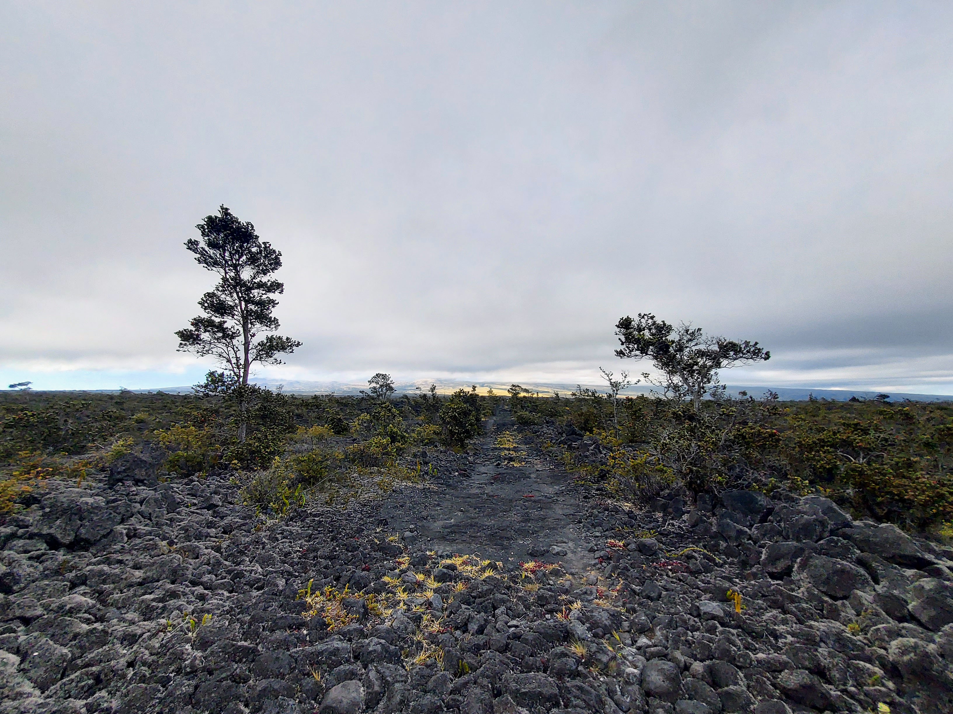
The unceremonious terminus of the Pu'u O'o trail is with an officially unnamed trail labeled as the Powerline Trail on maps. I returned to my car following this trail 3.2 miles back to the highway. It follows a near straight line, undoubtedly the reason for its namesake. Its less scenic than the former though it winds through a few kīpukas of its own. The last mile does have some altitude gain but it isn't strenuous. I caught a few glimpses of distant Mauna Kea rising above the clouds.
Once back to the highway, I crossed and found the road back to the car at the Kaulana Manu Trailhead. The hike took me roughly 3 hours and 50 minutes which is fairly average from what I can tell. The Pu'u O'o trail is an absolutely wonderful hike and unlikely you'd see many others on it.

No Comments